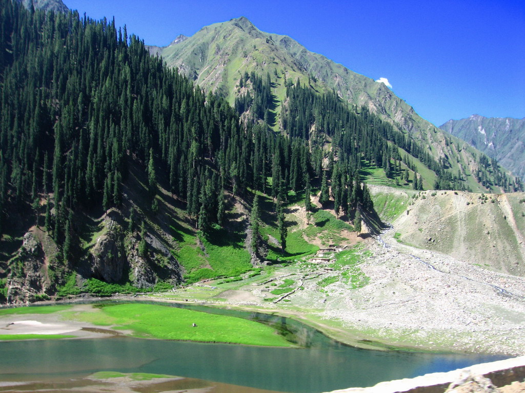
| Duration | 5 days |
| Distance | 43.4km |
| Standard | demanding, technical |
| Season | July-September |
| Start | Upper Naltar |
| Finish | Torbuto Das |
| Nearest Town | Gilgit |
| Zone and Permit | open, no permit |
| Public Transport | yes |
| Summary | This semi- loop alpine trek crosses a pass and explores interesting side valleys north of the lower Hunza River. |
Daintar Pass (4500m) links the upper Naltar Valley with the Daintar Nala in Lower Nagyr. George Cockerill first crossed it in 1893 and described the south side as ‘almost vertical’. While the pass is steep on both sides, it is easier to cross from south to north. Trevor Braham, who spent from the 1940s to the 1970s in the Himalaya, describes the northern descent as ‘230m of shattered rock at a 50- degree angle, ending in a wide crevasse’.
PLANNING
What to Bring
Mountaineering equipment necessary to fix ropes for safety on the descent from the pass is recommended (see Mountaineering Equipment,); wearing a climbing helmet is prudent.
Maps
The Swiss Foundation for Alpine Research 1:250,000 orographical map Karakoram (Sheet 1) covers the trek.
Guides and Porters
See Guides and Porters for the Pakora Pass trek for details. Naltar Porters have the right to work only up to Daintar Pass, and Daintar porters work from the pass down to Torbuto Das. You need to prearrange to change porters at the pass on a specified date. These logistics and the necessity of paying wapasi to two groups of porters adds to the trek’s complexity and expense. Small trekking parties may be able to avoid changing porters.
Stages
It’s six stages total from Upper Naltar: (1) Naltar Lake; (2) Daintar High Camp; (3) Khaniwal; (4) Tolebari; (5) Taling; and (6) Torbuto Das.
NEAREST TOWN
GETTING TO/FROM THE TREK
To the Start
Several daily jeeps depart from the Jaglot bus stand on Gilgit’s Domyal link Rd to Lower Naltar and Upper Naltar (two hours). Special hires. The road to Naltar follows the Hunza River’s true right bank 25km north- east of Gilgit to Nomal, where it narrows and turns north- west up the Naltar Valley 16km to Upper Naltar.
The Jeep road continues beyond Upper Naltar to Naltar Lake. Most special hires only go as far as Upper Naltar. If you can convince a driver to go all the way to the lake, it costs additional. Alternatively, it takes five to six hours to walk on the road between Nomal and Upper Naltar. A plan to build a bridge over the Hunza River at Nomal, linking these villages to the KKH, is under consideration.
From the Finish
Torbuto Das- Gilgit jeeps depart in the morning. Otherwise, walk to Chalt and look for a ride. Two bridges over the Hunza River link Chalt to the KKH; a new one below town and another above it 1km west of a petrol station. Vehicles going down or up the KKH can give you a ride.
THE TREK
Days 1- 2 : Upper Naltar to Lower Shani
2 days, 20.7km, 870m ascent
See Days 1-2 of the Pakora Pass trek for details. The Daintar Pass is visible from Shing. Even though you can reach the high camp from Naltar Lake on Day 2, it’s better for acclimatization to camp at Lower Shani (3690m). For further acclimatization, spend another day here and explore the beautiful upper Naltar Valley.
Day 3 : Lower Shani to Daintar High Camp
1-2 hours, 2km, 410m ascent
Daintar Pass is north of Lower Shani. The trail stays east (right) of the stream coming down from the ridge. Daintar High Camp (4100m) is in a level area below an obvious snowfield.
Day 4 : Daintar High Camp Tolebari
5- 5½ hours, 6.7km, 400m ascent, 1050m descent
The ascent to the pass follows the crest of a spur from the main ridge. Near the top of the angle is quite steep and a rope may be needed. It appears to be Class 2. The cornice on top can be large. A cairn marks Daintar Pass (4500m). The approach to beautiful Snow Dome (5029m) is along the ridge east- south- east from the pass. A steep scree gully is the standard descent from the pass. Beware of rock- fall and crevasses on the glacier below. Descend to Tolebari (3450m) huts and pastures, three to 3½ hours from the pass.
Day 5 : Tolebari to Torbuto Das
4- 5 hours, 14km, 1350m descent
Descend the Tolebari Nala to the herders’ huts of Taling and Daintar (2743m) in two hours. Continue along the road down Daintar Nala through a gorge to Torbuto Das (2100m), at the confluence of the Daintar Nala and Bar Nala, in two to three hours. Halfway downvalley, pass a rough trail leading north- east across the Talamutz Pass to Bar village (see Baltar and Toltar Glaciers under Other Treks,). Alternatively, across the river from the Daintar huts, a rugged trail leads south- east over the ridge (3657m) to Chalt on the Chaprot Nala’s west bank. Chalt Tourist Inn has a nice camp site and rooms.
