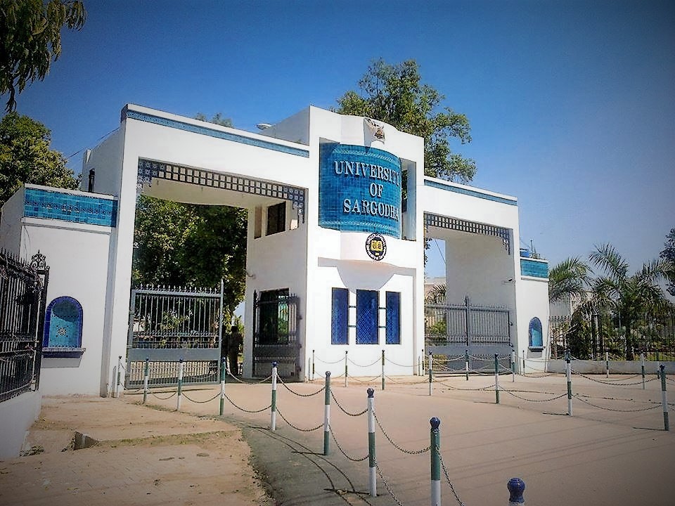
Sargodha (Punjabi and Urdu: سرگودھا) is a city and capital of Sargodha Division, located in Punjab province, Pakistan. It is Pakistan’s 12th largest city by population and one of the fastest-growing cities in the country. Sargodha is also known as the City of Eagles. It is one of the few planned cities of Pakistan (others include Faisalabad, Islamabad & Gwadar).
History
Sargodha was established by the British as a canal-colony in 1903 and was initially spelled Sargoda. Sargodha was badly affected by an outbreak of the bubonic plague in 1903 and experienced a milder outbreak in 1904. Although it was a small town, in the beginning, the British Royal Air Force built an airport here due to its strategic location. The term “Sargodha” has its origin in the words “Sar” meaning “pond” and “Godha” meaning “Sadhu”, which means “Pond of Godha”. This city was founded by Lady Trooper by the supervision of Sir Charles Montgomery Rivaz KCSI (1845 – 7 October 1926), a colonial administrator in British India and Lieutenant-Governor of Punjab from 1902–1907.
Location
Sargodha is situated in the Pakistani province of Punjab. It is located 187 kilometers (116 mi) northwest of Lahore, in Sargodha District. It lies about 48 kilometers (30 mi) from the M-2 motorway, which connects Lahore and Islamabad. It is connected to the M-2 by several interchanges at different locations. Sargodha is roughly 91 km (57 mi) from Faisalabad, due southeast. Directly east connected by the M-2 motorway are Lahore and the route to Rawalpindi and Islamabad. Due east is the city of Jhang; toward the west are the city of Mianwali and the Chashma Barrage.
Topography
Sargodha mainly comprises flat, fertile plains, although there are a few small hills on the Sargodha-Faisalabad Road. The River Jhelum flows on the western and northern sides, and the River Chenab lies on the eastern side of the city. The city is located at 190 meters above sea level.
Climate
The city has a climate of extreme heat in the summers and moderate cold in the winters. The maximum temperature reaches 50 °C (122 °F) in the summer while the minimum temperature recorded is as low as the freezing point in the winter.
Demographics
The total population of the city was 458,440 according to the 1998 census. The majority of the people in the city speak Punjabi. According to the 2017 Census of Pakistan, the population of the city was recorded as 872,557 with a rise of 43.94% from 1998. The population of the metropolitan area (City District) reached 3,903,588, in which around 1 million forms the urban population. The population of the Sargodha Division was recorded as 8,181,499 by the 2017 Census of Pakistan.
Economy
The majority of Sargodha’s economy is based on agriculture. Sargodha is considered the best citrus-producing area of Pakistan and therefore is also known as the California of Pakistan. Sargodha is the largest Kinnow-producing district in the world. It produces oranges that are considered high-quality and supply them to the different parts of the country. These oranges are also exported to other countries. Sargodha produces a large amount of wheat, cotton, rice, and vegetables that are transported to other parts of the country and exported to other countries.
There are also Textile mills, Rice processing plants and Nestle and Shezan juice factories.
The Sargodha Chamber of Commerce and Industry monitors industrial activity in the city and reports its findings to the Federation of Pakistan Chamber of Commerce and Industry and provincial government. A dry port is also under construction in Sargodha.
Transportation
Roads and flyovers
The 4 km (2.5 mi) long University Road runs from 47 Pull to Khayyam Chowk. Other main roads include 6 km (3.7 mi) long Fatima Jinnah Road & City Road, Canal Road, Katchery Road, Stadium Road, Club Road, Jail Road, Queens Road, Mushaf Ali Mir Road, Railway Road, Lahore Road, Faisalabad Road, Eid Gah Road, Mianwali Road, Sillanwali Road, Bhalwal Road, and Shaheenabad Road.
There are 3 flyovers located in the city area to regulate the flow of traffic:
- Khayyam Chowk’s flyover has a length of 1 km (0.62 mi) that leads to Mianwali Road.
- Fatima Jinnah Road’s flyover also has a length of 1 km (0.62 mi).
- A 0.4 km (0.25 mi) long flyover is located on Kachehry Road.
Motorways and highways
Sargodha lies about 45 km (28 mi) from the M-2 Motorway, which connects Lahore and Islamabad. The N-60 National Highway runs from Sargodha to Lahore through Pindi Bhattian and Sheikhupura. It is also connected to Faisalabad by a highway.
Buses
General Bus Stand is located on Fatima Jinnah Road that provides bus service from Sargodha to almost every part of the country. Daewoo Bus Service drives regular routes from Sargodha to the rest of the country. Others include Niazi Express, Faisal Movers, Bilal Travels, Islamabad Express, and Skyways, etc.
Taxi and Rickshaws
The online cab services Uber and Careem are available in the city. Many auto-rickshaws are also available throughout the city, which is often used by those who cannot afford the cab services.
Rail
Sargodha is also connected by the rest of the country through rail. Sargodha Junction railway station is located on the Shorkot-Lala Musa branch railway line.
Air Base
Pakistan’s largest airbase, PAF Base Mushaf (formerly PAF Base Sargodha), is situated in Sargodha and hosts the headquarters of the Pakistan Air Force’s Central Air Command. The airbase is also home to the Combat Commanders School (CCS), formerly the Fighter Leader’s School.