| Duration | 3 days |
| Distance | 39km |
| Standard | moderate |
| Season | Mid-June-mid-October |
| Start | Skardu |
| Finish | Ali Malik Mar |
| Zone and Permit | open, no permit |
| Public Transport | start only |
| Summary | Burji La combines tantalising views of the Baltoro Muztagh with the magnificent Deosai Plains in a short trek, which can be combined with other routes for superb longer treks. |
Burji la (4816m), the old British route between Srinagar and Skardu, is a snow-covered north-south pass between the Skardu Valley and Deosai Plains. From the pass, only 16km south of, but some 2600m above, Skardu, K2, the Gasherbrums and Masherbrum are distantly visible. The description below is from north to south, so acclimatized trekkers can combine this trek with the Deosai Traverse (see Other Treks,). The pass, however, is easier to cross in the reverse direction.
PLANNING
Maps
The US AMS 1:250,000 topographic map Mundik (NI 43-3) covers the trek.
GETTING TO/FROM THE TREK
To the Start
Follow the road west from Skardu towards the airport to the bridge over the Satpara stream. You can easily walk or take a Suzuki.
From the Finish
Walk a day or hitch along the road back to Satpara and Skardu or head west to the Astor Valley, since there’s no public transport. Special hires. (When reversing directions, Burji Lungma is the first clear side stream from the north.)
THE TREK
Day 1 : Skardu to Wozal Hadar
6-7 hours, 20km, 1520m ascent
Burji is the first valley west of the large, broad Satpara Valley. From the west side of the bridge over the Satpara stream, reach the obvious narrow opening of the Burji Nala in 1½ hours. Follow a herders’ trail along the clear stream, inexorably ascending past stands of birch and willow. Herders’ huts and a spring at Pindobal offer a camp site three to four hours upvalley for those not yet acclimatized or those crossing the pass from south to north. The treeless camp site of Wozal Hadar (3810m) is one to 1½ hours farther.
Day 2 : Wozal Hadar to Burji Lungma
5-6 hours, 9km, 1006m ascent, 701m descent
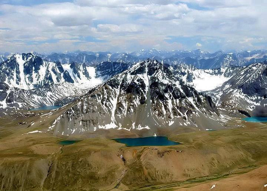
The valley opens into a wide Basin. Burji La is the obvious snowy saddle on the east side of the ridge above the upper basin two to three hours from Wozal Hadar. A broad snowfield lies below the pass. If crevasse are visible, ascend the rocky spur just west (right) of the snowfield to Burji La, marked by a cairn. The giant peaks at the Baltoro Glacier’s head rise above the lower ridges in a grand panorama. To the south, several icy blue lakes nestle below a small ridge. Descend south to the valley below, the Burji Lungma (4115m), and follow it to its confluence with a larger, clear stream, and camp in grass along its banks. Up this stream to the north-west is the Dari La (see).
Day 3 : Burji Lungma to Ali Malik Mar
3 hours, 10km, 183m descent
Follow the stream south to reach the Deosai Plains and Ali Malik Mar at the road.
