| Duration | 5-7 Hours |
| Distance | 6.9 km |
| Standard | Easy |
| Season | Mid April – Mid October |
| Start | Guru |
| Finish | Gumbak |
| Zone & Permits | Restricted, no permit, |
| Public Transport | Finish only |
| Summary | A superb day-long trek over a forested ridge between Birir and Bumboret offers a glimpse of Kalasha hill country and sweeping view of Hindukush Peaks. |
A pass (3060m) over the scenic ridge between Guru in Birir and Gumbak in Bumboret is called Gree An by villagers and Gumbak An by Bumboret Villagers. The trail, steep on both sides of the pass, is 2km longer on the Birir side and entails 132m ascent and 930m descent. Gree An, one of two passes linking Birir and Bumboret, is west of Gorimun Zom (3157m). Maskor Pass (2745m), which lies to its east, is a slightly longer route between Nojhbiu, east of Guru, in Birir and Burn in Bumboret.
Planning
Maps
Nearest Village
Guru
Birir’s hotel in Guru (1740m). Paradise hotel has rooms for RS 250- 450. Mehran Hotel, just up the road from the school, costs RS 300- 500. Rooms are upstairs each hotel has a stop with expensive basic supplies downstairs. Kalasha Guest House, a Traditional Kalasha house offers rooms and meals for RS 1000 per person. Book the C&W Rest-house, in a walled compound, with the Assistant Engineer in Chitral or Drosh.
Catch any vehicle heading south from Chitral to Drosh departing from Chitral’s ateliq bazaar, and get off near Ghariet Gol at Gasheriat where a bridge to Birir crosses The Chitral rivers. Then try to catch a jeep going up the valley or walk two or three hours to Guru.
Getting to/form the trek
For details of transport to the start of the trek see guru above and form the Finish of the trek see Bumboret
The trek
Walk up valley along the Birir Gol 20 minutes to Bishala and cross the river. A Bashali is on the true left bank just below the footbridge. Continue up the true left bank 10 minutes to Gaskuru. Turn north up a side valley, and go through the village 15 minutes to where the trail splits. Two trails lead from this point towards the pass. Straight ahead up a rocky slope with a few trees is a much steeper but slope with a few trees is much steeper but shorter herders trail. Instead, take the trail to the right, entering a narrow black walled gorge (tang in Persian) with high rock walls that provide morning shade. Most of the way to the pass dry, so get water from the canal before heading up the canyon. Follow the relentlessly steep, rocky trail 1 ½ to 2 ¼ hours. Gradually the canyon opens up as all the trail passes scattered oaks, hollies, pines, cedars and occasional junipers. Water may be found halfway up, but Isn’t reliable. The steepness lessens as you reach an open grazing area with a lot of deadwood.
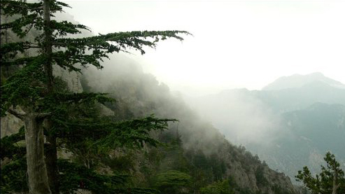
The steeper herder’s trail meets the trail up the George here. (If descending to Birir from the pass, the herders’ trail is clearly visible traversing the hillside. The trail down into the gorge is less distinct, but bears east or left). The pass is first visible from the head of this grazing area. Turn north-east (right) and continue to the pass in 45 minutes to one hour up switchbacks of loose, steep rock through Chilghoza pines. Green An (3060m) has superb views north to Tirich Mir and Noshaq; Istor-o-Nal hides behind Tirich Mir.
The descent is to Ghumbak, a Muslim village in Bumboret. Descend through forest along the actual side of a gully (snow filled early in the season and dry later on). Where the first side stream joins from the east, the trail crosses and then shortly recrosses the gully. A second side stream farther down offers water. Reach Gumbak (3130m) in 1 ½ to 2 hours. The pass is easily visible from Bumboret. It lays at the east of the forested low point on the ridge, where the trees meet the rock of Gorimun Zom. The darker peak west of the pass is called both Bachay Maddir and onsets.
