| Duration | 5½- 6 hours |
| Distance | 12. 2km |
| Standard | easy |
| Season | Late April-October |
| Start | Uthool |
| Finish | Shagrom |
| Zone and Permit | restricted, no permit |
| Public Transport | yes |
| Summary | Crossing the Zani An on the ridge above Mulkho offers spectacular sweeping views and the best and quickest approach to the Tirich Valley. |
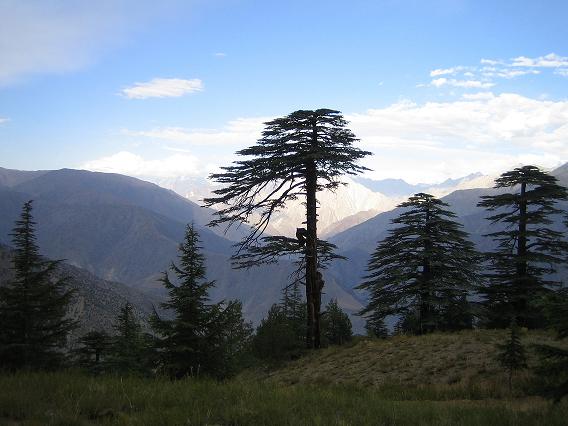
Zani An (3840m) is a pass that links Uthool in Mulkho to Shagrom in the Tirich Valley. Tirich villagers use the pass, the quickest and shortest route to their valley. Tirich villagers call the pass Zani An, although Uthool villagers call it Tirich An. A jeep road makes a pleasant, wide trail that eases the 1200m climb from Uthool to the pass, where the views of Istor-o- Nal and Saraghrar are magnificent. To the east, the Buni Zom massif soars over the Turikho and Mastuj rivers.
Crossing the Zani An get to Tirich significantly reduces transport cost and time spent in a jeep and is the best way to start the Tirich Mir Base Camp trek. Large parties can send the bulk of their supplies by road and walk over the Zani An to meet their Crew in Shagrom.
Although this is a short and easy pass crossing, proper acclimatization is necessary. Uthool villagers have plenty of stories of trekkers who quickly develop altitude problems when they reach Uthool (2640m) and begin walking the same day. Spend one night in Uthool (larger parties may like camping in the large meadow across from the school) and cross the pass the next morning. Uthool is a scenic village with sweeping views over Mulkho and Buni. Friendly villagers may show you to a lovely camp site in the village amid on open grassy area beneath walnut trees with a gushing spring nearby.
Planning
Maps
The US AMS 1: 250, 000 topographic map Mastuj (NJ 43- 13) covers the trek. The road beyond Uthool isn’t shown. It spells Uthool as Uthul, Warijun as Warinjun and Shagrom as Shagram. (Three villages have similar names, which are often confused and are misprinted on maps. Shagrom is Tirich Valley’s highest village, Shagram is Turikho’s main village and Shogram is along the Mastuj River’s true right bank opposite Reshun.)
Guides and porters
The route is fairly obvious, so a guide isn’t necessary. Porters usually spend the night in Shagrom and recross the pass the next day, so their wages include payment for wapasi and food rations. Left your needs be known when you arrive in Uthool, where the helpful school teacher speaks some English.
Getting TO/From THE TREK
To the Start
A link road before Warijun, Mulkho’s main village, leads to Uthool; don’t take the road just beyond Warijun that leads to Zani village. From Uthool, the road continues a few kilometres to Zani An. It was built to get an air compressor to a canal construction site. The canal, under construction since 1992, is to bring water to Mulkho from a ridge- top lake. The road isn’t well maintained beyond Uthool, so you can only rely on taking a jeep as far as Uthool. Drivers may take you further if conditions permit and you pay extra.
Chitral- Mulkho jeeps. Any Tirich- bound jeep can drop you in Warijun. From there, you can wait for a local jeep to Uthool, organize a Warijun- Uthool special hire, or walk several hours to Uthool, some 675m above Warijun. Chitral- Uthool jeeps five hours, but are infrequent since there are only a few in the village. Special hires.
From the Finish
Shagrom- Chitral jeeps cost nine hours, departing Shagrom at 4am. Jeeps don’t go on Friday and depart only every three or four days. Alternatively, walk along the road downvalley to Zindrauli, cross the bridge to Warkup, and wait for a jeep coming from Turikho to Chitral. Special hires.
The TREK
Follow the road from Uthool (2640m) to the pass. The trail climbs quickly, ascending 300m in the first hour. Water is available at the last green area near a few willow trees two hours above the village. Later in the season, when snow in the gullies above has melted, water is unavailable higher. Continue another hour to Zani An (3840m), 7.7km from Uthool. Snow typically remains, especially on its north side, until June.
Several large cairns mark the good trail as you descend into the narrow Tirich valley. Shagrom is visible upvalley, 4.5km and 1080m below the pass. Descend through fields and past houses to a footbridge over Tirich Gol two to 2½ hours from the pass. Cross the footbridge and head downstream along the road five 10 minutes and camp under poplar trees along the river or walk upstream 30 minutes to Shagrom (2760m).
