

Photo: Ahmedomair, with thanks · CC BY-SA 4.0 · via Wikimedia Commons · temporary stand-in photo

Chilas
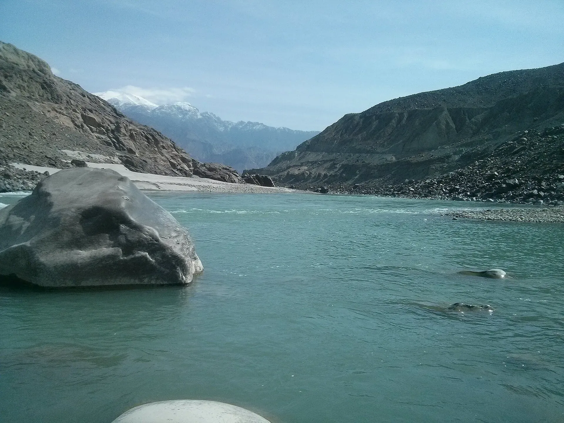
Headquarters of Diamer on the Karakoram Highway and the Indus, with thousands of ancient rock carvings, views towards Nanga Parbat, and the road junctions for Fairy Meadows and Babusar Pass.
Overview
Chilas is the headquarters of Diamer District and the capital of Diamer Division in Gilgit-Baltistan. It lies on the left bank of the Indus, on the Karakoram Highway (KKH), at about 1,265 m. Wikipedia's headline figure gives 1,265 m, while its climate table uses a station at 1,176 m, so treat the height as approximate. The KKH links it to Gilgit to the north and to Mansehra, Abbottabad and Haripur to the south. The N-15 road leaves the KKH here and goes over Babusar Pass to the Kaghan Valley.
Plan your visit
- Getting there
Road: KKH from Gilgit, about 137 km (about 1 hour 50 minutes); from Islamabad about 367 km and 4 h 25 min on OSRM (a model that ignores road works and slides; plan a full day via Mansehra). More
Best months
Apr – Jun, Sep – Oct
- Chilas
- Related places nearby: Gilgit, Darel Valley, Tangir Valley, Diamer-Bhasha Dam
History
Chilas was historically part of Yaghistan, a region of small independent communities in the Indus Kohistan area. A Dogra force took it in 1852, though the people kept internal autonomy. It joined the Gilgit Agency in 1888 and became part of Pakistan after the 1947 Gilgit rising. Wikipedia credits Syed Noor Shah (Ghazi Baba), a Sufi from the Kaghan Valley, with bringing Islam to the area and building the first mosque, in Thak.
People and population
People here speak Shina, and some Pashtun settlers speak Pashto. Urdu is widely understood.
Chilas has no separate 2023 census figure in published sources. Diamer District had 337,329 people in 2023, according to Gilgit-Baltistan government statistics. Wikipedia estimates the town at over 100,000 in 2026, but that is an estimate rather than a census count.
What to see and do
- Rock carvings: see the section below.
- The Indus viewpoints: the river here runs through a deep gorge.
- Local bazaar: simple shops, dried fruit, hats and everyday goods. It is a good place to stop for tea and supplies.
- Nanga Parbat views: the peak and Nanga Parbat National Park lie nearby, with Fairy Meadows reached from Raikot Bridge on the KKH.
Rock carvings of the Karakoram Highway
More than 50,000 carvings and inscriptions line the KKH in Gilgit-Baltistan, concentrated at ten main sites between Hunza and Shatial. The Chilas area is the richest part of this open-air gallery. A joint Pakistani and German research mission recorded more than 50,000 carvings and 5,000 inscriptions along the Indus.
The oldest carvings are thought to date from roughly 5000 to 1000 BCE and show animals, triangular figures and hunting scenes. Later Buddhist work is often chiselled. Wikipedia mentions a stupa carving dated to about 300 to 350 CE at Chilas, Bodhisattva figures, and a carving of Balarama and Krishna from the 1st century CE beside a Kharoshthi inscription (Kharoshthi is an ancient script written right to left). At Thalpan, a few kilometres east of Chilas on the right bank, Buddhist carvings include Buddha figures, stupas and Jataka scenes (stories of the Buddha's earlier lives). A carving of a donor venerating a stupa at Thalpan-Ziyarat dates to about the 7th century CE.
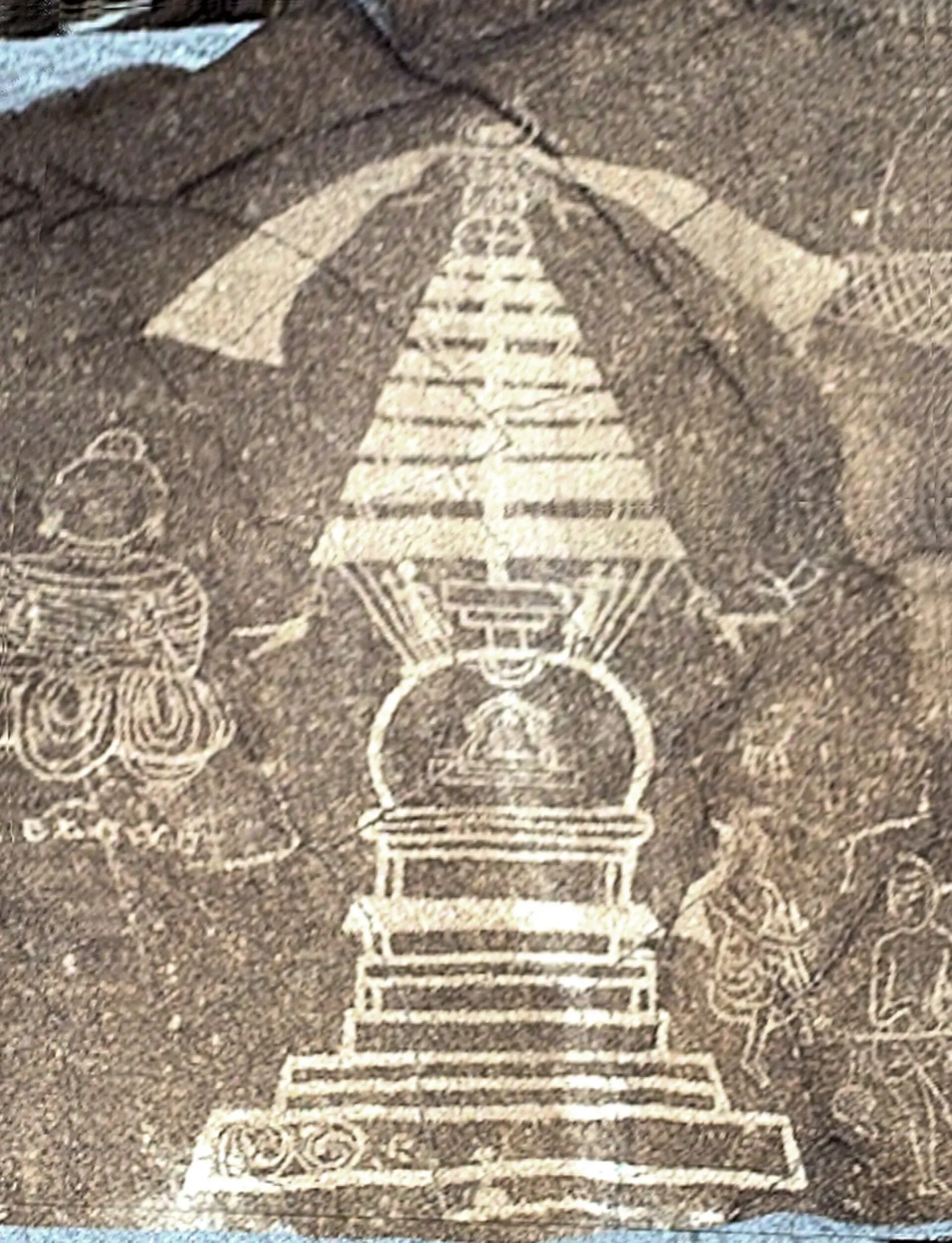
Photo: B.Degel, with thanks · Public domain (CC0) · via Wikimedia Commons · temporary stand-in photo

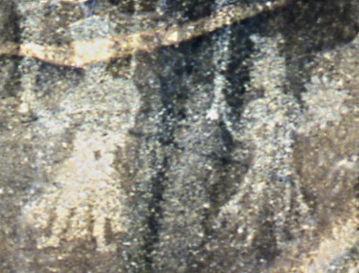
Photo: College de France, with thanks · Public domain (CC0) · via Wikimedia Commons · temporary stand-in photo

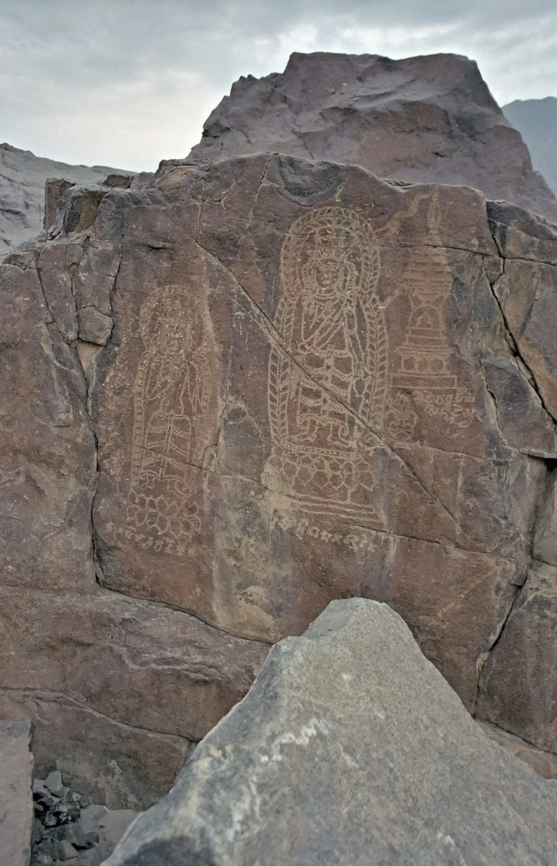
Photo: Kogo, with thanks · CC BY-SA 3.0 · via Wikimedia Commons · temporary stand-in photo

The carvings sit in the open, so look and do not touch or add to them. The Diamer-Bhasha Dam being built upstream will flood many of them.
Food
Food is simple and filling: mutton and chicken, rice, daal, bread and strong tea. Restaurants along the KKH serve travellers, but menus are limited. Carry snacks for long drives.
Getting there and around
- Road: Gilgit is about 137 km and roughly 1 hour 50 minutes (OSRM, checked 16 November 2026). From Islamabad, OSRM models about 367 km and 4 h 25 min (checked 17 November 2026), but it ignores slides, checkpoints and slow traffic, so expect a long full day on the KKH via Mansehra. The junction of the KKH and the Babusar road is known as Chilas Zero Point. The N-15 over Babusar Pass (4,173 m) is open only from about April to September and is a steep road with a history of accidents, so check conditions locally.
- Air: Chilas Airfield is nearby, but there is no known regular passenger service. Gilgit is the nearest practical airport.
- Around town: hire a local taxi or jeep. Ask your hotel about shared transport along the KKH.
Where to stay
Choose among a few simple hotels and guesthouses along the KKH and bazaar area. Chilas is hot, so rooms with fans or air conditioning are worth asking for. Many travellers stop here for one night between Besham and Gilgit or Hunza. Book ahead in the summer rush.
Day trips
- Thalpan and the carving sites: within a short drive of town.
- Raikot Bridge and Fairy Meadows: the bridge is on the KKH. A jeep road then leads to Tattu, followed by a walk of about 3 to 4 hours to Fairy Meadows at around 3,300 m.
- Babusar Pass: in season, for a dramatic drive towards Naran and the Kaghan Valley.
- Diamer-Bhasha Dam area: the dam being built upstream will flood many carvings.
When to visit
April to June and September to October are best. July is very hot in the valley (the average is about 28 C), and January averages about 5.6 C. The climate is cold semi-arid, and rainfall is low, about 254 mm a year, with March and April the wettest months.
Safety and good to know
This is a conservative area. Dress modestly, ask before taking photographs of people, and do not photograph women. There have been security incidents in Diamer in the past, so check current conditions with local police, the Gilgit-Baltistan tourism office or your hotel. Travel in daylight, and avoid driving the KKH at night because of rockfall and landslides. Carry your passport or national ID.
For foreign visitors: the UK FCDO advises against all travel on the Karakoram Highway between Mansehra and Chilas, via Battagram, Besham, Dasu and Sazin up to the N-15 junction (advice updated 27 October 2026, checked 17 November 2026), which is the usual road approach to Chilas. It does not advise against Gilgit-Baltistan generally. Read the live advice before you plan.
Highlights
- Thalpan and Chilas rock carvings
- Gateway to Fairy Meadows and Nanga Parbat
- Junction for the Babusar Pass road
- Overnight stop on the Karakoram Highway
Hotels, food, fuel and services in Chilas
Places to stay
- Shangrila Chilas HotelCall Shangrila Chilas HotelMap of Shangrila Chilas Hotel in Google Maps
- Indus lodges ChilasCall Indus lodges ChilasMap of Indus lodges Chilas in Google Maps
- Grace Continental Hotel & RestaurantCall Grace Continental Hotel & RestaurantMap of Grace Continental Hotel & Restaurant in Google Maps
- Tarangfa LodgesCall Tarangfa LodgesMap of Tarangfa Lodges in Google Maps
- Panorama Hotel & Restaurant ChilasCall Panorama Hotel & Restaurant ChilasMap of Panorama Hotel & Restaurant Chilas in Google Maps
- Hotel Royal City ChilasCall Hotel Royal City ChilasMap of Hotel Royal City Chilas in Google Maps
Places to eat
- Babusar Gateway RestaurantCall Babusar Gateway RestaurantMap of Babusar Gateway Restaurant in Google Maps
Essential services fuel stations, ATMs, banks and hospitals and clinics
Fuel
- PSO (Meera Jan) at Gini (Chilas)Call PSO (Meera Jan) at Gini (Chilas)Map of PSO (Meera Jan) at Gini (Chilas) in Google Maps
- Total Parco Filling Station ChilasMap of Total Parco Filling Station Chilas in Google Maps
- PSO Petroleum ChilasMap of PSO Petroleum Chilas in Google Maps
- Khair-ul-Bashar Filling - Total Petrol StationCall Khair-ul-Bashar Filling - Total Petrol StationMap of Khair-ul-Bashar Filling - Total Petrol Station in Google Maps
ATMs
Banks and money exchange
- Faysal Bank ChilasMap of Faysal Bank Chilas in Google Maps
- Meezan Bank - Chillas BranchCall Meezan Bank - Chillas BranchMap of Meezan Bank - Chillas Branch in Google Maps
Hospitals and clinics
- Regional Headquarters Hospital ChilasMap of Regional Headquarters Hospital Chilas in Google Maps
- Marham health care centre (MHCC)Call Marham health care centre (MHCC)Map of Marham health care centre (MHCC) in Google Maps
Listings come from Google Maps data and are unverified: phone numbers, opening months and prices may have changed. Report a problem · Own one of these? Claim it
Tips
- Visit April to June or September to October; July is very hot.
- Do not touch or add to the rock carvings.
- Check road and security conditions locally before travelling.
- Avoid driving the KKH at night.
Photos we still need: Chilas bazaar; Thalpan carving site (visitor access). Send us yours
Sources and last checked
Last checked Confidence medium8 sources4 still to check
- Last checked
- Method
- Desk research from published sources
- Confidence
- medium
- Checked by
- trek.pk research team
Researched from published sources; not yet checked on the ground by our team. Spot something out of date? Report a mistake.
Sources
- Chilas · Wikipedia · checked
- Diamer District · Wikipedia · checked
- Babusar Pass · Wikipedia · checked
- Fairy Meadows National Park · Wikipedia · checked
- Diamer District 2023 population (GB Planning and Development statistics) · Gilgit-Baltistan Planning and Development · checked
- OSRM driving routes (road distances and times) · Project OSRM / OpenStreetMap · checked
- Foreign travel advice: Pakistan - warnings and insurance · UK FCDO · checked
- Chilas · Wikivoyage · checked
Still to be checked on the ground (4)
- Current security situation and permits for foreign visitors (FCDO names the KKH Mansehra-Chilas section; no official permit rule found)
- Babusar Pass opening dates this season and road condition (Wikipedia gives April to September only)
- Town population (no 2023 census figure for Chilas town; Diamer district 337,329)
- Access to Thalpan and Chilas carving sites
Nearby and related

Gilgit
Gateway to Gilgit-Baltistan on the Karakoram Highway: a busy mountain town with the Kargah Buddha and the base for Hunza, Naltar and Skardu.

Islamabad
Pakistan's green, planned capital at the foot of the Margalla Hills: Faisal Mosque, hillside trails, cafes and the gateway to the north.
Darel Valley
A valley along the Darel River, a tributary of the Indus, in Darel District near Chilas. Known for Buddhist-period remains. Very few visitor services.
Tangir Valley
The Tangir River valley in Tangir District, about 67 km from Chilas. Remote, with few visitor services.
Diamer-Bhasha Dam
A large dam under construction on the Indus, about 40 km downstream of Chilas. It is a construction site, closed to casual visitors, and lies on the Karakoram Highway section covered by FCDO advice.