

Photo: Ijlalahmed, with thanks · CC BY-SA 4.0 · via Wikimedia Commons · temporary stand-in photo

Islamabad
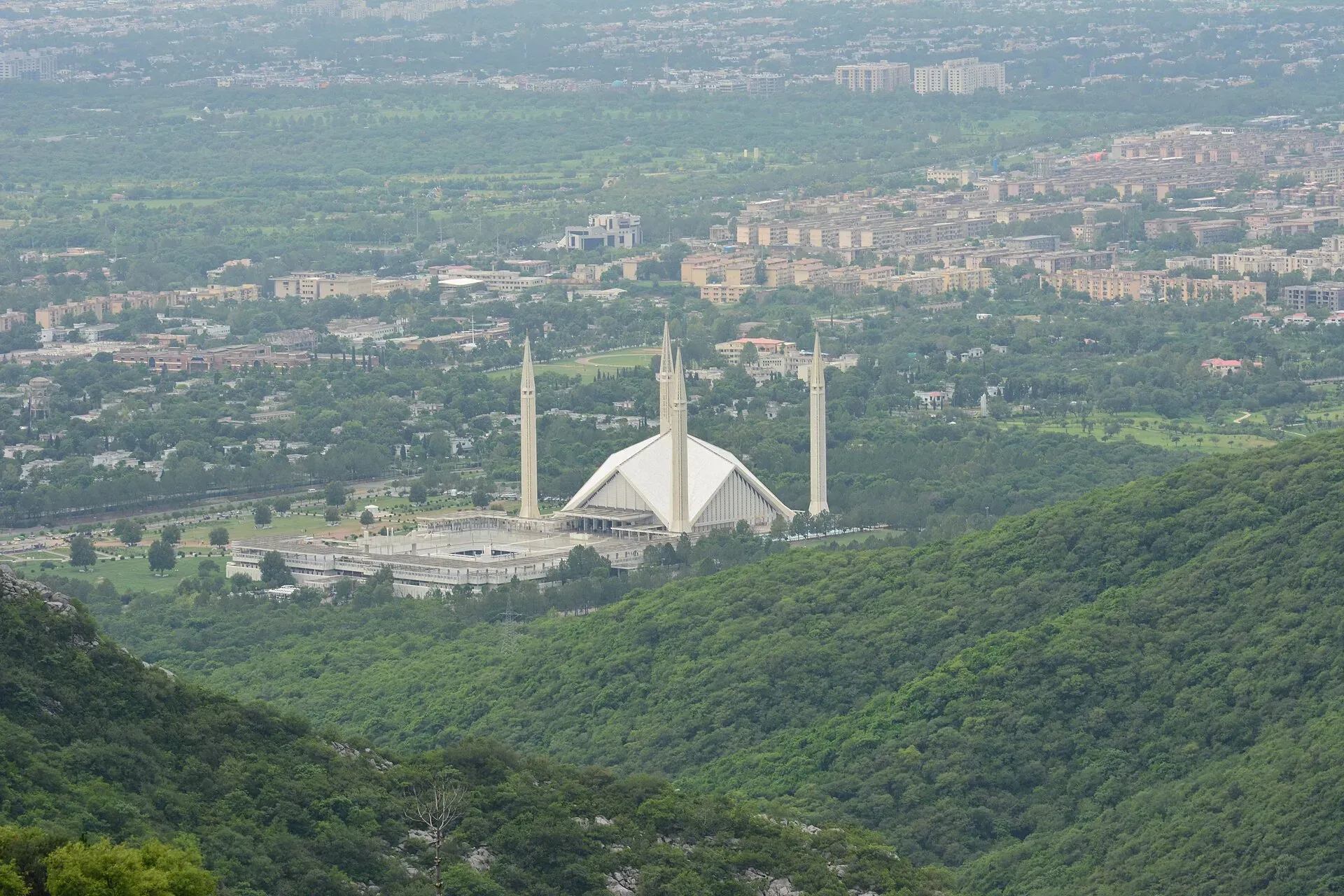
Pakistan's green, planned capital at the foot of the Margalla Hills: Faisal Mosque, hillside trails, cafes and the gateway to the north.
Overview
Islamabad is Pakistan's capital, a planned city built from the early 1960s at the foot of the Margalla Hills. It is greener, quieter and more orderly than most Pakistani cities, laid out on a grid of numbered sectors and wide avenues. It sits at about 540 m and merges with Rawalpindi to the south-west. For travellers it is the usual gateway to the north: the Karakoram Highway, Murree, Swat and Gilgit-Baltistan all start here.
Plan your visit
- Getting there
Air: Islamabad International Airport (ISB), about 25 to 30 km from the centre. Road: M-2 to Lahore, M-1 to Peshawar, N-35 Karakoram Highway north. Rail: use Rawalpindi, about 15 km away. More
Best months
Mar – Apr, Oct – Nov
- Islamabad
- Related places nearby: Rawalpindi, Simly Dam, Rawat Fort, Rawalpindi, Pakistan Railways Heritage Museum (Golra Sharif)
History in brief
The site was chosen in the late 1950s and the Greek planner Constantinos Doxiadis drew up the master plan. The capital moved from Karachi in stages through the 1960s, with Rawalpindi acting as the interim capital. Older settlements such as Saidpur village and the Rawal Lake area were absorbed into the new city.
Neighbourhoods
- Blue Area and Jinnah Avenue: the business spine, with offices, banks and many hotels. Good for convenience.
- F-6 (Super Market), F-7 (Jinnah Super) and F-10: cafes, restaurants, bookshops and bakeries. Good for evenings and eating out.
- Saidpur Village: a restored hillside village with craft shops and restaurants at the Margalla foot.
- E-7 and the Margalla foothills: quiet leafy streets and trailheads.
- G-6, G-8 and I-8: residential and market sectors, with Aabpara and Melody Market for street food.
- Shakarparian and Faisal Avenue: parks and the Pakistan Monument, with the Faisal Mosque at the northern end.
Top sights
- Faisal Mosque: the national mosque, finished in 1986, with a tent-like design by Vedat Dalokay. It can hold a very large congregation. Dress modestly.
- Pakistan Monument: a petal-shaped monument on Shakarparian hill with a small museum. The view over the city is good.
- Margalla Hills National Park: forest trails, including Trail 3, Trail 5 and the Daman-e-Koh route.
- Daman-e-Koh and Pir Sohawa: viewpoints on the hillside above the city, with food and a view over the sectors.
- Lok Virsa Heritage Museum: a good first stop for crafts, costume and regional culture. Lok Virsa's home page (checked 17 November 2026) lists the Heritage Museum and the Pakistan Monument Museum as open every day, 10 am to 7 pm. An earlier check of its pages gave 10 am to 8 pm and a Monday closure for the Monument Museum, so confirm by phone (051-9249209).
- Pakistan Museum of Natural History: next to Lok Virsa, with geology, minerals and animals. Its website lists 9 am to 5 pm every day, with a break on Fridays from 12:30 to 2:00 pm (checked 16 November 2026).
- Rawal Lake and Lake View Park: boating, picnics and sunset views.
- Saidpur Village: old lanes, a restored temple and small galleries.
- Rawal Dam and Shakarparian parks: easy greenery for a free afternoon.
- Centaurus and the Blue Area: modern malls and the city skyline.
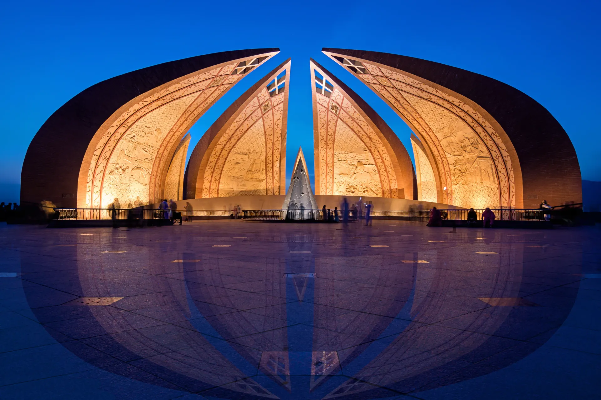
Photo: Muhammad Ashar, with thanks · CC BY-SA 4.0 · via Wikimedia Commons · temporary stand-in photo

Margalla Hills and wildlife
Margalla Hills National Park was established in 1980 and covers 17,386 hectares, of which 12,605 are the Margalla Hills themselves. It is run by the Islamabad Wildlife Management Board. The range rises from about 685 m at its western end to 1,604 m at Tilla Charouni in the east. Seven numbered trails cross it, Trail 1 to Trail 7 (Trail 7 is named Shah Allah Dittah), and Trail 3 and Trail 5 are the busiest. Wikipedia does not give trail lengths or difficulty, so ask at a trailhead or check with the Wildlife Management Board before setting out.
The park is home to gray goral, barking deer (muntjac) and Indian leopard, with jungle cats, golden jackals and rhesus macaques also listed. Himalayan vultures, peregrine falcons and kalij pheasants are among the birds, and snakes include Russell's viper and the Indian cobra. Pine, olive and phulai are among the native trees. Treat leopard country seriously: walk in groups, avoid the trails at dusk and keep food out of sight of the monkeys.
Food
Islamabad has a wide range, from Pakistani classics to international food. Try karahi, BBQ and chapli kebab, along with fresh naan and tea at Aabpara and Melody Market. F-7 and F-6 are good for cafes and bakeries. In summer, mulberry and sugarcane juice stalls appear. Hillside terrace restaurants above the city are popular for the views. Alcohol is not widely available in Pakistan; do not expect it on menus.
One or two days
One day. Start at Faisal Mosque in the morning, then drive to the Pakistan Monument on Shakarparian and the Lok Virsa Heritage Museum, which are close together. Have lunch in F-6 or F-7. In the late afternoon go up to Daman-e-Koh for the view over the sectors, or finish at Saidpur Village.
Two days. Spend the second morning on a Margalla trail (start early and carry water), then the Pakistan Museum of Natural History, which sits next to Lok Virsa, or an afternoon at Rawal Lake. Hours for museums are listed above; confirm them before you go.
Getting there
- By air: Islamabad International Airport (ISB) opened on 3 May 2018 at Fateh Jang, about 25 to 30 km south-west of the centre. It handles most international arrivals. Wikipedia gives 25 km from Islamabad; allow about an hour. The Metrobus Orange Line runs from Faiz Ahmed Faiz station (H-8/2) to the airport.
- By road: the M-2 motorway runs to Lahore (about 4 hours), and the M-1 to Peshawar (about 2 hours). The N-35 Karakoram Highway starts near Hasan Abdal and runs north to Gilgit-Baltistan.
- By rail: Islamabad has its own station (reopened 2009), served by the Green Line Express to Karachi and the Islamabad Express, according to Wikipedia. The main hub for trains is Rawalpindi, 15 km away. Check the Pakistan Railways timetable.
Getting around
Ride-hailing (Careem, inDrive, Bykea) is the easiest way to get around. The Metrobus Red Line runs from Pak Secretariat to Saddar in Rawalpindi (about 22.5 km, 24 stations), and the Orange Line runs to the airport. Wikipedia lists service hours as 06:15 to 22:00; check before relying on late trips. The Blue Area has pedestrian-friendly stretches. Taxis and rickshaws are available but you should agree fares. Distances between sectors are large, so plan to use a car.
Where to stay
- Blue Area, F-6 and F-7: most hotels and the best access to restaurants.
- E-7 and the foothills: guest houses and quiet boutique stays.
- Near the airport: a handful of practical hotels for early flights.
- Rawalpindi side: cheaper hotels near the Mall and Saddar.
Book ahead during diplomatic events and in the main holiday periods.
When to visit
Spring (March to April) and autumn (October to November) are the best seasons. Summers are hot and humid with monsoon rain from July to September. Winters are mild but can feel cold in the evenings.
Safety and etiquette
Islamabad is among the more secure cities in Pakistan, though you may pass checkpoints and heavy security around diplomatic areas and during protests. Carry ID. Some Margalla trails, especially Trail 3 and Trail 5, have wild animals including leopards and monkeys. Do not feed monkeys; read the national park rules. Check the situation before attending demonstrations or travelling through the Red Zone.
Day trips
- Margalla Hills trails and Pir Sohawa (30 minutes).
- Taxila (about 35 km), a UNESCO World Heritage site.
- Murree and the Galyat (about 60 km).
- Rohtas Fort near Jhelum (about 110 km).
- Khanpur Dam and Haripur for lakeside time.
Good to know
A fee applies at some sites, such as museums and the Pakistan Monument; current fees will be added soon. Check with the Capital Development Authority, the Islamabad Wildlife Management Board or the site office. Trail access in the Margalla Hills can close in bad weather or during fire risk.
Highlights
- Faisal Mosque and Pakistan Monument
- Margalla Hills National Park trails
- Lok Virsa Museum and Saidpur Village
- Cafes in F-6, F-7 and Jinnah Super
- Base for Taxila, Murree and the Karakoram Highway
Hotels, food, fuel and services in Islamabad
Places to stay
- Serena HotelCall Serena HotelMap of Serena Hotel in Google Maps
- Islamabad Marriott HotelCall Islamabad Marriott HotelMap of Islamabad Marriott Hotel in Google Maps
- Mabali IslandCall Mabali IslandMap of Mabali Island in Google Maps
- Ramada by Wyndham IslamabadCall Ramada by Wyndham IslamabadMap of Ramada by Wyndham Islamabad in Google Maps
- Avari Xpress Residences Islamabad HotelCall Avari Xpress Residences Islamabad HotelMap of Avari Xpress Residences Islamabad Hotel in Google Maps
- Movenpick Hotel CentaurusCall Movenpick Hotel CentaurusMap of Movenpick Hotel Centaurus in Google Maps
Places to eat
- The Monal IslamabadCall The Monal IslamabadMap of The Monal Islamabad in Google Maps
- Tehzeeb Bakers Blue AreaCall Tehzeeb Bakers Blue AreaMap of Tehzeeb Bakers Blue Area in Google Maps
- TKR 3Call TKR 3Map of TKR 3 in Google Maps
- Savour FoodsCall Savour FoodsMap of Savour Foods in Google Maps
- Cheezious Commercial MarketCall Cheezious Commercial MarketMap of Cheezious Commercial Market in Google Maps
- Savour FoodsCall Savour FoodsMap of Savour Foods in Google Maps
Essential services mechanics and pharmacies
Mechanics and tyre shops
- Mohammed Bilal tyre centreMap of Mohammed Bilal tyre centre in Google Maps
Pharmacies
- Imtiaz Mega - Ramzan Mall - islamabadCall Imtiaz Mega - Ramzan Mall - islamabadMap of Imtiaz Mega - Ramzan Mall - islamabad in Google Maps
Listings come from Google Maps data and are unverified: phone numbers, opening months and prices may have changed. Report a problem · Own one of these? Claim it
Tips
- Use ride-hailing, because sectors are far apart.
- Start Margalla hikes early and carry water.
- Dress modestly at Faisal Mosque.
- Carry ID for checkpoints.
- Do not feed the monkeys on the trails.
Photos we still need: Islamabad food (a street-food or karahi scene, open licence). Send us yours
Sources and last checked
Last checked Confidence medium13 sources4 still to check
- Last checked
- Method
- Desk research from published sources
- Confidence
- medium
- Checked by
- trek.pk research team
Researched from published sources; not yet checked on the ground by our team. Spot something out of date? Report a mistake.
Sources
- Islamabad · Wikipedia · checked
- Faisal Mosque · Wikipedia · checked
- Margalla Hills National Park · Wikipedia · checked
- Capital Development Authority · Government of Pakistan · checked
- Pakistan Tourism Guide 2021 · TDAP · checked
- Lok Virsa: museum timings · Lok Virsa · checked
- Pakistan Museum of Natural History: timings · PMNH · checked
- Islamabad Capital Territory · Wikipedia · checked
- List of cities in Pakistan by population (2023 census) · Wikipedia · checked
- List of airports in Pakistan · Wikipedia · checked
- Rawalpindi-Islamabad Metrobus · Wikipedia · checked
- Islamabad International Airport · Wikipedia · checked
- Islamabad railway station · Wikipedia · checked
Still to be checked on the ground (4)
- Airport transfer time (Wikipedia gives 25 km, no time; allow about an hour is our estimate)
- Entry fees (current fees will be added soon; no official price list found, Lok Virsa home page gives hours only)
- Which Margalla trails are open (Wikipedia lists Trails 1 to 7 with no status; iwmb.org.pk did not resolve)
- Margalla trail lengths, difficulty and closures (Wikipedia gives none)
Nearby and related

Rawalpindi
Islamabad's older twin city: a busy bazaar and cantonment, the north's main rail and bus hub, and an easy base for Taxila and Murree.

Lahore
Punjab's capital and Pakistan's cultural city: Mughal forts, mosques and gardens, a lively Walled City, and some of the best food in the country.

Simly Dam
An 80 m earthen dam on the Soan River, about 30 km east of Islamabad. It supplies drinking water and offers lake views and fishing.
Rawat Fort, Rawalpindi
A fortified caravanserai on the Grand Trunk Road about 17 km east of Rawalpindi, founded in the 15th century and turned into a Gakhar stronghold in the 16th. On Pakistan's UNESCO tentative list since 2026.

Pakistan Railways Heritage Museum (Golra Sharif)
A railway museum in Golra Sharif Junction station, Islamabad, with steam and electric locomotives, saloon cars and relics from over 150 years of railway history. Open since 2003.
Soan River
A seasonal river of the Pothohar Plateau that rises in the Murree Hills and runs past Islamabad and Rawalpindi to the Indus near Makhad. Its valley gave its name to the Soanian stone-tool culture.