

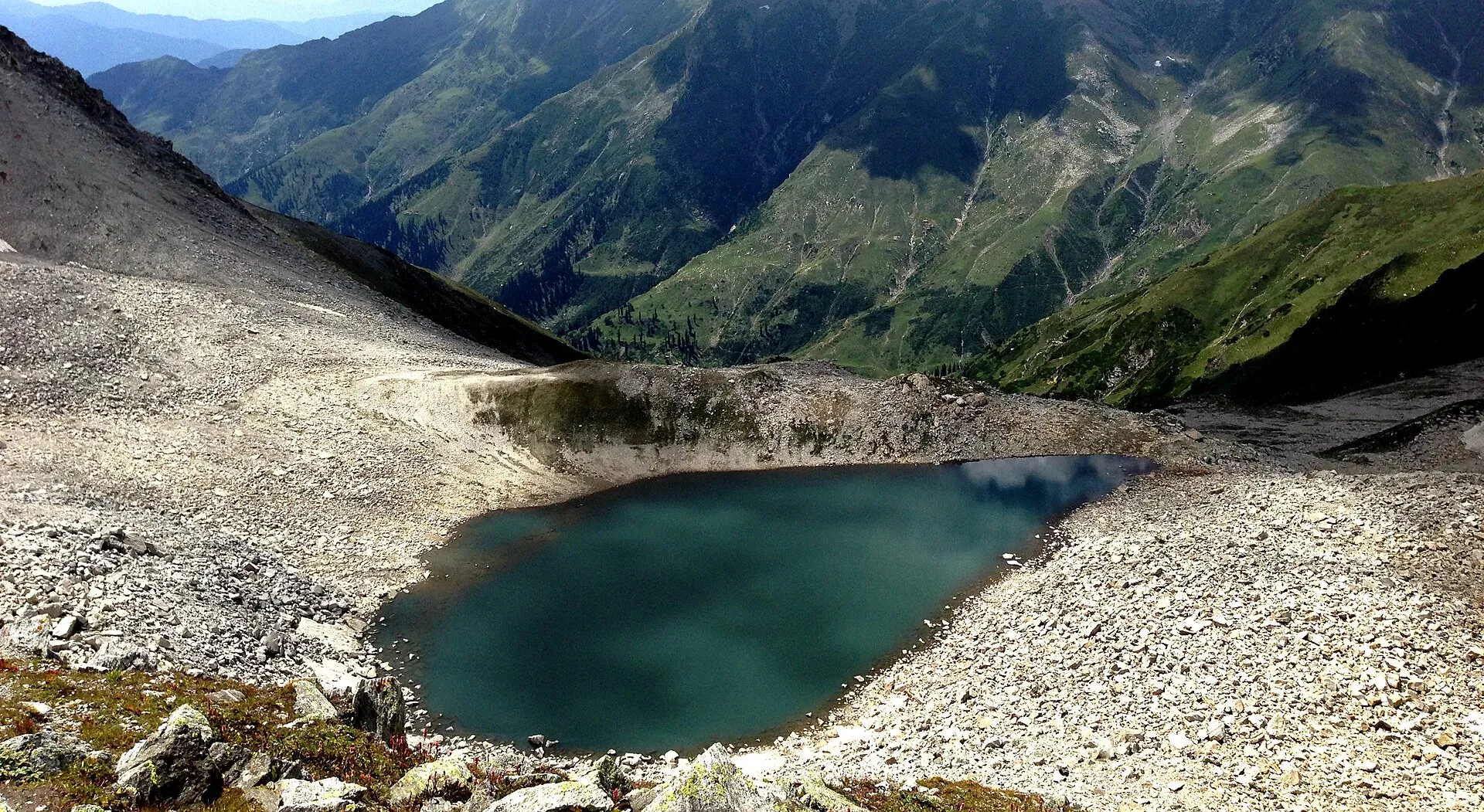
Photo: Sarmad1296ali, with thanks · CC BY-SA 4.0 · via Wikimedia Commons · temporary stand-in photo

Ansoo Lake
A tear-shaped lake at about 4,126 m below Malika Parbat, reached on a steep, long day or overnight hike from Saiful Muluk. A hard walk, often with snow.
Overview
Ansoo Lake, "Teardrop Lake", lies at about 4,126 m near Malika Parbat, the tallest peak in the Kaghan Valley, in Mansehra District. Wikipedia lists it as one of the highest lakes in the Himalayan range. Its tear shape gives it its name. Some sources give a much higher figure, so treat the altitude as approximate. It is a hard walk with no road.
Plan your visit
- Nearest town
- Naran
- Getting there
Drive from Naran to Saiful Muluk by jeep (about 9 km; OSRM 9.0 km), then walk. The trail runs up the valley to Malika Parbat base camp and then climbs to the lake. Allow a full day, or camp overnight. More
Best months
Jul – Aug
- Ansoo Lake
- Related place nearby: Saiful Muluk
How to reach it
The trek begins at Lake Saiful Muluk (see Saiful Muluk), about 9 km from Naran by jeep road.
- Stage 1: a valley walk beside the river to Malika Parbat base camp, about 2 to 2.5 hours.
- Stage 2: a harder climb up the rocky slope to the lake, about 2.5 to 3 hours.
Round trips range from 6 to 9 hours for strong walkers, and more than 12 hours for others (one operator page gives about 4 hours one way from Saiful Muluk and 7 to 9 hours return, and its own figures vary). Start at about 6 am. Most of the trail is covered in snow for a large part of the year. A second, less used route starts from Mahandri, about 40 km south of Naran.
Terrain and route notes
One operator (Nature Adventure Club) describes the route from Saiful Muluk as a valley walk along a stream to the Malika Parbat base camp, roughly the midpoint, followed by a steeper, rocky climb to the lake. It says the track crosses rocky and snowy ground, that parts are narrow with no room for horses, and that several glaciers or snow fields must be crossed. The alternative route from Mahandri, about 40 km below Naran, goes through the Manoor valley and a green meadow called Dher, about 7 hours in, before the final climb. Horses and guides can be hired at Saiful Muluk, according to the same operator.
Pack warm layers, waterproofs, food and a tent if you plan to camp. The operator warns of fog or rain that can hide the lake, landslides in the monsoon, and altitude sickness. Start early so you are back before dark.
The mountain above
Malika Parbat ("Queen of Mountains") rises to 5,290 m, the highest peak in the Kaghan Valley, about 6 km south of Saiful Muluk (Wikipedia). Its north summit was first climbed in 1920 by Captain B. W. Battye and four Gurkha soldiers, with a second ascent in 1967. Local people regard the mountain as unclimbable because of its steepness.
What to see and do
- The lake and Malika Parbat above it.
- Camping. A night at the base camp breaks the effort, but carry tents.
- Wildflowers and glacier views in July.
When to visit
Mid-July to mid-August is the best window reported by one operator (10 July to 15 August), with June to September given as the wider summer period. The lake is frozen and the route snow-covered for most of the year. Outside it the route is snowed in or dangerous. Ask guides about snow before you go.
Where to stay and eat
No accommodation. Stay in Naran and walk as a long day, or camp. There is no shop on the route.
Good to know
- Guide: a local guide is strongly advised because of snow and route-finding.
- Water: there is no water at the top; carry your own bottles.
- Fees: national park and guide fees are not confirmed here. Current fees will be added soon.
- Altitude: at over 4,000 m, altitude sickness is possible. Turn back if you feel unwell.
- Safety: steep snow, loose rock and sudden storms. Do not go alone, and tell someone your plan.
- Respect: growing numbers have strained the path and surroundings, so carry out all rubbish.
Highlights
- About 4,126 m, tear-shaped
- Trek from Saiful Muluk via Malika Parbat base camp
- Snow on the route for much of the year
- Views of Malika Parbat
Getting there
Drive from Naran to Saiful Muluk by jeep (about 9 km; OSRM 9.0 km), then walk. The trail runs up the valley to Malika Parbat base camp and then climbs to the lake. Allow a full day, or camp overnight. A second route starts at Mahandri south of Naran.
Tips
- Start at about 6 am.
- Hire a local guide and carry water.
- Turn back if the weather changes.
- Take all rubbish with you.
Photos we still need: the Malika Parbat base camp and the rocky final climb. Send us yours
Sources and last checked
Last checked Confidence low6 sources3 still to check
- Last checked
- Method
- Desk research from published sources
- Confidence
- low
- Checked by
- trek.pk research team
Researched from published sources; not yet checked on the ground by our team. Spot something out of date? Report a mistake.
Sources
- Ansoo Lake · Wikipedia · checked
- Kaghan Valley · Wikipedia · checked
- Pakistan Tourism Guide 2021 · TDAP (Trade Development Authority of Pakistan) · checked
- Ansoo Lake Trek, Upper Kaghan Valley · Nature Adventure Club · checked
- OSRM driving route service: road distances and times measured 16 November 2026 (driving only, optimistic on mountain roads) · OSRM / OpenStreetMap contributors · checked
- Malika Parbat (Wikipedia) · Wikipedia · checked
Still to be checked on the ground (3)
- Walking times on the day (operator pages disagree: about 4 h one way, 7 to 9 h return)
- Fees and guide rules (no official source found; a guide is advised, not required, by one operator)
- Altitude: Wikipedia gives 4,126 m; one operator quotes 4,245 to 4,259 m and also 5,027 m. We use Wikipedia's figure.
Nearby and related

Saiful Muluk
The best-known lake of the Kaghan Valley, at 3,224 m above Naran, with Malika Parbat behind it. It is about 9 km from Naran, reached by jeep, and is snowbound and frozen in winter.

Dudipatsar Lake
An alpine lake at about 3,800 m in Lulusar-Dudipatsar National Park, reached by a 5 to 8 hour walk from Besal on the Babusar road. Mid-June to late September.