

Photo: Emaad Paracha, with thanks · CC BY-SA 4.0 · via Wikimedia Commons · temporary stand-in photo

Chitral and Kalash
A 6-7 day road trip from Islamabad to Chitral through Dir and the Lowari Tunnel, with the Kalash valleys of Bumburet, Rumbur and Birir, Chitral Fort and Tirich Mir views.
Customise this route Change the dates, stops and how you travel in the Road Trip Planner.
Overview
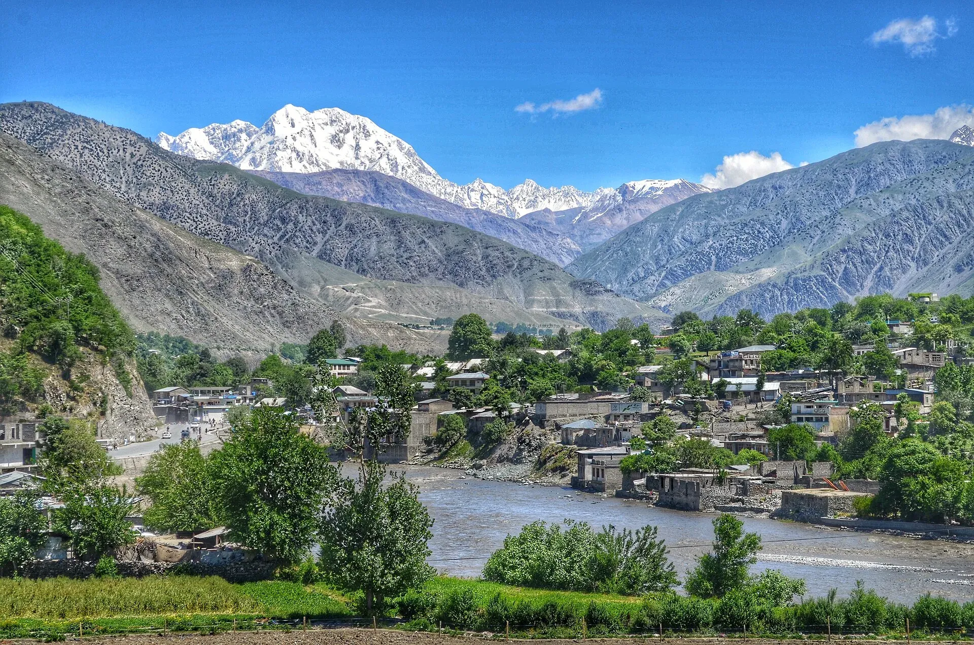
Chitral is a high valley on the western side of the Hindu Kush, close to Afghanistan. Since the Lowari Tunnel opened in 2017 you can drive there all year, instead of relying on the pass, which is closed in winter. Near Chitral are the three Kalash valleys, home to the Kalasha people, who follow their own religion and keep their own festivals.
Who it suits
Culture-curious travellers, photographers, and anyone who wants a quieter alternative to the KKH. The main road is paved, but the Kalash valley roads need a jeep.
When to go
April to October for easy travel. Chitral can be visited in winter by the tunnel, but side roads freeze or flood. Kalash festivals, such as Chilam Joshi in spring and Uchau in late summer, attract visitors; dates vary each year, so ask the Chitral district authorities. In 2026 Chilam Joshi ran in mid-May (Dawn, 15 May 2026, reported it under way; the Express Tribune gives 13 to 16 May). One tour operator lists Uchau on 20 to 22 August and Chawmos (winter) in December, but there are no known official dates.
The route in short
Islamabad to Chakdara by the M-1 and Swat motorway, then through Timergara and Dir to the Lowari Tunnel (8.5 km and 1.9 km tunnels, 10.4 km combined) on the N-45. Beyond the tunnel the road descends into Chitral district, through Drosh, to Chitral town. The Kalash valleys lie roughly 25 to 40 km south-west of Chitral by road. Wikivoyage says about 40 km. Our own OSRM figures (Bumburet 29 km, Rumbur 29 km, Birir 35 km) depend on where the start point sits in each valley, and a second routing check gave 25 to 39 km, so treat all of them as approximate.
Chitral town and the road in
Lowari Tunnel. Wikipedia says the two tunnels, 8.5 km and 1.9 km, opened in July 2017 after work began in 2005 (an earlier attempt began in 1975), at a cost of about Rs 27 billion. The NHA runs it. Before it opened, the pass was shut for much of winter, and travellers between Chitral and the rest of Pakistan sometimes detoured through Kunar in Afghanistan.
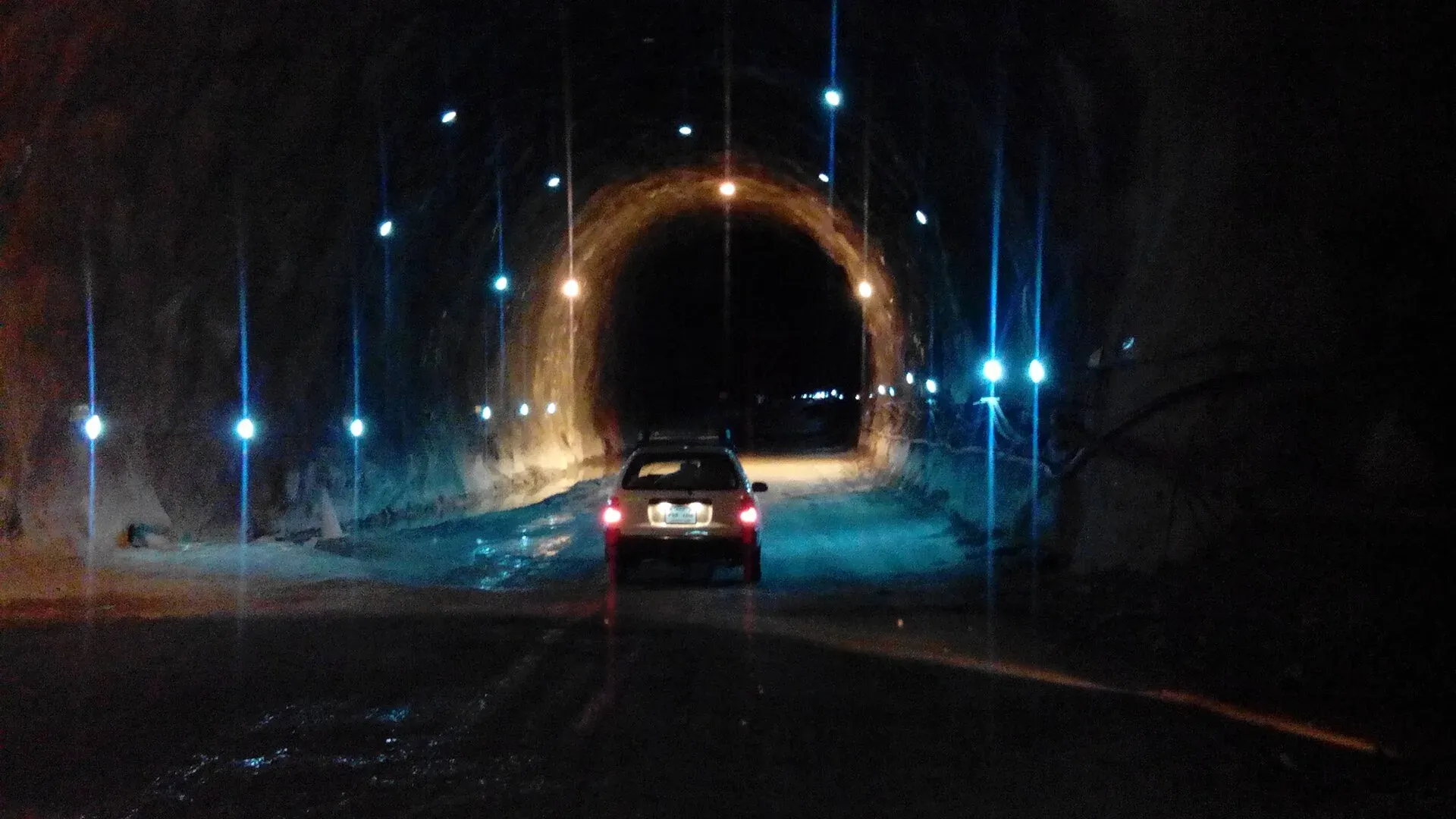
Photo: Ihsan Farid, with thanks · CC BY-SA 4.0 · via Wikimedia Commons · temporary stand-in photo

Chitral Fort. The fort on the bank of the Chitral river is believed to date from 1774, in the reign of Mohtaram Shah Katur II, and was restored in 1911. After Chitral State was merged into Pakistan in 1969 it became the last ruler's personal property. In 1895 about 400 British troops were besieged here.
Getting about. Wikivoyage gives about 8 to 10 hours by car from Islamabad. Shared jeeps run to Mastuj and Khot, and in the other direction to the Kalash valleys.
What to see
- Chitral town: the old fort, the Shahi Mosque, the bazaar and the polo ground, with Tirich Mir (7,708 m) overhead.
- Bumburet, Rumbur and Birir: the Kalash valleys. Bumburet is the most developed; Rumbur is quieter; Birir has the fewest visitors.
- Chitral Gol National Park: forest and markhor habitat near town.
The Kalash
Kalasha people have their own language, dress and customs. Be respectful: ask before photographing anyone, do not enter ceremonial or sacred places without permission, dress modestly and follow the advice of your host. Do not treat people as an attraction. A visitor fee for the valleys has been reported, but there is no known official notice with a current amount (blogs and Wikivoyage give figures that differ, and we have not used them); current fees will be added soon.
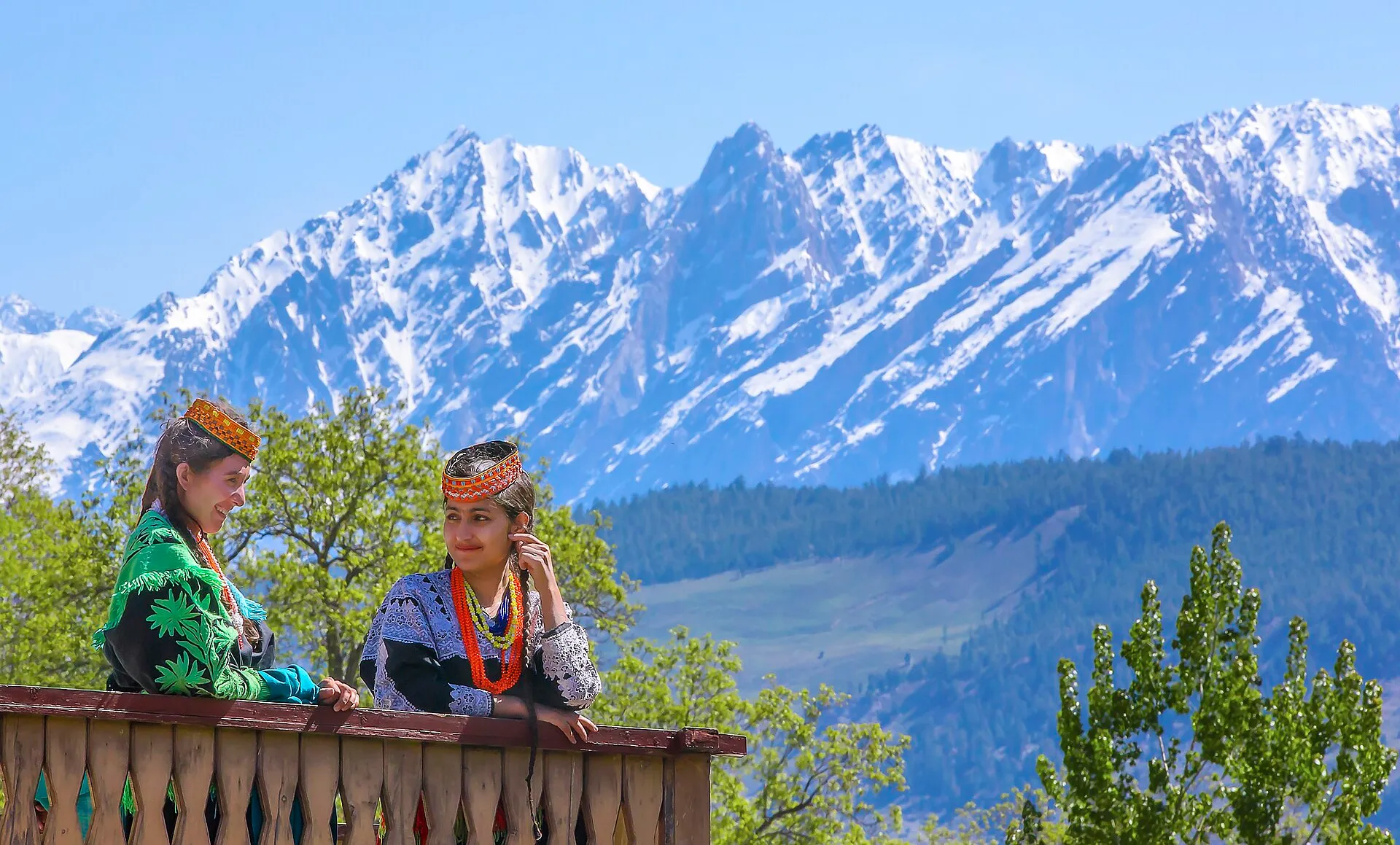
Photo: Tahsin A Shah, with thanks · CC BY-SA 4.0 · via Wikimedia Commons · temporary stand-in photo

The three valleys
Wikipedia names three Kalash valleys in Chitral District: Bumburet (Mumuret in Kalasha), Rumbur (Rukmu) and Birir (Biriu), with villages at roughly 1,900 to 2,200 m. The 2023 census counted 7,466 people whose mother tongue is Kalasha, an Indo-Aryan language; about 3,000 converts to Islam, or their descendants, also live in the villages. Wikipedia reports that Islam is the majority faith, with a minority following the traditional Kalasha religion.
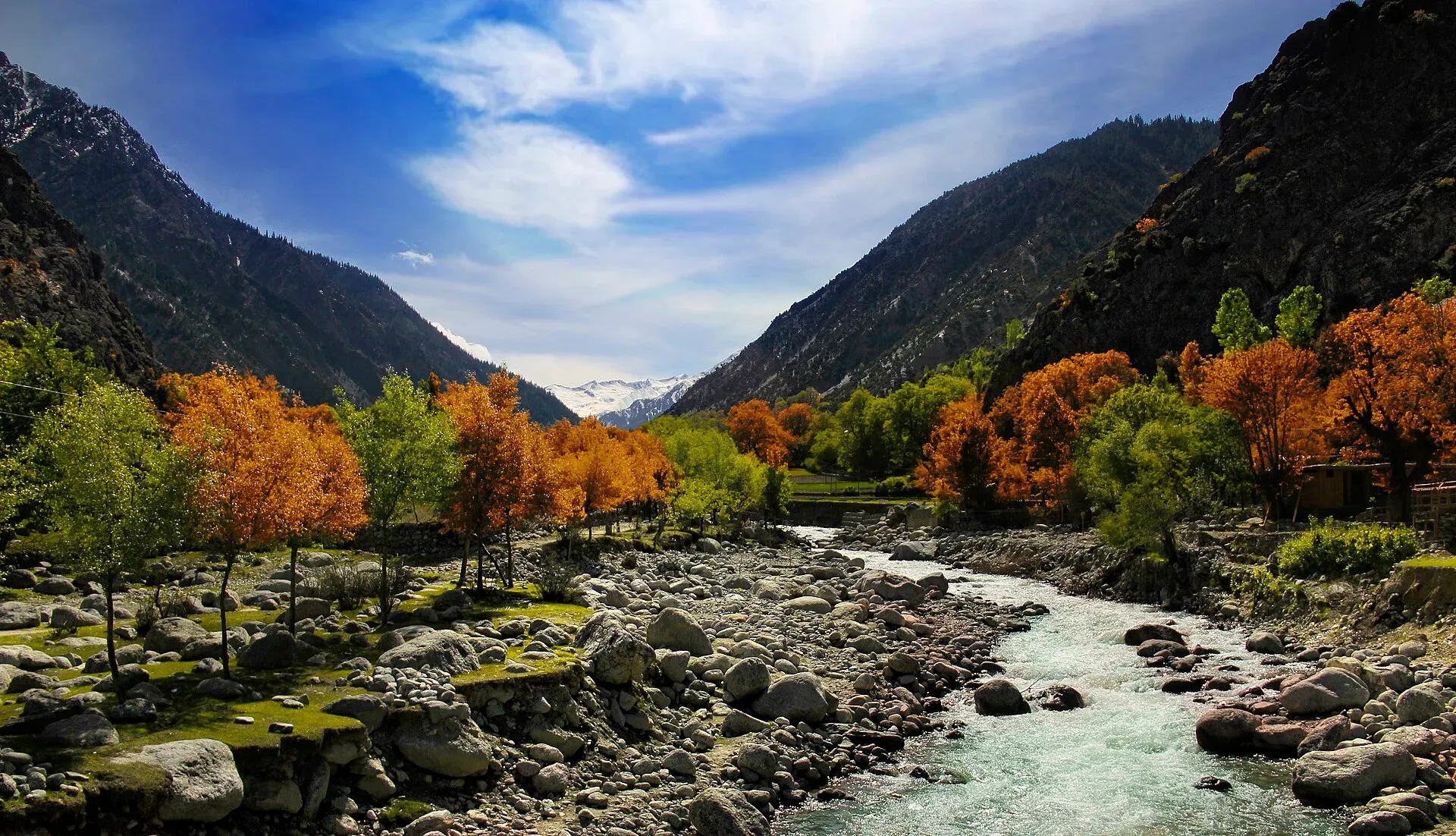
Photo: Hassan Ali (Hsnbook), with thanks · CC BY-SA 3.0 · via Wikimedia Commons · temporary stand-in photo

Wikivoyage describes Bumburet as the valley with most hotels. Rumbur is less visited, and Wikivoyage says it has a higher Kalash population. The valley roads are unpaved, with the river on one side, and jeeps leave Chitral in the morning and mid-afternoon.
Festivals. Wikipedia lists Chilam Joshi in spring (mid to late May), Uchau in autumn and Chawmos in midwinter, held for about two weeks around 7 to 22 December. Women's dress is a long black robe, often embroidered with cowrie shells. Festivals belong to the community, so ask a host about what visitors may attend and where photographs are acceptable.
Distances
Distances and times in this plan are from OSRM / OpenStreetMap, measured on 16 November 2026. They are driving time only, without stops, and OSRM is optimistic on mountain roads, unpaved tracks and in traffic, so real journeys are usually clearly longer; treat the times as a minimum. Islamabad to Chitral is about 423 km (6 h 40 by OSRM). The Dir to Lowari Tunnel and tunnel to Drosh legs are slow, so real times are noticeably longer.
Treks and side trips
Treks from here include Tirich Mir Base Camp, Gree An, Donson Pass and Kundyak An, Gokhshal An and Dooni An, Kasavir and other treks in Chitral.
Highlights
- Lowari Tunnel, the all-weather link to Chitral
- Chitral Fort and Tirich Mir views
- Bumburet, Rumbur and Birir valleys
- Kalasha festivals
- Chitral Gol National Park
Stops
- ChakdaraJunction on the way to Dir
- TimergaraLower Dir
- DirFuel and rest
- Lowari TunnelTwo tunnels, 10.4 km together
- DroshTown on the Chitral river
- ChitralMain base
- BumburetKalash valley, jeep road
km: distance from the start along the route.
Numbers follow the stops in order. The map shows the stops, not the road itself.
Day by day
Day 1 · Islamabad to Dir
M-1, Swat Motorway and N-45 through Lower Dir to Dir (304 km). Overnight at Dir, or push on if you start early.
Day 2 · Dir to Chitral
Cross the Lowari Tunnel, descend to Drosh and follow the river to Chitral. Visit the fort in the afternoon.
Day 3 · Chitral town
Walk the bazaar, the fort and the polo ground. Take a rest day.
Day 4 · Bumburet
Take a jeep to Bumburet (29 km from Chitral). Visit the Kalasha museum and meet your host or guide.
Day 5 · Rumbur or Birir
Choose Rumbur (quiet, 29 km from Chitral) or Birir (fewest visitors, 35 km). Return to Chitral. The distance shown is the longer, Birir.
Day 6 · Chitral to Dir
Return through the tunnel.
Day 7 · Dir to Islamabad
Long return drive.
Road conditions
- M-1, M-16, N-45 to Dir: good surface with congested sections around Chakdara and Timergara.
- Lowari Tunnel: 8.5 km and 1.9 km tunnels; open all year. Dawn (3 August 2026) reported that the NHA had notified a plan to close it 12 hours a day (three hours closed, three open, alternating), but said it was still open round the clock and that Chitral residents had rejected the plan. Earlier schedules (2017, 2024) had night closures. Check current hours before you go; snow can also close it.
- Dir to Lowari and Chitral: paved, with winter snow on the Dir side before the tunnel.
- Kalash valleys: narrow tracks; jeeps recommended. Birir jeeps often run when there is demand.
Distances and times in this plan are from OSRM / OpenStreetMap, measured on 16 November 2026. They are driving time only, without stops, and OSRM is optimistic on mountain roads, unpaved tracks and in traffic, so real journeys are usually clearly longer; treat the times as a minimum.
Fuel and services
Fuel at Chakdara, Dir, Drosh and Chitral. No fuel at the tunnel or in the Kalash valleys. Guesthouses and small hotels at Chitral and in the valleys. ATMs at Chitral. Mobile coverage is variable.
Where to stay, eat and fuel up
Places to stay
- Apple Hotel & RestaurantCall Apple Hotel & RestaurantMap of Apple Hotel & Restaurant in Google Maps
- Shelton Hotel and RestaurantCall Shelton Hotel and RestaurantMap of Shelton Hotel and Restaurant in Google Maps
- Tirch Mir View Hotel ChitralCall Tirch Mir View Hotel ChitralMap of Tirch Mir View Hotel Chitral in Google Maps
- Hayat Hotel & RestaurantCall Hayat Hotel & RestaurantMap of Hayat Hotel & Restaurant in Google Maps
- Tower Hotel ChitralCall Tower Hotel ChitralMap of Tower Hotel Chitral in Google Maps
- Legendary Hotel ChitralCall Legendary Hotel ChitralMap of Legendary Hotel Chitral in Google Maps
Places to eat
- River View RestaurantCall River View RestaurantMap of River View Restaurant in Google Maps
- HFCCall HFCMap of HFC in Google Maps
- Khurak MahalCall Khurak MahalMap of Khurak Mahal in Google Maps
- Royal Dir Restaurant (best family Restaurant)Call Royal Dir Restaurant (best family Restaurant)Map of Royal Dir Restaurant (best family Restaurant) in Google Maps
- River Swat RestaurantCall River Swat RestaurantMap of River Swat Restaurant in Google Maps
- Diwan Hotel & RestaurantCall Diwan Hotel & RestaurantMap of Diwan Hotel & Restaurant in Google Maps
Essential services fuel stations, mechanics, ATMs, banks, pharmacies and hospitals and clinics
Fuel
- Haji Nawab Filling Station - Attock PetroleumMap of Haji Nawab Filling Station - Attock Petroleum in Google Maps
- Swat Motorway PSO Filling StationCall Swat Motorway PSO Filling StationMap of Swat Motorway PSO Filling Station in Google Maps
- Total ParcoCall Total ParcoMap of Total Parco in Google Maps
- BycoMap of Byco in Google Maps
- Wali CNG StationMap of Wali CNG Station in Google Maps
- ABC Petroleum StationCall ABC Petroleum StationMap of ABC Petroleum Station in Google Maps
Mechanics and tyre shops
- Sharjah TyresCall Sharjah TyresMap of Sharjah Tyres in Google Maps
- Noor Autos BatkhelaCall Noor Autos BatkhelaMap of Noor Autos Batkhela in Google Maps
- Car Repairing Near Al Khidmat FoundationMap of Car Repairing Near Al Khidmat Foundation in Google Maps
ATMs
- Habib Bank Limited. (HBL)Map of Habib Bank Limited. (HBL) in Google Maps
- Bank AlfalahMap of Bank Alfalah in Google Maps
- Allied BankCall Allied BankMap of Allied Bank in Google Maps
Banks and money exchange
- Bank Of PanjabCall Bank Of PanjabMap of Bank Of Panjab in Google Maps
- Bank AlfalahCall Bank AlfalahMap of Bank Alfalah in Google Maps
- National Bank of Pakistan (NBP)Map of National Bank of Pakistan (NBP) in Google Maps
- Bank AlfalahMap of Bank Alfalah in Google Maps
- National bank of Pakistan(NBP)Map of National bank of Pakistan(NBP) in Google Maps
- BankIslami - Chitral BranchCall BankIslami - Chitral BranchMap of BankIslami - Chitral Branch in Google Maps
Pharmacies
- Star PharmacyCall Star PharmacyMap of Star Pharmacy in Google Maps
- IDREES MEDICOSCall IDREES MEDICOSMap of IDREES MEDICOS in Google Maps
Hospitals and clinics
- Bacha Khan Medical ComplexCall Bacha Khan Medical ComplexMap of Bacha Khan Medical Complex in Google Maps
- Doctor Aneeqa Waqar ClinicMap of Doctor Aneeqa Waqar Clinic in Google Maps
- Zakir eye centerCall Zakir eye centerMap of Zakir eye center in Google Maps
- Gulrang International HospitalCall Gulrang International HospitalMap of Gulrang International Hospital in Google Maps
- Nowshera Medical CollegeCall Nowshera Medical CollegeMap of Nowshera Medical College in Google Maps
- Sardar Momorial HospitalCall Sardar Momorial HospitalMap of Sardar Momorial Hospital in Google Maps
Listings come from Google Maps data and are unverified: phone numbers, opening months and prices may have changed. Report a problem · Own one of these? Claim it
Safety
- Rockfall and slides: possible on the Dir and Chitral roads in monsoon and spring.
- Cultural respect: festivals and rituals are private events for the community. Ask permission, follow instructions, and keep distance from sacred places.
- Border area: Chitral is close to the Afghan border; carry identity documents and obey checkpoints.
- Advisories: NDMA's January 2026 landslide alert covered KP; no Chitral-specific advisory found as of 16 November 2026. Check with district administration before you go.
For foreign visitors: the UK FCDO advises against all travel on the N-45 from north of the Mardan ring road to the edge of Chitral city, including the Kalash valleys (advice updated 27 October 2026, checked 16 November 2026). Most road routes to Chitral use the N-45. Read the live advice before you plan.
Tips
- Ask for permission before taking photos of Kalasha people or homes.
- Use a local jeep for the valley roads; larger vehicles can get stuck.
- Book a guesthouse in advance during festival weeks.
- Carry some cash; ATMs are in Chitral only.
- Dress modestly in towns and villages.
Sources and last checked
Last checked Confidence medium10 sources5 still to check
- Last checked
- Method
- Desk research from published sources
- Confidence
- medium
- Checked by
- trek.pk research team
Researched from published sources; not yet checked on the ground by our team. Spot something out of date? Report a mistake.
Sources
- Pakistan Tourism Guide 2021 · Trade Development Authority of Pakistan (TDAP) · checked
- Lowari Tunnel · Wikipedia · checked
- Kalasha Valleys · Wikivoyage · checked
- NDMA issues landslide alerts for KP, Balochistan, GB, AJK (January 2026) · Radio Pakistan · checked
- OSRM driving route service: distances and times measured 16 November 2026 (drive times are without stops) · OSRM / OpenStreetMap contributors · checked
- 12-hour daily closure plan for Lowari tunnel draws criticism (3 Aug 2026) · Dawn · checked
- Spring festival kicks off in Kalash valleys (15 May 2026) · Dawn · checked
- Chitral · Wikivoyage · checked
- Kalash people · Wikipedia · checked
- Chitral Fort · Wikipedia · checked
Still to be checked on the ground (5)
- Current Kalash visitor fee (no official source found)
- Official dates for Uchau (August) and Chawmos (December): only a tour operator lists them
- Whether the NHA 12-hour Lowari Tunnel closure plan has taken effect since 3 August 2026
- Exact road distance to each Kalash valley (OSRM start points are approximate; jeep tracks are slower than OSRM suggests)
- Jeep timings to the Kalash valleys (Wikivoyage, undated)
Nearby and related

Tirich Mir Base Camp

Gree An

Donson Pass and Kundyak An

Gokhshal An and Dooni An

Kasavir (Chitral Gol National Park)
Other treks in Chitral

Chitral
The main town of Lower Chitral District, at about 1,500 m on the Chitral River, with a historic fort, a royal mosque and views of Tirich Mir. The base for the Kalash valleys.

Chitral Fort (Shahi Qila)
The fort and royal residence on the Chitral river, with a history reaching back to the 18th century and the 1895 siege. It is still the home of the ceremonial Mehtar, so access is limited.
Chitral Bazaar
The main market street of Chitral town, running between the river, the old fort area and the polo ground. A place for caps, dried fruit, wool and tea. Check FCDO advice for the N-45 road first.

Chitral Polo Ground
The town polo field on the south side of Chitral, beside the museum, where free-style polo is played in season. It is separate from the festival ground at Shandur.

Kalash Valleys (Bumburet, Rumbur, Birir)
Three side valleys of the Chitral River, home to the Kalasha people, who keep their own religion, language and festivals. Visit with respect and check security advice first.

Chitral Valley
The long Chitral River valley at the foot of the Hindu Kush, with Chitral town's fort and Shahi Mosque, the Lowari Tunnel route, Tirich Mir views and side valleys leading to Kalash and Shandur.

Lowari Tunnel
A road tunnel of about 10 km under the Lowari Pass, linking Dir with Chitral on the N-45. Opened in 2017, it gives all-year access, but current UK advice is against all travel on this road.

Lowari Pass
A 3,118 m road pass on the Hindu Raj between Upper Dir and Chitral. Snow shuts the old road for months each winter; the Lowari Tunnel, opened in July 2017, now carries the traffic.

Dir
The old capital of the princely state of Dir, on the Dir River at the foot of the Lowari Pass, with a palace on the hill above. A stop on the road between Peshawar and Chitral.

Timergara
District capital of Lower Dir on the Panjkora River, at about 823 m. For foreign visitors: the UK FCDO advises against all travel to Lower Dir, so this is for information only.
Tirich Mir
At 7,708 m Tirich Mir is the highest mountain of the Hindu Kush and the great landmark of Chitral, visible from the town's bazaar. First climbed in 1950; today it is a serious expedition peak.

Chitral Gol National Park
A mountain park beside Chitral town, set up in 1984 to protect the markhor. About 78 square kilometres rising from 1,450 m to 5,000 m, with snow leopard and ibex.
Chitral Museum
A small museum in Chitral town, established in 2010, with galleries on Chitrali life, weapons, and Kalash and Gandhara Grave archaeology.
N-45 Nowshera-Chitral
The 309 km N-45 runs from Nowshera over the Malakand pass area through Lower and Upper Dir, then through the 10.4 km Lowari Tunnel to Chitral. The UK advises against travel on it from north of Mardan to Chitral.

Swat and Kalam
A 4-5 day road trip from Islamabad up the Swat valley by the M-16 and N-95 to Mingora, Madyan, Bahrain and Kalam, with Mahodand Lake and Ushu forest in summer.

Kumrat Valley
A 4-day road trip from Islamabad to Kumrat in Upper Dir: deodar forest, the Panjkora river and waterfalls, via Chakdara, Dir and Thal, with a final jeep leg.

Gilgit-Shandur-Chitral Summer Biker Route
A 3-4 day summer ride from Gilgit over Shandur Pass (about 3,720 m) to Chitral through the Ghizer and Yarkhun valleys. Rough track on the Chitral side; summer only.