

Photo: Vasiq Eqbal, with thanks · CC BY-SA 4.0 · via Wikimedia Commons · temporary stand-in photo

Skardu
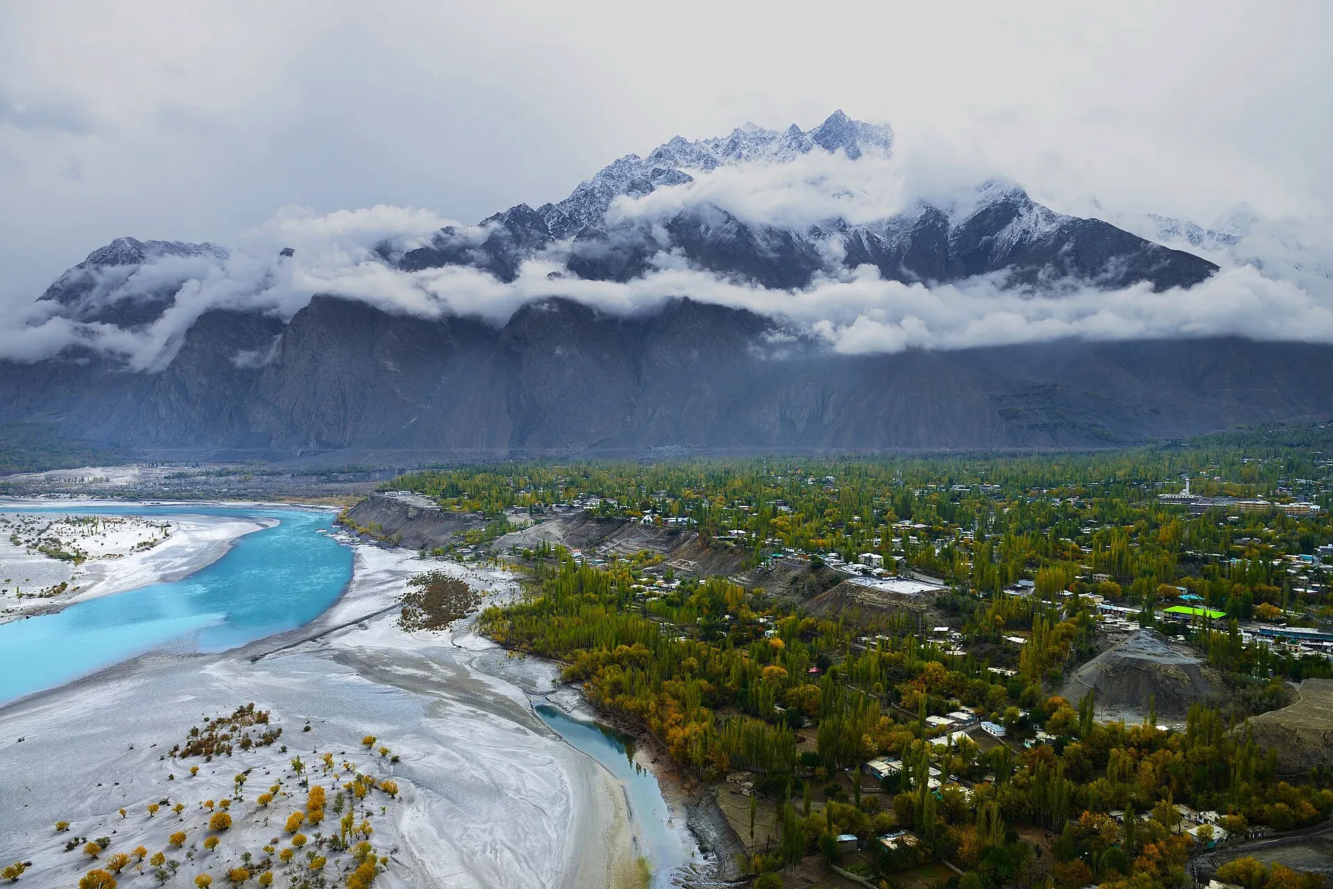
The main town of Baltistan, where the Indus meets the Shigar river. Skardu is the base for the Deosai Plains, the Kachura and Satpara lakes, Shigar, and the K2 and Baltoro treks.
Overview
Skardu is the capital of Skardu District and of Baltistan Division in Gilgit-Baltistan. It sits on a wide valley floor where the Indus is joined by the Shigar river, ringed by bare Karakoram ridges. Wikipedia's headline figure gives 2,228 m, while its lead gives an average of nearly 2,500 m (citing Pirumshoev and Dani, 2003), so treat it as roughly 2,200–2,500 m. Most people speak Balti; Urdu and English are widely understood.
For visitors Skardu is a gateway. Roads and jeep tracks fan out to the Deosai Plains, the lakes, Shigar and Khaplu, and expeditions for K2, the Gasherbrums and Broad Peak start here.
There is no known reliable 2023 census figure for the town. Wikipedia gives 112,996 for the city, labelled as a 2021 figure from a journal article, which we do not treat as census data.
Plan your visit
- Getting there
Road: Gilgit to Skardu about 210 km (OSRM, optimistic 2 h 30 min); Islamabad about 613 km. Air: Islamabad to Skardu about 1 hour, weather-dependent; check airlines. Plan two days by road. More
Best months
May – Oct
- Skardu
- Related places nearby: Gilgit-Baltistan, Shigar Valley, Satpara Lake, Upper Kachura Lake, Lower Kachura Lake (Shangrila), Kharpocho Fort, Manthal Buddha Rock, Deosai National Park, Sheosar Lake, Khaplu and Hushe, Shigar Fort (Fong-Khar), Shigar, Khaplu, Roundu (Rondu) Valley, Kutiah Lungma Glacier (Stak Valley), Zharba Lake (Blind Lake), Shigar, Basho Valley, Tormik Valley, Kharmang Valley, Sarfaranga Cold Desert
History in brief
The name Skardu is believed to come from a Balti phrase meaning a lowland between two high places. The earliest written mention dates from the first half of the 16th century, when Mirza Haidar described Askardu as a district of Baltistan in his Tarikh-i-Rashidi.
Around 1500 Maqpon Bokha was crowned ruler and founded Skardu as his capital. The Maqpon dynasty, based here, ruled Baltistan for about 700 years. The Mughals took Baltistan in 1586 under Akbar, and Skardu's rulers were later described as rulers of Little Tibet. In 1839 the Dogra commander Zorawar Singh seized Skardu Fort, and Skardu became part of Jammu and Kashmir. After 1948 it became the headquarters of the Baltistan Agency, and today it is one of the main administrative and cultural centres of Gilgit-Baltistan, alongside Gilgit.
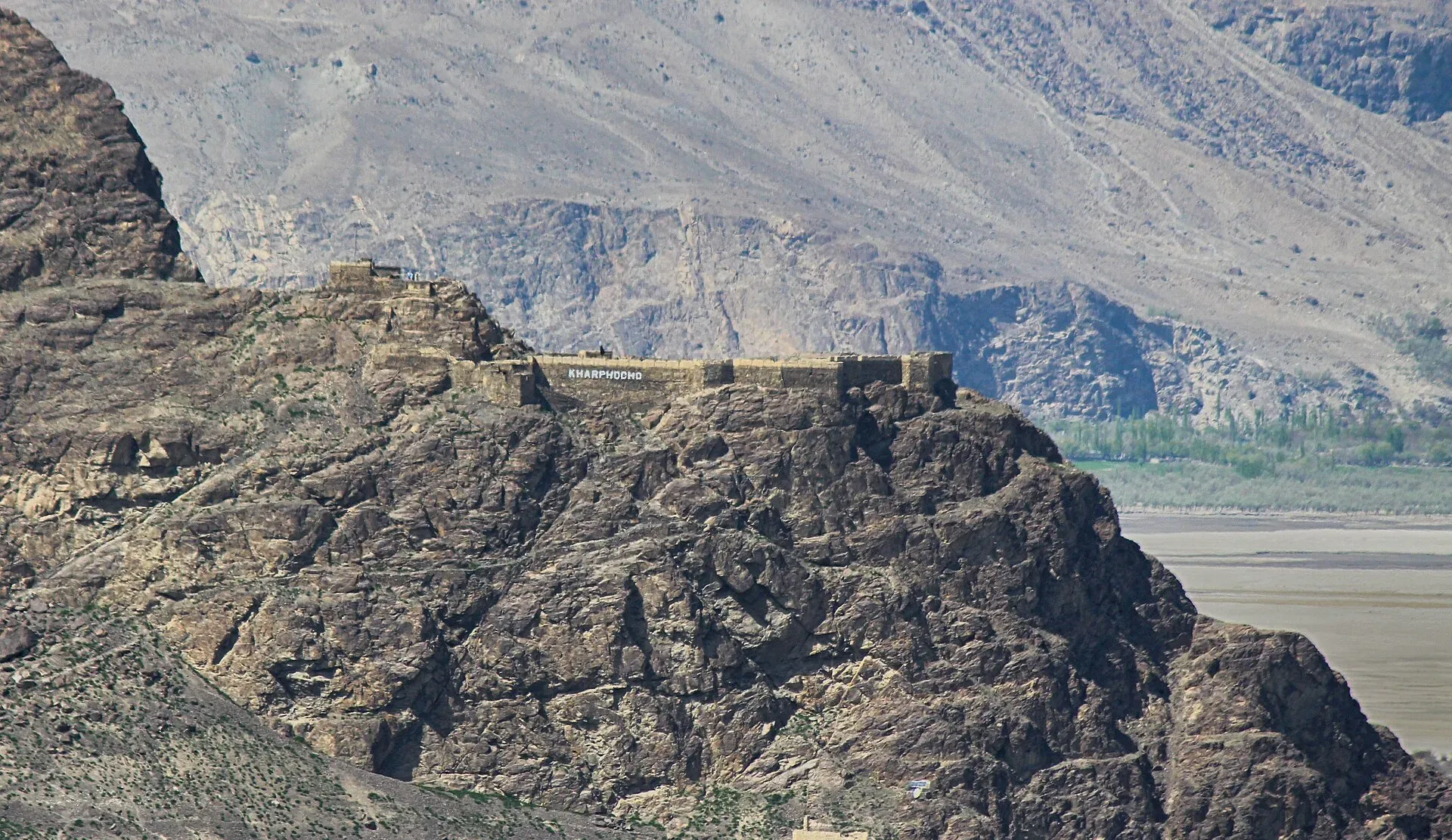
Photo: Rgyalchan, with thanks · CC BY-SA 4.0 · via Wikimedia Commons · temporary stand-in photo

Baltistan has long been in the cultural sphere of Tibet. Wikivoyage notes that it is sometimes called Tibet-e-Khurd (Little Tibet), because its culture and architecture resemble Tibetan models.
What to see and do
- Kharpocho Fort (Skardu Fort). The ruined fort stands on the eastern face of Khardrong hill, above the town and the Indus. Khar means fort in Balti, and the name is usually read as "king of forts". It was built by the Maqpon rulers, and Wikipedia says it once had seven storeys. Sources disagree on its age: Wikipedia gives the 8th century, Wikivoyage the 16th. A mosque inside is thought to date from the arrival of Islam. See Kharpocho Fort.
- Narsok walk. A path starts at the foot of the fort and runs east above the river to the village of Narsok, which has a large spring at the base of the rock. Wikivoyage gives about an hour from Skardu, with a couple of exposed sections along the rock face.
- Manthal Buddha Rock. A large figure of a meditating Buddha, framed by smaller bodhisattvas (enlightened beings in Buddhist art), is carved on a rock west of the Satpara nala (seasonal stream). Wikivoyage dates the carving to about AD 900 in one entry and to the 8th century in another. See Manthal Buddha Rock.
- Katpana cold desert. Sand dunes outside town, a short drive away (about 10 km in the official guide).
- Deosai National Park. About 41 km from Skardu to Deosai Top, roughly 1 hour 30 minutes by car or jeep, according to the Gilgit-Baltistan tourism guide. See Deosai National Park.
- Bazaar and shops. Baltistan is known for pattu, hand-woven woollen cloth used for jackets and coats, for embroidered chugas (the Balti gown) and for wooden spoons, according to Wikivoyage. Naya Bazar and Old Bazar are among the main shopping areas. It is also the place to buy supplies and dried fruit before a trek.
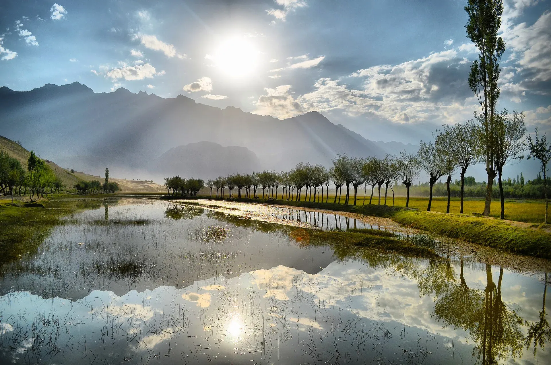
Photo: Qammer Wazir, with thanks · CC BY-SA 4.0 · via Wikimedia Commons · temporary stand-in photo

Lakes and Deosai
Satpara Lake lies about 9.7 km from Skardu and is the source of the town's drinking water. The Satpara Dam, finished in 2011, also supplies irrigation water and a 17.36 MW power plant, with the main inflow coming from melting ice on the Deosai Plains in summer. Wikipedia lists trout fishing and rowing as activities, and Wikivoyage says fishing permits come from the Fisheries Department.
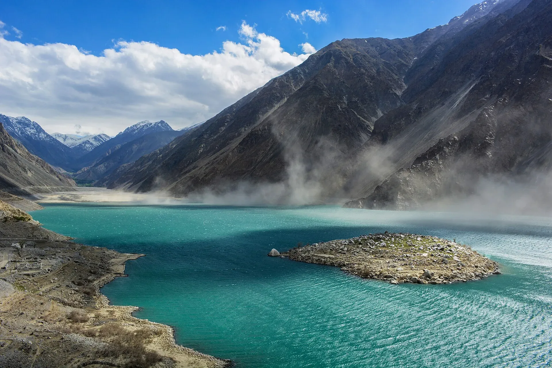
Photo: Qammer Wazir, with thanks · CC BY-SA 4.0 · via Wikimedia Commons · temporary stand-in photo

Kachura lakes are two lakes in the Kachura valley. Lower Kachura, also called Shangrila Lake, is the better known, and it has a resort beside it. A restaurant at the resort is set inside the fuselage of an Orient Airways DC-3 that crash-landed on 3 October 1953, with all aboard surviving. Wikipedia gives the elevation of the lakes as about 2,500 m.
Deosai is a high plateau reached on a seasonal road. The official guide gives the distance and drive time above, and the skardu.pk road page says the road is closed in winter.
Shigar and Khaplu
Wikivoyage describes Shigar as 23 km from Skardu by jeep road, with terraces of wheat, maize and barley and orchards of apricot, mulberry, peach, plum, pear, apple and nuts. A wooden mosque in the town was built by Kashmiri carpenters several hundred years ago. Khaplu, on the Shyok river, is 103 km east, according to the same page, and is the start point for expeditions to Masherbrum and the Saltoro peaks. See Shigar Valley and Khaplu and Hushe.
One or two days
Skardu works as a base more than a single-stop town. This outline uses only the places on this page.
- Day one. Walk up to Kharpocho Fort in the morning, then the bazaar. In the afternoon drive to Satpara Lake and the Buddha Rock at Manthal, which are close together on the Satpara road.
- Day two, option A. The Kachura lakes and Shigar, both reached by road or jeep from town.
- Day two, option B. A full day on the Deosai Plains, in summer only, starting early because of the 1 hour 30 minutes each way to Deosai Top.
Getting there
- Road: Skardu is about 210 km from Gilgit (about 2 hours 30 minutes on OSRM) and about 613 km from Islamabad (OSRM). Real journeys are much longer because of the Besham–Chilas section of the Karakoram Highway and the narrow Skardu road along the Indus. Plan two days from Islamabad.
- Air: Skardu Airport is at about 2,230 m. Flights from Islamabad take about an hour and depend on weather, so a delay of a day is common. Check current schedules and fares with the airline. There is no known official timetable to quote here.
- Around town: local taxis and hired jeeps cover the lakes and Shigar. Agree a price before you set out.
When to visit
Skardu is a tourist destination from April to October, with daytime highs up to about 27 C. December and January can fall below minus 10 C, and snow can cut roads for long periods (Wikipedia). Rainfall is low, about 173 mm a year. Deosai is a summer place: the skardu.pk road page (dated 17 November 2026) says the Deosai road is closed in winter and open in summer, and gives no current condition. There is no known report confirming or denying damage to the road in August 2026, so ask locally before going.
Where to stay and eat
Food in Baltistan leans on local fruit: apricots, apples, peaches, pears, mulberries and walnuts grow in the valleys, and Shigar and Khaplu are known for orchards. Wikivoyage also lists tikka, seekh kebabs and grilled fish among dishes served at restaurants in town. Hotels and guesthouses cluster in three areas. Central Skardu and the bazaar has the simplest rooms and the most restaurants. The Kachura lake side (west of town) has quieter lodges with lake views. The road towards the airport and Katpana has newer hotels. Everyday food is simple: rice, meat, bread, apricots and strong tea. Book ahead in July and August.
Treks and day trips
Day trips go to Satpara, Kachura, Shigar and Deosai. Skardu is also the start for the Baltoro, Masherbrum and Khaplu treks; see the treks below. Wikipedia names Askole and Hushe as the main road gateways to K2, the Gasherbrums, Broad Peak and the Trango Towers, and Skardu has shops and hotels for expedition supplies. Prices rise in the main trekking season. Ask a licensed operator in Skardu which permits and fees apply to your dates.
Safety and good to know
Roads are narrow and rockfall is common, especially after rain. Carry your passport or national ID. Dress modestly and ask before photographing people. The Tourist Police help line is 1422 (24 hours within Gilgit-Baltistan, per the district guide). Fees for parks and permits are not confirmed here; current fees will be added soon.
Ask the district administration or local police about current conditions before you go. For foreign visitors: the UK FCDO advises against all travel on the Karakoram Highway between Mansehra and Chilas (advice updated 27 October 2026, checked 17 November 2026), but does not advise against Gilgit-Baltistan generally. Read the live advice before you plan.
Highlights
- Gateway to K2 and Baltoro treks
- Deosai Plains and Satpara Lake
- Kharpocho Fort and Katpana cold desert
- Shigar and Khaplu forts nearby
Hotels, food, fuel and services in Skardu
Places to stay
- Hotel Mashabrum Skardu, PakistanCall Hotel Mashabrum Skardu, PakistanMap of Hotel Mashabrum Skardu, Pakistan in Google Maps
- Himalaya Hotel SkarduCall Himalaya Hotel SkarduMap of Himalaya Hotel Skardu in Google Maps
- Baltistan Continental Hotel Skardu,Baltistan PakistanCall Baltistan Continental Hotel Skardu,Baltistan PakistanMap of Baltistan Continental Hotel Skardu,Baltistan Pakistan in Google Maps
- Avari Xpress Skardu HotelCall Avari Xpress Skardu HotelMap of Avari Xpress Skardu Hotel in Google Maps
- Baltistan ResortMap of Baltistan Resort in Google Maps
- Skardu Arcadian ResortCall Skardu Arcadian ResortMap of Skardu Arcadian Resort in Google Maps
Places to eat
- Shahi DewanCall Shahi DewanMap of Shahi Dewan in Google Maps
- Rafsal restaurantCall Rafsal restaurantMap of Rafsal restaurant in Google Maps
- Dewan-e-Khas Hotel & RestaurantCall Dewan-e-Khas Hotel & RestaurantMap of Dewan-e-Khas Hotel & Restaurant in Google Maps
- The Grind Cafe and Eatery, SkarduCall The Grind Cafe and Eatery, SkarduMap of The Grind Cafe and Eatery, Skardu in Google Maps
- Balti Cuisine SkarduCall Balti Cuisine SkarduMap of Balti Cuisine Skardu in Google Maps
- Bismillah Bakery - SkarduCall Bismillah Bakery - SkarduMap of Bismillah Bakery - Skardu in Google Maps
Essential services fuel stations, mechanics, ATMs, banks, pharmacies and hospitals and clinics
Fuel
- Saltoro Petrol PumpCall Saltoro Petrol PumpMap of Saltoro Petrol Pump in Google Maps
- Total Petrol Filling StationCall Total Petrol Filling StationMap of Total Petrol Filling Station in Google Maps
- Sadpara Filling Station - TOTAL Parco Petrol PumpCall Sadpara Filling Station - TOTAL Parco Petrol PumpMap of Sadpara Filling Station - TOTAL Parco Petrol Pump in Google Maps
- Haji Akbar Petrol PumpMap of Haji Akbar Petrol Pump in Google Maps
- SKURDU FILLING STATION- Total Petrol StationCall SKURDU FILLING STATION- Total Petrol StationMap of SKURDU FILLING STATION- Total Petrol Station in Google Maps
- IRFAN WAZIR & SONS FILLING STATION (BYCO Filling station)Call IRFAN WAZIR & SONS FILLING STATION (BYCO Filling station)Map of IRFAN WAZIR & SONS FILLING STATION (BYCO Filling station) in Google Maps
Mechanics and tyre shops
- Wali Imtiaz Autos (Wali Ustad)Call Wali Imtiaz Autos (Wali Ustad)Map of Wali Imtiaz Autos (Wali Ustad) in Google Maps
ATMs
- Askari BankCall Askari BankMap of Askari Bank in Google Maps
- Bank Al Habib And ATMMap of Bank Al Habib And ATM in Google Maps
- UBL Bank Skardu and ATMMap of UBL Bank Skardu and ATM in Google Maps
- Allied Bank and ATM SkarduMap of Allied Bank and ATM Skardu in Google Maps
- HBL Alamdar Chowk BranchMap of HBL Alamdar Chowk Branch in Google Maps
Banks and money exchange
Pharmacies
- Zaheer Chemist&surgical storeMap of Zaheer Chemist&surgical store in Google Maps
Hospitals and clinics
- DOLTI HOSPITAL SKARDUCall DOLTI HOSPITAL SKARDUMap of DOLTI HOSPITAL SKARDU in Google Maps
- Doctors Hospital SkarduCall Doctors Hospital SkarduMap of Doctors Hospital Skardu in Google Maps
- Hussain Memorial Hospital SkarduCall Hussain Memorial Hospital SkarduMap of Hussain Memorial Hospital Skardu in Google Maps
- FE&MT Eye Care CenterCall FE&MT Eye Care CenterMap of FE&MT Eye Care Center in Google Maps
Listings come from Google Maps data and are unverified: phone numbers, opening months and prices may have changed. Report a problem · Own one of these? Claim it
Tips
- Allow two days for the road from Islamabad, or fly and expect weather delays.
- Check the Deosai road before you go; it closes in winter.
- Buy supplies and arrange guides in Skardu before a trek.
- Carry your passport or national ID.
Photos we still need: Skardu bazaar (pattu cloth, chugas, wooden spoons); Shigar mosque or orchards. Send us yours
Sources and last checked
Last checked Confidence medium7 sources5 still to check
- Last checked
- Method
- Desk research from published sources
- Confidence
- medium
- Checked by
- trek.pk research team
Researched from published sources; not yet checked on the ground by our team. Spot something out of date? Report a mistake.
Sources
- Skardu · Wikipedia · checked
- District Skardu tourist guide and map · Tourism & Culture Department, Gilgit-Baltistan (tourism.gov.pk) · checked
- Skardu Deosai road conditions · skardu.pk · checked
- OSRM driving route service: distances and times measured 16 November 2026 (times are optimistic, without stops) · OSRM / OpenStreetMap · checked
- Pakistan Tourism Guide 2021 · TDAP Pakistan · checked
- Pakistan travel advice: warnings and insurance (updated 27 October 2026) · UK Foreign, Commonwealth & Development Office · checked
- Skardu travel guide · Wikivoyage · checked
Still to be checked on the ground (5)
- Town altitude: Wikipedia gives both 2,228 m (infobox) and nearly 2,500 m (lead); no official figure found
- Current Islamabad–Skardu flight schedule (Wikipedia has no timetable; the GB tourism site only links to PIA)
- Deosai road condition after the reported August 2026 washout (skardu.pk dated 17 November 2026 gives only the seasonal opening; the original report was not found)
- 2023 census figure for Skardu town (not found)
- Age of Kharpocho Fort and of the Manthal carving (sources give 8th century and 16th century, and 8th century and about AD 900)
Nearby and related

Baltoro Glacier and K2 Base Camp

Masherbrum Base Camp

Other treks in Baltistan

Thalle La

Burji La

Gilgit-Baltistan
Pakistan's far north: three great ranges meet here, with K2, Nanga Parbat, giant glaciers, the Karakoram Highway and the valleys of Hunza, Skardu and Gilgit.

Shigar Valley
A green valley north-east of Skardu with Shigar Fort, old wooden mosques and orchards, leading to Askole and the trailheads for the Baltoro, Biafo and Hispar treks.

Satpara Lake
A large lake at about 2,600 m, a short drive south of Skardu. It supplies Skardu's water and fed the Satpara Dam. Trout, a small island and the road to Deosai make it an easy half-day outing.

Upper Kachura Lake
A clear lake about 70 m deep at around 2,500 m, near Shangrila, west of Skardu. Also called Foroq Tso, it freezes in winter. A short walk or drive from the road, it is popular for walks and trout fishing.

Lower Kachura Lake (Shangrila)
Also called Shangrila Lake, a lake at about 2,500 m near Skardu inside a resort that has operated since 1983. Boating, gardens and an aircraft-fuselage restaurant.

Kharpocho Fort
A ruined hilltop fort above the Indus at Skardu, linked to the Maqpon rulers of Baltistan and to a 1840 Dogra attack. Visit for the history and the view over the valley.

Manthal Buddha Rock
A granite boulder carved with a Buddha in relief, probably from the 8th century, at Manthal village near Skardu.

Deosai National Park
A vast high plateau at about 4,100 m above Skardu and Astore, covered in wildflowers in summer. Created in 1993 to protect the Himalayan brown bear. Open only in summer.
Sheosar Lake
An alpine lake at about 4,250 m on the western side of Deosai National Park. It is reached by jeep from Skardu or Astore in summer and is usually snowbound from November to May.

Khaplu and Hushe
Khaplu, the old Yabgo capital on the Shyok River with its restored palace and mosque, and the Hushe valley beyond, the road end for Masherbrum, K6, K7 and the Gondogoro La.

Shigar Fort (Fong-Khar)
A 17th-century palace of the Amacha rajas of Shigar, restored by the Aga Khan Cultural Service Pakistan in 1999-2004 and now a museum and heritage hotel.
Shigar
Headquarters of Shigar District in Baltistan, at about 2,230 m on the Shigar River. It is the gateway to the Shigar valley and the Braldu route towards K2, with a 17th-century fort and old mosques.

Khaplu
Administrative centre of Ghanche District in the Shyok valley at about 2,600 m, with a Tibetan-style palace, old mosques and the Hushe valley road for Masherbrum and Gondogoro La.

Roundu (Rondu) Valley
A long stretch of the Indus valley between Skardu and Gilgit, now a district of its own. Side valleys such as Stak, Bilamik and Tormik branch off it.

Kutiah Lungma Glacier (Stak Valley)
A glacier at the head of Stak valley, north of Nanga Parbat. Known for a rapid surge in the 1950s that sent the ice about 12.8 km down the valley in 91 days.
Zharba Lake (Blind Lake), Shigar
A small lake near the start of the Shigar valley, about 30 minutes by road from Skardu, between the Indus and the Shigar River.
Basho Valley
A side valley in Skardu District, Baltistan, listed as a place worth a side trip from Skardu. Few published details and few visitor services.
Tormik Valley
A side valley of the Roundu district on the Skardu to Gilgit road, rising to Stak La. Known for the Broq summer pasture and its polo ground.
Kharmang Valley
The Indus valley where the river enters Pakistan east of Skardu, now Kharmang District. Home to Manthoka Waterfall, Mehdiabad and Kharmang Fort.
Sarfaranga Cold Desert
A dune field at about 2,300 m where the Shigar River meets the Indus, between Shigar and Skardu. Home to the Sarfaranga Cold Desert Jeep Rally, whose 5th edition ran in October 2023.
Skardu, Shigar and Deosai
A 7-day road trip from Islamabad to Skardu, the Shigar valley and the high Deosai Plains, with day-by-day distances, road conditions and the summer-only Deosai season.