

Photo: Mountainloverk2, with thanks · CC BY-SA 3.0 · via Wikimedia Commons · temporary stand-in photo

Gilgit
Gateway to Gilgit-Baltistan on the Karakoram Highway: a busy mountain town with the Kargah Buddha and the base for Hunza, Naltar and Skardu.
Overview
Gilgit is the capital of Gilgit-Baltistan, in a dry valley at about 1,500 m where the Gilgit and Hunza rivers meet. Wikipedia gives a population of 261,440 at the 2011 census. It is the region's main town and transport hub on the Karakoram Highway, and the usual base for onward travel to Hunza, Skardu, Ghizer and Astore.
The town itself is a working administrative and market centre rather than a sightseeing destination. Its value for visitors lies in the services (banks, hotels, transport, supplies), a few historic sites, and the day trips that start here.
Plan your visit
- Getting there
Air: Gilgit Airport (GIL), weather dependent. Road: Karakoram Highway (N-35) from Islamabad via Besham and Chilas, about 500 km and 12 to 15 hours. From Baltistan: the Skardu Road. More
Best months
Apr – Oct
- Gilgit
- Related places nearby: Jaglot, Astore, Nomal Valley
History in brief
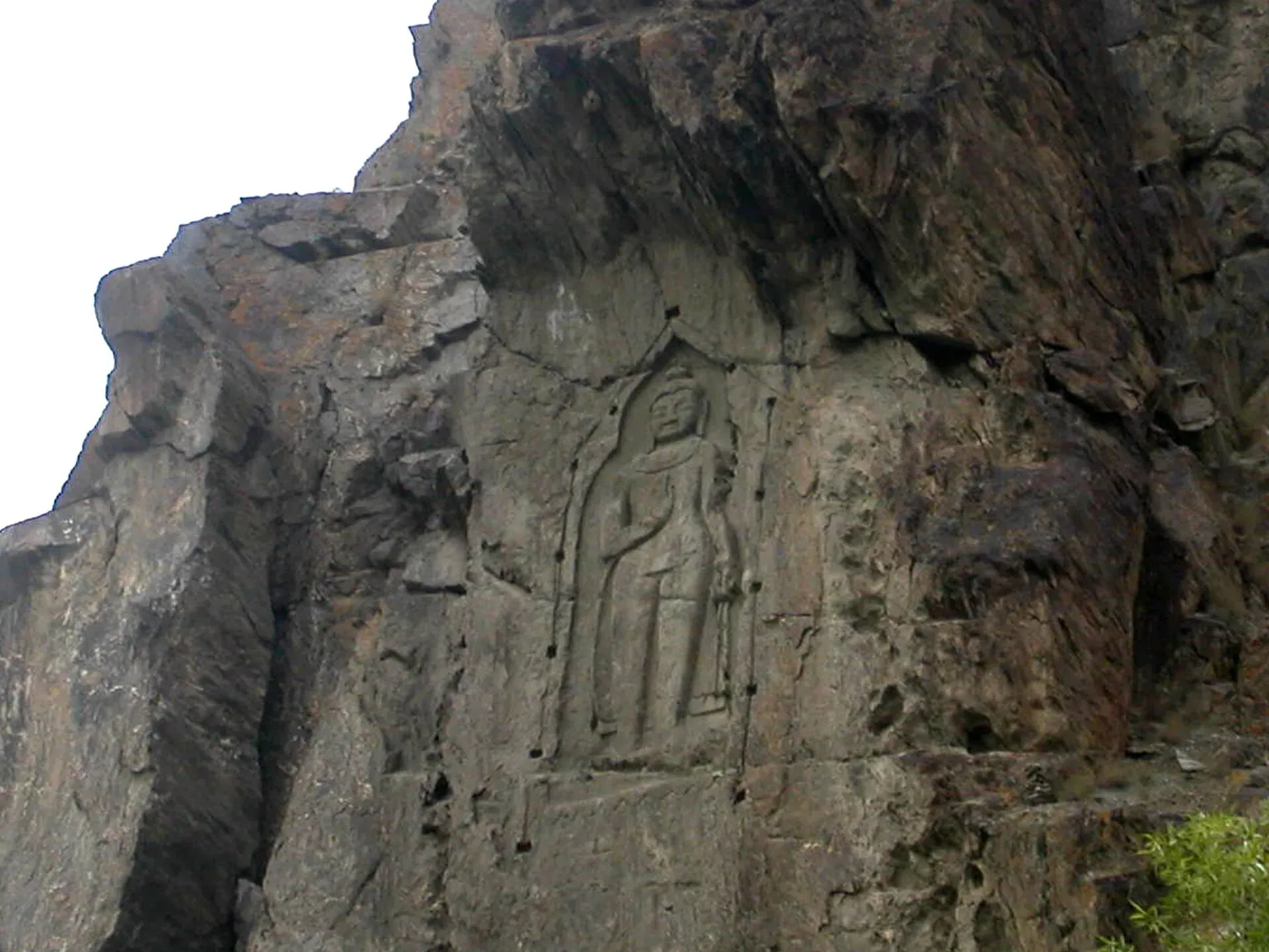
The name appears in the 7th century in the Hatun Rock Inscription as Giligitta. At that time the valley was ruled by a Buddhist dynasty that Chinese sources called Little Balur, probably the Patola Shahis. The Kargah Buddha, carved into a cliff outside town, dates from around 700 CE. A later Tibetan period ended in the late 800s.
Local rulers of the Trakhan dynasty held Gilgit until about 1810. A great flood in 1841 blocked the Indus and turned the valley into a lake for a time. In 1846 the area was transferred to Gulab Singh of Kashmir under the Treaty of Amritsar, and a local uprising drove out the Dogra garrison in 1852. The British set up the Gilgit Agency in 1877 and leased the Gilgit tehsil from the Dogra state in 1935.
In October and November 1947 a coup led by Major William Brown ended Dogra rule, and Pakistan's political agent took over on 16 November. The area was known as the Northern Areas until it was renamed Gilgit-Baltistan in 2009. The Karakoram Highway, completed in 1978, tied the town more closely to the rest of the country.
Neighbourhoods
- Main Bazaar and Jutial: the busy centre, with shops, hotels and banks. Good for shopping and transport.
- Jutial and Konodas: residential areas on the river bank. A statue of a polo player stands at Jutial.
- Airport Road and Danyore: the area toward the airport and the Hunza river bridge.
- Kargah and Naupura: the area west of town with the Kargah Buddha.
- Sher Qila and Singal: valleys to the west on the Ghizer road.
Top sights
- Kargah Buddha: a Buddhist rock carving of about 7th-century date, on a cliff in Kargah Nala (a nala is a side valley or stream gully) about 10 km (6 miles) west of town. See Kargah Buddha. Wikipedia lists public access as open; the sources give no ticket or access details.
- Gilgit Bridge: a suspension bridge over the Gilgit River at the end of the bazaar. Wikivoyage gives its length as 182 m and its width as 2 m, so one jeep crosses at a time. It is a popular place for an evening walk.
- Central Imaamia Mosque: a mosque that Wikipedia shows among the city's landmarks.
- CAA Park: a public park in the city listed by Wikipedia.
- Old British Cemetery: a reminder of the Gilgit Agency years, listed by Wikivoyage.
- Rakaposhi view: on clear days the peak shows to the south, and the road toward Nagar gives closer views. See Rakaposhi viewpoint.
- Confluence of the Gilgit and Hunza rivers: about 10 km east near Danyore, where three mountain ranges meet. See Jaglot confluence.
Bazaars and shopping
The bazaar sells fruit, dried apricots, nuts, woollens and crafts. Wikivoyage describes the NLI Market as a lively bazaar that is closed to traffic on some days, where supplies, souvenirs and gemstones are sold; Chinese goods such as silk and electronics also appear in the shops. A local SIM card needs a passport copy and visa. Few ATMs accept foreign cards, so carry enough cash. See also Gilgit Bazaar.
Food
Wikivoyage lists baked breads, handmade noodle soups, salted and roasted meats, dairy products and salted tea among local foods, along with apples, cherries, apricots, almonds, walnuts and chestnuts. Local food is generally not spicy. Chapshuro (a meat-filled flatbread) and mantu dumplings are common dishes in the region, and fresh trout appears on menus in some valleys. The main bazaar has many small restaurants and tea houses. Choose busy places and use bottled water.
Polo and culture
Shina and Urdu are the main languages in the town. Polo is the region's traditional sport and is played at village grounds across Gilgit-Baltistan; the best-known event is at the Shandur polo ground, high on the pass between Ghizer and Chitral. Ask locally about match dates, which are not fixed in the sources. Wikipedia also records a local New Year tradition of a juniper procession along the river.
Getting there
- By air: Gilgit Airport (GIL) is a domestic airport with flights to Islamabad that are often cancelled in bad weather, so allow extra days. Wikipedia says PIA is the only airline and flies from Islamabad (Wikivoyage: about 45 minutes, with frequent weather cancellations). Third-party listings showed ATR flights from Islamabad in late summer 2026 (about 1 hour 15 minutes), but there is no known official timetable.
- By road: the Karakoram Highway (N-35) links Islamabad to Gilgit through Besham, Chilas and the Indus gorge, about 500 km and typically 12 to 15 hours. Coaches and vans run daily. The Babusar Pass route is a seasonal alternative via Naran.
- From the east: the Skardu Road joins Gilgit to Baltistan.
Getting around
Taxis, rickshaws and shared minivans link the town and nearby villages. Wikivoyage says to wave to hail a minivan and to knock on the driver's cabin to get off. For trips to Naltar, Hunza or the Ghizer valleys, hire a car with a driver at the bazaar or through a hotel. Walk in the centre.
Where to stay
- Main Bazaar area: most hotels, with a range from simple to mid-range, and good access to transport.
- Jutial and the river: quieter guest houses.
- Airport road: a few options for flights.
Book ahead in July and August, when many visitors arrive.
When to visit
April to October is the best time, with warm days and cool nights. Wikipedia classes the climate as cold desert, with 120 to 240 mm of rain a year. Summer highs can pass 40 degrees C in the valley floor, and the recorded extremes are 46.3 degrees C in July and minus 11.1 degrees C in December. Winters are cold and snowy in the surrounding mountains, and roads can close. Landslides and avalanches are frequent.
Safety and etiquette
Gilgit is generally peaceful, but conditions on the roads can vary. Landslides block the Karakoram Highway at times, so check road reports and carry spare days. Check current official advice about security and any road restrictions, especially on the Besham to Chilas section. Dress modestly, ask before photographing people, and respect local religious customs. Foreign visitors should check current permit and registration rules for the areas they plan to visit.
Ask the district administration or local police about current conditions before you go. For foreign visitors: the UK FCDO advises against all travel on the Karakoram Highway between Mansehra and Chilas (advice updated 27 October 2026, checked 16 November 2026), but does not advise against Gilgit-Baltistan generally. Read the live advice before you plan.
Day trips
- Kargah Buddha (about 10 km).
- Naltar Valley (about 35 km; Wikivoyage says about two hours by jeep). It has alpine forest, small lakes and a ski slope. See Naltar Valley.
- Taj Mughal Monument (a victory monument about 30 km away, reached by jeep, per Wikivoyage).
- Sher Qila (38 km) and Singal (about 61 km), on the Ghizer road. Sher Qila is a trekking route to Naltar and a place for trout fishing.
- Gahkuch (73 km), the Ghizer district headquarters.
- Hunza and Karimabad (about 100 km).
- Bagrot Valley (about 30 km). See Bagrot Valley.
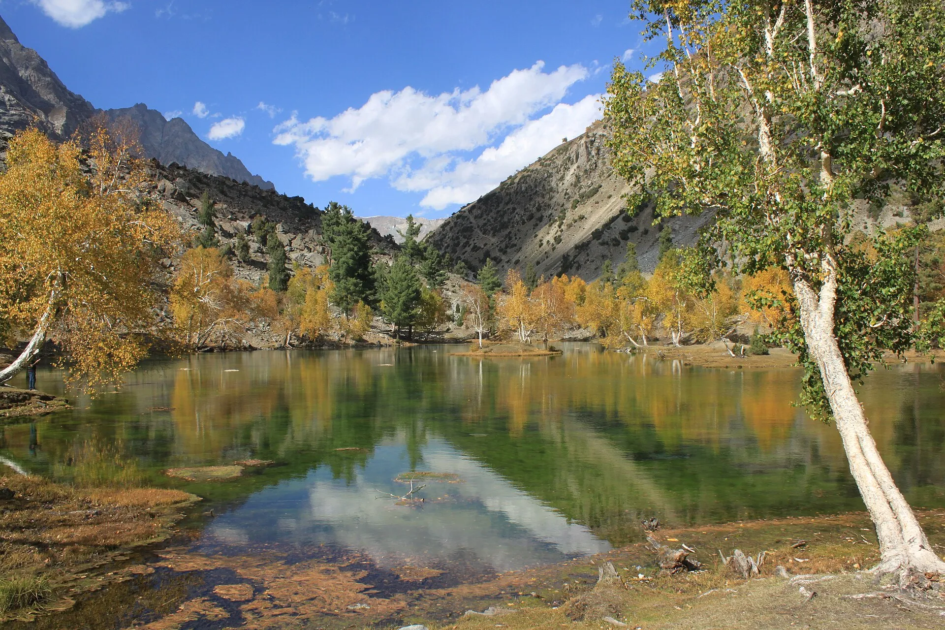
Photo: Tipuabdul, with thanks · CC BY-SA 3.0 · via Wikimedia Commons · temporary stand-in photo

Good to know
A fee applies at some sites and for some valleys; current fees will be added soon. Check with Gilgit-Baltistan Tourism or your hotel.
Highlights
- Kargah Buddha rock carving
- Gilgit Bazaar and local foods
- Gateway to Hunza and Skardu
- Naltar Valley and Bagrot Valley
- Confluence of the Gilgit and Hunza rivers
Hotels, food, fuel and services in Gilgit
Places to stay
- Indus Lodges GilgitCall Indus Lodges GilgitMap of Indus Lodges Gilgit in Google Maps
- Gilgit Serena HotelCall Gilgit Serena HotelMap of Gilgit Serena Hotel in Google Maps
- Park Hotel GilgitCall Park Hotel GilgitMap of Park Hotel Gilgit in Google Maps
- Avari Xpress Hotel, GilgitCall Avari Xpress Hotel, GilgitMap of Avari Xpress Hotel, Gilgit in Google Maps
- Gilgit Gateway HotelCall Gilgit Gateway HotelMap of Gilgit Gateway Hotel in Google Maps
- Hotel shaheen internationalCall Hotel shaheen internationalMap of Hotel shaheen international in Google Maps
Places to eat
- Pizza King GBCall Pizza King GBMap of Pizza King GB in Google Maps
- The CherryTree CaféCall The CherryTree CaféMap of The CherryTree Café in Google Maps
- Dawat Restaurant @ Indus LodgesCall Dawat Restaurant @ Indus LodgesMap of Dawat Restaurant @ Indus Lodges in Google Maps
- Abbas ali shah, Danyore, District Gilgit.Call Abbas ali shah, Danyore, District Gilgit.Map of Abbas ali shah, Danyore, District Gilgit. in Google Maps
- GB Rahat Pizza and Fast Food Gilgit, Since 2020 In GilgitCall GB Rahat Pizza and Fast Food Gilgit, Since 2020 In GilgitMap of GB Rahat Pizza and Fast Food Gilgit, Since 2020 In Gilgit in Google Maps
- GB STEAKHOUSECall GB STEAKHOUSEMap of GB STEAKHOUSE in Google Maps
Essential services fuel stations and hospitals and clinics
Fuel
- Ibex PSO Petrol StationMap of Ibex PSO Petrol Station in Google Maps
- PSOMap of PSO in Google Maps
- Pakistan State Oil (PSO) Gilgit filling station( Chilasi petrol pump)Call Pakistan State Oil (PSO) Gilgit filling station( Chilasi petrol pump)Map of Pakistan State Oil (PSO) Gilgit filling station( Chilasi petrol pump) in Google Maps
Hospitals and clinics
- Aga Khan Hospital, GilgitCall Aga Khan Hospital, GilgitMap of Aga Khan Hospital, Gilgit in Google Maps
- D.H.Q HospitalCall D.H.Q HospitalMap of D.H.Q Hospital in Google Maps
Listings come from Google Maps data and are unverified: phone numbers, opening months and prices may have changed. Report a problem · Own one of these? Claim it
Tips
- Allow spare days for flights and road closures.
- Book hotels ahead in July and August.
- Check Karakoram Highway conditions before you travel.
- Carry cash; ATMs can be unreliable.
Photos we still need: Gilgit bazaar street scene or local food. Send us yours
Sources and last checked
Last checked Confidence medium9 sources6 still to check
- Last checked
- Method
- Desk research from published sources
- Confidence
- medium
- Checked by
- trek.pk research team
Researched from published sources; not yet checked on the ground by our team. Spot something out of date? Report a mistake.
Sources
- Gilgit · Wikipedia · checked
- Karakoram Highway · Wikipedia · checked
- Pakistan Tourism Guide 2021 · TDAP · checked
- List of airports in Pakistan · Wikipedia · checked
- Gilgit-Baltistan · Wikipedia · checked
- NOC requirements for foreigners visiting Pakistan abolished (26 March 2019) · Dawn · checked
- Gilgit · Wikivoyage · checked
- Kargah Buddha · Wikipedia · checked
- Gilgit Airport · Wikipedia · checked
Still to be checked on the ground (6)
- Current Karakoram Highway conditions and drive times (no official source; Wikivoyage gives 12 hours by bus, undated)
- Naltar road status and distance (Wikipedia 34 km; Wikivoyage 'two hours by jeep')
- Foreigner permit and registration rules (Dawn 2019 only; Wikivoyage mentions a ministry permit for restricted zones and passport copies for police checkpoints on the NATCO bus, undated)
- Gilgit flight schedule: only third-party listings (no airline schedule or dated report for 2026)
- Central Imaamia Mosque and CAA Park: opening and access (listed by Wikipedia, no visiting details)
- Taj Mughal Monument and Sher Qila distances (Wikivoyage, undated)
Nearby and related

Islamabad
Pakistan's green, planned capital at the foot of the Margalla Hills: Faisal Mosque, hillside trails, cafes and the gateway to the north.

Jaglot
A town on the Karakoram Highway south-east of Gilgit, at the junction where the road to Skardu and Astore leaves the KKH, near the meeting of the Gilgit and Indus rivers.

Gupis
A small town on the road between Gilgit and Shandur, in Gupis-Yasin District of Gilgit-Baltistan. It is a practical overnight stop and the gateway to Phander and the Yasin valley.

Astore
Main town of Astore District in Gilgit-Baltistan, at about 2,546 m. It is the base for the Astore valley, Rupal valley, Rama Meadows and the road to Deosai.
Nomal Valley
A green oasis on the Hunza River about 25 km north of Gilgit, and the turn-off for the Naltar road.