

Photo: Ak.bangash, with thanks · CC BY-SA 3.0 · via Wikimedia Commons · temporary stand-in photo

Kohat
A fort-and-cantonment city south of Peshawar, reached through the Kohat Tunnel, with a British-era fort, Tanda Dam and wildlife park, and a reputation for guavas. Check security advice first.
Overview
Kohat is the headquarters of Kohat District in Khyber Pakhtunkhwa and sits in a valley south of Peshawar. The Mughal emperor Babur mentioned the area in 1505. The British annexed it in 1849 and set up a cantonment in 1874. A British-era fort stands at the heart of the old city, with bazaars around it and the cantonment on one side.
Kohat lies on the old route between Peshawar and the southern districts. It is a small, busy regional city and not a typical tourist destination. At the 2023 census it had about 235,880 people (Wikipedia, citing the Pakistan Bureau of Statistics). Pashto is the main language, with Hindko second.
Kohat has been affected by militant violence. An attack on the Old Police Lines on 18 September 2026 killed dozens of people. Read the safety section before travelling.
Plan your visit
- Getting there
Road: Peshawar about 68 km (about 1 hour 20 minutes) through the Kohat Tunnel. Rail: line to Rawalpindi; check current service. Air: use Peshawar's Bacha Khan International Airport. More
Best months
Oct – Mar
- Kohat
- Related places nearby: Peshawar, Tanda Dam, Handyside Fort
History in brief
- Early period: local tradition credits a Buddhist king, Raja Kohat. Archaeological surveys in 2004 found sites of the 1st to 5th centuries CE.
- 1505: Babur records a raid on Kohat in the Baburnama.
- By 1747: Kohat was part of the Durrani Empire, governed by local chiefs.
- 1839-1840: a Sikh governor captured the area; the Sikhs left in 1840.
- 1849-1874: the British annexed it in March 1849, finished the Kohat Pass road by 1850 and set up the cantonment in 1874. The railway reached the town in 1897-1902.
- 1897-98: Kohat was the starting point of the British Tirah campaign.
People and setting
Kohat stands at about 489 m on the left bank of the Toi River, in hot, dry semi-arid country with about 500 mm of rain a year, mostly in July and August. The Bangash Pashtuns are regarded as the centre of its population, and the Orakzai and Khattak also feature in its history. In urban Kohat Tehsil, the 2023 census recorded Pashto as the first language of 73 per cent of people and Hindko, in its Kohati form, of about 20 per cent.
What to see and do
- Kohat Fort: the British-era fort that dominates the old city. Parts are used by the military, so check access and photography rules.
- Old bazaars: the lanes around the fort sell cloth, dry fruit, kitchenware and daily goods. Kohat is known for its guavas, which are worth buying in season.
- Ghamkol Sharif: a Naqshbandi Sufi shrine with a green central dome and white marble courtyard. Dress modestly and remove your shoes.
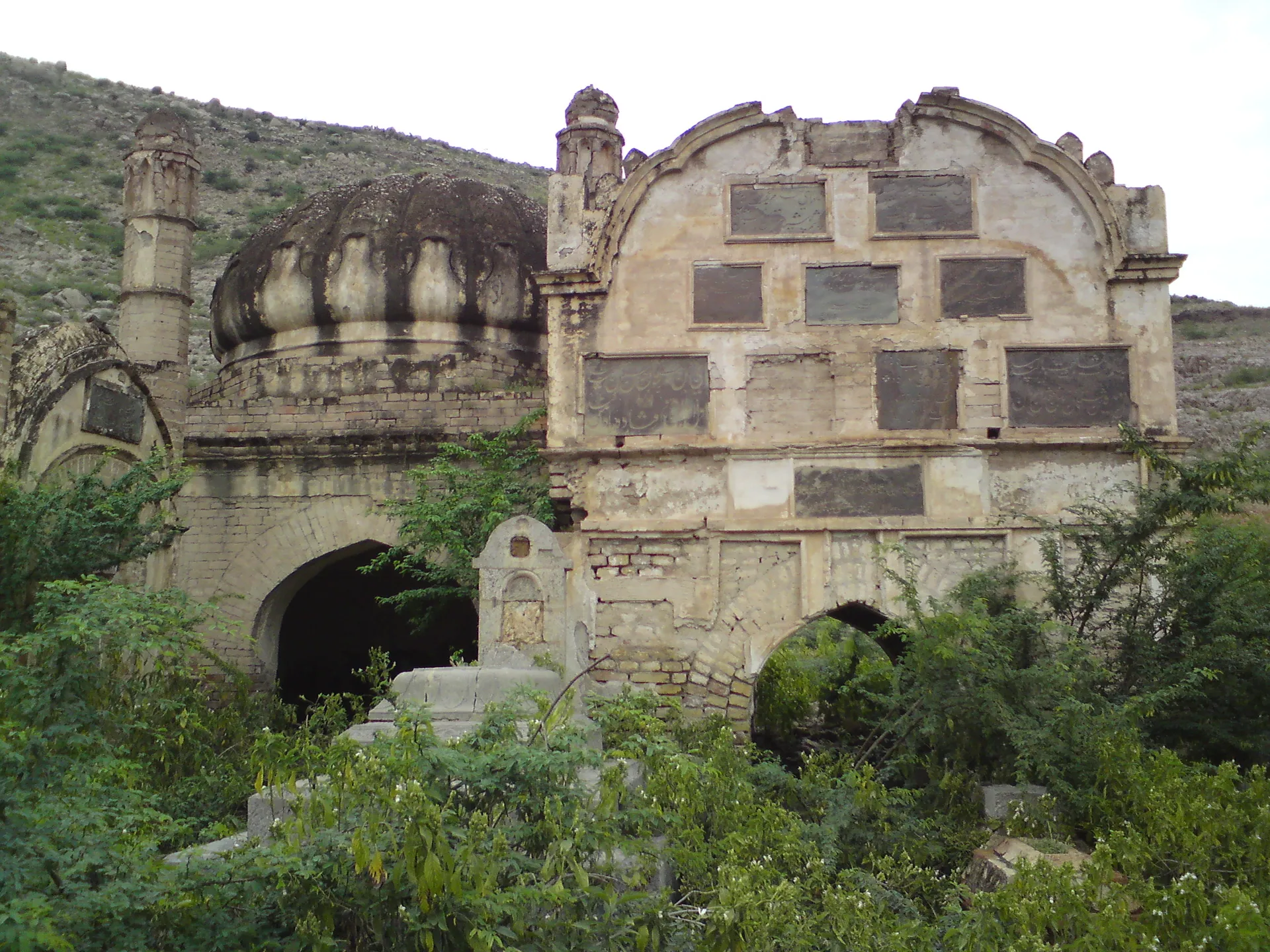
- Durrani royal tomb: a ruined domed tomb with inscribed panels, in the Shahpur area near the town.
- Kohat Tehsil gate: a British-era gate, photographed in 1919.
- Kohat Tunnel and Pass: the British completed a road through Kohat Pass in 1850. The 1.9 km Kohat Tunnel, finished in 2004 with Japanese help, now carries the main road to Peshawar through the hills.
- Tanda Dam and Lake: about 18 km away, finished in 1967 and listed as a Ramsar wetland in 1976. Tanda Wildlife Park, about 11 sq km, is the largest wildlife park in the province, with urial, chinkara and hog deer. It is reached by the Hangu-Kaghazi gravel road or the Shahpur-Bar road. The Kotal Pheasantry keeps four pheasant species. Check opening times and access before going.
Food
Kohat is Pashtun country, so expect charcoal-grilled meat, rice dishes, flatbreads and strong green or black tea. Ask locals for popular tikka and karahi stalls. Seasonal guavas are sold in the bazaar.
Getting there and around
- Road: Peshawar is about 68 km and takes roughly 1 hour 20 minutes through the Kohat Tunnel (OSRM, checked 16 November 2026). The Indus Highway (N-55) passes through Kohat, and another national highway links to Islamabad.
- Rail: Kohat is the end of a line from Rawalpindi. Wikipedia reports that service was suspended in 2013 and restored in 2017. Check Pakistan Railways for the current status.
- Air: Peshawar's Bacha Khan International Airport is the nearest commercial airport. Kohat's air base has no civilian service.
- Around town: rickshaws and taxis.
Where to stay
Choices are limited. Look near the cantonment and the main road for hotels and guesthouses, or consider staying in Peshawar and visiting Kohat as a day trip. Arrange accommodation in advance.
Day trips
- Tanda Dam and Wildlife Park: about 18 km away, for lake views and birds.
- Peshawar: about 68 km north, with a rich old city, museum and bazaars.
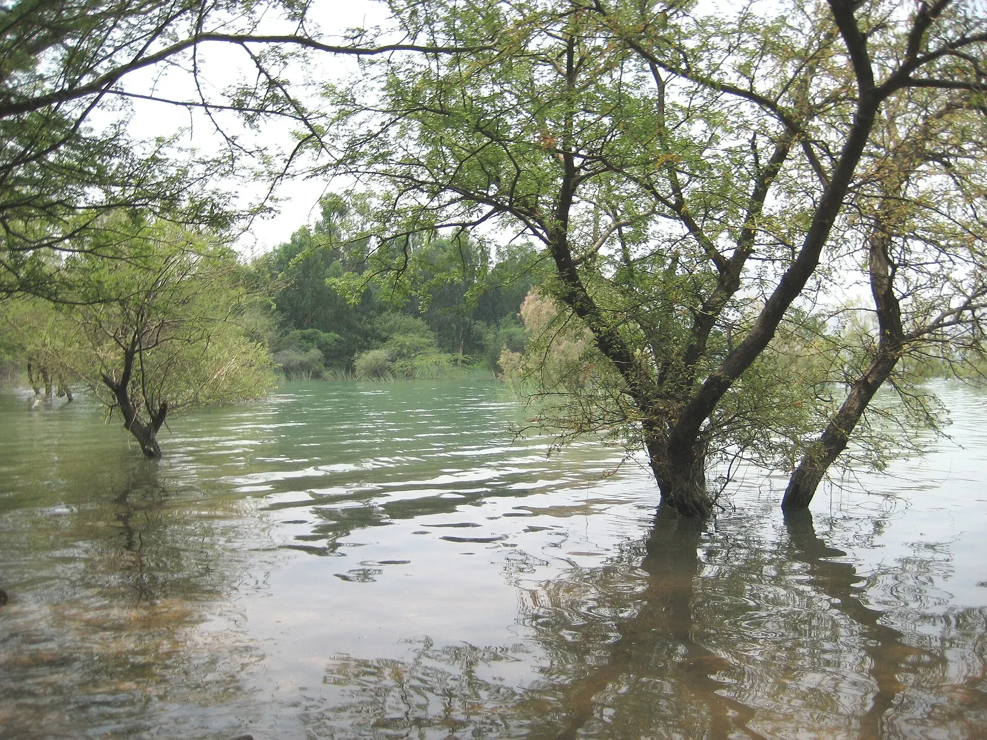
Photo: Aftabbanoori, with thanks · CC BY-SA 3.0 · via Wikimedia Commons · temporary stand-in photo

When to visit
October to March is the most comfortable time. Summers are hot.
Safety
Kohat has seen several attacks, including a major attack on the Old Police Lines in September 2026. Check your government's travel advice and local police guidance. Travel with a local host, stay on main roads, avoid crowds and sensitive sites, and do not travel after dark.
For foreign visitors: the UK FCDO advises against all travel to Kohat (advice updated 27 October 2026, checked 16 November 2026). Read the live advice before you plan.
Highlights
- British-era Kohat Fort and old bazaars
- Kohat Tunnel on the road to Peshawar
- Tanda Dam, a Ramsar wetland, and wildlife park
- Ghamkol Sharif shrine
Hotels, food, fuel and services in Kohat
Places to stay
- Dewan e Khas Guest HouseCall Dewan e Khas Guest HouseMap of Dewan e Khas Guest House in Google Maps
- B1 Hostel KUSTMap of B1 Hostel KUST in Google Maps
- DGR (Div Guest Rooms)Map of DGR (Div Guest Rooms) in Google Maps
- Kohat HotelCall Kohat HotelMap of Kohat Hotel in Google Maps
- G3 Hostel KUSTMap of G3 Hostel KUST in Google Maps
Places to eat
- Bake Inn.2Map of Bake Inn.2 in Google Maps
- Charsada Sardaryab fish previously Yousuf Fish Hotel یوسف مچھلی فروشCall Charsada Sardaryab fish previously Yousuf Fish Hotel یوسف مچھلی فروشMap of Charsada Sardaryab fish previously Yousuf Fish Hotel یوسف مچھلی فروش in Google Maps
- Sizzler Food & Grill KohatCall Sizzler Food & Grill KohatMap of Sizzler Food & Grill Kohat in Google Maps
Essential services fuel stations, mechanics, ATMs, banks, pharmacies, hospitals and clinics and Rescue 1122
Fuel
- Rehman CNGMap of Rehman CNG in Google Maps
- Sher Zaman Afridi CNGMap of Sher Zaman Afridi CNG in Google Maps
- ShellCall ShellMap of Shell in Google Maps
- SALAR CNGCall SALAR CNGMap of SALAR CNG in Google Maps
- Bilal Khel AssociatesMap of Bilal Khel Associates in Google Maps
- Pakistan State Oil (PSO)Call Pakistan State Oil (PSO)Map of Pakistan State Oil (PSO) in Google Maps
Mechanics and tyre shops
- Hayat Decoration KohatCall Hayat Decoration KohatMap of Hayat Decoration Kohat in Google Maps
ATMs
- Habib Bank LtdCall Habib Bank LtdMap of Habib Bank Ltd in Google Maps
Banks and money exchange
- HBL CURRENCY EXCHANGE KOHAT CANTT BOOTHCall HBL CURRENCY EXCHANGE KOHAT CANTT BOOTHMap of HBL CURRENCY EXCHANGE KOHAT CANTT BOOTH in Google Maps
- Allied Bank Bannu Road BranchCall Allied Bank Bannu Road BranchMap of Allied Bank Bannu Road Branch in Google Maps
- hbl cantt branch kohatMap of hbl cantt branch kohat in Google Maps
- MUZDALIFAH TRADERSCall MUZDALIFAH TRADERSMap of MUZDALIFAH TRADERS in Google Maps
Pharmacies
- Jameel pharmacy kohatCall Jameel pharmacy kohatMap of Jameel pharmacy kohat in Google Maps
- Sahara veterinary medicine shopCall Sahara veterinary medicine shopMap of Sahara veterinary medicine shop in Google Maps
- Shams Medicose (شمس میڈیکوز )Call Shams Medicose (شمس میڈیکوز )Map of Shams Medicose (شمس میڈیکوز ) in Google Maps
- Abu Bakar MedicoseMap of Abu Bakar Medicose in Google Maps
Hospitals and clinics
- NAVEED HOSPITALCall NAVEED HOSPITALMap of NAVEED HOSPITAL in Google Maps
- Afghan Homeopathic ClinicCall Afghan Homeopathic ClinicMap of Afghan Homeopathic Clinic in Google Maps
- Saleem Homeo ClinicCall Saleem Homeo ClinicMap of Saleem Homeo Clinic in Google Maps
- Gulsha Ara ClinicCall Gulsha Ara ClinicMap of Gulsha Ara Clinic in Google Maps
- Healthcare Centre KUSTCall Healthcare Centre KUSTMap of Healthcare Centre KUST in Google Maps
- DR FOUZIA GUL CLINICMap of DR FOUZIA GUL CLINIC in Google Maps
Rescue 1122
- Rescue 1122 Station 11 KDAMap of Rescue 1122 Station 11 KDA in Google Maps
Listings come from Google Maps data and are unverified: phone numbers, opening months and prices may have changed. Report a problem · Own one of these? Claim it
Tips
- Check security advice and travel with a local host.
- Visit between October and March.
- Confirm access to the fort and Tanda before you go.
- Consider a day trip from Peshawar.
Photos we still need: Kohat Fort and the old bazaar; Kohat Tunnel. Send us yours
Sources and last checked
Last checked Confidence low4 sources5 still to check
- Last checked
- Method
- Desk research from published sources
- Confidence
- low
- Checked by
- trek.pk research team
Researched from published sources; not yet checked on the ground by our team. Spot something out of date? Report a mistake.
Sources
- Kohat · Wikipedia · checked
- Attack on Kohat Old Police Lines, September 2026 (Express Tribune) · The Express Tribune · checked
- OSRM driving routes (road distances and times) · Project OSRM / OpenStreetMap · checked
- Tanda Dam (Ramsar listing 23 July 1976) · Wikipedia · checked
Still to be checked on the ground (5)
- Current security situation and travel advice (follow the FCDO advice; nothing newer opened)
- Fort access and photography rules (Wikipedia gives none; no Kohat Fort article exists under that title)
- Status of the Kohat to Rawalpindi train service (Wikipedia says daily service; suspended 2013, restored 2017; no Pakistan Railways page opened)
- Opening times for Tanda Wildlife Park (not published in sources opened)
- 2023 city population (Wikipedia gives 235,880: 204,829 municipal committee plus 31,051 cantonment; Pakistan Bureau of Statistics table not opened)
Nearby and related

Peshawar
Khyber Pakhtunkhwa's capital and one of South Asia's oldest living cities: the Gandhara museum, Qissa Khwani Bazaar, mosques and a strong food culture.

Islamabad
Pakistan's green, planned capital at the foot of the Margalla Hills: Faisal Mosque, hillside trails, cafes and the gateway to the north.

Tanda Dam
A small dam and 405-hectare lake near Kohat in Khyber Pakhtunkhwa, operating since 1967. A Ramsar wetland of international importance since 23 July 1976, with winter migratory birds. FCDO advises against all travel to Kohat.
Handyside Fort
A British-era hilltop fort in Kohat, named after a Frontier Constabulary officer killed in 1926. It is in use as a Pakistan Army headquarters and is not a visitor site.