

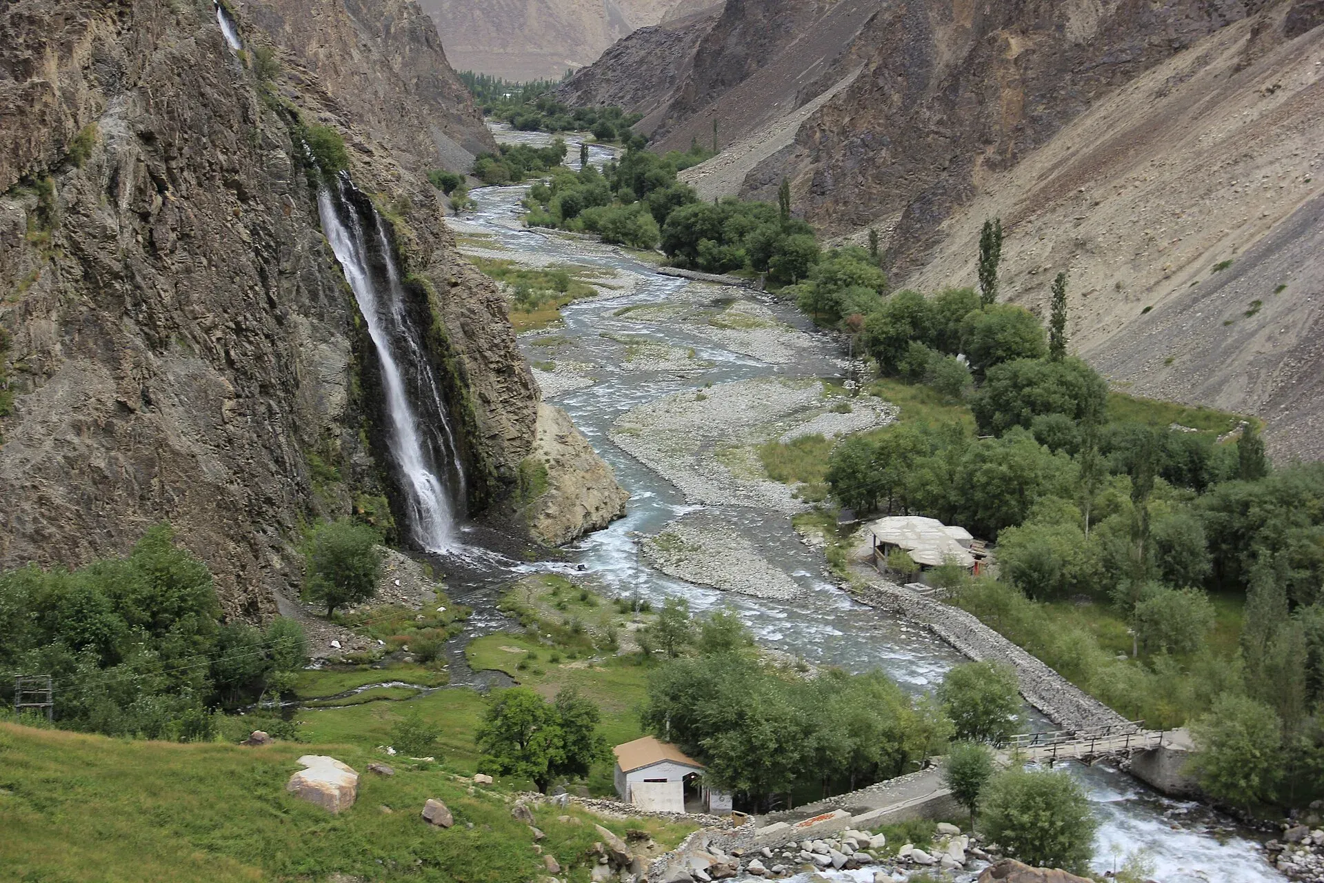
Photo: Rajab Saha, with thanks · CC BY-SA 3.0 · via Wikimedia Commons · temporary stand-in photo

Manthoka Waterfall
A multi-tiered fall of about 55 m in the Kharmang valley, east of Skardu in Gilgit-Baltistan, reached along the Skardu-Kargil road. Sources disagree on the distance, so check locally.
Overview
Manthoka Waterfall (also spelled Manthokha) is in the Kharmang valley, the stretch of the Indus valley east of Skardu in Gilgit-Baltistan. Wikipedia and a tourism feature carried by Associated Press of Pakistan both give a height of about 55 m (180 ft). Published heights for waterfalls in Pakistan are often rough, so treat this as an estimate. The fall drops in several tiers, fed by the Manthoka nala (a mountain stream), through green pasture below Karakoram ridges. One travel guide places it near the confluence with the Indus.
Local belief, reported by the same guide, links the name to a prince called Manthokha who used the area as a retreat, and holds that the water has healing properties.
Plan your visit
- Nearest town
- Skardu
- Getting there
Drive east from Skardu on the Skardu-Kargil road towards Manthoka village in the Kharmang valley, then take the side road and walk to the falls. Sources give 40 to 80 km; More
Best months
Jun – Sep
- Manthoka Waterfall
- Related places nearby: Skardu, Kharmang Valley
The Kharmang valley
Kharmang is a district in its own right since 2015, with its headquarters at Tolti. It borders Skardu, Ghanche and Astore districts and, to the south, the Kargil and Leh districts on the Indian-administered side of the Line of Control. Wikipedia gives its area as about 6,144 square kilometres and its population as 61,304 (2023). The Maqpon dynasty of Skardu ruled the valley before the Dogra conquest of 1840. For more on the valley, see Kharmang Valley.
Getting there
The route starts at Skardu bazaar and follows the Skardu-Kargil road east through Hussainabad, Thorgo, Parkutta, Ghasing and Manthoka. From Manthoka main village a side road of about 6 km leads towards the falls, which one guide puts about 5 km beyond the village. The same guide calls the last stretch a rugged, steep and rocky approach, but gives no walking distance or time, so ask locally how far a vehicle can go.
Distances disagree. Sources give anything from 40 km to 80 km from Skardu, and Wikipedia and the APP feature both say about 80 km. The OSRM routing service gives about 67 km and 74 minutes by road to the falls' map position (an estimate, checked 16 November 2026). Allow more time than the map suggests.
What to see and do
- The fall itself. A multi-tiered fall with mist rising from the cascade, cliffs and greenery around it, and spots for photographs. Visitors swim in the cool water at the base.
- Local trout. A fish farm where trout are bred, and small restaurants and kiosks near the site serving freshwater trout and local food.
- Village life. Manthoka village is used as a base for treks into the Kharmang sub-region, and farm animals graze around the falls.
When to visit
There is no known official season. As with other high-valley falls, the flow follows snowmelt, so the water is usually strongest in early summer and the road is most dependable from June to September. Check road and weather news in Skardu before you set out.
Where to stay and eat
Stay in Skardu, which has a full range of guesthouses and hotels. Near the falls, expect only simple kiosks and restaurants. Carry water and snacks for the walk.
Good to know
- Safety. Wet rock near falls is slippery, and meltwater makes pools and streams colder and faster in summer. There are no known dated incident reports for this site. Do not swim alone.
- Travel advice. For foreign visitors: the UK FCDO does not list Kharmang by name on its Pakistan page (updated 27 October 2026, checked 16 November 2026). It does advise against all travel within 10 miles of the Line of Control, and Kharmang is a border district. Check whether your route falls inside that zone, and ask the Gilgit-Baltistan tourism office about any permission needed.
- Fees. No official fee information found; current fees will be added soon.
- Etiquette. Take all litter back to Skardu and keep out of the fish farm unless invited.
Highlights
- About 55 m in several tiers (estimate)
- Karakoram setting in the Kharmang valley
- Fresh trout at local restaurants
- Base area for Kharmang treks
Tips
- Start early from Skardu and ask locally about road conditions
- Wear shoes with grip; the approach is steep and rocky
- Carry water, as facilities near the fall are basic
- Check FCDO advice and ask about the Line of Control zone before travelling
Photos we still need: the Skardu-Kargil road or Manthoka village, and the fish farm. Send us yours
Sources and last checked
Last checked Confidence low6 sources6 still to check
- Last checked
- Method
- Desk research from published sources
- Confidence
- low
- Checked by
- trek.pk research team
Researched from published sources; not yet checked on the ground by our team. Spot something out of date? Report a mistake.
Sources
- Manthokha Waterfall · Wikipedia · checked
- Manthokha waterfall distance and height · Associated Press of Pakistan · checked
- Manthoka waterfall, Skardu · Pakistan Traveler · checked
- OSRM demo routing service (driving routes) · Project OSRM · checked
- Pakistan travel advice: warnings and insurance · UK Foreign, Commonwealth & Development Office · checked
- Kharmang District · Wikipedia · checked
Still to be checked on the ground (6)
- Distance from Skardu (Wikipedia and APP say ~80 km; OSRM ~67 km; other sources 40 km)
- Height (about 55 m from Wikipedia and APP only; both say 180 ft)
- Walking time and whether the side road is drivable
- Best months
- Whether the site is inside the 10-mile Line of Control zone and any permission needed
- Whether the Manthokha prince story is a documented local tradition
Nearby and related

Skardu
The main town of Baltistan, where the Indus meets the Shigar river. Skardu is the base for the Deosai Plains, the Kachura and Satpara lakes, Shigar, and the K2 and Baltoro treks.
Kharmang Valley
The Indus valley where the river enters Pakistan east of Skardu, now Kharmang District. Home to Manthoka Waterfall, Mehdiabad and Kharmang Fort.