

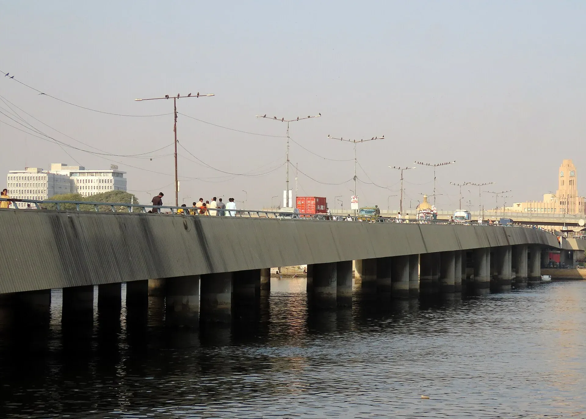
Photo: King Eliot, with thanks · CC BY-SA 4.0 · via Wikimedia Commons · temporary stand-in photo

Napier Mole Bridge and Keamari
The Napier Mole (Native Jetty) Bridge, built 1861 to 1864, links central Karachi to the port. A historic causeway and a look at the working harbour, not a resort.
Overview
The Napier Mole, also called the Native Jetty Bridge, connects the city with the Port of Karachi. Wikipedia gives its construction as 1861 to September 1864 and the cost of the mole as Rs 643,440. The bridge is 167.64 m long with two lanes. Keamari is the port district on the far side.
Plan your visit
- Nearest town
- Karachi
- Getting there
The bridge is about 8.8 km (about 11 minutes) by road from Empress Market in Saddar (OSRM, checked 16 November 2026), towards the port. Take a taxi or ride-hailing car. More
Best months
Oct – Mar
- Napier Mole Bridge and Keamari
- Related places nearby: Karachi, Empress Market, Clifton and Sea View, Baba and Bhit Islands, Manora Island
Why it was built
Karachi's modern port began operating in 1854 under British rule. Keamari was then a low island between Manora and the city, and its shallow anchorage could not take large ships. A raised embankment about three miles long, the Napier Mole Road, linked Karachi and Keamari in 1854, and a Sindh Railway spur followed. The mole is named after Charles Napier, the governor, and a Napier obelisk was built in 1853. The Wikipedia article on Keamari describes an iron Napier Mole Bridge of about 379 m built in 1865. That length matches the separate rail bridge, so the two should not be confused.
What to see and do
The bridge is a short piece of Karachi's colonial harbour history, and a way to see the working port, with cranes, ships and container traffic in the distance. Wikipedia notes that the wider Jinnah Bridge replaced it for heavy traffic, and that the old bridge area has been converted into a food street, the Port Grand Food and Entertainment Complex. A separate freight rail bridge, the Port Grand Train Track (Chinna Creek Bridge), connects Karachi City Station to Keamari.
Port Grand was developed by Karachi Port Trust with a private company and opened on 28 May 2011. It covers about 19,000 sq m along 305 m of the bridge, with 11 restaurants and speedboat rides on Chinna Creek that show the mangroves. We have not confirmed from an official or dated source what is open on the bridge today, or whether the food complex is currently operating. Treat this as a stop to look at, not a planned destination.
Keamari
In the colonial period Keamari had a naval yard, a government commissariat, a post office, customs houses and railway houses. Wikipedia lists the Sydenham Passenger Pavilion at the Boat Basin (opened 1914), Mules Mansion (1917, by the architect Moses Somake) and St George's church as colonial-era sites. Today it is a dense working district around the port, with mangroves and small islands in the harbour. Manora is a naval base and is administered separately; see Manora Island and Baba and Bhit islands.
When to visit
Daytime, October to March. Avoid the area after dark.
Where to stay and eat
Stay in Saddar or Clifton. Eat in Saddar, which is close; see Empress Market.
Good to know
- Port area. Much of the harbour is a controlled working zone. Do not photograph port installations, and follow any instructions from guards.
- Traffic. The approach is busy with trucks. Take a taxi and keep to marked areas.
- Safety. Choose daylight and go with a local if you can. Karachi is not covered by the FCDO 'against travel' lists (checked 16 November 2026), but read the live FCDO page before you go.
Highlights
- Built 1861 to 1864
- 167.64 m long, two lanes
- Links the city to the Port of Karachi
- Old bridge area linked to the Port Grand food complex
Getting there
The bridge is about 8.8 km (about 11 minutes) by road from Empress Market in Saddar (OSRM, checked 16 November 2026), towards the port. Take a taxi or ride-hailing car.
Tips
- Go in daylight only.
- Do not photograph port installations.
- Check whether Port Grand is open before you go.
- Take a taxi.
Photos we still need: Keamari Boat Basin and Sydenham pavilion, Mules Mansion (section: Keamari). Send us yours
Sources and last checked
Last checked Confidence low5 sources3 still to check
- Last checked
- Method
- Desk research from published sources
- Confidence
- low
- Checked by
- trek.pk research team
Researched from published sources; not yet checked on the ground by our team. Spot something out of date? Report a mistake.
Sources
- Native Jetty Bridge · Wikipedia · checked
- OSRM driving route calculation · OSRM (OpenStreetMap routing) · checked
- Pakistan travel advice (warnings and insurance), updated 27 October 2026 · UK Foreign, Commonwealth & Development Office · checked
- Port Grand · Wikipedia · checked
- Keamari Town · Wikipedia · checked
Still to be checked on the ground (3)
- Whether the bridge area and Port Grand are open to visitors today (no current source; Wikipedia describes the 2011 opening only)
- Rules on photography near the port (no published rule found)
- Length of the Napier Mole bridge: 167.64 m (Native Jetty article) against about 379 m (Keamari article, which seems to describe the rail bridge)
Nearby and related

Karachi
Pakistan's largest city and main port: colonial buildings, museums, beaches, busy bazaars and some of the country's best food.

Empress Market
A big Indo-Gothic market hall in Karachi's Saddar, built 1884 to 1889 with a clock tower. Still used for fruit, vegetables, meat, spices and more.

Clifton and Sea View
Karachi's most visited city beach, open day and night, with camel rides, food stalls and seaside restaurants. Strong currents make the sea risky, and swimming is often banned.
Baba and Bhit Islands
Two densely populated fishing islands in Karachi Harbour, reached by ferry from Keamari. They are working villages, not tourist sites.

Manora Island
A peninsula at Karachi harbour, once an island, with a lighthouse completed in 1889, old fort and beaches. The Navy holds part of it; expect photography limits.