

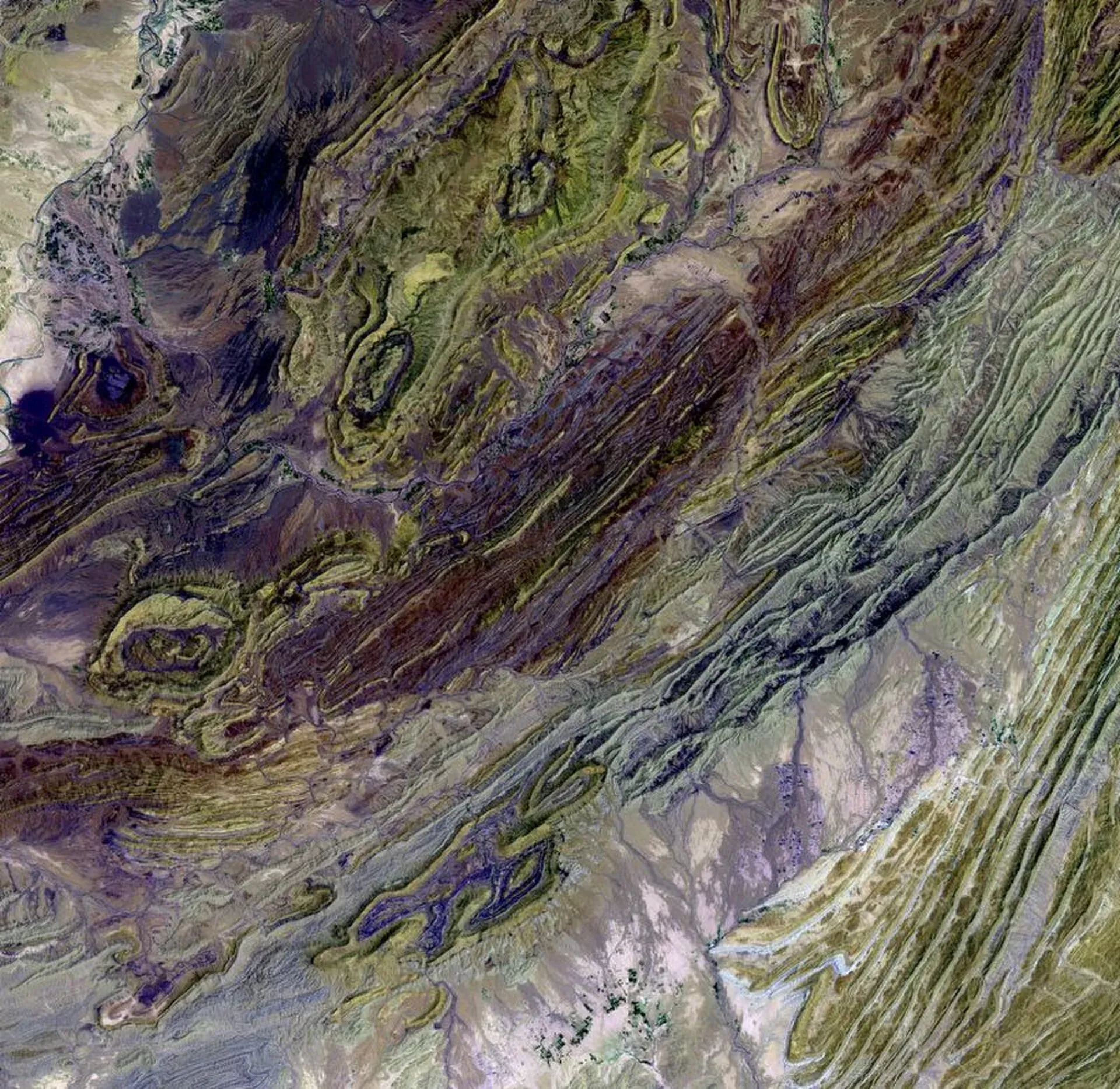
Photo: USGS EROS Data Center Satellite Systems Branch, with thanks · Public domain (CC0) · via Wikimedia Commons · temporary stand-in photo

Sulaiman Range
A long north-south fold range on the Balochistan, KP and Punjab borders. Takht-e-Sulaiman (3,487 m) is the main peak; check current security advice before any visit.
Overview
The Sulaiman Range runs north to south across western Pakistan and eastern Afghanistan. In Pakistan it touches northern Balochistan, Khyber Pakhtunkhwa (including Waziristan) and south-west Punjab. Its eastern edge is about 450 km long, from the Gomal Pass to near Jacobabad.
The range is a north-south extension of the southern Hindu Kush and forms the Sulaiman-Kirthar geological province with the Central Brahui and Kirthar ranges. The highest peak of the main range is Takht-e-Sulaiman (3,487 m), a twin-peaked mountain near Darazinda, Dera Ismail Khan. The name means 'Throne of Solomon'. Ibn Battuta recorded it as Koh-i-Sulaiman.
Geology
The Sulaiman is a fold-and-thrust belt, made when the India-Eurasia collision pushed the rocks into long ridges about 30 million years ago. It is still active. The 1997 Harnai doublet earthquakes (M7.1 then M6.8) happened here.
Places
- Fort Munro is a hill station near Dera Ghazi Khan. Wikipedia's Fort Munro page gives 1,970 m in its introduction, 2,180 m in its headline figure and 1,800 m in the text, so treat it as roughly 1,800 to 2,200 m. It is in Dera Ghazi Khan District, about 85 km from the city.
- Ziarat has a famous juniper forest around Khilafat Hill (3,475 m). Wikipedia groups it with the wider Sulaiman system.
- Zarghun (3,578 m) lies near Quetta in the Central Brahui Range, which Wikipedia describes as a sub-range of the wider Sulaiman system. We list it on the Central Brahui page.
When to go
Snow lies on Takht-e-Sulaiman from late November to March, so climbs happen in summer. Other places are comfortable in spring and autumn.
Good to know
- Gateways: Dera Ghazi Khan, Dera Ismail Khan, Loralai and Zhob.
- Ask the district administration or local police about current conditions before you go. For foreign visitors: the UK FCDO advises against all travel to Balochistan Province and all but essential travel to Dera Ghazi Khan (advice updated 27 October 2026, checked 17 November 2026). Read the live advice and check local conditions.
- Trekking tourism here is minimal.
Geology
A fold-and-thrust belt formed about 30 million years ago by the India-Eurasia collision. The 1997 Harnai earthquakes (M7.1 and M6.8, 19 seconds apart) struck the area.
Notable peaks
Sources and last checked
Last checked Confidence medium5 sources3 still to check
- Last checked
- Method
- Desk research from published sources
- Confidence
- medium
- Checked by
- trek.pk research team
Researched from published sources; not yet checked on the ground by our team. Spot something out of date? Report a mistake.
Sources
- Sulaiman Mountains · Wikipedia · checked
- Foreign travel advice: Pakistan · UK GOV.UK · checked
- Fort Munro · Wikipedia · checked
- Central Brahui Range · Wikipedia · checked
- Takht-e-Sulaiman · Wikipedia · checked
Still to be checked on the ground (3)
- Security situation in each district (FCDO advises against all travel to Balochistan and KP districts such as Dera Ismail Khan and the Waziristans; all but essential to Dera Ghazi Khan)
- Fort Munro elevation: Wikipedia gives 1,800, 1,970 and 2,180 m; no authoritative source opened
- Season dates are estimates (Wikipedia: snow late November to March on Takht-e-Sulaiman)