

Photo: Kaazmiii, with thanks · CC BY-SA 4.0 · via Wikimedia Commons · temporary stand-in photo
Chajian Waterfall
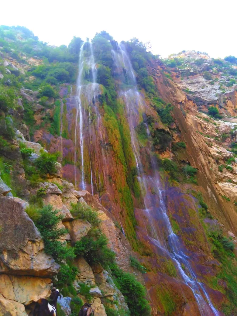
A spring-fed fall near Chhajjian village in Haripur district, described as the tallest in Hazara Division. Sources give heights of 120 m and about 400 m and describe poor road access.
Overview
Chajian Waterfall is near Chhajjian (Chajian) village in Haripur District, Khyber Pakhtunkhwa. Wikipedia calls it the tallest waterfall in Hazara Division and says natural springs feed it. It is overlooked by Siribang, the district's highest peak. Wikipedia puts it about 25 km from Haripur city. The Express Tribune (2012) says about 45 km south-east of the district headquarters.
Height figures disagree. Wikipedia gives 120 m (400 ft) and marks the figure as needing a citation. The 2012 Tribune article says about 400 m. Treat the height as unconfirmed.
What to see and do
- The fall. The water drops in several strands down a rock face striped with moss and mineral colours, with goats and green scrub on the ledges below.
- Springs and seasons. Springs feed the fall. The Tribune says winter snow can choke the springs, while monsoon rain increases the flow.
- Watermills and the river. Before the water reaches the Haro River, about 5 km downstream, it turns four watermills that local people use for flour. The Tribune quotes a local businessman saying the fall has fed the river for over 100 years.
The village and its setting
The Tribune describes Chajian as a village of over 3,000 people among green hills, with forests, springs and mineral deposits. Khanpur Dam is nearby. The Tribune also says Daman-e-Koh, the hill-top garden above Islamabad, is about three hours away on foot. Locals told the paper that better access could bring tourism and jobs and suggested a road from Dartian village, near Khanpur Lake, on the western side. These are proposals, not built roads.
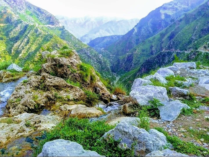
Photo: Kaazmiii, with thanks · CC BY-SA 4.0 · via Wikimedia Commons · temporary stand-in photo
When to visit
No official season was found. The Tribune notes the flow rises with monsoon rain and can fall in winter, so the fall is not at its fullest all year.
Getting there
Head for Chajian village from Haripur city (25 km by Wikipedia, 45 km by the 2012 Tribune report). In 2012 the only road was narrow, built decades earlier and never blacktopped, and picnickers avoided the site because of it. A new road may have been built since; this was not checked, so ask locally.
Where to stay and eat
Haripur has hotels and restaurants. No facilities at the fall were described in the sources.
Good to know
- Not set up for tourism. The same report describes the site as neglected, with no tourism investment.
- Fees. No official fee information found; current fees will be added soon.
- Safety. Treat the approach and wet rocks with care and ask locally.
- Travel advice. For foreign visitors: the UK FCDO page (updated 27 October 2026, checked 17 November 2026) does not name Haripur. Read the current page before you go.
Highlights
- Described as the tallest waterfall in Hazara Division
- Spring-fed, below Siribang peak
- Not developed for visitors in the sources found
Tips
- Ask locally about the current road before setting out
- Bring food and water; no facilities are described
- Do not rely on the quoted height
Sources and last checked
Last checked Confidence low4 sources6 still to check
- Last checked
- Method
- Desk research from published sources
- Confidence
- low
- Checked by
- trek.pk research team
Researched from published sources; not yet checked on the ground by our team. Spot something out of date? Report a mistake.
Sources
- Chajian Waterfall · Wikipedia · checked
- Tallest waterfall in Hazara Division obscured by neglect · The Express Tribune · checked
- Pakistan travel advice: warnings and insurance · UK Foreign, Commonwealth & Development Office · checked
- Chajian Waterfall (photos, coordinates) · Wikimedia Commons · checked
Still to be checked on the ground (6)
- Height (120 m on Wikipedia, about 400 m in 2012 Tribune)
- Current road access (sources date from 2012)
- Distance from Haripur (25 km vs 45 km)
- Best months
- Facilities and safety at the site
- Photo resolution: the waterfall photo is portrait and about 780 px wide; a larger landscape photo would suit the hero


