

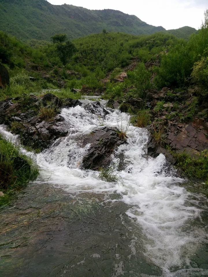
Photo: Shaniazamkhan, with thanks · CC BY-SA 4.0 · via Wikimedia Commons · temporary stand-in photo

Haripur
A city in the Hazara plain, about 65 km north of Islamabad and 35 km south of Abbottabad, founded in 1822. A practical stop on the way to the hills and the Karakoram Highway.
Overview
Haripur is the headquarters of Haripur District in Hazara Division, Khyber Pakhtunkhwa. It lies about 65 km north of Islamabad and 35 km south of Abbottabad, at about 520 m. Wikipedia, citing the 2023 census, gives the city 91,915 people, making it the 14th largest in the province. Hindko is the main language (79.3 per cent), followed by Pashto (10.9 per cent) and Urdu (6.4 per cent).
Plan your visit
- Getting there
Road: about 71 km from Islamabad (OSRM about 1 h, optimistic) and about 39 km from Abbottabad (about 30 min). Buses and vans run on the Hazara road. More
Best months
Mar – Apr, Oct – Nov
- Haripur
- Related places nearby: Abbottabad, Islamabad, Rawalpindi, Harkishan Garh Fort, Hazara Waterfalls (Jab Valley), Noori Waterfall (Haripur), Chajian Waterfall
History
Hari Singh Nalwa, a commander under Ranjit Singh, founded the town in 1822. He became governor of Hazara after the first governor, Amar Singh Majithia, was killed by local people at Samundar Katha near Abbottabad. The German traveller Baron Hugel visited on 23 December 1835 and found the town busy. Haripur stayed the headquarters of Hazara until 1848.
The British took control after the First Anglo-Sikh War in 1846. An obelisk marks the grave of Colonel Canara, a European officer of the Sikh artillery who died in 1848 defending his guns against forces under Chattar Singh. In 1851 the 4th (Hazara) Mountain Battery was raised here from local gunners, trained by James Abbott, the first deputy commissioner of Hazara. The town's municipality dates to 1867. Hazara moved from Punjab to the North-West Frontier Province in 1901, and Haripur became a district with its own headquarters in 1991. For the Sikh-era fort, see Harkishan Garh Fort.
What to see and do
Haripur is a service town, not a tourist centre. The University of Haripur is here, and the grave of Colonel Canara is a small historic stop. The usual reasons to come are the water and hills around it.
Khanpur Dam
The dam is on the Haro river at Khanpur, about 50 km from Islamabad. It is 51 m high and was completed in 1983 after a 15-year build. Its reservoir, Khanpur Lake, holds about 79,980 acre-feet and supplies drinking water to Islamabad and Rawalpindi, and irrigation water to nearby farmland. People come to boat, fish and picnic. The ruined Rajgan Mosque ("Rajon ki Masjid") and the Buddhist site of Bhamala, with sculptures from the 2nd to 5th centuries CE, are nearby. See Khanpur Dam.
Waterfalls and the Haro
The district has several small waterfalls. Wikipedia notes that the Hazara Waterfalls were discovered in 2021; see Hazara Waterfalls, Noori Waterfall and Chajian Waterfall. The Haro river rises on the southern slopes of the Dunga Gali range, and its two branches, the Dhund and the Karral Haro, meet at the head of the Khanpur area.
Getting there
- From Islamabad: about 71 km, OSRM about 1 hour (optimistic).
- To Abbottabad: about 39 km, OSRM about 30 minutes.
- Buses and vans run along the Hazara road from Rawalpindi and Islamabad. The Hazara Motorway (M-15) page covers the faster road.
When to visit
The climate is humid subtropical. June is hottest, with daily highs around 39 C, and January is coolest, with highs near 17 C and lows near 3 C. About 1,260 mm of rain falls in a year, with July (about 250 mm) and August (about 240 mm) the wettest months. November is the driest. October to April is more comfortable.
Where to stay and eat
There are simple hotels and many restaurants. Most travellers stay in Abbottabad or Islamabad.
Basic services
Haripur is one of the larger cities in the province, so a hospital, pharmacies and ATMs are likely. Hospitals, pharmacies, fuel stations and ATMs are normal in a district headquarters, but we have not confirmed any of them for this town from an official source. Ask at your hotel, and use the business listings on this site.
Safety and good to know
For foreign visitors: the UK FCDO (updated 27 October 2026, checked 16 November 2026) does not name Haripur. It does advise against all travel in several KP districts and on the Karakoram Highway north of Mansehra. This is government advice. Read the page before you go, and check road news.
Highlights
- Founded in 1822 by Hari Singh Nalwa
- About 65 km north of Islamabad
- Near Khanpur Dam
Hotels, food, fuel and services in Haripur
Places to stay
- NRTC GuesthouseMap of NRTC Guesthouse in Google Maps
- Staff College Hostel No. 2Map of Staff College Hostel No. 2 in Google Maps
- Ali Baba Guest House HaripurCall Ali Baba Guest House HaripurMap of Ali Baba Guest House Haripur in Google Maps
- Royal Inn Guest HouseCall Royal Inn Guest HouseMap of Royal Inn Guest House in Google Maps
Places to eat
- Flame On HaripurCall Flame On HaripurMap of Flame On Haripur in Google Maps
- Desi Mehfil RestaurantMap of Desi Mehfil Restaurant in Google Maps
- Labaik BroastCall Labaik BroastMap of Labaik Broast in Google Maps
- Jameel sweetsCall Jameel sweetsMap of Jameel sweets in Google Maps
- Tasty Ilyasi PakoraCall Tasty Ilyasi PakoraMap of Tasty Ilyasi Pakora in Google Maps
- Chatkhara PointCall Chatkhara PointMap of Chatkhara Point in Google Maps
Essential services fuel stations, mechanics, ATMs, pharmacies, hospitals and clinics and Rescue 1122
Fuel
- PUMA Petrol PumpCall PUMA Petrol PumpMap of PUMA Petrol Pump in Google Maps
- Petrol Station / Desil StationMap of Petrol Station / Desil Station in Google Maps
- Sajawal CNG StationMap of Sajawal CNG Station in Google Maps
- AdmoreMap of Admore in Google Maps
Mechanics and tyre shops
- Honda Gold StarCall Honda Gold StarMap of Honda Gold Star in Google Maps
- London wheels 3D computerised wheel Alignment serviceCall London wheels 3D computerised wheel Alignment serviceMap of London wheels 3D computerised wheel Alignment service in Google Maps
- Japan tyre and battery haripurCall Japan tyre and battery haripurMap of Japan tyre and battery haripur in Google Maps
- Shahzad Autos Authorised Yamaha 3s dealerMap of Shahzad Autos Authorised Yamaha 3s dealer in Google Maps
ATMs
- National Bank of PakistanCall National Bank of PakistanMap of National Bank of Pakistan in Google Maps
- National Bank of Pakistan (NBP)Call National Bank of Pakistan (NBP)Map of National Bank of Pakistan (NBP) in Google Maps
- Bank Al HabibCall Bank Al HabibMap of Bank Al Habib in Google Maps
- HBL ATMMap of HBL ATM in Google Maps
- Dubai Islamic BankMap of Dubai Islamic Bank in Google Maps
- Habib Bank ATMMap of Habib Bank ATM in Google Maps
Pharmacies
- Jamil Medical StoreCall Jamil Medical StoreMap of Jamil Medical Store in Google Maps
- Hamdard Matab HaripurCall Hamdard Matab HaripurMap of Hamdard Matab Haripur in Google Maps
- Abdullah Medical StoreCall Abdullah Medical StoreMap of Abdullah Medical Store in Google Maps
- Amir Nouman Medical StoreMap of Amir Nouman Medical Store in Google Maps
- Health First Medical Store & CosmeticsCall Health First Medical Store & CosmeticsMap of Health First Medical Store & Cosmetics in Google Maps
Hospitals and clinics
- Allama Iqbal Hospital HaripurCall Allama Iqbal Hospital HaripurMap of Allama Iqbal Hospital Haripur in Google Maps
- DHQ Hospital, HaripurCall DHQ Hospital, HaripurMap of DHQ Hospital, Haripur in Google Maps
- Women And Children HospitalCall Women And Children HospitalMap of Women And Children Hospital in Google Maps
- Ibne Seena Hospital KhalabatCall Ibne Seena Hospital KhalabatMap of Ibne Seena Hospital Khalabat in Google Maps
- Abdul Qayyum Memorial HospitalCall Abdul Qayyum Memorial HospitalMap of Abdul Qayyum Memorial Hospital in Google Maps
- SMT Welfare HospitalCall SMT Welfare HospitalMap of SMT Welfare Hospital in Google Maps
Rescue 1122
- Rescue 1122 HaripurCall Rescue 1122 HaripurMap of Rescue 1122 Haripur in Google Maps
Listings come from Google Maps data and are unverified: phone numbers, opening months and prices may have changed. Report a problem · Own one of these? Claim it
Tips
- Use Haripur as a food and fuel stop.
- Allow extra time at peak weekends.
- Read the FCDO advice before travelling north.
- Carry some cash.
Photos we still need: Haripur town centre or the Canara obelisk. Send us yours
Sources and last checked
Last checked Confidence medium5 sources4 still to check
- Last checked
- Method
- Desk research from published sources
- Confidence
- medium
- Checked by
- trek.pk research team
Researched from published sources; not yet checked on the ground by our team. Spot something out of date? Report a mistake.
Sources
- Haripur, Pakistan · Wikipedia · checked
- Haripur District · Wikipedia · checked
- Pakistan travel advice (updated 27 October 2026) · UK Foreign, Commonwealth & Development Office · checked
- OSRM driving route service: distances and times measured 16 November 2026 (times are optimistic, without stops) · OSRM / OpenStreetMap · checked
- Khanpur Dam · Wikipedia · checked
Still to be checked on the ground (4)
- Services and hotels
- Khanpur Dam visiting arrangements (Wikipedia's Haripur page does not mention the dam)
- Exact location of the waterfall in the photo (Commons says only 'near Haripur city')
- Tarbela Dam and Hattar industrial estate: not covered by Wikipedia's Haripur pages, so omitted
Nearby and related

Abbottabad
A cool, green cantonment city at about 1,256 m in Hazara, the military academy town and the main gateway to Nathia Gali, Thandiani, Ayubia National Park and the Kaghan Valley.

Islamabad
Pakistan's green, planned capital at the foot of the Margalla Hills: Faisal Mosque, hillside trails, cafes and the gateway to the north.

Rawalpindi
Islamabad's older twin city: a busy bazaar and cantonment, the north's main rail and bus hub, and an easy base for Taxila and Murree.

Khyber Pakhtunkhwa
Mountains, Buddhist ruins and old bazaars in north-west Pakistan: Swat, Kaghan, Chitral, the Kalash valleys, the Khyber Pass and Peshawar.
Harkishan Garh Fort
A Sikh-era fort in Haripur, built under Hari Singh Nalwa around 1822-23. It was the British district headquarters from 1849 to 1853. Parts are used by government offices, and a museum conversion was announced in 2019.
Hazara Waterfalls (Jab Valley)
A group of eight cascades in Jab Valley, Haripur district, about 25 km from Haripur city. Publicised from 2021, with a trail, hut and viewing platforms built in 2025.
Noori Waterfall (Haripur)
A waterfall of about 30 m in Haripur district that drops into a turquoise pool. Reached on foot over hilly ground; popular since 2020. Not the same as Noori Top in Kaghan.

Chajian Waterfall
A spring-fed fall near Chhajjian village in Haripur district, described as the tallest in Hazara Division. Sources give heights of 120 m and about 400 m and describe poor road access.
Haro River
A river of Hazara that rises near Dunga Gali, feeds Khanpur Dam, then crosses Attock District to the Indus near the Ghazi Barotha Dam.