

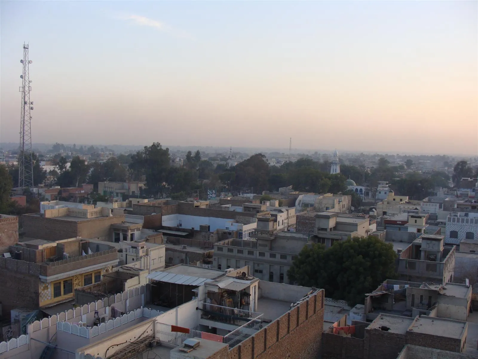
Photo: mEe-ThE SuRGe, with thanks · CC BY-SA 3.0 · via Wikimedia Commons · temporary stand-in photo

Haroonabad
Border-area market town in Bahawalnagar District, laid out in the 1920s as a canal colony town.
Overview
Haroonabad is the headquarters of Haroonabad Tehsil in Bahawalnagar District, in the far south-east of Punjab. The 2023 census counted 149,679 people, up from 10,014 in 1951. Most people speak Punjabi (about 88.7 per cent), and about 10.8 per cent speak Urdu. Bahawalnagar District borders the Indian districts of Bikaner and Firozpur to the east and south, and Haroonabad is described as touching the border.
Plan your visit
- Getting there
A branch railway built in 1927 linked Fort Abbas and Bahawalnagar, and Haroonabad station opened the same year (Wikipedia). Current services and road details are not verified. More
Best months
Oct – Mar
- Haroonabad
- Related places nearby: Fort Abbas, Bahawalnagar
History and layout
The town was laid out as a mandi (market town) under the Sutlej Valley Project, a British-era irrigation scheme, in the early 20th century; sources date this to the 1910s or the 1920s. The site was earlier called Toba Badru Wala, after a natural pond (toba) and a local community. A branch railway linking Fort Abbas and Bahawalnagar opened in 1927, with a station first named Badru Wala.
The town was renamed after Prince Haroon-ur-Rashid, son of Sir Sadeq Mohammad Khan V, Nawab of Bahawalpur. Before 1947 the town had a Hindu and Sikh majority. Muslim refugees from the Malwa region of East Punjab then settled here, and the population grew quickly.
Farming and canals
Canal irrigation shaped the area. An irrigation system under the Sutlej Valley Project began in 1934, and later canals, including the 3R and 4R, brought most of the surrounding land under irrigation. Cotton is the main crop, followed by cauliflower. Three tea brands have their headquarters in the town. The countryside is flat, canal-watered farmland, so the interest for a visitor is in everyday town life and the canal landscape, not in set sights.
What to see and do
No sights are listed for the town. For a wider trip, Fort Abbas and Bahawalnagar are nearby, with the Cholistan Desert to the west. Haroonabad Tehsil covers 1,295 square km and had 615,476 people in 2023; neighbouring Fort Abbas Tehsil is much larger, at 2,536 square km.
When to visit
October to March. Summers are very hot.
Where to stay and eat
Hotels and restaurants are those of a working district town; no verified names. Bigger cities nearby have more choice.
Good to know
As a district town it should have banks, pharmacies and fuel, but there are no verified details, so check on arrival. Safety: the UK FCDO Pakistan page (updated 27 October 2026, checked 17 November 2026) advises against all but essential travel within 5 miles of the India border and, in Punjab, to Dera Ghazi Khan only. Haroonabad is described as touching the India border, so it is likely to lie within the 5-mile area; the FCDO page does not name it, so check the live page and local advice.
Highlights
- Laid out in the 1920s
- Cotton and tea town
- Close to the India border
Getting there
A branch railway built in 1927 linked Fort Abbas and Bahawalnagar, and Haroonabad station opened the same year (Wikipedia). Current services and road details are not verified.
Hotels, food, fuel and services in Haroonabad
Places to stay
- Kamal Guest HouseCall Kamal Guest HouseMap of Kamal Guest House in Google Maps
- GSS TOWER HOTELCall GSS TOWER HOTELMap of GSS TOWER HOTEL in Google Maps
Places to eat
- Fifth Avenue Pizza - HaroonabadCall Fifth Avenue Pizza - HaroonabadMap of Fifth Avenue Pizza - Haroonabad in Google Maps
- Bandhan Restaurant & Marriage HallCall Bandhan Restaurant & Marriage HallMap of Bandhan Restaurant & Marriage Hall in Google Maps
- Al Faisal Marque Marriage Hall And RestuarantCall Al Faisal Marque Marriage Hall And RestuarantMap of Al Faisal Marque Marriage Hall And Restuarant in Google Maps
- DENSIRE HAROONABADCall DENSIRE HAROONABADMap of DENSIRE HAROONABAD in Google Maps
- HFC HAROONABADCall HFC HAROONABADMap of HFC HAROONABAD in Google Maps
- Decent Sweets And Bakers Branch (1)Call Decent Sweets And Bakers Branch (1)Map of Decent Sweets And Bakers Branch (1) in Google Maps
Essential services fuel stations, mechanics, ATMs, pharmacies and hospitals and clinics
Fuel
- Haroonabad - PSO AL-KAWAITCall Haroonabad - PSO AL-KAWAITMap of Haroonabad - PSO AL-KAWAIT in Google Maps
- Haroonabad filling station AdmoreCall Haroonabad filling station AdmoreMap of Haroonabad filling station Admore in Google Maps
- Ideal Filling Station HaroonabadCall Ideal Filling Station HaroonabadMap of Ideal Filling Station Haroonabad in Google Maps
- SITARA PETROLEUM SERVICES (SWL)- Go Petrol StationCall SITARA PETROLEUM SERVICES (SWL)- Go Petrol StationMap of SITARA PETROLEUM SERVICES (SWL)- Go Petrol Station in Google Maps
- LALEKA PETROLIUMMap of LALEKA PETROLIUM in Google Maps
- ShellCall ShellMap of Shell in Google Maps
Mechanics and tyre shops
- Ahsan HondaCall Ahsan HondaMap of Ahsan Honda in Google Maps
- Punjab Tyre HouseCall Punjab Tyre HouseMap of Punjab Tyre House in Google Maps
- Concept Autos (Parts & Workshop)Call Concept Autos (Parts & Workshop)Map of Concept Autos (Parts & Workshop) in Google Maps
- Sindh auto service and spare partsCall Sindh auto service and spare partsMap of Sindh auto service and spare parts in Google Maps
- Bashir auto electrition and Car A/C serviceCall Bashir auto electrition and Car A/C serviceMap of Bashir auto electrition and Car A/C service in Google Maps
- Ghauri AutosCall Ghauri AutosMap of Ghauri Autos in Google Maps
ATMs
- Meezan Bank ATMMap of Meezan Bank ATM in Google Maps
- ATM Bank Alfalah LtdMap of ATM Bank Alfalah Ltd in Google Maps
Pharmacies
- NAZIR MEDICAL STORECall NAZIR MEDICAL STOREMap of NAZIR MEDICAL STORE in Google Maps
- Punjab Medical HallCall Punjab Medical HallMap of Punjab Medical Hall in Google Maps
- Al Wahab pharmacyCall Al Wahab pharmacyMap of Al Wahab pharmacy in Google Maps
- شریف میڈیکل ہالCall شریف میڈیکل ہالMap of شریف میڈیکل ہال in Google Maps
- National pharmacyCall National pharmacyMap of National pharmacy in Google Maps
- Sardar Medical Storeسردار میڈیکل سٹورCall Sardar Medical Storeسردار میڈیکل سٹورMap of Sardar Medical Storeسردار میڈیکل سٹور in Google Maps
Hospitals and clinics
- Tahir Medical ComplexCall Tahir Medical ComplexMap of Tahir Medical Complex in Google Maps
- Sheikh Saleem Children ComplexCall Sheikh Saleem Children ComplexMap of Sheikh Saleem Children Complex in Google Maps
- Tehsil Headquarter Hospital HaroonabadCall Tehsil Headquarter Hospital HaroonabadMap of Tehsil Headquarter Hospital Haroonabad in Google Maps
- Zaineb Madicare CentreCall Zaineb Madicare CentreMap of Zaineb Madicare Centre in Google Maps
- Aqsa Hospital HaroonabadCall Aqsa Hospital HaroonabadMap of Aqsa Hospital Haroonabad in Google Maps
- THQ Hospital, Haroonabad, BahawalnagarCall THQ Hospital, Haroonabad, BahawalnagarMap of THQ Hospital, Haroonabad, Bahawalnagar in Google Maps
Listings come from Google Maps data and are unverified: phone numbers, opening months and prices may have changed. Report a problem · Own one of these? Claim it
Tips
- Check the FCDO border-area advice before visiting.
Photos we still need: a street or bazaar in Haroonabad. Send us yours
Sources and last checked
Last checked Confidence low3 sources4 still to check
- Last checked
- Method
- Desk research from published sources
- Confidence
- low
- Checked by
- trek.pk research team
Researched from published sources; not yet checked on the ground by our team. Spot something out of date? Report a mistake.
Sources
- Haroonabad, Punjab · Wikipedia · checked
- Pakistan travel advice: warnings and insurance · UK FCDO (GOV.UK) · checked
- Bahawalnagar District · Wikipedia · checked
Still to be checked on the ground (4)
- Distance to the India border (the town is described as touching it, with no figure)
- Rail and road services
- Hotels and services
- Date the town was laid out (sources give the 1910s or the 1920s)
Nearby and related
Fort Abbas
A small desert town in Bahawalnagar district, named after the Nawab's son, and a base for the ruined Pholra, Mir Garh and Jam Garh forts of Cholistan.
Bahawalnagar
District capital in the south-east of Punjab, near the Cholistan desert and the Fort Abbas area, renamed in 1904.

Cholistan Desert
Cholistan is a desert of about 25,800 km2 in Punjab's Bahawalpur Division, with dunes, seasonal ponds called tobas, camel herders and Derawar Fort. Visit October to March.