

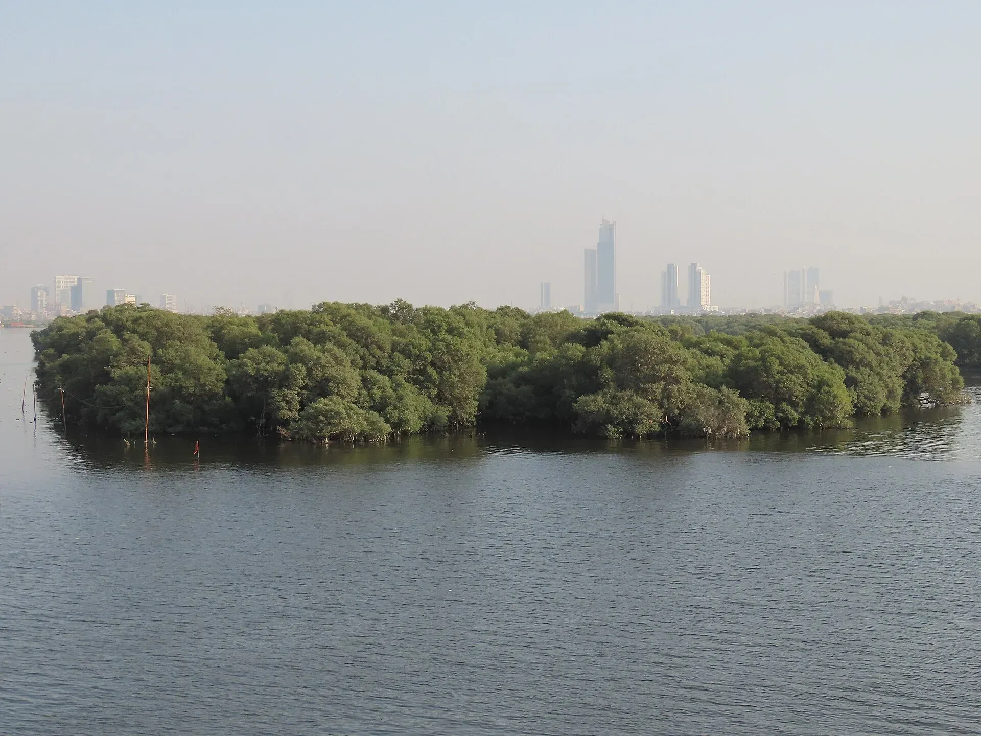
Photo: King Eliot, with thanks · CC BY-SA 4.0 · via Wikimedia Commons · temporary stand-in photo

Indus Delta Mangroves (Keti Bandar)
The mangrove forests of the Indus delta in Thatta, about 600,000 ha by the Sindh Forest Department, a Ramsar site since 2002 and shaped by sea intrusion and reduced river flow.
Overview
The Indus delta in Thatta District, southern Sindh, holds one of the largest arid-climate mangrove systems in the world. The Sindh Forest Department gives the mangrove area as about 600,000 hectares, but figures vary widely between studies and years. Wikipedia quotes 263,000 ha in 1977 and 158,500 ha in 1990 from one study, and also reports about 600,000 ha until the 1980s. The delta became a Ramsar wetland of international importance on 5 November 2002.
The delta is cut by 17 major creeks and many minor ones. From west to east they include Korangi Creek near Karachi, Khobar Creek (the main Indus mouth) and Hajamro Creek. Keti Bandar, a historic port town on Hajamro Creek, had 4,272 people in 2017. The climate is arid, with 250 to 500 mm of rain a year according to Wikipedia, and the delta takes the strongest wave action of any river delta in the world, which has built sand beaches along the coast.
Plan your visit
- Nearest town
- Keti Bandar
- Getting there
Karachi to Keti Bandar is about 152 km (OSRM, modelled 2.2 h); road conditions in the last section are poor. Thatta is the usual base. More
Best months
Nov – Mar
The mangroves
Four mangrove species survive of the eight once reported. The Sindh Forest Department says about 90% is Avicennia marina (grey mangrove), with Rhizophora mucronata about 8% and smaller amounts of Aegiceras corniculatum and Ceriops tagal. Wikipedia gives a higher share for Avicennia, about 99%, so the exact split is uncertain. The mangroves grow between mean sea level and the high-water mark of spring tides.
Management is split between the Sindh Forest Department, the Port Qasim Authority and the Sindh Board of Revenue. The first two hold protected forest; the Board of Revenue's areas are classed as government wasteland.
Wildlife
The Zoological Survey of Pakistan has recorded 98 fish species in the area, along with three lizard species and 14 snake species. The Sindh Forest Department says flocks of migratory birds, including flamingos, pelicans, cranes and cormorants, visit from November to February to feed, roost and breed, though numbers have fallen as habitat has degraded. The Indian Ocean humpback dolphin lives in the larger estuaries. The Indus river dolphin, listed by the IUCN as Endangered, was cut off from its upstream population by dams.
The mangroves are a nursery for commercial fish, shrimp, lobsters and crabs. The Forest Department says about 90% of commercially important tropical marine fish species spend part of their life cycle there.
People and livelihoods
Wikipedia gives about 900,000 people for the active delta in 2003, and says at least 75% depend on fishing. Main communities named include Mallaah, Mohano, Soomro, Samma and Jat, all Sindhi speakers. Mangroves also supply fuelwood. Villages have lost people as freshwater and fish stocks have shrunk; one estimate cited by Wikipedia puts displacement at 90,000 people and about 120 villages depopulated. Only about a third of residents have access to clean drinking water.
What to see and do
Most visits are boat trips through creeks with local fishing families. Keti Bandar is the usual landing point. Birdwatchers come in winter for migratory waterbirds. Wikipedia also records older ports on the delta: Debal, a port of about the 6th century, and Kharochan, a busy delta city until the 1970s that lost its port to the sea by 2006.
When to visit
November to March is cooler and best for birds; the Sindh Forest Department says migratory birds visit from November to February. Summer heat and cyclones make the coast risky; check the Pakistan Meteorological Department forecast before any boat trip.
Where to stay and eat
Keti Bandar has very limited facilities. Most visitors come on a long day trip or stay in Thatta or Karachi.
Getting there
By road, Karachi to Keti Bandar is about 152 km (modelled 2.2 h, OSRM estimate); the final stretch is slow. Thatta is the usual base for a trip.
Threats
- Shrinking delta. Wikipedia reports the delta area has shrunk by 92% since 1883, to about 1,000 km² in 2018, because dams and irrigation since the 1940s cut freshwater and silt. Annual flow fell from about 180 billion m³ to 43 billion m³ by 1994. Salt water pushes inland.
- Pollution. Untreated sewage and industrial waste from Karachi, oil from shipping and farm chemicals cause habitat loss.
- Storms. In 1999 the A-2 cyclone caused serious loss of life in Keti Bunder and Shah Bunder. The Forest Department says weaker mangrove cover reduces cyclone protection.
- Disputed figures. The department reports large replanting programmes and about 600,000 ha; independent studies give much lower and widely varying areas.
Good to know
- Boat charges are agreed locally and are not confirmed here; current fees will be added soon.
- Do not cut or damage mangrove roots.
- Thatta is south of Nawabshah; read the FCDO page for Sindh before you travel.
Highlights
- Largest arid-climate mangrove system, per the Sindh Forest Department
- Ramsar site since 2002
- Boat trips to Keti Bandar
- Indus river dolphin and winter birds
Tips
- Hire a local boat with a guide
- Avoid the cyclone season
- Carry drinking water
- Do not cut or damage roots
Wildlife
Photos we still need: Keti Bandar and the creeks of Hajamro or Khobar, and boats among the mangroves; delta birdlife (flamingos or pelicans) at a delta site. Send us yours
Sources and last checked
Last checked Confidence medium7 sources5 still to check
- Last checked
- Method
- Desk research from published sources
- Confidence
- medium
- Checked by
- trek.pk research team
Researched from published sources; not yet checked on the ground by our team. Spot something out of date? Report a mistake.
Sources
- Indus River Delta (Wikipedia) · Wikipedia · checked
- Keti Bandar (Wikipedia) · Wikipedia · checked
- Mangroves · Sindh Forest Department · checked
- Indus river dolphin (Wikipedia) · Wikipedia · checked
- Pakistan launches mangrove plantation drive · Arab News · checked
- Pakistan travel advice (updated 27 October 2026) · UK Foreign, Commonwealth & Development Office · checked
- OSRM driving routes (modelled distance and time) · OSRM project · checked
Still to be checked on the ground (5)
- Mangrove area: Sindh Forest Department says about 600,000 ha, other studies differ widely; the 2025 recovery figures (240,000 to 250,000 ha) were not found in an opened source
- Boat access and fees
- Cyclone-season months (no official source opened)
- Current road condition
- Which mangrove share is correct: 90% Avicennia marina (Forest Department) or about 99% (Wikipedia)
Nearby and related

Thatta
Sindh's medieval capital, home to the UNESCO-listed Makli Necropolis and the tiled Shah Jahan Mosque, about 100 km from Karachi and Hyderabad.

Karachi
Pakistan's largest city and main port: colonial buildings, museums, beaches, busy bazaars and some of the country's best food.

Indus Dolphin Reserve (Sukkur-Guddu)
A river reserve on the Indus in northern Sindh between Guddu and Sukkur barrages, declared in 1974 and Ramsar site no. 1065 since 2001. Home to the largest group of the Endangered Indus river dolphin. Security advice applies.
Nurri Lagoon
A 2,540-hectare lagoon in Badin District, Sindh, listed as a Ramsar wetland of international importance on 10 May 2001. Very little visitor information exists.