

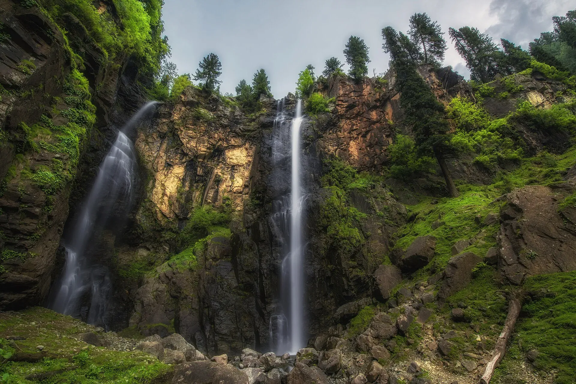
Photo: Uzair889, with thanks · CC BY-SA 4.0 · via Wikimedia Commons · temporary stand-in photo

Jarogo Waterfall
A forest waterfall in the Chatekal valley of Matta tehsil, about 55 km north-west of Mingora in Swat. Wikipedia's 120 m height is unsourced. For foreign visitors: the UK FCDO advises against all travel to Swat.
Overview
Jarogo Waterfall (also Jarogo Banda) is in the Chatekal valley of Matta tehsil, Swat, Khyber Pakhtunkhwa, about 55 km north-west of Mingora according to Dawn (9 June 2015) and The Express Tribune (28 May 2016). Dawn describes it as lying deep between two very large mountains, in thick forest of pine and other trees. Wikipedia gives a height of about 120 m (400 ft), but marks that figure as needing a citation, and Dawn gave no height. Some online sources call it the highest waterfall in Pakistan, which is unverified, so do not rely on it. Wikipedia adds that it is sometimes called a duplicate of the Gabin Jabba waterfall because of their similarities.
The name comes from a Pashto word for a broom. Local stories link it either to a woman called Jarogai, said to date from the Hindu Shahi period, or to village women who gathered grass to make brooms. Dawn quoted an 80-year-old resident for the first account.
Plan your visit
- Nearest town
- Matta
- Getting there
Drive from Mingora to Matta, then follow Fazal Banda Road (about 30 km, per Wikipedia) towards Chatekal and walk the track along the stream. OSRM routes about 52 km in 71 minutes from Mingora (checked 16 November 2026). More
Best months
May – Sep
- Jarogo Waterfall
- Related places nearby: Swat Valley, Matta
The walk
Visitors reach the fall by following a winding stream, with thick forest on both sides and birds in the tall pines. Dawn (2015) reported that no road or jeepable track reached it then, and that local people and hoteliers wanted one built. It describes the water as clear. No source gives the walking time or a route description.
The fall
A trekker quoted by Dawn said the spread of falling water covered more than 120 m, which describes width, not height. The Tribune notes that tourists travelling between Kalam and Mingora pass the Chatekal valley, so the fall can be a stop on that road; it also names the Mahodand, Shingrai (Shingrai Dand) and Manglor waterfalls and places in the area.
Camping
Wikipedia says camping pods were built nearby after the federal government transferred 19 PTDC motels to the KP tourism authority in 2022, when the falls were included in an Integrated Tourism Zones project. The KP Tourism site lists camping pods under its stay options but gives no detail on this site, so their current use is unconfirmed.
When to visit
There is no known official season. Flow follows snowmelt and rain, so it is strongest in late spring and the summer monsoon. Winter snow and wet tracks make the approach harder.
Where to stay and eat
There are guesthouses in Mingora, Matta and Kalam. There are no sourced services near the fall; bring food and water.
Good to know
- Getting there. Wikipedia describes a 30 km route from Matta along Fazal Banda Road. The OSRM routing service gives about 52 km and 71 minutes from Mingora to the fall's map position (checked 16 November 2026), but that cannot show the final track.
- Safety. Forest tracks and wet rock are slippery, and streams rise quickly after rain. There are no known dated incident reports for this fall.
- Fees. No official fee information found; current fees will be added soon.
- Etiquette. Take your litter out, and ask before camping on private land.
- Travel advice. For foreign visitors: the UK FCDO page (updated 27 October 2026, still current when checked on 17 November 2026) advises against all travel to Swat, and KP is also under emergency measures and Governor's Rule since 11 October 2026. Read the current page before making any plans.
Highlights
- Forest waterfall in the Chatekal valley
- About 55 km north-west of Mingora
- Name means broom in Pashto
- Reached by a track along a stream
Getting there
Drive from Mingora to Matta, then follow Fazal Banda Road (about 30 km, per Wikipedia) towards Chatekal and walk the track along the stream. OSRM routes about 52 km in 71 minutes from Mingora (checked 16 November 2026). Ask locally about the current state of the track.
Tips
- Do not trust claims that it is the highest in Pakistan or 120 m tall
- Check the current FCDO advice and local security news first
- Use a local guide for the last stretch
- Carry food and water; services are limited
Photos we still need: the forest stream track leading to Jarogo. Send us yours
Sources and last checked
Last checked Confidence medium6 sources4 still to check
- Last checked
- Method
- Desk research from published sources
- Confidence
- medium
- Checked by
- trek.pk research team
Researched from published sources; not yet checked on the ground by our team. Spot something out of date? Report a mistake.
Sources
- Jarogo Waterfall · Wikipedia · checked
- Spectacular Swat waterfall is largely hidden · Dawn · checked
- Creating a splash: Venturing out in search of hidden gems · The Express Tribune · checked
- OSRM demo routing service (driving routes) · Project OSRM · checked
- Pakistan travel advice: warnings and insurance · UK Foreign, Commonwealth & Development Office · checked
- Camping pods and stays · KP Culture and Tourism Authority · checked
Still to be checked on the ground (4)
- Height (Wikipedia 120 m is uncited; Dawn and Tribune give none)
- Current road or track access (Dawn 2015 said no road; Wikipedia gives a 30 km route from Matta; no current source)
- Camping pod status (Wikipedia says built; kptourism.com lists pods generally, nothing specific to Jarogo)
- Best months (no source states them)
Nearby and related

Swat Valley
A long green river valley in northern Khyber Pakhtunkhwa, with Gandhara Buddhist sites, orchards, hill towns and the road up to Kalam. Check the current security advice before you plan a trip.
Matta
The main town of Matta tehsil in the Swat Valley, on the way to Chatekal and Jarogo Waterfall. UK advice is against all travel to Swat.