

Photo: Rahul1473, with thanks · CC BY-SA 4.0 · via Wikimedia Commons · temporary stand-in photo

Kot Diji
A fort on a rocky hill in Khairpur district, built by the Talpurs in the late 18th century, below an early Indus-era town that gave its name to the Kot Dijian culture. Across the Indus from Moenjodaro.
Overview
Kot Diji is two sites in one. On a steep hill above the town of Diji stands a Talpur fort of the late 1700s, still well preserved. At the foot of the hill, about 2.6 hectares in all, are the remains of an early town from about 3300 BCE, the first of its kind excavated, which gave archaeologists the name "Kot Dijian" for the cultures that led to the Indus civilisation. The site is on the east bank of the Indus, roughly opposite Moenjodaro.
Plan your visit
- Nearest town
- Khairpur
- Getting there
Kot Diji is about 23 km (24 minutes) by road from Khairpur and about 50 km (47 minutes) from Sukkur (OSRM, checked 16 November 2026). Sukkur has the nearest airport and railway junction; More
Best months
Nov – Feb
- Kot Diji
- Related places nearby: Moenjodaro, Sukkur, Larkana, Mehrano Wildlife Sanctuary
History
The early town. Pakistan's Department of Archaeology dug here in 1955 and 1957. The remains show a raised citadel of about 150 by 110 m, separated by a wall with bastions from the lower town. Houses were of mud brick on stone foundations. Wheel-made red pottery, bull-head and fish designs, copper and bronze ornaments, terracotta figurines and a toy cart were found. Burn layers across the site point to a fire that ended this phase.
The fort. The Sindh Department of Antiquities says the fort was built by Mir Suhrab Khan Talpur in the last quarter of the 18th century. Wikipedia gives about 1790 and describes his rule as 1783 to 1830. It sits on the ridge of the Rohri Hills, with three almost vertical sides and three gateways on terraces up the east side.
What the excavations show. Wikipedia dates the Kot Dijian phase to roughly 3300 to 2600 BCE (sources vary) and calls it an Early Harappan phase of the Indus Valley Civilisation. The earliest layer had no copper or bronze. Later layers used bronze, mainly for ornaments. The pots were wheel-thrown red ware, decorated with fish-scale patterns, intersecting circles, bulls' heads, fish and pipal leaves. Other finds include bangles, beads, stone tools, terracotta figurines of a mother goddess and animals, and a toy cart that hints at wheeled bullock carts. Signs that may be early Indus script appear on a pot and a sealing. Pots of the Kot Diji type have been found as far away as Burzahom in Jammu and Kashmir. The cause of the burning that marks the whole site is not explained, and similar burn layers appear at other Early Harappan sites such as Amri and Kalibangan.
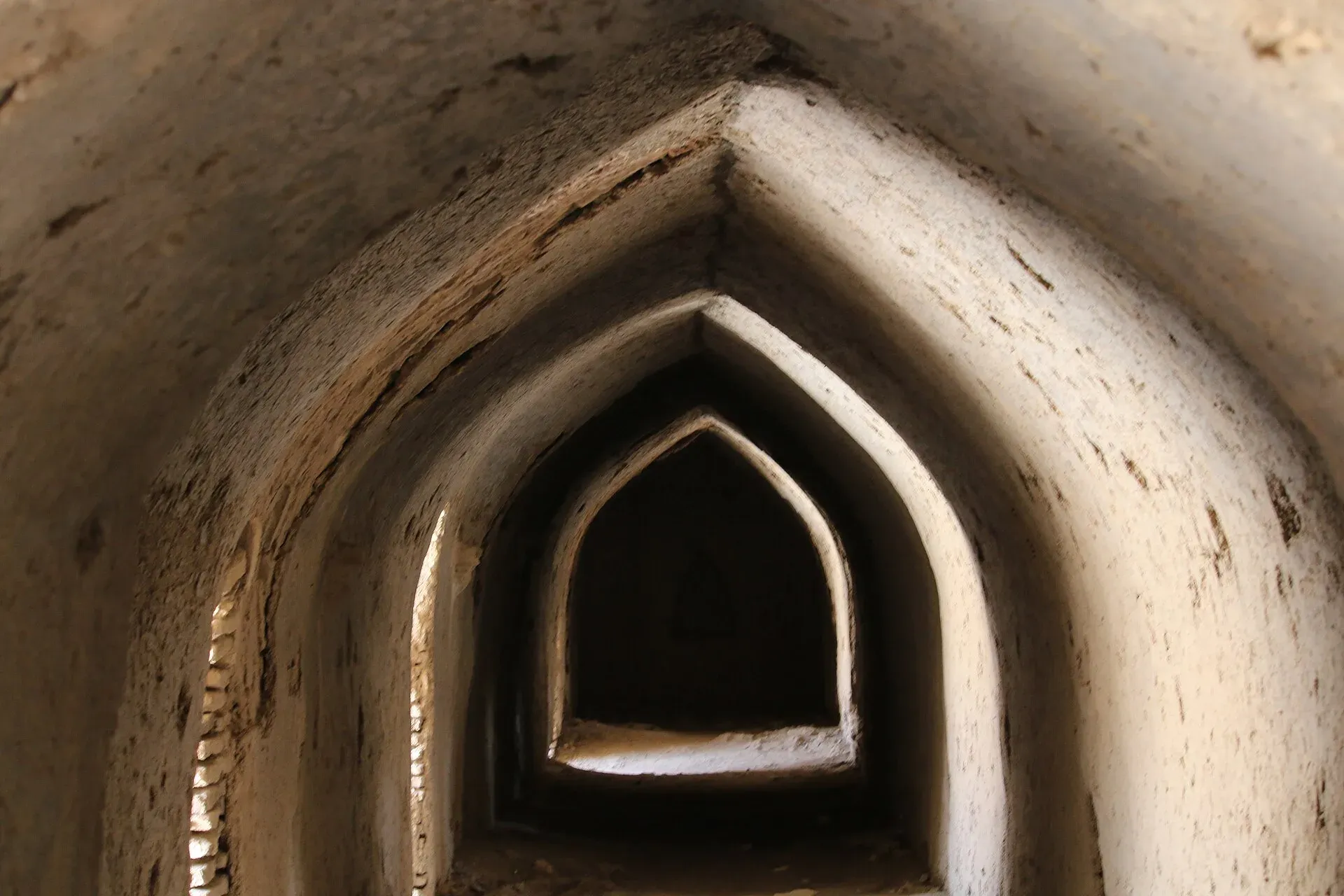
The fort in use. The Sindh Department of Antiquities says there is no major residential building inside. There is a house to the right of the entrance gate and narrow vaulted chambers along the defences, which suggests the fort was a stronghold rather than a palace.
UNESCO status
Wikipedia's list shows Kot Diji Fort added to Pakistan's UNESCO tentative list in 2026. It is not an inscribed World Heritage Site (checked 16 November 2026; UNESCO's own entry is not cited here).
What to see and do
- The three gateways. Climb the east approach terrace by terrace to see why the fort was hard to take.
- Bastions and the brass cannon. The semicircular bastions once held heavy guns. The one surviving gun, "Mariam", carries Portuguese and Persian inscriptions.
- The cut-stone pavilion. A pavilion overlooking the east defences was probably the ruler's seat in peacetime.
- Sheesh Mahal. The Sindh culture department publishes a virtual tour of the Shahi/Sheesh Mahal at Kot Diji. Ask locally what can be visited.
- The early town site. Foundations at the foot of the hill; there is little to see without a guide.
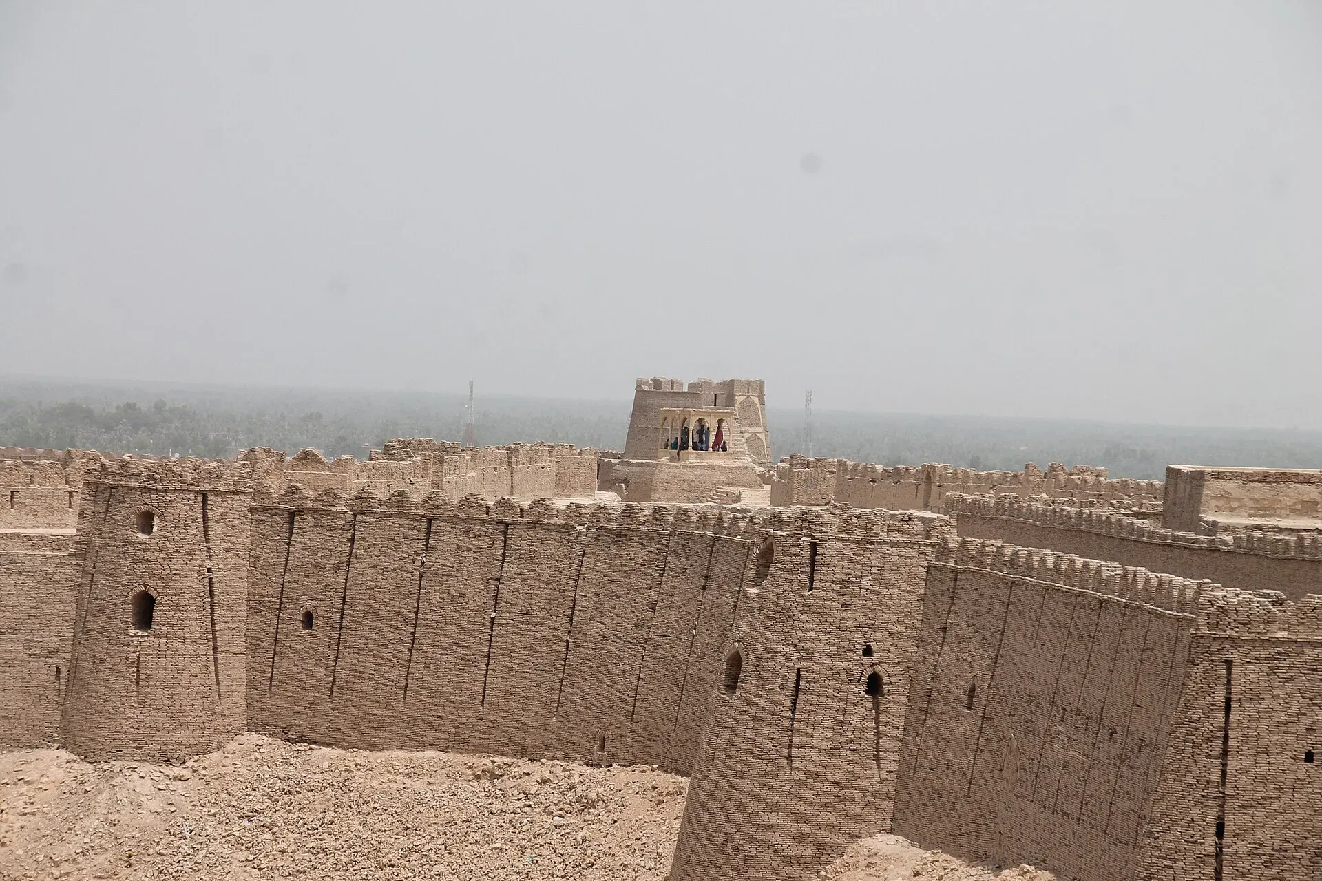
Photo: BMK.110, with thanks · CC BY-SA 4.0 · via Wikimedia Commons · temporary stand-in photo

A suggested visit
Allow a half day. Climb the east approach through the three gateways first, in the cooler hours, and look at the bastions, the pavilion and the cannon on top. Then walk to the foot of the hill for the early town. Combine with Moenjodaro across the river only if you have a full day and the travel advice below allows it.
When to visit
November to February. Summers in upper Sindh are very hot.
Where to stay and eat
Stay in Khairpur, Sukkur or Larkana. There is little at Diji itself.
Good to know
- For foreign visitors: the UK FCDO advises against all but essential travel to Sindh north of and including Nawabshah (updated 27 October 2026, checked 16 November 2026). Kot Diji is in that area. Read the live page before you plan.
- No official opening hours or entry fee were published on the sources we could check. Current fees will be added soon; check with the Directorate General of Antiquities & Archaeology, Government of Sindh.
- The climb is on uneven stone. Wear sturdy shoes.
Highlights
- Talpur fort on a near-vertical rocky hill
- Type site of the early Kot Dijian culture, about 3300 BCE
- Brass cannon named Mariam
- On Pakistan's UNESCO tentative list (listed 2026, per Wikipedia)
Getting there
Kot Diji is about 23 km (24 minutes) by road from Khairpur and about 50 km (47 minutes) from Sukkur (OSRM, checked 16 November 2026). Sukkur has the nearest airport and railway junction; buses and vans run from Sukkur and Khairpur to Diji.
Tips
- Check the FCDO advice for upper Sindh before you travel.
- Wear sturdy shoes for the stone approach.
- Combine with Moenjodaro and Sukkur if conditions allow.
- Ask in Diji about access to the Sheesh Mahal.
Photos we still need: the three gateways on the east approach; the brass cannon Mariam; excavated foundations of the early town. Send us yours
Sources and last checked
Last checked Confidence medium8 sources3 still to check
- Last checked
- Method
- Desk research from published sources
- Confidence
- medium
- Checked by
- trek.pk research team
Researched from published sources; not yet checked on the ground by our team. Spot something out of date? Report a mistake.
Sources
- Fort of Kotdiji, District Khairpur · Directorate General of Antiquities & Archaeology, Government of Sindh · checked
- Kot Diji · Wikipedia · checked
- List of World Heritage Sites in Pakistan (tentative list table) · Wikipedia (UNESCO site whc.unesco.org returned HTTP 403) · checked
- Virtual tours (Kot Diji Shahi Mahal) · Government of Sindh Culture Department · checked
- Pakistan Tourism Guide 2021 · TDAP (Trade Development Authority of Pakistan) · checked
- OSRM driving route calculation · OSRM (OpenStreetMap routing) · checked
- Pakistan travel advice (warnings and insurance), updated 27 October 2026 · UK Foreign, Commonwealth & Development Office · checked
- Fort of Kotdiji (description of gateways, bastions, cannon and pavilion) · Directorate General of Antiquities & Archaeology, Government of Sindh · checked
Still to be checked on the ground (3)
- Opening hours and any entry fee (none on the Sindh Antiquities or Wikipedia pages)
- Whether the early town excavations are visible to visitors (no source says)
- Distance from Khairpur: Wikipedia says about 45 km, OSRM gives about 23 km
Nearby and related

Moenjodaro
The ruins of a planned Indus Valley city built around 2500 BCE, with brick streets, drains and the Great Bath. A UNESCO World Heritage Site since 1980, about 30 km from Larkana in Sindh.

Sukkur
Sindh's third-largest city on the Indus, with the 1932 Sukkur Barrage, the 1889 Lansdowne Bridge, Masum Shah's Minaret and the river islands of Rohri.

Larkana
A rice-growing city in northern Sindh and the base for Mohenjo-daro, the UNESCO-listed Indus Valley city about 30 km away, with the Bhutto family mausoleum nearby.
Mehrano Wildlife Sanctuary
A 280-hectare riverside forest near Kot Diji in Khairpur District, Sindh, kept by the Talpur Mir family and endorsed by the Sindh Wildlife Department. Blackbuck, Indian gazelle and hog deer are recorded. Visitor access is not published.