

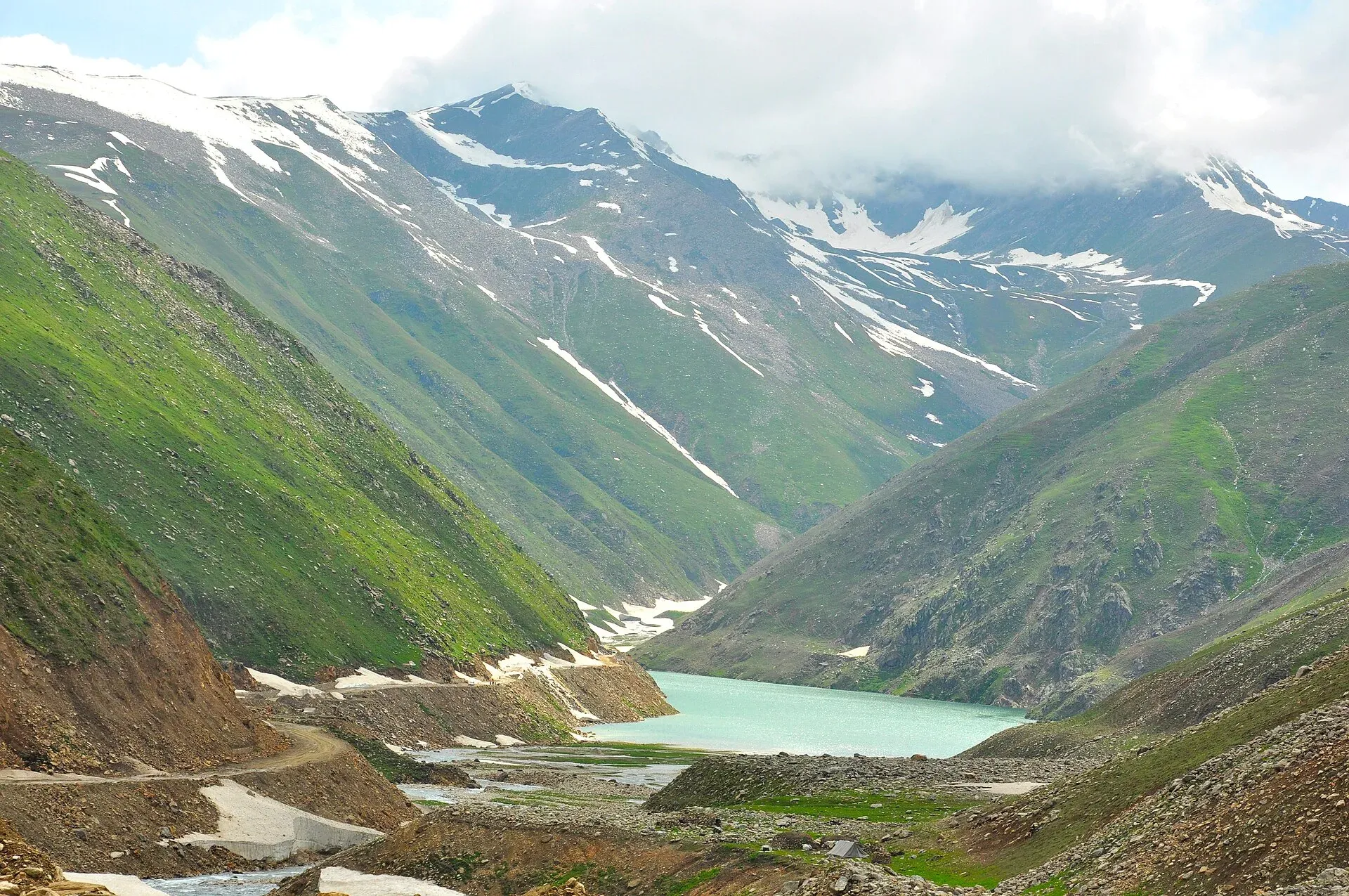
Photo: irfan muhammad, with thanks · CC BY-SA 3.0 · via Wikimedia Commons · temporary stand-in photo

Lulusar-Dudipatsar National Park
A high national park at the head of the Kaghan Valley, created in 2003. It protects Lulusar Lake, Dudipatsar Lake and the wildlife of the Babusar area.
Overview
Lulusar-Dudipatsar National Park is at the northern end of the Kaghan Valley in Mansehra District, above Naran. It was created in 2003 and, with Saiful Muluk National Park next door, protects about 88,000 hectares (880 square kilometres) between them. The park includes Lulusar Lake, beside the road to Babusar Top, and Dudipatsar Lake, which lies higher up in a basin of snowy peaks.
Wildlife includes snow leopard, black bear, lynx, leopard, marmot, weasel, Himalayan snowcock and snow partridge. Subalpine forest gives way to alpine meadow and shrub. Lakes and wetlands provide stops for migratory waterbirds.
Plan your visit
- Nearest town
- Naran
- Getting there
From Naran, Lulusar is about 45 km up the Kaghan road (a routing check gives under an hour, but on the rough upper road allow 1.5 to 2 hours) and the road continues to Babusar Top. More
Best months
Jun – Sep
- Lulusar-Dudipatsar National Park
- Related places nearby: Saiful Muluk, Pyala Lake
Plants, animals and landscape
The park covers two ecoregions: Western Himalayan subalpine conifer forest, and the higher Western Himalayan alpine shrub and meadows. Its lakes and wetlands matter for resident animals and for migratory waterfowl. Saiful Muluk National Park, with Lake Saiful Muluk, lies next door. Together the two parks protect about 88,000 hectares.
What to see and do
- Lulusar Lake. A bright blue lake beside the Babusar road, at roughly 3,350–3,410 m (sources differ; Wikipedia's 3,410 m may refer to the highest point of the group), reached by car from Naran.
- Dudipatsar Lake. The name is said to mean "white mountain lake": dudi is white, pat is mountain and sar is lake, after the snow on the surrounding peaks. In summer the water reflects the peaks like a mirror. Wikipedia puts its surface at about 3,800 m and Besal about 15 km from the lake, a walk of 6 to 8 hours one way for a fit person. Treat it as a high-altitude trek, and many people split it with a night out.
- Babusar Top. The pass at the head of the valley (about 4,170 m) links Kaghan with Chilas on the Karakoram Highway.
- Other lakes. Pyala (Jalkad) Lake is a round, bowl-shaped glacial lake on the park boundary beside Jalkad Nullah (a nullah is a stream bed or gully). It lies on the way to Lulusar from Naran, about 40 km from Naran by Wikipedia's account. Dohian Mali lakes are two lakes about 5 km from the Nori Top road base camp, a smaller and a slightly larger one.
- Sat Sari Mala. "Seven lakes in a chain", at about 3,050 m, five of them linked as cascades. Surkhail Lake, at 14,100 ft, is the highest. The trek begins just before Gittidas village, between Jalkhad and Babusar Pass, and the lakes are open only in August and September because they are snowbound for most of the year.
- Daraham Sir and Sambak Sir. Daraham Sir is a glacial lake at about 4,100 m, left of Babusar Top, reached by trekking from Lulusar Lake. Sambak Sir, at about 3,300 m, is larger and its water is not fully melted even in August and September. Both are known for trout breeding. These are for experienced trekkers with local guides.
When to visit
The road usually opens from about June to September. Wikipedia says the Kaghan roads and Babusar Pass usually stay open from May to the end of September, and gives April to September for Babusar Road; exact dates change every year. Snow can block the upper road into early summer and from October. Dudipatsar is best from July to September.
Where to stay and eat
Use Naran as your base. Stalls near Lulusar sell tea and snacks in summer. Camping is possible at Besal and at Dudipatsar with a guide.
Good to know
- A fee may apply. Current fees will be added soon; check with the park office or the provincial wildlife department before you go.
- Dudipatsar is remote and high. Go with a local guide, carry warm clothing and watch for altitude sickness.
- Follow the standard park rules: take your litter out with you, do not light fires outside marked sites, do not pick plants or disturb animals, and do not hunt. Hunting and trapping inside a national park are offences. Ask the park office before flying a drone; many parks need written permission and drones are banned near borders and sensitive sites.
- Roads were damaged in the 2005 earthquake and have been rebuilt; landslides can still block the road.
Travel advice
Ask the district administration or local police about current conditions before you go. For foreign visitors: the UK FCDO does not name the Kaghan valley, but it advises against all travel on the Karakoram Highway between Mansehra and Chilas (advice updated 27 October 2026, checked 16 November 2026). Most visitors reach Kaghan by the N-15 from Mansehra, not the KKH. Read the live advice before you plan.
Highlights
- Lulusar Lake beside the road
- Dudipatsar Lake trek from Besal
- Babusar Top and link to Chilas
- Snow leopard and black bear habitat
Getting there
From Naran, Lulusar is about 45 km up the Kaghan road (a routing check gives under an hour, but on the rough upper road allow 1.5 to 2 hours) and the road continues to Babusar Top. For Dudipatsar, drive to Besal and trek on foot. Naran is about 250 km from Islamabad; routing tools suggest around 3 hours without traffic, but trips usually take much longer in the summer rush.
Tips
- Take a local guide for Dudipatsar
- Check road and weather before leaving Naran
- Allow time for altitude
- Camp only at allowed places
Wildlife
Facilities
- Road to Lulusar Lake
- Camping at Besal
- Hotels at Naran
Sources and last checked
Last checked Confidence medium7 sources6 still to check
- Last checked
- Method
- Desk research from published sources
- Confidence
- medium
- Checked by
- trek.pk research team
Researched from published sources; not yet checked on the ground by our team. Spot something out of date? Report a mistake.
Sources
- Lulusar-Dudipatsar National Park (Wikipedia) · Wikipedia · checked
- Pakistan Tourism Guide 2021 · TDAP Pakistan · checked
- Kaghan Valley (Wikipedia) · Wikipedia · checked
- Lulusar Lake (Wikipedia) · Wikipedia · checked
- Babusar Pass · Wikipedia · checked
- Dudipatsar Lake · Wikipedia · checked
- OSRM driving routes (road distances and times) · Project OSRM / OpenStreetMap · checked
Still to be checked on the ground (6)
- Fees and permits (no official source found)
- Exact road opening dates each year (Wikipedia: Kaghan roads May to September; Babusar Road April to September)
- Real drive time from Naran on the upper road (OSRM Islamabad to Naran: about 252 km, 3 h without traffic)
- Area of this park alone (Wikipedia gives 88,000 ha for both parks together)
- Lulusar altitude (3,410 m is given by Wikipedia for the peak and, on the lake page, for peaks and lake together)
- Whether guides are required, and how to arrange them, for Dudipatsar, Sat Sari Mala, Daraham Sir and Sambak Sir
Nearby and related

Lulusar Lake
A large lake beside the Naran-Babusar road in upper Kaghan, at roughly 3,350–3,410 m. It is the main source of the Kunhar River and the gateway to Lulusar-Dudipatsar National Park.

Dudipatsar Lake
An alpine lake at about 3,800 m in Lulusar-Dudipatsar National Park, reached by a 5 to 8 hour walk from Besal on the Babusar road. Mid-June to late September.

Saiful Muluk
The best-known lake of the Kaghan Valley, at 3,224 m above Naran, with Malika Parbat behind it. It is about 9 km from Naran, reached by jeep, and is snowbound and frozen in winter.
Pyala Lake
A small round lake at about 3,400 m near Jalkhand in the upper Kaghan Valley, about 40 km from Naran. A bowl-shaped lake best reached with local advice.