

Photo: SM Faraz, with thanks · CC BY-SA 4.0 · via Wikimedia Commons · temporary stand-in photo

Malika Parbat
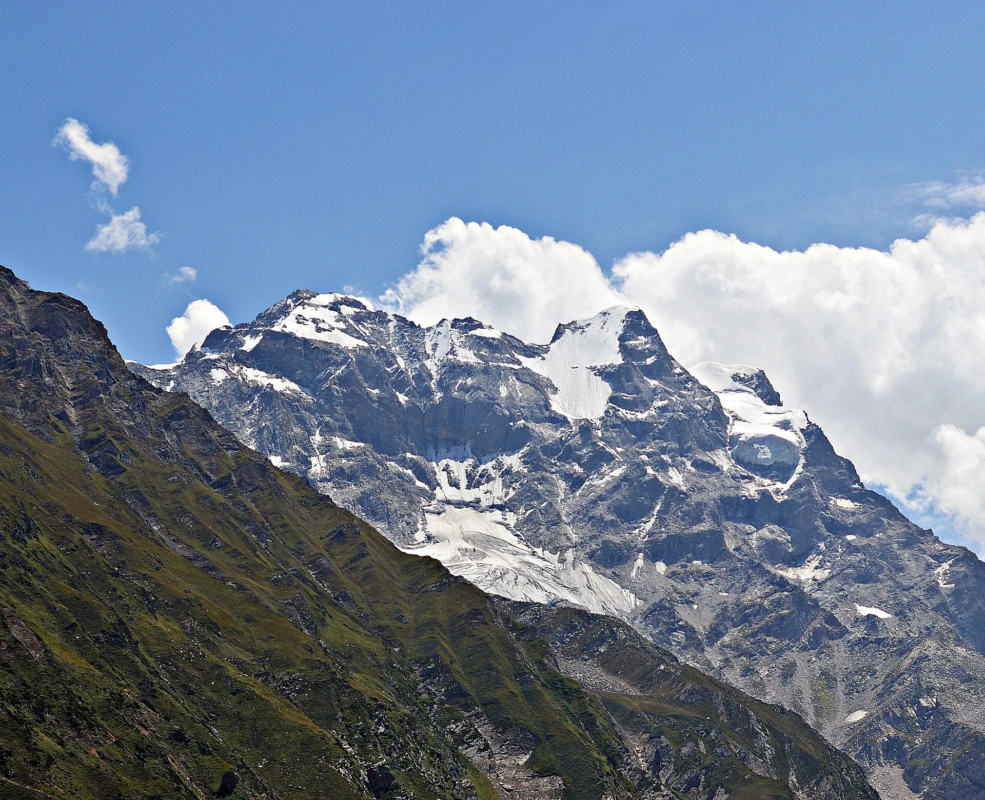
Malika Parbat (5,290 m), the 'Queen of the Mountains', is the highest peak of the Kaghan Valley, seen behind Saiful Muluk Lake. It has been climbed only a handful of times.
Overview
Malika Parbat means "Queen of the Mountains". At 5,290 m (17,360 ft) it is the highest peak of the Kaghan Valley and of the Hazara region, with a prominence of about 1,357 m. It stands about 6 km south of Saiful Muluk Lake, near Ansoo Lake, in Mansehra District. A 1965 Himalayan Journal report gives 17,356 ft, the same height. Sources do not agree on which mountain range it belongs to, so this page does not assign one. The mountain has three summits: the North Peak, a Cresta (crest) and the South Peak. A 1965 climber's account calls it the one real giant of Kaghan.
Plan your visit
- Nearest town
- Naran
- Getting there
Drive from Islamabad via Abbottabad, Mansehra and Balakot to Naran, then take a jeep to Saiful Muluk Lake. See the Kaghan Valley page. More
Best months
Jun – Sep
- Malika Parbat
- Related places nearby: Saiful Muluk, Ansoo Lake, Naran, Kaghan Valley (with Naran), Saiful Muluk National Park
Seeing Malika Parbat
Most visitors see the mountain reflected in Saiful Muluk Lake, which is reached by jeep from Naran (about 9 km). The lake is the classic photograph; see Saiful Muluk. The Ansoo Lake trail gives further views of the same peak.
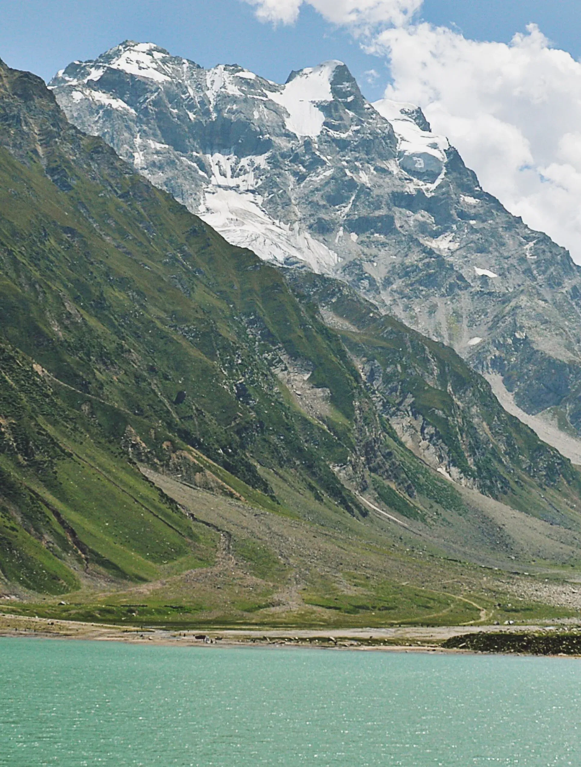
Photo: SM Faraz, with thanks · CC BY-SA 4.0 · via Wikimedia Commons · temporary stand-in photo

Cloud tends to build in the afternoon, so go early. Trevor Braham, writing about a June 1965 visit, noted that storms built quickly in the afternoons.
Climbing history
Very few people have climbed the mountain, and sources disagree on the first ascent.
- One source names Captain B. W. Battye and four Gurkha soldiers on the North Peak in 1920.
- The 1965 Himalayan Journal says Captain Battye of a Gurkha regiment climbed it in the late 1920s, reported to the author secondhand, probably by an easy route from the north side.
- That account adds a second ascent by Lieutenants Willoughby and Price in 1940, by R. L. Holdsworth's southwest face route, with a lot of step-cutting on the steep upper slopes.
- Another source gives a 1967 ascent by Trevor Braham, Norman Norris and Gene White.
- In 1998 two Pakistani climbers, Rashid Butt and Omer Aziz, reached the main peak; Butt died while descending the steep slopes of the South Peak.
- In July 2012 Imran Junaidi of Pakistan and Jens Simonsen of Denmark reached the North Peak. One count lists only about a dozen climbers on that summit.
Many local people consider the mountain unclimbable because of its steepness and supernatural hazards.
Approaches for climbers
Two approaches are described. From the south, climbers base themselves at Saiful Muluk (Safr Muluk in the 1965 account), at about 10,500 ft. R. L. Holdsworth attempted the southwest face in 1936 and 1939 from there, and in 1939 reached to within about 500 ft of the summit. Braham's party in 1965 judged the steep, snow-plastered southwest face too severe in the conditions it found.
From the north, the route runs from Batakundi, by way of the Dadar Chitta glacier (the 1965 account names the Mahli or Chitta glaciers). Braham estimated about two days of glacier travel from Burawai to reach the mountain. Other climbing areas listed nearby include the Siran basin and the Burawai cirque.
Hazards
Braham's account records avalanche debris in the gullies, steep snow over grass and boulders that felt insecure, and shattered, rotten rock on the ridges. The mountain needs experienced climbers and guides.
When to visit
Kaghan roads are open mainly May or June to October. Saiful Muluk is snowbound in winter. In mid-June 1965 the Naran road had only just opened, the lake was still frozen and deep snow covered the jeep track, so early summer can be too early for the lake. Plan climbs for July to September, and allow for the August holiday crowds at the lake.
Where to stay and eat
Naran has hotels and guesthouses. At the lake there are tea stalls; camping is usually allowed. See Naran and the Kaghan Valley.
Good to know
- Permits. The peak is below 6,500 m, so no federal expedition permit is expected, but local rules are not confirmed. Ask KP Tourism or the local administration. Current fees will be added soon.
- Safety. Steep snow, crevasses and fast weather change. Climb only with experienced guides.
- Ask the district administration or local police about current conditions before you go. Travel advice. For foreign visitors: the UK FCDO does not list Mansehra district's Kaghan road by name, but it advises against all travel on the Karakoram Highway between Mansehra and Chilas and against all travel to Swat and other listed KP districts (page updated 27 October 2026, checked 16 November 2026). Read the live page before you plan.
Highlights
- Highest peak of the Kaghan Valley, 5,290 m
- The backdrop of Saiful Muluk Lake
- 'Queen of the Mountains'
- Very few documented ascents
- First ascent date reported differently
Getting there
Drive from Islamabad via Abbottabad, Mansehra and Balakot to Naran, then take a jeep to Saiful Muluk Lake. See the Kaghan Valley page.
Tips
- Visit Saiful Muluk early, before cloud builds up.
- Do not trust a single source for the first ascent date.
- Check road status from Balakot to Naran before travelling.
Photos we still need: the north (Burawai or Batakundi) side of the massif, and the Saiful Muluk base-camp area. Send us yours
Sources and last checked
Last checked Confidence medium4 sources3 still to check
- Last checked
- Method
- Desk research from published sources
- Confidence
- medium
- Checked by
- trek.pk research team
Researched from published sources; not yet checked on the ground by our team. Spot something out of date? Report a mistake.
Sources
- Malika Parbat · Wikipedia · checked
- Mountains of Kaghan, 1965 · The Himalayan Journal, vol. 26 · checked
- Pakistan travel advice: warnings and insurance · UK Foreign, Commonwealth & Development Office (FCDO) · checked
- Fees and Paperwork for a Karakorum Trek (peaks above 6,500 m need a climbing permit; Alpine Club of Pakistan quoted) · ExplorersWeb · checked
Still to be checked on the ground (3)
- First ascent: Wikipedia says Battye in 1920; the Himalayan Journal (1965) says 'late 1920s' and that Braham found no record (secondhand); unresolved
- Permit rules for peaks under 6,500 m in Kaghan (no official source found)
- Current road status (live information)
Nearby and related

Ansoo Lake Trail

Saiful Muluk
The best-known lake of the Kaghan Valley, at 3,224 m above Naran, with Malika Parbat behind it. It is about 9 km from Naran, reached by jeep, and is snowbound and frozen in winter.
Ansoo Lake
A tear-shaped lake at about 4,126 m below Malika Parbat, reached on a steep, long day or overnight hike from Saiful Muluk. A hard walk, often with snow.

Naran
The main base of the Kaghan Valley, at 2,409 m beside the Kunhar River. Naran is the starting point for Saiful Muluk, Lulusar and the road to Babusar Top.

Kaghan Valley (with Naran)
A 155 km Himalayan valley above Balakot along the Kunhar River, with Shogran, Naran, Saiful Muluk and Lulusar lakes, and the road to Babusar Pass. Open mainly from May to October.

Saiful Muluk National Park
A national park in the Kaghan Valley centred on Saiful Muluk Lake at about 3,200 m, below the peak of Malika Parbat. Declared in 2003 and linked to Lulusar-Dudipatsar National Park.