

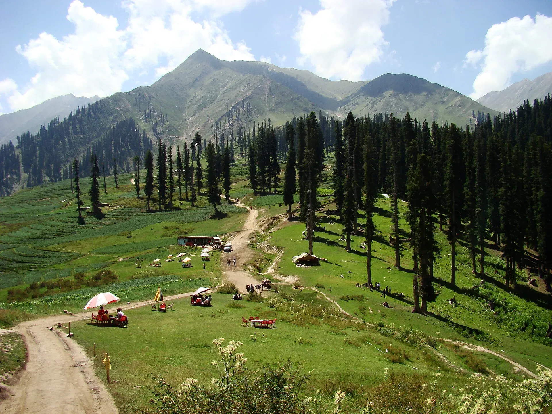
Photo: Faisal Rafiq, with thanks · CC BY-SA 4.0 · via Wikimedia Commons · temporary stand-in photo

Kaghan Valley (with Naran)
A 155 km Himalayan valley above Balakot along the Kunhar River, with Shogran, Naran, Saiful Muluk and Lulusar lakes, and the road to Babusar Pass. Open mainly from May to October.
Overview
The Kaghan Valley follows the Kunhar River through Mansehra District. It runs about 155 km, rising from roughly 650 m near Balakot to the Babusar Pass at about 4,170 m, and is lined with pine and deodar forest, high meadows and glacial lakes. Malika Parbat, the valley's highest peak at around 5,290 m, is often visible from the Siri Paye meadows above Shogran. Naran, the main base, sits about 82 km above Balakot.
Kaghan is among the most visited summer valleys in Pakistan. Wikipedia reports more than 300,000 visitors during the Eid al-Adha holidays in June 2024, and in 2020 the provincial government set up the Kaghan Development Authority to manage the valley.
Plan your visit
- Nearest town
- Naran
- Getting there
From Islamabad via Abbottabad or Mansehra to Balakot (OSRM about 170 km, 2.1 h) and up to Naran (about 82 km, 1.0 h). OSRM times are optimistic; allow 6 to 8 hours in summer. More
Best months
Jun – Sep
- Kaghan Valley (with Naran)
- Related places nearby: Saiful Muluk, Saiful Muluk National Park, Lulusar-Dudipatsar National Park, Ansoo Lake, Pyala Lake, Payee Lake
Getting there
Most visitors come by road from Islamabad through Abbottabad or Mansehra to Balakot. OSRM gives Islamabad to Balakot at about 170 km and 2.1 hours, Balakot to Naran at about 82 km and 1.0 hours, and Islamabad to Naran at about 252 km and 3.1 hours. OSRM times are optimistic. Allow 6 to 8 hours from Islamabad in summer, as traffic above Balakot can be slow.
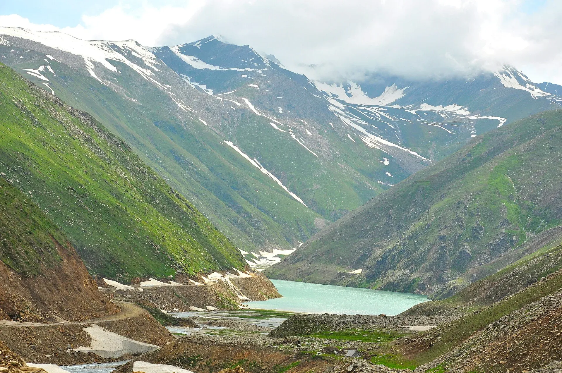
Photo: irfan muhammad, with thanks · CC BY-SA 3.0 · via Wikimedia Commons · temporary stand-in photo

The road north of Naran continues over the Babusar Pass to Chilas on the Karakoram Highway. Pakistan Today reported the pass reopened on 25 May 2026 for the summer, with advice to drive in daylight, check the weather and use sound vehicles, and the same site later carried a headline about the road closing again in early June 2026. Check the road with the National Highway Authority or local police before you travel. Wikivoyage (2025) says that from Chilas over the pass to Naran takes about four hours, and that traffic heading north is stopped daily at Chilas Zero Point at 17:00 until early morning; confirm the current rule locally.
Villages and sights
- Balakot. The gateway town on the Kunhar. The 2005 earthquake destroyed much of it.
- Shogran and Siri Paye. A hill station at about 2,362 m on a plateau above Kiwai, with jeep tracks to the Siri and Paye meadows beneath Makra Peak.
- Kiwai. A village with a waterfall near Shogran.
- Naran. The valley's main bazaar and hotels, beside the river at about 2,400 m.
- Saiful Muluk. A glacial lake about 9 km above Naran, reached by jeep, with a legend of a prince and a fairy.
- Lalazar, Besal and Jalkhad. Meadows and small bazaars on the way to Babusar, with Lalazar at about 3,120 m.
- Lulusar, Dudipatsar and Gittidas. The high lakes and meadows inside Lulusar-Dudipatsar National Park, near Babusar Top.
Treks and walks
Day walks include Makra Peak from Shogran and Ansoo Lake above Saiful Muluk. Longer trips reach Dudipatsar Lake from Besal. Other routes are listed under Other treks in Diamir. Hire a local guide for high-altitude lakes: weather turns fast and tracks are poorly marked.
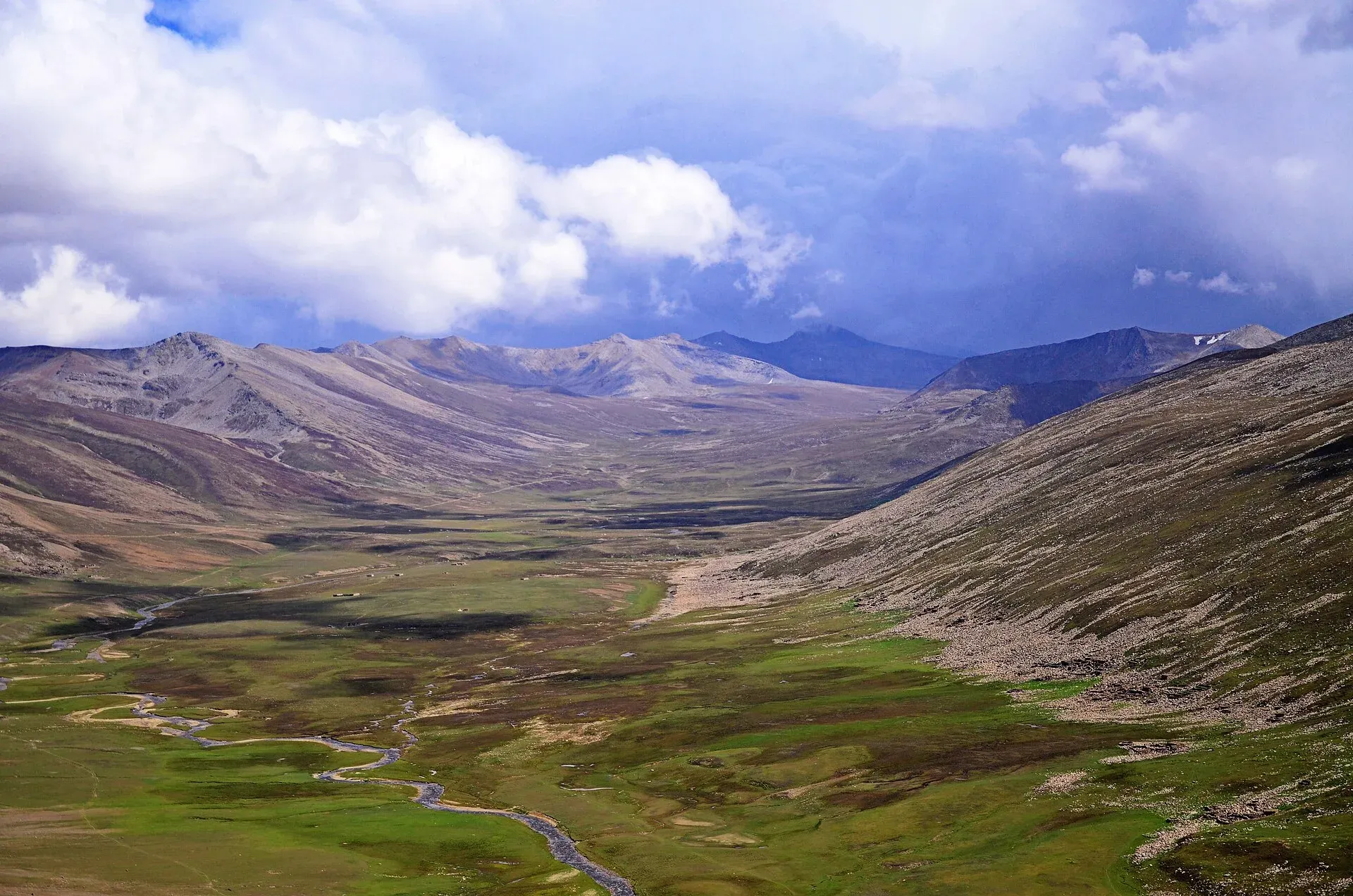
Photo: The47man, with thanks · CC BY-SA 3.0 · via Wikimedia Commons · temporary stand-in photo

When to visit
Mid-May to early October for the full valley. Winter snow cuts the road above Naran and the Babusar Pass from roughly November to late May. Wikipedia notes that the glaciers on the road typically melt between February and April and that the road and pass usually stay open from May to the end of September. June to August are the warmest and busiest, and the monsoon brings landslides. September has clear skies and quieter roads.
Where to stay and eat
Naran has the largest choice, from budget rooms to riverside hotels. Shogran, Kiwai and Balakot have smaller options. Book ahead for Eid and school holidays, when prices rise and rooms sell out. Fresh trout, mutton and bread are the valley staples. Brown trout and mahseer are stocked between Kaghan and Naran, and Wikivoyage says fishing licences come from the Fisheries Department in Naran.
Culture and languages
Hindko is the main language. Pashto and Gujari are also spoken, and the Gujar families who live in summer pastures still herd cattle and buffalo. Urdu is understood everywhere. The valley is conservative, so dress modestly.
Safety and practical points
- Roads. Landslides, washed-out sections and flash floods are common in monsoon months. Do not drive after dark.
- Rivers and lakes. Do not wade in the Kunhar or swim in glacial lakes. Do not take boats without life jackets.
- Security advice. The UK Foreign Office advises against all travel on the Karakoram Highway between Mansehra and Chilas (checked 16 November 2026). Kaghan is not named separately, but you should read the advice and ask local police before travelling.
- Altitude. Babusar Pass, Lulusar and Dudipatsar are above 3,000 m. Go up slowly if you have breathing or heart conditions.
Highlights
- Saiful Muluk Lake near Naran
- Shogran and the Siri Paye meadows
- Lulusar and Dudipatsar lakes
- Babusar Pass link to Chilas
- Kunhar River gorges and deodar forests
Tips
- Plan for mid-May to September; the road is cut by snow in winter.
- Book ahead for Eid and school holidays.
- Check Babusar Pass status before you cross.
- Carry cash and fuel; supplies run out above Naran.
Photos we still need: Naran bazaar and the Kunhar river road (openly licensed). Send us yours
Sources and last checked
Last checked Confidence medium8 sources4 still to check
- Last checked
- Method
- Desk research from published sources
- Confidence
- medium
- Checked by
- trek.pk research team
Researched from published sources; not yet checked on the ground by our team. Spot something out of date? Report a mistake.
Sources
- Kaghan Valley (Wikipedia) · Wikipedia · checked
- Babusar Pass opens for tourists after seasonal closure (25 May 2026) · Pakistan Today · checked
- Naran Road reopens after months · The Express Tribune · checked
- Pakistan travel advice (last updated 27 October 2026) · UK FCDO · checked
- Pakistan Tourism Guide 2021 · TDAP · checked
- OSRM routing · Project OSRM · checked
- Shogran (Wikipedia) · Wikipedia · checked
- Kaghan Valley (Wikivoyage) · Wikivoyage · checked
Still to be checked on the ground (4)
- Current Babusar Pass and Naran road status (Pakistan Today: pass reopened 25 May 2026; a 5 June 2026 headline said Babusar Top road closed again; no later notice found)
- Altitude of Naran (Shogran confirmed at 2,362 m; no source opened gives Naran's height, so about 2,400 m stays unconfirmed)
- Fees on jeep tracks to Saiful Muluk (only an unofficial 2025 guide figure found, so not added)
- Any local rules after the 2020 Kaghan Development Authority act (Wikipedia confirms the act; the rules were not found)
Nearby and related

Makra Peak Trail

Ansoo Lake Trail

Other treks in Diamir

Saiful Muluk
The best-known lake of the Kaghan Valley, at 3,224 m above Naran, with Malika Parbat behind it. It is about 9 km from Naran, reached by jeep, and is snowbound and frozen in winter.

Saiful Muluk National Park
A national park in the Kaghan Valley centred on Saiful Muluk Lake at about 3,200 m, below the peak of Malika Parbat. Declared in 2003 and linked to Lulusar-Dudipatsar National Park.

Lulusar Lake
A large lake beside the Naran-Babusar road in upper Kaghan, at roughly 3,350–3,410 m. It is the main source of the Kunhar River and the gateway to Lulusar-Dudipatsar National Park.

Lulusar-Dudipatsar National Park
A high national park at the head of the Kaghan Valley, created in 2003. It protects Lulusar Lake, Dudipatsar Lake and the wildlife of the Babusar area.

Dudipatsar Lake
An alpine lake at about 3,800 m in Lulusar-Dudipatsar National Park, reached by a 5 to 8 hour walk from Besal on the Babusar road. Mid-June to late September.
Ansoo Lake
A tear-shaped lake at about 4,126 m below Malika Parbat, reached on a steep, long day or overnight hike from Saiful Muluk. A hard walk, often with snow.

Siran Valley
A quiet forested valley in Mansehra District, west of Kaghan, with deodar forest, meadows (galis) and peaks such as Musa ka Musalla. Roads are poor, and few visitors come.

Chilas
Headquarters of Diamer on the Karakoram Highway and the Indus, with thousands of ancient rock carvings, views towards Nanga Parbat, and the road junctions for Fairy Meadows and Babusar Pass.

Khyber Pakhtunkhwa
Mountains, Buddhist ruins and old bazaars in north-west Pakistan: Swat, Kaghan, Chitral, the Kalash valleys, the Khyber Pass and Peshawar.
Pyala Lake
A small round lake at about 3,400 m near Jalkhand in the upper Kaghan Valley, about 40 km from Naran. A bowl-shaped lake best reached with local advice.
Payee Lake
A small lake in the Paye meadow above Shogran, in the Kaghan Valley, reached by a 4x4 track. Usually combined with Siri Paye meadows and the Makra Peak walk.