

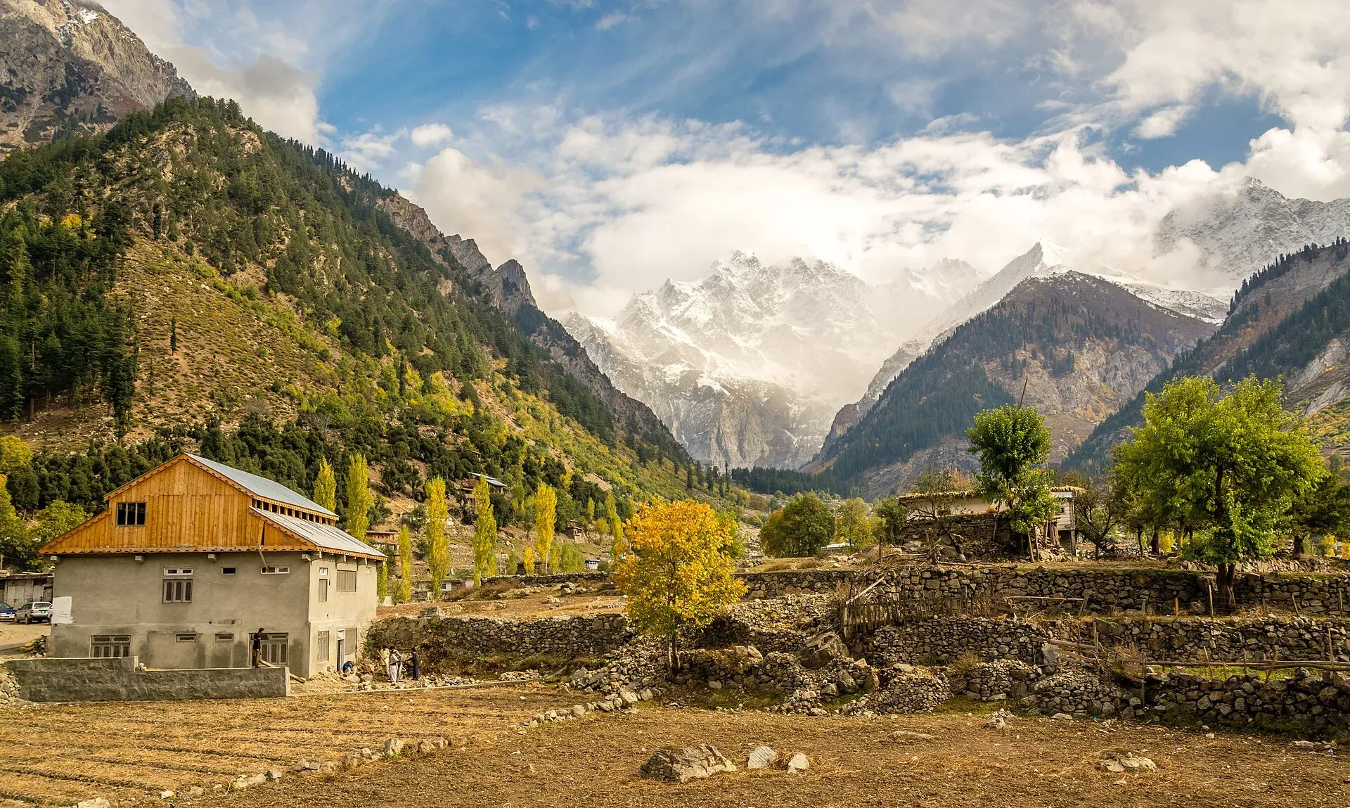
Photo: Muh.Ashar, with thanks · CC BY-SA 3.0 · via Wikimedia Commons · temporary stand-in photo

Matiltan Waterfall
A roadside waterfall in the Matiltan area of the Usho valley above Kalam, Swat, on the way to Mahodand Lake. Few reliable sources exist. For foreign visitors: the UK FCDO advises against all travel to Swat.
Overview
Matiltan Waterfall is a seasonal fall in the Matiltan area of the Usho valley, above Kalam in Upper Swat, Khyber Pakhtunkhwa. A tourism listing calls it "Mighty 22 Waterfall" and says it is also known as Matiltan or Ushu Waterfall. It stands on the road to Mahodand Lake, about half an hour before the lake. Wikipedia's list of Pakistan's waterfalls includes it, citing a 2022 Dawn photo feature. No source gives its height or exact position.
Plan your visit
- Nearest town
- Kalam
- Getting there
From Kalam, take the non-metalled road up the Usho valley to Matiltan and on towards Mahodand Lake, using a four-wheel-drive vehicle (Wikipedia). More
Best months
Jun – Sep
The Usho valley and Matiltan
Matiltan is a village in the Usho valley, about 11 km from Kalam. Wikipedia describes the valley as one of large glaciers, thick forest and high peaks. Falak Sar, described there as the tallest peak of Swat, can be seen from the village. The population is mainly Gawri (the people who speak Gawri, also called Kalami, in the upper valleys). The village is also the site of the 84 MW Matiltan Hydropower Plant.
What to see and do
- A roadside stop. The fall is seen from the track on the way to Mahodand, so most visitors stop briefly.
- Matiltan village. Use it as a halt for tea and for views towards Falak Sar. See the Falak Sar page.
- Mahodand Lake. The lake lies beyond Matiltan and is the usual destination for this road. See Mahodand Lake.
When to visit
The listing calls the fall seasonal, so expect more water in late spring and summer, when snow melts and the road is open. Winter snow closes the upper road.
Where to stay and eat
Kalam is the base, with guesthouses and restaurants (see Kalam). Nothing is listed at the fall itself.
Good to know
- Getting there. Wikipedia describes a non-metalled road from Kalam to Matiltan that needs a four-wheel-drive vehicle. OSRM gives about 13 km and 22 minutes from Kalam to Matiltan village (an estimate; real times on this track are longer). One listing puts the fall 46 km and two hours from Kalam. These figures disagree, so ask locally where the fall is.
- Safety. The listing says it is safe for families, but there is no official safety assessment. Rough roads, wet rock and fast water are the main risks.
- Fees. Current fees will be added soon.
- Etiquette. Take litter away and keep to the road and paths.
- Travel advice. For foreign visitors: the UK FCDO page (updated 27 October 2026, checked 16 November 2026) advises against all travel to Swat, and KP is also under emergency measures and Governor's Rule since 11 October 2026. Read the current page before making any plans.
Highlights
- Seasonal fall on the road to Mahodand Lake
- Also called Mighty 22 or Ushu Waterfall
- Matiltan village with Falak Sar views
- Four-wheel-drive road from Kalam
Getting there
From Kalam, take the non-metalled road up the Usho valley to Matiltan and on towards Mahodand Lake, using a four-wheel-drive vehicle (Wikipedia). OSRM gives about 13 km and 22 minutes from Kalam to Matiltan village (checked 16 November 2026). The fall is on the way to the lake.
Tips
- Use a local 4x4 driver from Kalam
- Ask in Matiltan which fall locals mean
- Check the road and weather in Kalam first
- Check FCDO advice and local security news before any trip
Photos we still need: Matiltan Waterfall itself (the current hero shows Matiltan village); the Usho valley road above Kalam. Send us yours
Sources and last checked
Last checked Confidence low5 sources4 still to check
- Last checked
- Method
- Desk research from published sources
- Confidence
- low
- Checked by
- trek.pk research team
Researched from published sources; not yet checked on the ground by our team. Spot something out of date? Report a mistake.
Sources
- List of waterfalls in Pakistan · Wikipedia · checked
- Matiltan · Wikipedia · checked
- Mighty 22 Waterfall · Visit Silk Road · checked
- OSRM demo routing service (driving routes) · Project OSRM · checked
- Pakistan travel advice: warnings and insurance · UK Foreign, Commonwealth & Development Office · checked
Still to be checked on the ground (4)
- Exact location of the fall on the Matiltan road (a tourism listing's map puts it near 35.64 N, 72.69 E, which we have not confirmed)
- Distance from Kalam (Wikipedia: Matiltan village 11 km; Visit Silk Road: the fall 46 km)
- Height
- Road condition
Nearby and related

Kalam
The last large town in the upper Swat Valley, at about 2,000 m where the Ushu and Gabral rivers meet. Kalam is the base for Ushu, Utror, Mahodand Lake and Kundol Lake.

Mahodand Lake
A cold trout lake at about 2,865 m in the Usho valley above Kalam, reached by a rough 4x4 track of around 40 km. Open in summer only.