

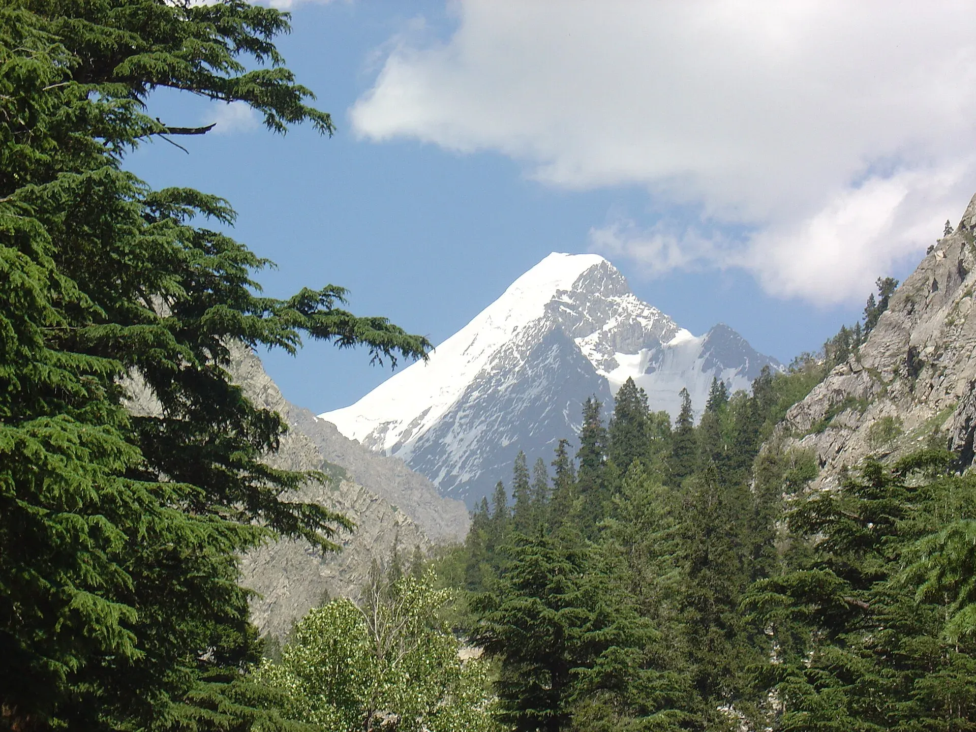
Photo: Falak Sar, with thanks · CC BY-SA 3.0 · via Wikimedia Commons · temporary stand-in photo

Falak Sar
Falak Sar (about 5,918 m) is the highest peak in the Swat Valley, above Matiltan. First climbed in 1957; sources disagree on its height and range. Check the FCDO advice on Swat first.
Overview
Falak Sar is the highest mountain in the Swat Valley, standing on the border between Swat and the Kandia valley of Kohistan in Khyber Pakhtunkhwa. Wikipedia gives 5,918 m, with a prominence of 1,558 m, which makes it an ultra-prominent peak. Other listings give 5,957 m, so treat the height as approximate. Wikipedia places it in the Hindu Kush; its range is not settled, so this page does not assign one. Mankial Sar is the next highest summit in Swat.
Plan your visit
- Nearest town
- Matiltan
- Getting there
Swat is reached by road from Islamabad via Saidu Sharif and Mingora, then up the valley through Kalam to Matiltan. Check security status first; the UK FCDO advises against all travel to Swat. More
Best months
Jul – Sep
- Falak Sar
- Related places nearby: Swat Valley, Kalam, Kalam, Utror and Gabral
Approach
The approach is by road from Peshawar through Saidu Sharif to Matiltan in the upper Swat valley, then on foot up the Falak Sar valley. A Yamaguchi University expedition used this route, and set base camp at about 3,350 m (11,000 ft) on 15 August. No detailed route description for the valley is published.
Climbing history
The first ascent was in 1957 by W. K. A. Berry and Cecil Hugh Tyndale-Biscoe of New Zealand, by the north ridge. Dr Wolf Gang Stephen made the second ascent.
The Yamaguchi University party, led by Yoshiyuki Nagahiro and Toshiyuki Akiyama, summited on 20 August, then moved via Kalam to the Amagal valley, where it looked for a peak the locals called Miangul Sar and found one called Par (about 18,000 ft) instead.
On 17 August 2020 Hamza Anees, Ahmed Mujtaba and Adnan Saleem were the first Pakistanis to reach the top, by the north ridge. In June 2023 Bine Žalohar, Tom Grant and Aaron Rolph made the first ski descent, skiing from the summit with three 50 m rappels down an ice field on the face.
When to visit
Climbing and treks are done in July to September; snow lies deep from late autumn.
Where to stay and eat
Kalam, at about 2,000 m, has hotels and restaurants. Matiltan has guesthouses. Beyond that you camp.
Good to know
- Permits. The peak is below 6,500 m, so no federal peak permit is expected, but local rules are not confirmed. A KP NOC may be needed for foreigners. Current fees will be added soon; ask KP Tourism or the district administration.
- Safety. Glaciers, steep ice and weather. Climb only with experienced guides.
- Travel advice. For foreign visitors: the UK FCDO advises against all travel to Swat (page updated 27 October 2026, checked 16 November 2026), and KP is under emergency measures. Do not plan a visit without reading the live page.
- Nearby. Kalam and the Swat Valley.
Highlights
- Highest peak in the Swat Valley
- First climbed in 1957 by New Zealanders
- First Pakistani ascent on 17 August 2020
- First ski descent in June 2023
- Height reported as 5,918 m or 5,957 m
Getting there
Swat is reached by road from Islamabad via Saidu Sharif and Mingora, then up the valley through Kalam to Matiltan. Check security status first; the UK FCDO advises against all travel to Swat.
Tips
- Treat the height as approximate.
- Do not travel before checking the UK FCDO and KP Tourism advice.
- Use a local guide who knows the valley.
Photos we still need: Falak Sar peak or its valley. Send us yours
Sources and last checked
Last checked Confidence low3 sources4 still to check
- Last checked
- Method
- Desk research from published sources
- Confidence
- low
- Checked by
- trek.pk research team
Researched from published sources; not yet checked on the ground by our team. Spot something out of date? Report a mistake.
Sources
- Falak Sar (Swat) · Wikipedia · checked
- Pakistan travel advice: warnings and insurance · UK Foreign, Commonwealth & Development Office (FCDO) · checked
- Pakistan treks and mountain ranges (trek.pk research report) · trek.pk · checked
Still to be checked on the ground (4)
- Height: Wikipedia 5,918 m (cites Peaklist); the 5,957 m figure has no source
- Range: Wikipedia says Hindu Kush; not assigned on this page pending an authoritative source
- Security and permits in Swat
- Route and campsites above Matiltan (no published description found)
Nearby and related

Swat Valley
A long green river valley in northern Khyber Pakhtunkhwa, with Gandhara Buddhist sites, orchards, hill towns and the road up to Kalam. Check the current security advice before you plan a trip.

Kalam
The last large town in the upper Swat Valley, at about 2,000 m where the Ushu and Gabral rivers meet. Kalam is the base for Ushu, Utror, Mahodand Lake and Kundol Lake.

Kalam, Utror and Gabral
The head of the Swat valley: Kalam town where the Ushu and Gabral rivers meet, with Ushu forest, Utror and Kundol Lake, Gabral, and jeep tracks to Mahodand Lake.