

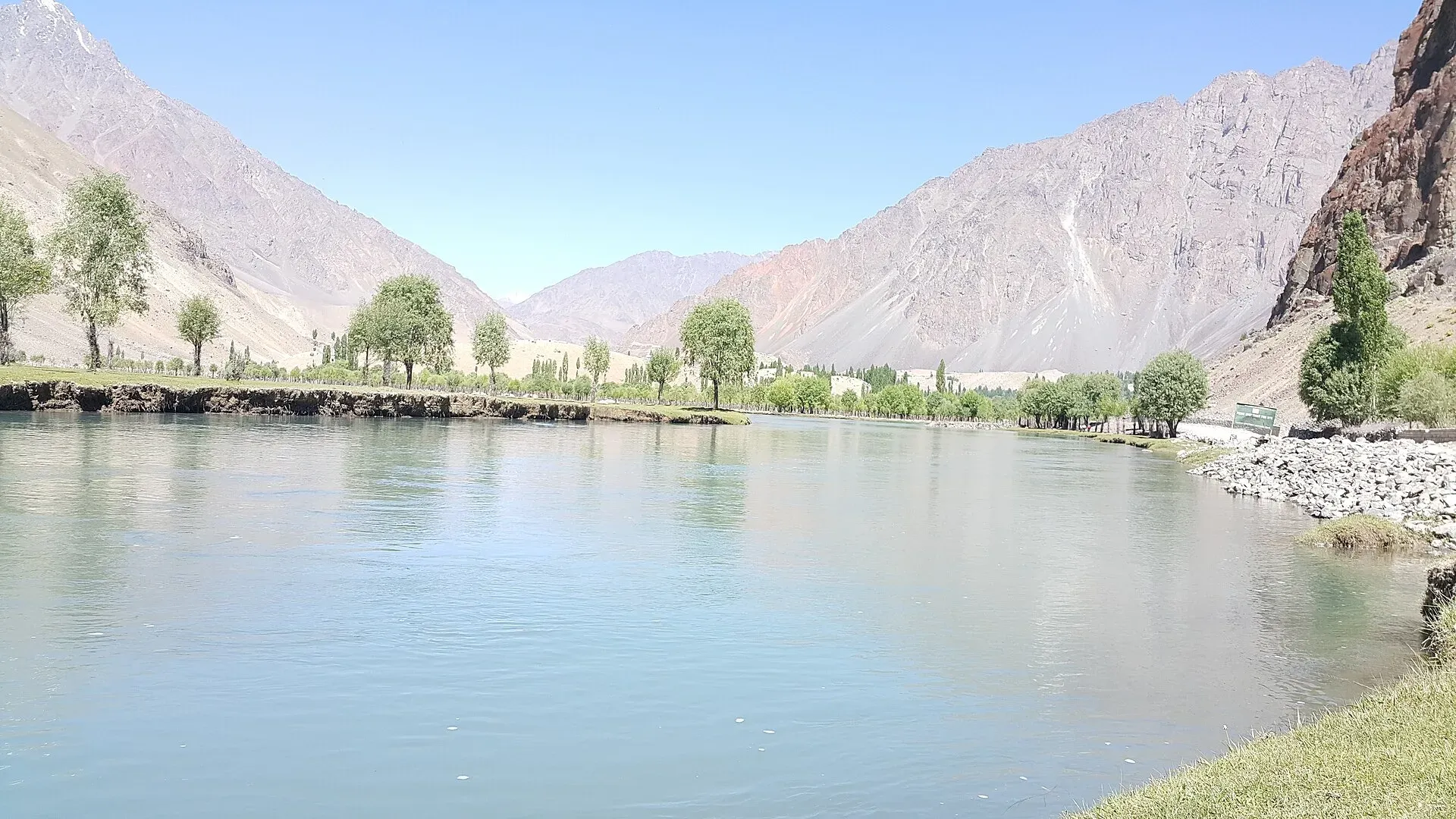
Photo: Kskhh, with thanks · CC BY-SA 4.0 · via Wikimedia Commons · temporary stand-in photo

Phander Lake
A small, deep lake in Phander village, Gupis-Yasin district, in the far west of Gilgit-Baltistan. It is fed by the Ghizer River and sits on the road between Gilgit and Shandur.
Overview
Phander Lake, also called Nango Chatt, lies in Phander village in the Gupis-Yasin district of Ghizer (Phander is the district headquarters), in the westernmost part of Gilgit-Baltistan. It is about 900 m long, 460 m wide, 16 hectares in area and up to 44 m deep. The Ghizer River flows into it. Wikipedia calls it an important source of fresh water. It is a small lake in a green valley, with poplars, farms and snow peaks around it.
Plan your visit
- Nearest town
- Gupis
- Getting there
Phander is on the Gilgit-Chitral road through Gupis. From Gilgit OSRM measures about 162 km (1 hour 55 minutes of pure driving); other sources give 170 to 184 km and roughly six hours by car, so allow six hours. More
Best months
May – Oct
- Phander Lake
- Related places nearby: Phander, Gupis, Khalti Lake
Getting there
Phander is on the Gilgit to Chitral road through Gupis, in the Ghizer valley. From Gilgit, OSRM measures about 162 km (an estimate of 1 hour 55 minutes of pure driving). Other sources give 170 to 184 km and roughly six hours by car, so allow six hours. Gupis is about 61 km from the Shandur Pass, and the road from Gupis climbs through Phander. Public buses and vans run to Gupis; hire a jeep for the last stretch if needed. See Gupis and Phander for the village.
What to see and do
- The lake shore. A short walk and a place to sit. The Ghizer River feeds the lake, and Wikipedia gives its size as about 900 m by 460 m, with a depth of up to 44 m.
- Phander Valley. Villages, orchards and meadows. Ghizer is a mountain district of passes and trekking routes; Wikipedia lists the Chillinji, Hayal, Darkot and Thui passes, and Koyo Zom (6,871 m) on the Chitral boundary is its highest peak. Trout fishing is popular in the district.
- Shandur Pass. The road continues to Shandur (about 3,720 m), famous for the polo festival in summer.
- Nearby lakes. Khalti Lake and Handarap Lake in the same district are other options.
When to visit
Roughly April to October. Summer and early autumn are best. In winter the lake can freeze. The Gilgit-Chitral road over Shandur is generally closed by snow in winter; no source gives exact dates, so ask in Gupis or Gilgit before travelling.
Where to stay and eat
There are small hotels and guesthouses in Phander and Gupis, and basic camping is available in season. Ask your guesthouse about rules for camping near the lake.
Good to know
- Distance: about 162 km from Gilgit by OSRM, and the road runs on to the Shandur Pass, which Wikipedia puts 212 km from Gilgit (other sources say 170 to 184 km to Phander). The drive is about 6 hours by car or longer by bus.
- Fees: current fees will be added soon.
- Weather: the valley is cold at night even in summer. Pack a jacket.
- Fishing: ask locally about licences before fishing.
- Respect: keep the shore clean and ask before camping on farmland.
Highlights
- Small deep lake, about 44 m at its deepest
- Fed by the Ghizer River
- On the road to Shandur Pass
- Trout fishing in the valley
Tips
- Start early from Gilgit; the drive is long.
- Carry warm layers: nights are cold.
- Check the road before you go in spring and late autumn.
Photos we still need: Phander village and the Ghizer valley road (not lake close-ups). Send us yours
Sources and last checked
Last checked Confidence low6 sources4 still to check
- Last checked
- Method
- Desk research from published sources
- Confidence
- low
- Checked by
- trek.pk research team
Researched from published sources; not yet checked on the ground by our team. Spot something out of date? Report a mistake.
Sources
- Phander Lake · Wikipedia · checked
- Government of Gilgit-Baltistan Tourism Department: Ghizer district · Gilgit-Baltistan Tourism Department · checked
- OSRM driving route service: road distances and times measured 16 November 2026 (driving only, optimistic on mountain roads) · OSRM / OpenStreetMap contributors · checked
- Shandur Pass · Wikipedia · checked
- Gupis-Yasin District · Wikipedia · checked
- Ghizer District · Wikipedia · checked
Still to be checked on the ground (4)
- Shandur road closure months (no source found for exact dates)
- Fees, camping rules and trout licences (no source found; the GB tourism district page cited earlier returned 404)
- Distance Gilgit to Phander: OSRM 162 km (re-run 17 Nov 2026, end point snapped 418 m from the pin); other sources 170 to 184 km; Wikipedia puts Shandur Pass at 212 km from Gilgit
- Lake altitude (not found in any source opened)
Nearby and related

Phander
A village and valley in Ghizer, Gilgit-Baltistan, on the Gilgit to Shandur road. It is known for its lake, trout streams and quiet fields, and is a common overnight stop before Shandur Pass.

Gupis
A small town on the road between Gilgit and Shandur, in Gupis-Yasin District of Gilgit-Baltistan. It is a practical overnight stop and the gateway to Phander and the Yasin valley.
Khalti Lake
A 40 ha trout lake in a bend of the Ghizer River near Gupis, at about 2,217 m. It usually freezes in winter, when people walk on the ice.