

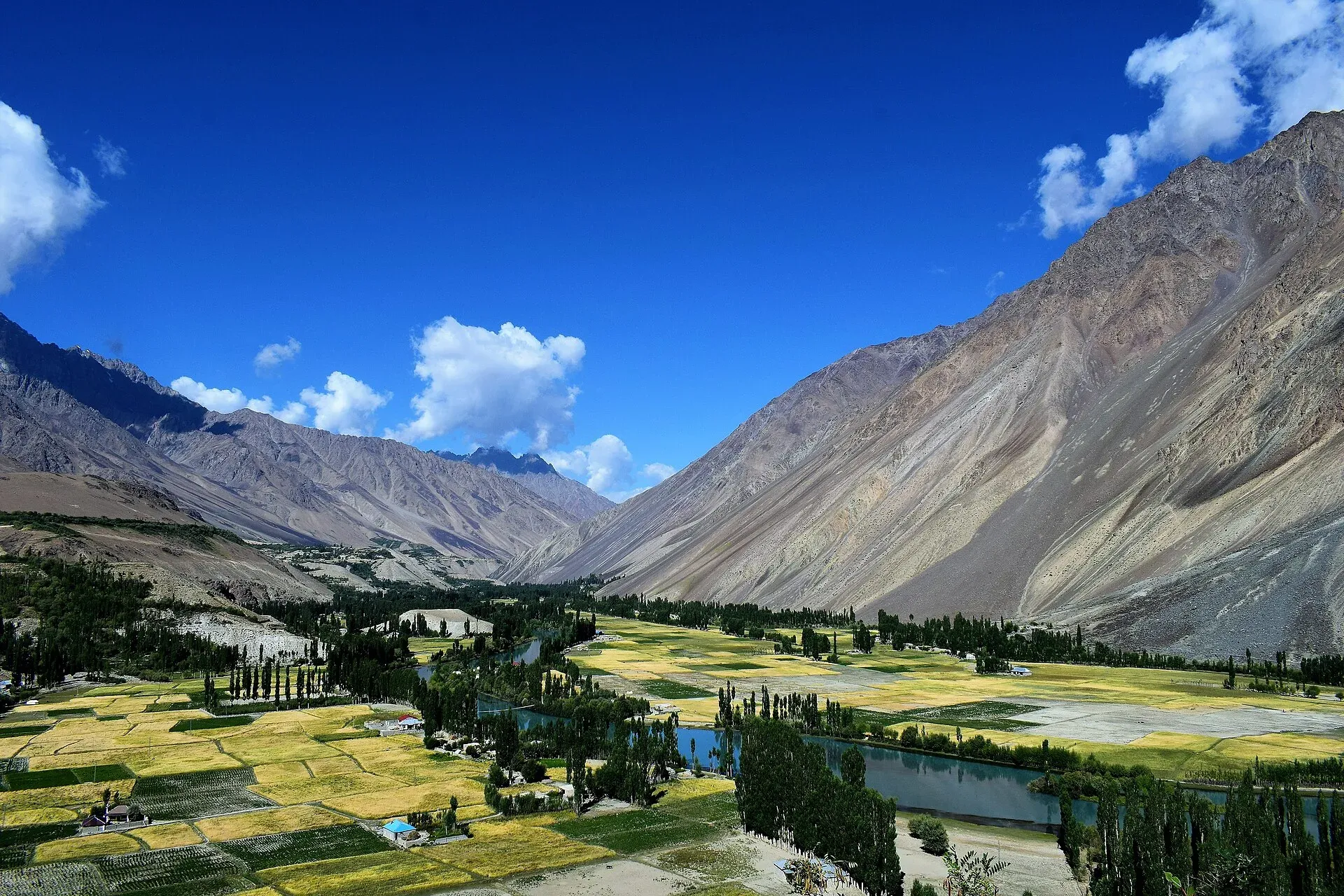
Photo: Shahid Rao, with thanks · CC BY-SA 4.0 · via Wikimedia Commons · temporary stand-in photo

Phander
A village and valley in Ghizer, Gilgit-Baltistan, on the Gilgit to Shandur road. It is known for its lake, trout streams and quiet fields, and is a common overnight stop before Shandur Pass.
Overview
Phander is a village and valley in Ghizer, Gilgit-Baltistan, about 184 km from Gilgit by Wikipedia's figure. Wikipedia's text places it in Ghizer District and tags it Gupis-Yasin District as well, so the official district label has changed; this page uses Ghizer. It is on the road to Shandur Pass, which continues to Chitral. The Gilgit River splits into several channels as it enters the valley and joins again as it leaves.
The valley has four lakes, and Phander Lake is the largest. Wikipedia gives the lake as up to 900 m long and 460 m wide, with a surface area of about 40 acres (16 ha) and a maximum depth of 44 m. It is fed by the Ghizer River and is also called Nango Chatt. Wikipedia calls it an important source of fresh water. No altitude is published.
Plan your visit
- Nearest town
- Gupis
- Getting there
Road: about 184 km from Gilgit (Wikipedia). Gupis is about 56 km before Phander (OSRM, about 40 minutes, checked 16 November 2026). Jeeps and shared vehicles run along this road; ask in Gilgit. More
Best months
May – Oct
- Phander
- Related places nearby: Phander Lake, Gupis, Shandur Pass, Ghizer Valley
What to see and do
- Phander Lake: a lake close to the village, deep for its size, set among fields and mountains.
- Trout streams: Phander is known for trout, and local fishing rules apply, so ask at your guesthouse or the local tourism office before fishing.
- Valley walks: gentle walks through orchards and fields, and along the river channels.
- Shandur Pass: the road continues to the pass at about 3,720 m on the boundary of Upper Chitral and Gilgit-Baltistan, beside the Shandur polo ground. Wikipedia gives it as 212 km from Gilgit. See Shandur Pass.
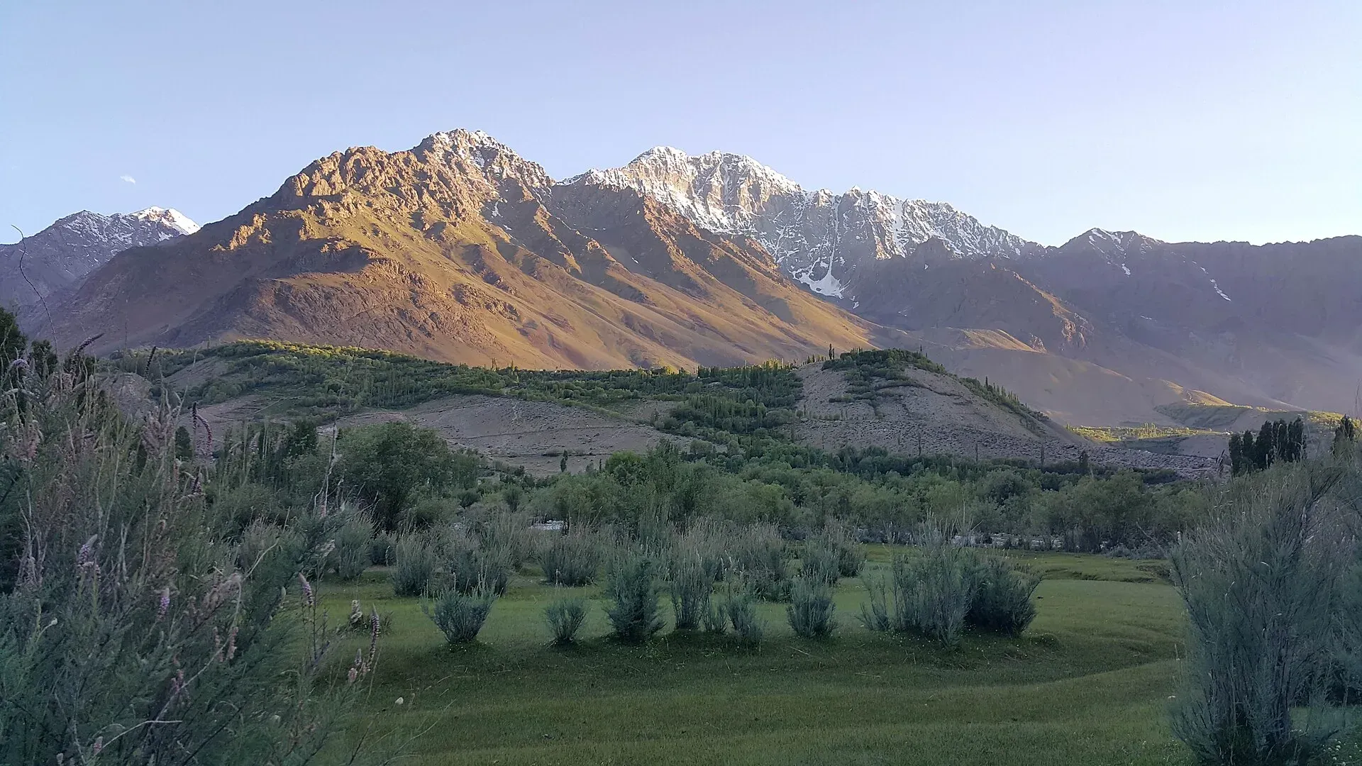
Photo: Kskhh, with thanks · CC BY-SA 4.0 · via Wikimedia Commons · temporary stand-in photo

Along the road
Gupis is the main town before Phander. Wikipedia lists Gupis as one of the tehsils of Ghizer District. It notes that passes such as Attar, Punji and Korumbar in the district serve as trekking routes with camping sites and views of the Hindu Kush and Hindu Raj. No route descriptions for them are published here.
When to visit
May to October is usual. Winter snow cuts the higher road, and the valley is very quiet then.
Where to stay and eat
Simple guesthouses and small hotels operate near the lake and along the main road, serving rice, daal, trout in season, bread and tea. Book ahead for the Shandur Polo Festival period in summer.
Good to know
- Phander is a village, so supplies are limited. Carry cash, fuel and any medicine from Gilgit or Gupis.
- Mobile coverage can be patchy.
- Dress modestly and ask before photographing people.
- Road conditions between here and Shandur change quickly, so ask locally. For foreign visitors: the UK FCDO does not advise against Gilgit-Baltistan generally (advice updated 27 October 2026, checked 16 November 2026). Read the live advice before you plan.
Highlights
- Phander Lake and four small lakes
- Trout streams
- Calm base before Shandur Pass
- River channels and green fields
Getting there
Road: about 184 km from Gilgit (Wikipedia). Gupis is about 56 km before Phander (OSRM, about 40 minutes, checked 16 November 2026). Jeeps and shared vehicles run along this road; ask in Gilgit.
Hotels, food, fuel and services in Phander
Places to stay
- Lake lodge phanderCall Lake lodge phanderMap of Lake lodge phander in Google Maps
- Phander Rest HouseMap of Phander Rest House in Google Maps
- Hill top lodge phanderCall Hill top lodge phanderMap of Hill top lodge phander in Google Maps
- The Rover by Roomy, PhanderCall The Rover by Roomy, PhanderMap of The Rover by Roomy, Phander in Google Maps
- Phander View HotelCall Phander View HotelMap of Phander View Hotel in Google Maps
- Phander ValleyCall Phander ValleyMap of Phander Valley in Google Maps
Listings come from Google Maps data and are unverified: phone numbers, opening months and prices may have changed. Report a problem · Own one of these? Claim it
Tips
- Carry cash and fuel from Gilgit.
- Ask about local fishing rules before you fish.
- Check the Shandur road locally.
- Mobile coverage is limited.
Photos we still need: Phander Lake itself and the trout streams (existing photos show the valley). Send us yours
Sources and last checked
Last checked Confidence medium7 sources4 still to check
- Last checked
- Method
- Desk research from published sources
- Confidence
- medium
- Checked by
- trek.pk research team
Researched from published sources; not yet checked on the ground by our team. Spot something out of date? Report a mistake.
Sources
- Phander · Wikipedia · checked
- OpenStreetMap Nominatim (coordinates) · OpenStreetMap · checked
- OSRM driving routes (road distances and times) · Project OSRM / OpenStreetMap · checked
- Pakistan travel advice · UK FCDO (GOV.UK) · checked
- Phander Lake · Wikipedia · checked
- Shandur Pass · Wikipedia · checked
- Ghizer District · Wikipedia · checked
Still to be checked on the ground (4)
- Altitude (none sourced; Wikipedia silent)
- Distance from Gilgit (Wikipedia 184 km; OSRM about 163 km to the page coordinates; sources differ)
- Fuel and ATM availability
- Fishing rules
Nearby and related

Phander Lake
A small, deep lake in Phander village, Gupis-Yasin district, in the far west of Gilgit-Baltistan. It is fed by the Ghizer River and sits on the road between Gilgit and Shandur.

Gupis
A small town on the road between Gilgit and Shandur, in Gupis-Yasin District of Gilgit-Baltistan. It is a practical overnight stop and the gateway to Phander and the Yasin valley.

Shandur Pass
A high grassy pass of about 3,720 m between Ghizer in Gilgit-Baltistan and Upper Chitral. Home to the Shandur polo ground and a summer festival, reached by a rough road.

Ghizer Valley
The long upper Gilgit River valley running west from Gilgit to Shandur, with Punial orchards, Gahkuch, Gupis, Khalti and Phander lakes, trout fishing and side valleys to Yasin and Ishkoman.

Gilgit
Gateway to Gilgit-Baltistan on the Karakoram Highway: a busy mountain town with the Kargah Buddha and the base for Hunza, Naltar and Skardu.