

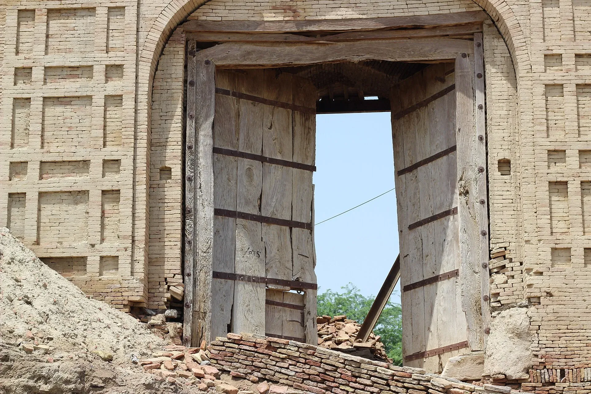
Photo: Waqas.anees, with thanks · CC BY-SA 3.0 · via Wikimedia Commons · temporary stand-in photo

Rajanpur
District capital in the far south-west of Punjab, west of the Indus below the Sulaiman range. A small administrative town with few visitor facilities.
Overview
Rajanpur is the capital of Rajanpur District, in the far south-west of Punjab and entirely west of the Indus. At the 2023 census it had 137,553 people, up from 5,280 in 1951. About 76 per cent speak Saraiki, with smaller numbers speaking Punjabi, Urdu and Balochi.
Plan your visit
- Getting there
From Dera Ghazi Khan: about 114 km, roughly 1 hour 50 minutes (OSRM estimate, optimistic, checked 16 November 2026). That route runs through the area the FCDO advises against, so check conditions first. More
Best months
Nov – Feb
- Rajanpur
- Related places nearby: Rahim Yar Khan, Jampur
History
Sheikh Rajan Shah, makhdum (hereditary spiritual head) of Sitpur, founded the town about 1732 after taking his estates from the Nahar tribesmen. It stayed a largely unimportant village until floods in 1862 damaged the district headquarters at Mithankot. Government offices then moved to Rajanpur, which became a municipality in 1873.
The district
Rajanpur District was split from Dera Ghazi Khan on 1 July 1982. It covers about 12,318 square km and had about 2.3 million people in 2023. The Sulaiman Mountains lie to the west. Besides Saraiki (about 77 per cent), Balochi is spoken by about 18 per cent. Farming relies on canal irrigation and also on rod-kohi (hill-torrent spate irrigation), and cotton and sugarcane are the main crops. Flash floods from the Koh Sultan and Shacher torrents in July 2015 damaged many homes and crops.
What to see and do
No sights are verified in the town itself. It is a district administrative and market centre in farmland close to the Sulaiman foothills, so do not expect tourist infrastructure. Within the district, Mithankot (Kot Mithan) lies on the west bank of the Indus, a short distance below its junction with the Panjnad, and holds the shrine of the Sufi poet Khawaja Ghulam Farid. Harrand Fort, Fazilpur and the Maari hill resort are also listed for the district; the photo on this page shows a gate of Harrand Fort, which is not in the town.
When to visit
November to February; summers are very hot.
Where to stay and eat
Basic hotels and roadside food only, as far as is known. No names are verified. Larger towns such as Dera Ghazi Khan or Rahim Yar Khan are better bases, but see the safety note below.
Good to know
As a district headquarters it should have a government hospital, pharmacies, banks with ATMs and fuel stations, but none is verified, so check on arrival and fill up and withdraw cash before heading into the countryside. Safety: the UK FCDO Pakistan page (updated 27 October 2026, checked 16 November 2026) advises against all but essential travel to Dera Ghazi Khan, the only Punjab area it lists. Rajanpur is not named, but it adjoins Dera Ghazi Khan and the Balochistan border, where the FCDO advises against all travel. Check the live page and take local advice before you go.
Highlights
- Founded about 1732 by Sheikh Rajan Shah
- District seat since the 1860s
- West of the Indus, near the Sulaiman foothills
Getting there
From Dera Ghazi Khan: about 114 km, roughly 1 hour 50 minutes (OSRM estimate, optimistic, checked 16 November 2026). That route runs through the area the FCDO advises against, so check conditions first. Rail and bus services are not verified.
Hotels, food, fuel and services in Rajanpur
Places to stay
- Canal Rest HouseCall Canal Rest HouseMap of Canal Rest House in Google Maps
Places to eat
- Dara Machi WalaMap of Dara Machi Wala in Google Maps
- Quetta Chaman Loading Hotel (Deenu's Hotel)Call Quetta Chaman Loading Hotel (Deenu's Hotel)Map of Quetta Chaman Loading Hotel (Deenu's Hotel) in Google Maps
- Royal FoodsCall Royal FoodsMap of Royal Foods in Google Maps
- A One RestaurantCall A One RestaurantMap of A One Restaurant in Google Maps
- (Piyala Hotel) پیالہ ہوٹلCall (Piyala Hotel) پیالہ ہوٹلMap of (Piyala Hotel) پیالہ ہوٹل in Google Maps
- Jhok Family Restaurant and Event GardensCall Jhok Family Restaurant and Event GardensMap of Jhok Family Restaurant and Event Gardens in Google Maps
Essential services fuel stations, pharmacies, hospitals and clinics and Rescue 1122
Fuel
- ShellCall ShellMap of Shell in Google Maps
- Awan Petrol PumpCall Awan Petrol PumpMap of Awan Petrol Pump in Google Maps
- Allied Petroleum نواب پٹرولیمMap of Allied Petroleum نواب پٹرولیم in Google Maps
- Shane Muhammad Petroleum serviceCall Shane Muhammad Petroleum serviceMap of Shane Muhammad Petroleum service in Google Maps
Pharmacies
- Allied PharmaCall Allied PharmaMap of Allied Pharma in Google Maps
- Bismillah Pharmacy Zia Shaheed Road Rajan purCall Bismillah Pharmacy Zia Shaheed Road Rajan purMap of Bismillah Pharmacy Zia Shaheed Road Rajan pur in Google Maps
- Adam Medical CenterCall Adam Medical CenterMap of Adam Medical Center in Google Maps
- Al Riaz Pharmacy + VaccineCall Al Riaz Pharmacy + VaccineMap of Al Riaz Pharmacy + Vaccine in Google Maps
- Bhatti Medical StoreCall Bhatti Medical StoreMap of Bhatti Medical Store in Google Maps
- Adam PharmaMap of Adam Pharma in Google Maps
Hospitals and clinics
- District Headquarter Hospital (DHQ)Call District Headquarter Hospital (DHQ)Map of District Headquarter Hospital (DHQ) in Google Maps
- Family CareCall Family CareMap of Family Care in Google Maps
- Wali Muhammad Child Care ClinicCall Wali Muhammad Child Care ClinicMap of Wali Muhammad Child Care Clinic in Google Maps
- Faiza General HospitalCall Faiza General HospitalMap of Faiza General Hospital in Google Maps
- Shaukat Eye CenterCall Shaukat Eye CenterMap of Shaukat Eye Center in Google Maps
- Tayyab Nazeer Medical HospitalCall Tayyab Nazeer Medical HospitalMap of Tayyab Nazeer Medical Hospital in Google Maps
Rescue 1122
- Punjab Emergency Service Rescue 1122 Rajan PurCall Punjab Emergency Service Rescue 1122 Rajan PurMap of Punjab Emergency Service Rescue 1122 Rajan Pur in Google Maps
Listings come from Google Maps data and are unverified: phone numbers, opening months and prices may have changed. Report a problem · Own one of these? Claim it
Tips
- Seek local advice before travelling.
- Treat it as a transit stop.
- Carry cash and fuel.
Photos we still need: a street or bazaar in Rajanpur town. Send us yours
Sources and last checked
Last checked Confidence low5 sources3 still to check
- Last checked
- Method
- Desk research from published sources
- Confidence
- low
- Checked by
- trek.pk research team
Researched from published sources; not yet checked on the ground by our team. Spot something out of date? Report a mistake.
Sources
- Rajanpur · Wikipedia · checked
- OSRM driving routes (road distances and times, optimistic) · Project OSRM · checked
- Pakistan travel advice: warnings and insurance · UK FCDO (GOV.UK) · checked
- Rajanpur District · Wikipedia · checked
- Mithankot · Wikipedia · checked
Still to be checked on the ground (3)
- Hotels and services
- Current local security conditions (the FCDO does not name Rajanpur but lists neighbouring Dera Ghazi Khan)
- Visitor access to Harrand Fort and Mithankot
Nearby and related

Dera Ghazi Khan
Divisional city on the west bank of the Indus in south-west Punjab, in Saraiki and Baloch country, and the gateway to the cool hills of Fort Munro and the shrine town of Sakhi Sarwar.

Rahim Yar Khan
District capital at the south-west tip of Punjab and a hub for sugar and mango growing. Gateway to the Cholistan desert and the Bahawalpur heritage sites.
Jampur
Tehsil town in Rajanpur District between the Indus and the Sulaiman Range, with 155,243 people at the 2023 census.