

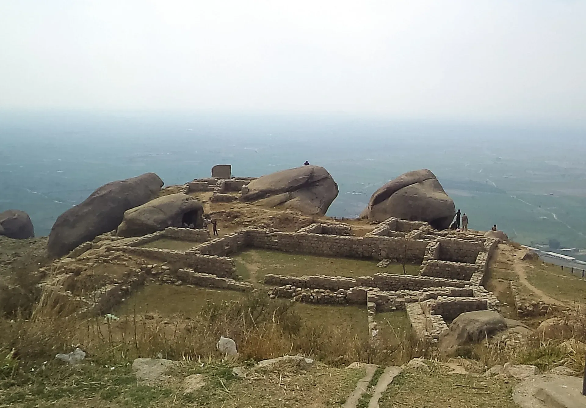
Photo: Shahnaveed33, with thanks · CC BY-SA 3.0 · via Wikimedia Commons · temporary stand-in photo

Ranigat
A large Buddhist monastic complex on a rocky hill at Nogram, Buner, built in the 2nd century CE. It is reached by about 500 steps and has long been studied by Japanese archaeologists.
Overview
Ranigat is a Gandhara-era Buddhist monastic site on a rocky ridge above Nogram village, on the boundary of Buner and Swabi districts. The name is usually explained as Sanskrit rani ("queen") plus Pashto gat ("large rock"), roughly "Queen's Rock". The site spreads over about 4 square kilometres and includes stupas, monasteries, shrines and a drainage system, built from stone gathered from nearby mountains.
Plan your visit
- Nearest town
- Swabi
- Getting there
Ranigat is at Nogram village, about 20 km from Swabi and roughly 100 km from both Peshawar and Islamabad. Take the M-1 motorway to the Swabi area, then the N-35 road towards Buner. Use a private car; More
Best months
Oct – Mar
History
Sources give a construction date in the 2nd century CE, with the site abandoned around the 6th century. (Some pages call it 2,500 years old, which does not fit the archaeology.) Alexander Cunningham and Henry Walter Bellew are named among the 19th-century investigators. A Japanese team has excavated and documented Ranigat since the 1980s; sources differ on the exact start date. The site is protected under Pakistan's Antiquities Act of 1975, and after vandalism it was fenced with barbed wire and put under guard.
The site
- The climb: from the parking area at Nogram (space for roughly 15 cars) about 500 stairs, built with Japanese support, lead up the ridge.
- Stupas and monasteries: the main features are ruined stupa bases, monastery buildings and shrines on terraces across the ridge.
- The great rock: a large rock stands some distance from the main complex. It is about 40 m high and 25 m wide and sits on the boundary between Swabi and Buner. It was probably used for worship in the past.
- Drainage: the complex includes a built drainage network.
- Views: over the valley on a clear day.
Buner around the site
Buner lies between Swabi to the south and Swat to the north, separated from Swat by the Mora hills and the Ilam range. Elevation rises from about 370 m in the south to over 2,900 m at Dosara peak in the north, and most hills are covered in pine. The Barandu river runs through the centre of the district. Buner also holds the shrine of Pir Baba, a Sufi saint, and is remembered for the Ambela campaign against the British in the 19th century.
UNESCO status
UNESCO's Tentative List includes Ranigat (reference 1879), submitted on 30 January 2004 under criteria (ii) and (iv). It is not a World Heritage Site. A news summary in 2026 also mentions a preliminary assessment request, so the current status should be checked with the Pakistan National Commission for UNESCO.
When to visit
October to March is best. The climb is steep and the site is exposed, so avoid the middle of the day in summer.
Getting there
Ranigat is at Nogram village, about 20 km from Swabi and roughly 100 km from both Peshawar and Islamabad. The M-1 motorway and the N-35 road both lead to the area. There is no regular public transport to Nogram.
Where to stay and eat
There are no tourist facilities at the site. Swabi and the motorway service areas have simple food and hotels.
Good to know
- Entry and hours: not confirmed from an official source. Contact the Khyber Pakhtunkhwa Directorate of Archaeology and Museums.
- Respect: do not climb on stupa remains, remove stones or write on walls.
- Photography: fine for personal use. Ask the caretaker before using a drone.
- Safety: check current security advice for Buner before you travel.
Travel advice
Ask the district administration or local police about current conditions before you go. For foreign visitors: the UK FCDO advises against all travel to Buner (advice updated 27 October 2026, checked 16 November 2026). Read the live advice before you plan.
Highlights
- Largest Buddhist monastic complex of its kind in the area, over about 4 sq km
- About 500 stone steps to the site
- Studied by Japanese teams since the 1980s
- On UNESCO's tentative list since 2004
Tips
- Take water and wear grippy shoes for the stairs.
- Go early, the slope has little shade.
- Ask in Nogram village for the caretaker.
- Check current security conditions in Buner first.
Photos we still need: Ranigat stupas and monastery ruins on the ridge; the stairway up to Ranigat; the great rock at Ranigat. Send us yours
Sources and last checked
Last checked Confidence medium4 sources3 still to check
- Last checked
- Method
- Desk research from published sources
- Confidence
- medium
- Checked by
- trek.pk research team
Researched from published sources; not yet checked on the ground by our team. Spot something out of date? Report a mistake.
Sources
- Ranigat (Wikipedia) · Wikipedia · checked
- Ranigat · Department of Archaeology and Museums, Government of Pakistan · checked
- Pakistan travel advice: warnings and insurance (updated 27 October 2026) · UK Foreign, Commonwealth & Development Office · checked
- Buner District (Wikipedia) · Wikipedia · checked
Still to be checked on the ground (3)
- Opening hours and fee (the DoAM page lists none; contact details are on it)
- Exact start year of the Japanese excavations (both sources say only 'since the 1980s')
- Whether the site is open to visitors given the FCDO advice against all travel to Buner
Nearby and related

Islamabad
Pakistan's green, planned capital at the foot of the Margalla Hills: Faisal Mosque, hillside trails, cafes and the gateway to the north.

Peshawar
Khyber Pakhtunkhwa's capital and one of South Asia's oldest living cities: the Gandhara museum, Qissa Khwani Bazaar, mosques and a strong food culture.

Khyber Pakhtunkhwa
Mountains, Buddhist ruins and old bazaars in north-west Pakistan: Swat, Kaghan, Chitral, the Kalash valleys, the Khyber Pass and Peshawar.