

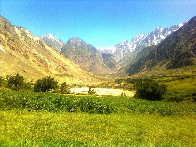
Photo: Arif Rizvi, with thanks · CC BY-SA 4.0 · via Wikimedia Commons · temporary stand-in photo

Roundu (Rondu) Valley
A long stretch of the Indus valley between Skardu and Gilgit, now a district of its own. Side valleys such as Stak, Bilamik and Tormik branch off it.
Overview
Roundu (also written Rondu) lies in western Baltistan, Gilgit-Baltistan, along the Indus between Skardu and Gilgit. It was created as a separate district from Skardu in 2019. Wikipedia gives its area as 1,895 square km and its population as 39,490 (2023, UNOSAT). About 70 percent speak Balti and about 30 percent Shina, and most Shina speakers are bilingual. Residents are mostly Shia Muslim. Wikipedia calls it the fourth-largest valley in Gilgit-Baltistan, after Skardu, Khaplu and Shigar.
The district has four union councils: Mindi, Stak, Tormik and Ganji. Wikipedia names Bilamik, Talubruq, Tormik and Ganji among its green side valleys. It also describes Roundu as a main route between Baltistan and Gilgit. Sources disagree on the district headquarters: Wikipedia names Thowar, about 65 to 70 km from Skardu, and also says Dambudas, in the middle of the valley, currently serves as the headquarters.
Plan your visit
- Nearest town
- Skardu
- Getting there
The Skardu to Gilgit road crosses the district. Thowar is about 65 to 70 km from Skardu (Wikipedia). Shared vans run between Skardu and Gilgit and can drop you at junctions; hire a jeep for side valleys. More
Best months
May – Oct
- Roundu (Rondu) Valley
- Related places nearby: Skardu, Kutiah Lungma Glacier (Stak Valley), Tormik Valley
What to see and do
Roundu is mainly a place to pass through, but its side valleys reward a stop. Wikipedia describes the valley as the main trade and travel route between Baltistan and Gilgit. Wikipedia describes the valley as the main trade and travel route between Baltistan and Gilgit.
- Stak valley. On the right bank of the Indus, with a road to the foot of the Kutiah Lungma Glacier. See the Kutiah Lungma Glacier page.
- Thorchay and Tormik. Wikipedia lists Thorchay and Tormik with Stak as the larger side valleys, each more populous than Dambudas. See the Tormik Valley page for the road to Stak La and the Broq summer pasture.
- Thorchay and Tormik. Wikipedia lists Thorchay and Tormik with Stak as the larger side valleys, each more populous than Dambudas. See the Tormik Valley page for the road to Stak La and the Broq summer pasture.
- Other side valleys. Bilamik, Talubruq, Tormik and Ganji have villages and farmland. Tourist facilities are very limited; ask locally before you go.
Getting there
The Skardu to Gilgit road runs through Roundu. Wikipedia gives Thowar as about 65 to 70 km from Skardu. Allow extra time: the road follows a narrow gorge and can be closed by landslides or floods.
When to visit
Roughly May to October. Winters are cold at altitude and some side roads can be blocked.
Where to stay and eat
Facilities are limited. Most visitors stay in Skardu or Gilgit and travel in a day. Ask locally about village guest houses.
Good to know
- Travel advice. For foreign visitors: the UK FCDO page for Pakistan (updated 27 October 2026, checked 17 November 2026) does not advise against Gilgit-Baltistan as a whole. It does advise against all travel on the Karakoram Highway between Mansehra and Chilas, and against travel within 10 miles of the Line of Control. Check the live page for your route.
- Fees and permits. No visitor fees are published. Current fees will be added soon.
- Not set up for tourism. The district has few visitor services. Carry cash and supplies.
Highlights
- Indus gorge between Skardu and Gilgit
- Side valleys: Stak, Bilamik, Tormik, Ganji
- District created in 2019
- Gateway to Kutiah Lungma Glacier
Tips
- Check the road for landslides before you travel.
- Carry cash and food; services are few.
- Use a local guide for side valleys.
Photos we still need: the Indus gorge on the Skardu to Gilgit road in Roundu; a village or terraced fields in Tormik or Bilamik. Send us yours
Sources and last checked
Last checked Confidence low3 sources5 still to check
- Last checked
- Method
- Desk research from published sources
- Confidence
- low
- Checked by
- trek.pk research team
Researched from published sources; not yet checked on the ground by our team. Spot something out of date? Report a mistake.
Sources
- Roundu District · Wikipedia · checked
- Stak Valley · Wikipedia · checked
- Foreign travel advice: Pakistan · UK FCDO · checked
Still to be checked on the ground (5)
- Exact district headquarters (Thowar or Dambudas)
- Coordinates are the Wikipedia district point, not a single valley
- Road conditions and any guest houses
- Distance and time from Skardu by current road
- Villages in order along the main road and river crossings
Nearby and related

Skardu
The main town of Baltistan, where the Indus meets the Shigar river. Skardu is the base for the Deosai Plains, the Kachura and Satpara lakes, Shigar, and the K2 and Baltoro treks.

Kutiah Lungma Glacier (Stak Valley)
A glacier at the head of Stak valley, north of Nanga Parbat. Known for a rapid surge in the 1950s that sent the ice about 12.8 km down the valley in 91 days.
Tormik Valley
A side valley of the Roundu district on the Skardu to Gilgit road, rising to Stak La. Known for the Broq summer pasture and its polo ground.