

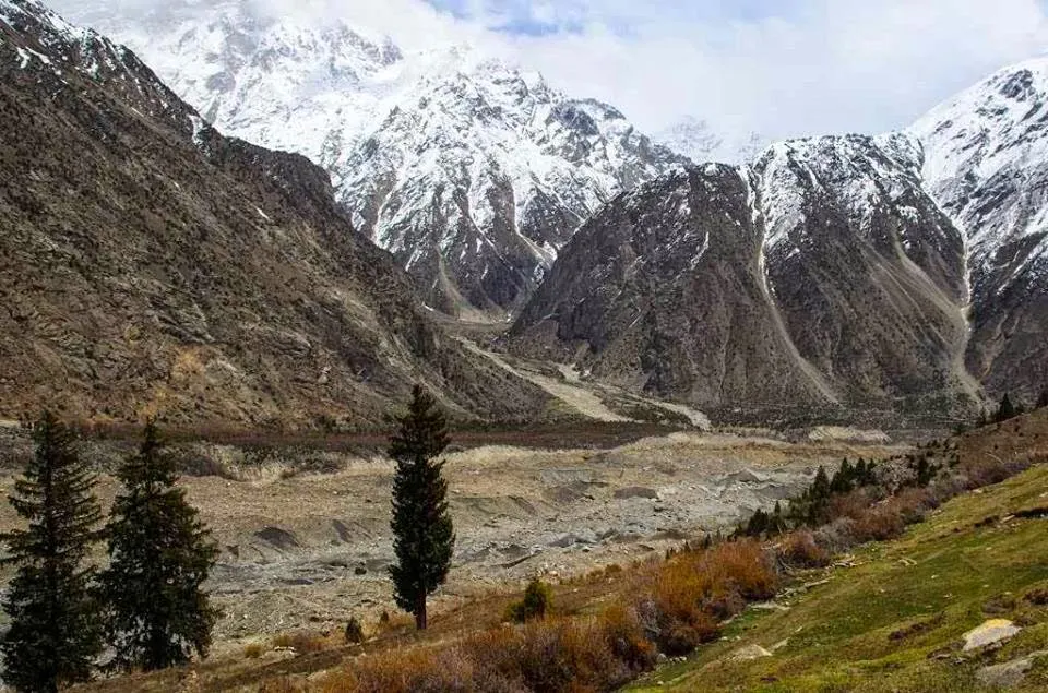
Photo: Arif Rizvi, with thanks · CC BY-SA 4.0 · via Wikimedia Commons · temporary stand-in photo

Kutiah Lungma Glacier (Stak Valley)
A glacier at the head of Stak valley, north of Nanga Parbat. Known for a rapid surge in the 1950s that sent the ice about 12.8 km down the valley in 91 days.
Overview
Kutiah Lungma (also Kutia Lungma) Glacier is in the Karakoram, at the head of Stak Valley in Roundu, Skardu region. Wikipedia gives it as about 12 km long and 3 km wide, lying north of Nanga Parbat and about 20 km from the northern bank of the Indus.
It is known for a surge, described below.
Plan your visit
- Nearest town
- Skardu
- Getting there
From Skardu or Gilgit on the Gilgit to Skardu road to the Indus-Stak junction, then an unpaved road to the base camp (Wikipedia: about 10 km from the main road). Hire a jeep. More
Best months
Jun – Sep
- Kutiah Lungma Glacier (Stak Valley)
- Related places nearby: Roundu (Rondu) Valley, Skardu, Nanga Parbat
The Stak valley
Stak (also written Staq) is the largest valley of the Roundu subdivision by area and population. It lies on the right bank of the Indus, between Skardu and Gilgit. The Stak river rises near Stak-La (4,601 m) and runs about 30 km to the Indus, fed on the way by streams from the Goropha, Kutiah and Tooklano side valleys. It splits the valley into two halves.
Villages stand on both banks. Named settlements include Rgialmokaza, Skangbudas, Khirzang and Tookla, the last village in the valley. Geologists note that most villages sit on moraines, the loose rock and gravel left behind by old glaciers. The valley is counted among the fertile valleys of Roundu. A large flood in 1999 partly destroyed Tookla and Gongma Tookla and destroyed Gamba Tookla completely.
Above the villages the valley opens towards Haramosh (7,397 m) in the north and the Goropha Glacier to the north-east, with the Kutiah Lungma Glacier to the north.
The surge
A surging glacier is one that advances far and fast for a short time, then slows and shrinks. Kutiah Lungma is one of the best-known cases in Pakistan. The usual account gives an advance of about 12.8 km in 91 days in 1955, at just over a mile a month, burying pasture. Local elders describe the ice thickening and then collapsing forward, reaching the first hamlet within months. Within two or three years it had retreated about 4 to 5 km. It now ends roughly 4 to 5 km above Tookla.
The surge figures trace to one 1998 reference book, and other writers give the early 1950s, so the year and distances are approximate. Local people also tell of the surge in terms of ritual and of an older legend of a princess, Apino, who is said to have cursed the valley. Treat these as local tradition, not as an explanation of how glaciers behave.
What to see and do
Visitors come to see the ice and the valley. The glacier can be visited from June to September. The walk and the views depend on how far the road is passable, so ask your driver before leaving the main road.
Getting there
The glacier is about 10 km from the Gilgit to Skardu road. An unpaved road runs from the junction where the Stak stream meets the Indus to the base camp. Start from Skardu or Gilgit. Hire a jeep and driver and ask locally about the road.
When to visit
June to September .
Where to stay and eat
Facilities are limited. Most visitors stay in Skardu or Gilgit. Carry food and water.
Good to know
- Travel advice. For foreign visitors: the UK FCDO page for Pakistan (updated 27 October 2026, checked 17 November 2026) does not advise against Gilgit-Baltistan as a whole. It does advise against all travel on the Karakoram Highway between Mansehra and Chilas, and against travel within 10 miles of the Line of Control. Check the live page for your route.
- Safety. Do not walk on the ice without a guide. Floods have damaged Stak villages before; a flood in 1999 damaged Tookla and nearby hamlets.
- Fees and permits. None published. Current fees will be added soon.
Highlights
- About 12 km long, 3 km wide
- Surge of about 12.8 km in 91 days (1950s)
- Stak valley villages on old moraines
- North of Nanga Parbat
Tips
- Go with a local driver and guide.
- Check the Stak road before you set out.
- Carry food and water.
Photos we still need: Stak valley villages and moraine fields; Tookla village and the glacier snout. Send us yours
Sources and last checked
Last checked Confidence low3 sources6 still to check
- Last checked
- Method
- Desk research from published sources
- Confidence
- low
- Checked by
- trek.pk research team
Researched from published sources; not yet checked on the ground by our team. Spot something out of date? Report a mistake.
Sources
- Kutiah Lungma Glacier · Wikipedia · checked
- Stak Valley · Wikipedia · checked
- Foreign travel advice: Pakistan · UK FCDO · checked
Still to be checked on the ground (6)
- Year of the surge (Wikipedia gives 1955; other sources say 1953)
- Surge distance and speed (not fully sourced)
- Road distance and condition from the Indus-Stak junction
- Coordinates are Wikipedia's for the glacier
- Surge figures rest on a single 1998 reference; verify against glaciological literature
- Condition of the Stak road in summer
Nearby and related

Roundu (Rondu) Valley
A long stretch of the Indus valley between Skardu and Gilgit, now a district of its own. Side valleys such as Stak, Bilamik and Tormik branch off it.

Skardu
The main town of Baltistan, where the Indus meets the Shigar river. Skardu is the base for the Deosai Plains, the Kachura and Satpara lakes, Shigar, and the K2 and Baltoro treks.

Nanga Parbat
Nanga Parbat (8,126 m), the ninth-highest mountain on Earth, rises above the Indus in Diamer and Astore. Fairy Meadows and the Rupal Valley give the best treks to its north and south faces.