

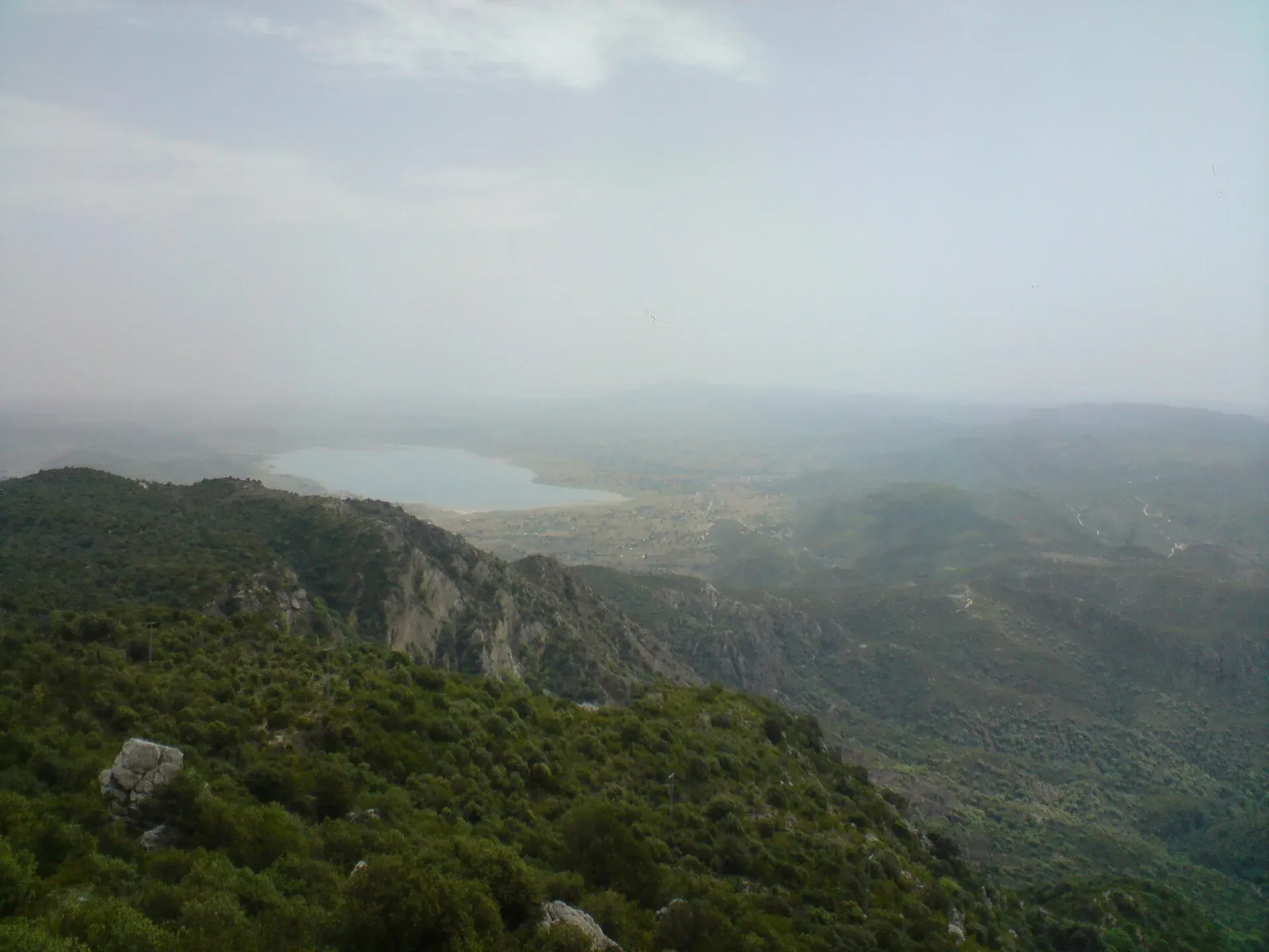
Photo: M. Ali Awab, with thanks · CC BY-SA 3.0 · via Wikimedia Commons · temporary stand-in photo

Sakesar Top
The highest point of the Salt Range, about 1,525 m (other sources 1,522 to 1,530 m), above Soon Valley and Uchhali Lake. The summit area has a Pakistan Air Force station and access is controlled; the Amb temples on its flank are a documented sight.
Overview
Sakesar is the highest peak of the Salt Range in Punjab. Its height is given as 1,525 m (5,003 ft) on Wikipedia's Sakesar page, 1,530 m on its Soon Valley page and 1,522 m by the Salt Range article and Jatland, so the figure is 1,522 to 1,530 m. It lies on the outer edge of Soon Valley, in Khushab District. Uchhali Lake lies just below it.
The mountain has a few distinctions. It was once the summer headquarters of the Deputy Commissioners of Campbellpur (now Attock), Mianwali and Shahpur (now Sargodha), who came up to escape the plains heat. Wikipedia also calls it the only mountain in this part of Punjab that gets snow in winter.
Plan your visit
- Nearest town
- Chakwal
- Getting there
About 224 km and 3 hours by road from Islamabad, and about 121 km and 2 hours from Chakwal (OSRM, 16 Nov 2026, to the summit position). The final approach uses local roads; verify access before travelling. More
Best months
Oct – Mar
- Sakesar Top
- Related places nearby: Uchhali Lake, Kallar Kahar Lake, Khabikki Lake, Khushab
Soon Valley below the peak
Soon Valley, also called Soon Sakesar Valley, is in the north-west of Khushab District. It runs from Padhrar village to Sakesar, about 56 km long and on average 14 km wide, with an area of about 800 square km. Its largest settlement is Naushera. The valley has been settled since ancient times, and the Awan tribe, which still lives there, is the most recent group to arrive. Wikipedia gives road distances to the valley of 230 km from Islamabad, 120 km from Sargodha and 320 km from Lahore.
The summit area
The Pakistan Air Force has had a radar station on the mountain since the late 1950s, and a Pakistan Television transmission centre stands there too. An Express Tribune writer in 2013 found access to the airbase restricted. There is no newer report, so do not assume you can reach the top.
The Amb temples
Near Amb Sharif village, on the flank of Sakesar, stand two pre-Islamic Hindu temples facing each other, built of brick and mortar. Wikipedia dates them to the 7th to 9th centuries. The main temple rises several storeys, roughly 15 to 20 m. A smaller two-storey temple, 7 to 8 m high, stands about 75 m to the west. Both are carved on the outside and show up clearly against the dry hills.
Lakes and birds
Uchhali Lake is brackish, which means saltier than fresh water. It is one of three lakes in the Uchhali Complex, a Ramsar wetland of international importance, along with Khabikki Lake and Jahlar Lake. Migratory birds from Siberia, Mongolia and Central Asia reach the lakes each winter, and some breed there. Khabikki is about 1 km wide and 2 km long, and attracts white-headed ducks. See Uchhali Lake and Khabikki Lake for more.
What to see and do
- Views. On a clear day the top overlooks Soon Valley and Uchhali Lake. A travel article mentions possible views of the Margalla Hills and the River Jhelum; this is not independently confirmed.
- The Amb temples. See above. They are the best-documented sight on the mountain.
- Nearby lakes. Uchhali Lake is about 13 km from Sakesar, with boating, and Khabikki Lake is also in the valley.
When to visit
October to March is cool and clear. Summers in the Salt Range foothills are hot, though the top is cooler. Rain can make dirt tracks slippery. This is general advice, not an official figure.
Getting there
By road it is about 224 km and about 3 hours from Islamabad, and about 121 km and 2 hours from Chakwal, measured to the Sakesar summit position (OSRM estimates, 16 November 2026). The final section is local roads. Confirm access with the Pakistan Air Force, local police or the Khushab district office before you set out.
Where to stay and eat
The Tribune reported in 2013 that the nearby Uchhali Lake area lacked toilets, hotels, restaurants and rest houses, and that the road to the lake was in a dilapidated state. Conditions may have changed. Bring food and water, and base yourself in Chakwal or Khushab.
Good to know
- Photography near military sites may be restricted. Ask before you take photos.
- Do not enter sealed or guarded areas.
- Safety. For foreign visitors: the UK FCDO Pakistan page (updated 27 October 2026, checked 17 November 2026) does not name Khushab, Chakwal or Talagang.
- Any fees are not confirmed here.
Highlights
- Highest point of the Salt Range
- Views over Soon Valley and Uchhali Lake
- Pre-Islamic Amb temples nearby
- Access to the summit is controlled
Tips
- Check access with the PAF or local police before you go
- Ask before photographing
- Carry food and water
- Plan a day trip from Chakwal
Photos we still need: the view from the Sakesar summit road, if public access is confirmed. Send us yours
Sources and last checked
Last checked Confidence low7 sources3 still to check
- Last checked
- Method
- Desk research from published sources
- Confidence
- low
- Checked by
- trek.pk research team
Researched from published sources; not yet checked on the ground by our team. Spot something out of date? Report a mistake.
Sources
- Sakesar (Wikipedia) · Wikipedia · checked
- Sakesar (Pakistan Traveler) · Pakistan Traveler · checked
- Tourist spots soon: Sakesar valley · The Express Tribune (30 October 2013) · checked
- UK FCDO Pakistan travel advice · UK Foreign, Commonwealth & Development Office · checked
- OSRM public routing service (road distances and times, 16 Nov 2026) · OpenStreetMap / Project OSRM · checked
- Khushab District · Wikipedia · checked
- Soon Valley (Wikipedia) · Wikipedia · checked
Still to be checked on the ground (3)
- Whether the public can reach the summit (Tribune, 30 October 2013, says entry to the airbase area is restricted; nothing newer found)
- Current facilities and road condition (only a 2013 report, for the Uchhali Lake road)
- Height: 1,522 m, 1,525 m and 1,530 m all appear in published sources
Nearby and related

Uchhali Lake
The largest of three brackish lakes in the Soon Valley of the Salt Range, part of the Uchhali Complex Ramsar site and a winter home for waterbirds including white-headed ducks.

Chakwal
District capital on the Pothohar plateau, about 125 km from Islamabad, and a base for the Salt Range sights at Kallar Kahar and Katas Raj.

Kallar Kahar Lake
A shallow salt lake beside the town of Kallar Kahar in the Salt Range, minutes from the M-2 motorway. Known for its peacocks and the Mughal-era Takht-e-Babri.
Khabikki Lake
A salt lake in the Soon Valley of the Salt Range, Khushab District, Punjab. Part of the Uchhali wetlands complex, with winter birds, boats and a small resort.
Khushab
Jhelum-side town in Khushab District, the usual starting point for Soon Valley, with 139,905 people at the 2023 census.