

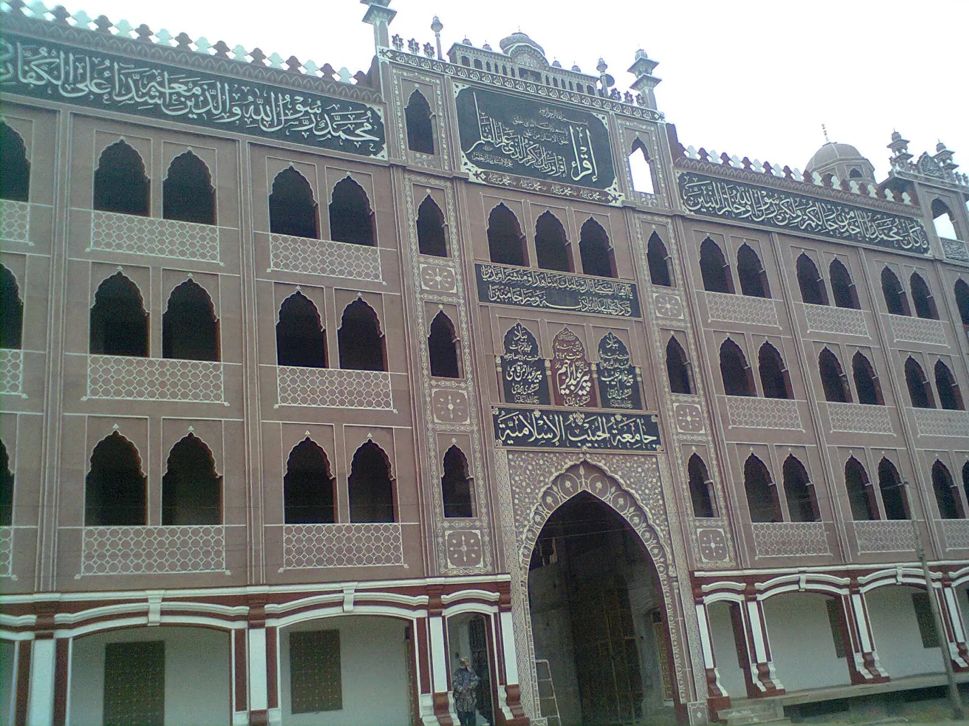
Photo: Armaghan Muawiyah, with thanks · CC BY-SA 4.0 · via Wikimedia Commons · temporary stand-in photo

Chakwal
District capital on the Pothohar plateau, about 125 km from Islamabad, and a base for the Salt Range sights at Kallar Kahar and Katas Raj.
Overview
Chakwal is the capital of Chakwal District in northern Punjab. It lies on the Pothohar Plateau, where gently rolling land is cut by gullies and low hill ranges. Wikipedia describes the climate as semi-arid to sub-humid with erratic monsoon rainfall. Chakwal became a separate district in 1985.
The local economy is mostly farming, especially wheat and groundnuts (peanuts), and Wikipedia notes that irregular rainfall, low mechanisation and cheap imports of groundnuts are persistent problems for farmers.
At the 2023 census Chakwal had 218,356 people (Wikipedia, citing the census). Wikipedia places it about 90 km south-west of Islamabad as the crow flies and 270 km from Lahore; by road it is further. Punjabi is the main language (80.7 per cent in 2023), with Pashto and Urdu also spoken.
Plan your visit
- Getting there
Road: Islamabad is about 125 km and roughly 1 hour 30 minutes (OSRM, checked 16 November 2026). Lahore is about 270 km by the route Wikipedia gives. More
Best months
Oct – Apr
- Chakwal
- Related places nearby: Katas Raj Temples, Kallar Kahar Lake, Rawalpindi, Takht-e-Babri and Bagh-e-Safa, Kallar Kahar, Chinji National Park, Salt Range National Park, Malot Fort, Choa Saidan Shah
History and military tradition
Chakwal became a separate district in 1985. It was carved out of Rawalpindi district, combining a subdivision from Jhelum, one from Attock and the Choa Saidan Shah police station. The district has three tehsils: Chakwal, Kallar Kahar and Choa Saidan Shah.
The area has a long record of military recruitment. Wikipedia says the British Army recruited local men in both world wars (460 enlisted in the First World War), and Khudadad Khan, the first South Asian recipient of the Victoria Cross, is a notable son of the district. Cannons, monuments and memorials mark this history, and the district has continued to supply recruits to the Pakistan armed forces.
What to see and do
- Katas Raj temples: a Hindu temple complex around a sacred pond in the Salt Range, about 37 km by road from Chakwal (OSRM). See Katas Raj temples.
- Kallar Kahar Lake: a salt lake with peacocks, about 26 km by road. See Kallar Kahar Lake. The district also holds Choa Saidan Shah, Malot Fort and Salt Range National Park.
- Thirchak-Mahal canyons: Wikipedia notes canyon scenery near the city. No visitor details are published, so ask locally.
- The town: a market town with a main jamia mosque. It works better as a base for the Salt Range than as a sightseeing stop in itself.
Landscape
Chakwal lies on the Pothohar Plateau. Wikipedia describes flat to gently undulating land broken by gullies and low hills, with a semi-arid to sub-humid climate and monsoon rainfall that varies from about 250 to 1,500 mm a year. That variation causes soil erosion and occasional flooding, and explains why rain-fed farming is uncertain.
When to visit
October to April is best. Summers are hot, and heavy monsoon rain in July and August can wash out tracks.
Where to stay and eat
Chakwal has a small number of hotels and roadside restaurants. Wikivoyage lists four hotels, mainly along Talagang Road and at Bhaun Chok, plus restaurants on the same roads. Names, prices and standards have not been checked.
Good to know
Chakwal has a district hospital, banks, pharmacies and fuel stations typical of a district capital. Confirm on arrival. Check current advice before you travel. Ask the district administration or local police about current conditions before you go. For foreign visitors: the UK FCDO Pakistan page (updated 27 October 2026, checked 16 November 2026) advises against all travel to Balochistan and to a long list of Khyber Pakhtunkhwa districts, and against all but essential travel within 5 miles of the India border. Dera Ghazi Khan is the only Punjab district it lists. Chakwal is not named on that page.
Highlights
- Base for Katas Raj temples and Kallar Kahar Lake
- Pothohar plateau landscape and Thirchak-Mahal canyons
- Strong local military tradition
- Groundnut and wheat farming country
Getting there
Road: Islamabad is about 125 km and roughly 1 hour 30 minutes (OSRM, checked 16 November 2026). Lahore is about 270 km by the route Wikipedia gives. Motorway: Wikivoyage lists the M-2 exits at Kallar Kahar (exit 17) and Balkassar (exit 18, on the Talagang-Chakwal road) as ways in, and the N5 via Mandra or Sohawa as the alternative. Air: Islamabad International Airport is the nearest major airport. Rail: not a practical way to reach Chakwal.
Hotels, food, fuel and services in Chakwal
Places to eat
- National Sweets And BakersCall National Sweets And BakersMap of National Sweets And Bakers in Google Maps
- Chai parathaMap of Chai paratha in Google Maps
- Pakiza International RestaurantCall Pakiza International RestaurantMap of Pakiza International Restaurant in Google Maps
- CityFamily ParkCall CityFamily ParkMap of CityFamily Park in Google Maps
- Tanzy’s RestaurantCall Tanzy’s RestaurantMap of Tanzy’s Restaurant in Google Maps
- Karachi FoodsCall Karachi FoodsMap of Karachi Foods in Google Maps
Essential services fuel stations, mechanics, ATMs, pharmacies, hospitals and clinics and Rescue 1122
Fuel
- Attock Petroleum Al MalikCall Attock Petroleum Al MalikMap of Attock Petroleum Al Malik in Google Maps
- ShellCall ShellMap of Shell in Google Maps
- Total Petrol PumpCall Total Petrol PumpMap of Total Petrol Pump in Google Maps
- Iqbal Petroleum ServicesMap of Iqbal Petroleum Services in Google Maps
Mechanics and tyre shops
- AUTO CARE Motor WorkshopCall AUTO CARE Motor WorkshopMap of AUTO CARE Motor Workshop in Google Maps
- GS Garage Suzuki Service Centre ChakwalCall GS Garage Suzuki Service Centre ChakwalMap of GS Garage Suzuki Service Centre Chakwal in Google Maps
ATMs
Pharmacies
- D.WATSON CHEMIST CHAKWALCall D.WATSON CHEMIST CHAKWALMap of D.WATSON CHEMIST CHAKWAL in Google Maps
- Chakwal ChemistCall Chakwal ChemistMap of Chakwal Chemist in Google Maps
- AL IMRAN CHEMISTCall AL IMRAN CHEMISTMap of AL IMRAN CHEMIST in Google Maps
- Hajvery Medical StoreMap of Hajvery Medical Store in Google Maps
- Ibrahim DistributorsCall Ibrahim DistributorsMap of Ibrahim Distributors in Google Maps
- Kamran ClinicCall Kamran ClinicMap of Kamran Clinic in Google Maps
Hospitals and clinics
- Capital Health HospitalCall Capital Health HospitalMap of Capital Health Hospital in Google Maps
- Imtiaz Medical ComplexCall Imtiaz Medical ComplexMap of Imtiaz Medical Complex in Google Maps
- Mother and Child HospitalCall Mother and Child HospitalMap of Mother and Child Hospital in Google Maps
- Gulzar Begum Hospital ChakwalCall Gulzar Begum Hospital ChakwalMap of Gulzar Begum Hospital Chakwal in Google Maps
- Mehtab Medical ComplexCall Mehtab Medical ComplexMap of Mehtab Medical Complex in Google Maps
- Ayat Hospital ChakwalCall Ayat Hospital ChakwalMap of Ayat Hospital Chakwal in Google Maps
Rescue 1122
- Rescue 1122 ChakwalCall Rescue 1122 ChakwalMap of Rescue 1122 Chakwal in Google Maps
Listings come from Google Maps data and are unverified: phone numbers, opening months and prices may have changed. Report a problem · Own one of these? Claim it
Tips
- Combine Katas Raj and Kallar Kahar in one day trip.
- Go between October and April.
- Carry water and sun protection in the Salt Range.
- Check the road before you leave: the M-2 motorway is the faster way to the Salt Range.
Photos we still need: Chakwal town market or the Salt Range landscape near the town. Send us yours
Sources and last checked
Last checked Confidence medium7 sources4 still to check
- Last checked
- Method
- Desk research from published sources
- Confidence
- medium
- Checked by
- trek.pk research team
Researched from published sources; not yet checked on the ground by our team. Spot something out of date? Report a mistake.
Sources
- Chakwal · Wikipedia · checked
- OSRM driving routes (road distances and times, optimistic) · Project OSRM · checked
- Pakistan travel advice: warnings and insurance · UK FCDO (GOV.UK) · checked
- Pakistan Tourism Guide 2021 · TDAP Pakistan · checked
- Chakwal · Wikivoyage · checked
- Lahore-Islamabad Motorway (M-2) · Wikipedia · checked
- Chakwal District · Wikipedia · checked
Still to be checked on the ground (4)
- Thirchak-Mahal canyon access (only Wikipedia, citing a 1981 guide, mentions it)
- Current hotel names and standards
- Current road conditions to the Salt Range (on the ground)
- Local food specialities (no source found)
Nearby and related

Katas Raj Temples
A group of Hindu temples around a sacred pond in the Salt Range near Kallar Kahar, dating from about the 6th to 10th centuries. Important to Hindus and visited by pilgrims each year. Near the M2 motorway.

Kallar Kahar Lake
A shallow salt lake beside the town of Kallar Kahar in the Salt Range, minutes from the M-2 motorway. Known for its peacocks and the Mughal-era Takht-e-Babri.

Islamabad
Pakistan's green, planned capital at the foot of the Margalla Hills: Faisal Mosque, hillside trails, cafes and the gateway to the north.

Rawalpindi
Islamabad's older twin city: a busy bazaar and cantonment, the north's main rail and bus hub, and an easy base for Taxila and Murree.

Takht-e-Babri and Bagh-e-Safa, Kallar Kahar
A rock-cut platform and the site of an orchard garden on the shore of Kallar Kahar Lake, linked to the first Mughal emperor, Babur, who camped here in 1519. Simple and often untidy, but easy to add to a trip along the M-2.

Chinji National Park
A dry, eroded hill park in Talagang, Punjab, set up in 1987. About 61 square kilometres on the Salt Range side of the Soan valley, near the village that gave its name to the Chinji fossil beds.
Salt Range National Park
A national park in the Salt Range in Chakwal District, Punjab, listed in 2021 at about 176 square kilometres. Limited visitor information; close to Kallar Kahar and the Chinji park.
Malot Fort
A 10th-century Hindu Shahi temple of red sandstone in the Salt Range, Chakwal district, also called Malot Temple or Malot Fort. It is in ruins and about seven miles from Katas Raj.
Choa Saidan Shah
Spring-fed town in Chakwal District named after the saint Saidan Shah, about 6 km from Katas Raj temples. Known for its shrine, roses and perfumes.