

Photo: Innocent Paki, with thanks · CC BY-SA 4.0 · via Wikimedia Commons · temporary stand-in photo

Sargodha
A planned canal-colony city in central Punjab, famous for kinnow oranges, with the dark Kirana Hills nearby and easy road links to Lahore, Faisalabad and Islamabad.
Overview
Sargodha is a planned canal-colony city in central Punjab, the headquarters of Sargodha District and Sargodha Division. The British founded it in 1903. It sits on flat, fertile plain at about 190 m, with the low, dark Kirana Hills rising just outside town. At the 2023 census the city had 975,886 people (CityPopulation.de, compiled from the Pakistan Bureau of Statistics), and Punjabi is the main language.
Sargodha is best known for citrus. The district is described as Pakistan's best citrus-growing area and the largest producer of kinnow, a sweet mandarin that is sold across the country and exported. Locals also call it the City of Eagles. It is also home to PAF Base Mushaf, a major Pakistan Air Force base, so expect some restricted areas and checkpoints.
This is a working city rather than a sightseeing destination. Most visitors come for business, family or to pass through on the way between Lahore, Faisalabad and the Salt Range or Mianwali side.
Plan your visit
- Getting there
Road: Lahore about 188 km (about 2 hours 25 minutes); Islamabad about 248 km (just over 3 hours); Faisalabad about 96 km (about 1 hour 40 minutes). Rail: Sargodha Junction. Air: use Faisalabad, Lahore or Islamabad. More
Best months
Nov – Mar
- Sargodha
- Related place nearby: Bhera
History
The British founded Sargodha in 1903 as a canal colony, beginning as a tehsil of Shahpur district, and it is one of the few planned cities in Pakistan. Wikipedia derives the name from sar (pond) and Godha, a reference to a sadhu, giving roughly "pond of Godha". Plague struck the new town in 1903 and again, more mildly, in 1904. The Royal Air Force later built an airfield here because of its position. Sargodha became a district headquarters in 1940 and a divisional headquarters in 1960, covering Sargodha, Khushab, Mianwali and Bhakkar districts. In 1966 the government awarded the city the Hilal-e-Istaqlal flag for its resistance in the 1965 war, and the flag is raised each Defence Day. The University of Sargodha was founded in 2002, and Wikipedia gives literacy as rising from 67.8 per cent in 1998 to 80.5 per cent in 2017.
What to see and do
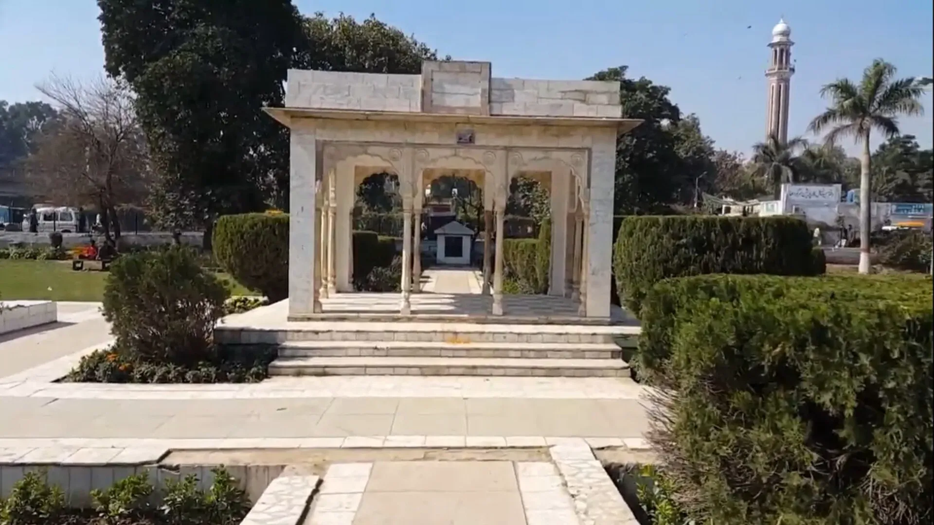
- Company Bagh: a well-known city park, with a retired fighter jet on display. Jinnah Hall, built in 1949 as a town hall and library, stands in the grounds and is now used for exhibitions and events.
- Kirana Hills: a low rocky range of dark, brownish rock, with a highest point of about 300 m. A small lake and a hill temple lie among them. Wikipedia says the hills are a Ministry of Defence reservation controlled by the Pakistan Air Force, with an active radar station, though it lists the site as open to the public and says parts opened for tourism in 1995. Ask locally before you go, and do not photograph military property.
- Bazaars: the city has around fifteen named markets, each known for certain goods. Kachehry Bazaar is the place for bakeries, street food and shoes. Liaquat Bazaar is known for bicycles (Wikipedia). Urdu Bazaar sells books and stationery, Sarafa Bazaar sells gold, and Amin Bazaar sells cloth.
- Kinnow orchards: the harvest runs from December to February, with the best picking from mid-January to mid-February (Wikipedia, Kinnow). Orchard visits can sometimes be arranged through local contacts. Check dates locally, as there is no known official festival calendar.
Kinnow
Kinnow is a hybrid of the King and Willow Leaf mandarins, developed by Howard B. Frost at the University of California Citrus Experiment Station and released for commercial growing in 1935 (Wikipedia). It peels easily and has a high juice content, though seeds are the main complaint, and seedless and low-seed types have been bred. The fruit ripens in January or February. Main export markets include Iran, the UAE, Saudi Arabia, Indonesia and Malaysia. Sargodha's juice factories include plants run by Nestle and Shezan (Wikipedia). The district's textile mills and rice processing are the other large employers.
Kirana Hills
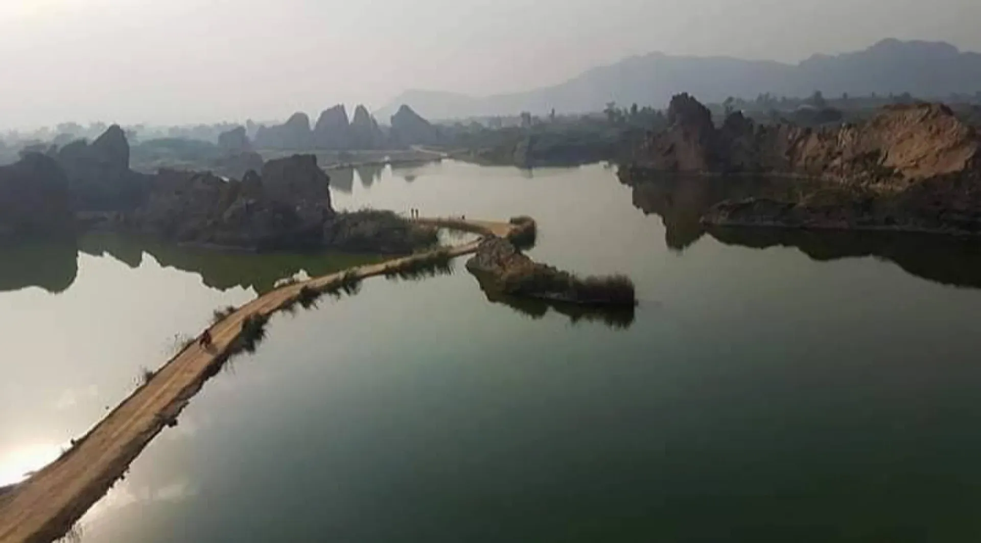
Photo: Innocent Paki, with thanks · CC BY-SA 4.0 · via Wikimedia Commons · temporary stand-in photo

The Kirana Hills lie between Sargodha and Chenab Nagar (formerly Rabwah), and locals call them the Black Mountains for their dark brownish rock. The rocks are mainly hardened shales and slates with minor quartzite and volcanic bands. British geologists studied them in 1913 and measured the highest point at about 320 m. The hills cover about 260 square km and run for about 19 km. Wikipedia says Hindus regarded them as a sacred hill and that an annual festival drew pilgrims before Partition. The Ministry of Defence took over the hills in 1970 and a Pakistan Air Force radar station operates there, as part of PAF Base Mushaf. The hills are described as partly open for tourism since 1995. Wikipedia also records that wild boar live in the surrounding area.
Food and bazaars
Expect Punjabi staples: tandoori roti, karahi, daal, lassi and sweet milky tea. There is a Food Street on Stadium Road. Fresh kinnow juice and fruit from the fruit mandi are the local treat in winter. Ask where families eat rather than where the signs are biggest.
Getting there
- Road: Lahore is about 188 km and 2 hours 25 minutes by road, Islamabad about 248 km and just over 3 hours, and Faisalabad about 96 km and 1 hour 40 minutes (OSRM, checked 16 November 2026). The M-2 motorway passes about 45 to 48 km away and several roads link the city to it. The N-60 runs towards Lahore.
- Rail: Sargodha Junction is on the Shorkot to Lala Musa branch line. Wikipedia says the Hazara Express, Millat Express, Sandal Express and Sargodha Express run daily to Rawalpindi, Lahore, Faisalabad, Multan and Karachi. Check Pakistan Railways for the current timetable.
- Bus: the general bus stand on Fatima Jinnah Road has services to most major cities.
- Air: no commercial airport is listed. Use Faisalabad, Lahore or Islamabad.
One or two days
This outline is built from the sights above.
- Day 1: Company Bagh and Jinnah Hall in the morning, then the bazaars: Kachehry for bakeries and street food, Urdu Bazaar for books and Sarafa for gold. Eat on Stadium Road's Food Street. In the afternoon, ask about the Kirana Hills.
- Day 2: Drive to Bhera for the old town and the mosque, then return through the farmland. In winter, time the trip for the kinnow harvest.
Sargodha's Mela Mandi Ground hosts competitions every March (Wikipedia).
Getting around
Auto-rickshaws are everywhere, and Uber and Careem have been reported in the city. The centre is compact enough for short rickshaw rides between the bazaars and Company Bagh.
Where to stay
Choose around University Road and the Khayyam Chowk to Fatima Jinnah Road area for the largest choice of hotels and eating places, or the quieter Satellite Town area. Many travellers stay in Lahore or Faisalabad and reach Sargodha by road in the day.
Day trips
- Bhera: an old walled town on the Jhelum, about 79 km by road (OSRM, 17 November 2026), with the Sher Shah Suri Mosque, dated by local sources to about 1540 to 1541. Wikipedia says the old town has eight gates and is divided into neighbourhoods (mohallas). Bhera is known for wood carving, quilts, khussa footwear and the sweets pheni and patisa, and was once known for knives and daggers. It was an important trading post on the road to Kabul. See Bhera.
- Chiniot and Faisalabad: easy to combine on the road towards Faisalabad. See Chiniot and Faisalabad.
- Kirana Hills: only a short drive from the city.
When to visit
November to March is comfortable. Summers are fierce, with highs that can reach about 50 degrees Celsius.
Safety
Sargodha is an ordinary Punjab city, but Pakistan has an ongoing risk of terrorism, so be careful in crowds and at checkpoints. Ask the district administration or local police about current conditions before you go. For foreign visitors: the UK FCDO advice, checked 16 November 2026 (page updated 27 October 2026), advises against all but essential travel in Punjab only for Dera Ghazi Khan, and says nothing against Sargodha. Photograph carefully near the air base and do not take pictures of military property.
Good to know
Dress modestly, carry cash for small shops, and expect power cuts in summer.
Highlights
- Kinnow capital of Pakistan
- Company Bagh and Jinnah Hall
- Kirana Hills and lake
- Fifteen specialist bazaars
Hotels, food, fuel and services in Sargodha
Places to stay
- "The Royal Hostel For Boys Sargodha" also known as "Bhatti Boys Hostel"Call "The Royal Hostel For Boys Sargodha" also known as "Bhatti Boys Hostel"Map of "The Royal Hostel For Boys Sargodha" also known as "Bhatti Boys Hostel" in Google Maps
- Circuit HouseCall Circuit HouseMap of Circuit House in Google Maps
- SFN Mess & Rest HouseCall SFN Mess & Rest HouseMap of SFN Mess & Rest House in Google Maps
- Skyline Hotel SargodhaCall Skyline Hotel SargodhaMap of Skyline Hotel Sargodha in Google Maps
- G12 Guest HouseCall G12 Guest HouseMap of G12 Guest House in Google Maps
- City HotelCall City HotelMap of City Hotel in Google Maps
Places to eat
- RanchersCall RanchersMap of Ranchers in Google Maps
- KFC Sargodha -1Call KFC Sargodha -1Map of KFC Sargodha -1 in Google Maps
- McDonald's sargodhaCall McDonald's sargodhaMap of McDonald's sargodha in Google Maps
- Stone Ove Pizza Valley Sargodha BranchCall Stone Ove Pizza Valley Sargodha BranchMap of Stone Ove Pizza Valley Sargodha Branch in Google Maps
- Mr. Wingg'z SargodhaCall Mr. Wingg'z SargodhaMap of Mr. Wingg'z Sargodha in Google Maps
- Charsi Shinwari Tikka & BBQ RestaurantCall Charsi Shinwari Tikka & BBQ RestaurantMap of Charsi Shinwari Tikka & BBQ Restaurant in Google Maps
Essential services fuel stations, mechanics, ATMs, banks, pharmacies, hospitals and clinics and Rescue 1122
Fuel
- PSOCall PSOMap of PSO in Google Maps
- Galaxy PetroleumCall Galaxy PetroleumMap of Galaxy Petroleum in Google Maps
- ShellCall ShellMap of Shell in Google Maps
- Lak Petroleum PSOMap of Lak Petroleum PSO in Google Maps
- Total Gas StationCall Total Gas StationMap of Total Gas Station in Google Maps
- STAR SPEED SERVICE STATION- Total Petrol StationCall STAR SPEED SERVICE STATION- Total Petrol StationMap of STAR SPEED SERVICE STATION- Total Petrol Station in Google Maps
Mechanics and tyre shops
- Kabari BazarCall Kabari BazarMap of Kabari Bazar in Google Maps
- Chaudhary Tyre MerchantCall Chaudhary Tyre MerchantMap of Chaudhary Tyre Merchant in Google Maps
- Tariq Saleem Battery ServiceCall Tariq Saleem Battery ServiceMap of Tariq Saleem Battery Service in Google Maps
ATMs
- National Bank of Pakistan (NBP)Call National Bank of Pakistan (NBP)Map of National Bank of Pakistan (NBP) in Google Maps
- The Bank of PunjabMap of The Bank of Punjab in Google Maps
- Askari BankCall Askari BankMap of Askari Bank in Google Maps
- Meezan Bank - Gole Chowk BranchCall Meezan Bank - Gole Chowk BranchMap of Meezan Bank - Gole Chowk Branch in Google Maps
- MCBCall MCBMap of MCB in Google Maps
- Habib Bank LimitedMap of Habib Bank Limited in Google Maps
Banks and money exchange
- HBL Currency Exchange Sargodha BoothCall HBL Currency Exchange Sargodha BoothMap of HBL Currency Exchange Sargodha Booth in Google Maps
- The Bank of PunjabCall The Bank of PunjabMap of The Bank of Punjab in Google Maps
- United Bank LimitedMap of United Bank Limited in Google Maps
- Meezan Bank - Lahore Road BranchCall Meezan Bank - Lahore Road BranchMap of Meezan Bank - Lahore Road Branch in Google Maps
- MCB BankCall MCB BankMap of MCB Bank in Google Maps
Pharmacies
- Dispenso Pharmacy & HealthcareCall Dispenso Pharmacy & HealthcareMap of Dispenso Pharmacy & Healthcare in Google Maps
- Clinix PharmacyCall Clinix PharmacyMap of Clinix Pharmacy in Google Maps
- CLINIX PHARMACYCall CLINIX PHARMACYMap of CLINIX PHARMACY in Google Maps
- Health plus pharmacyMap of Health plus pharmacy in Google Maps
- Anjum TownMap of Anjum Town in Google Maps
- Queen Pharmacy SargodhaCall Queen Pharmacy SargodhaMap of Queen Pharmacy Sargodha in Google Maps
Hospitals and clinics
- Sakina International Hospital SargodhaCall Sakina International Hospital SargodhaMap of Sakina International Hospital Sargodha in Google Maps
- Novocare International Hospital & Research Center - NIH&RCCall Novocare International Hospital & Research Center - NIH&RCMap of Novocare International Hospital & Research Center - NIH&RC in Google Maps
- Best Physiotherapist in Sargodha Dr Atif MalikCall Best Physiotherapist in Sargodha Dr Atif MalikMap of Best Physiotherapist in Sargodha Dr Atif Malik in Google Maps
- Mubarak Hospital [New Block]Call Mubarak Hospital [New Block]Map of Mubarak Hospital [New Block] in Google Maps
- Ibn-E-Sina HospitalCall Ibn-E-Sina HospitalMap of Ibn-E-Sina Hospital in Google Maps
- Mubarak Medical Complex Old BlockCall Mubarak Medical Complex Old BlockMap of Mubarak Medical Complex Old Block in Google Maps
Rescue 1122
- RESCUE 1122 Sargodha HeadquartersCall RESCUE 1122 Sargodha HeadquartersMap of RESCUE 1122 Sargodha Headquarters in Google Maps
Listings come from Google Maps data and are unverified: phone numbers, opening months and prices may have changed. Report a problem · Own one of these? Claim it
Tips
- Visit November to March; summers are extremely hot.
- Ask locally before entering the Kirana Hills.
- Do not photograph the air base or military property.
- Base in Lahore or Faisalabad if you prefer more hotel choice.
Photos we still need: kinnow orchard or fruit stall; Bhera old town or Sher Shah Suri Mosque; a bazaar street in Sargodha. Send us yours
Sources and last checked
Last checked Confidence medium8 sources3 still to check
- Last checked
- Method
- Desk research from published sources
- Confidence
- medium
- Checked by
- trek.pk research team
Researched from published sources; not yet checked on the ground by our team. Spot something out of date? Report a mistake.
Sources
- Sargodha · Wikipedia · checked
- Sargodha: Important Places · Government of Punjab, Sargodha district · checked
- City populations, 2023 census (compiled from Pakistan Bureau of Statistics) · CityPopulation.de · checked
- OSRM driving routes (road distances and times) · Project OSRM / OpenStreetMap · checked
- Pakistan travel advice (safety and security; updated 27 October 2026) · UK Foreign, Commonwealth & Development Office · checked
- Kirana Hills · Wikipedia · checked
- Kinnow · Wikipedia · checked
- Bhera · Wikipedia · checked
Still to be checked on the ground (3)
- Population: Wikipedia and CityPopulation.de both give 975,886 for the city (2023); a lower municipal-corporation figure was mentioned earlier but not found
- Current train services (Wikipedia says four named trains run daily; no timetable)
- Orchard-visit arrangements for kinnow (harvest months resolved; no arrangements found)
Nearby and related

Lahore
Punjab's capital and Pakistan's cultural city: Mughal forts, mosques and gardens, a lively Walled City, and some of the best food in the country.

Islamabad
Pakistan's green, planned capital at the foot of the Margalla Hills: Faisal Mosque, hillside trails, cafes and the gateway to the north.

Faisalabad
Pakistan's textile capital: a planned colonial city built around a clock tower with eight bazaars, plus gardens, a wildlife park, and the old wood-carving town of Chiniot nearby.

Punjab
Pakistan's most populous province: Mughal Lahore, ancient Taxila and Harappa, Sufi shrines, the Salt Range, the Cholistan desert and the hills of Murree.
Bhera
Old walled market town in Sargodha District, founded again by Sher Shah in 1540. Known for its Jamia Mosque, wood carving, textiles and sweets.