

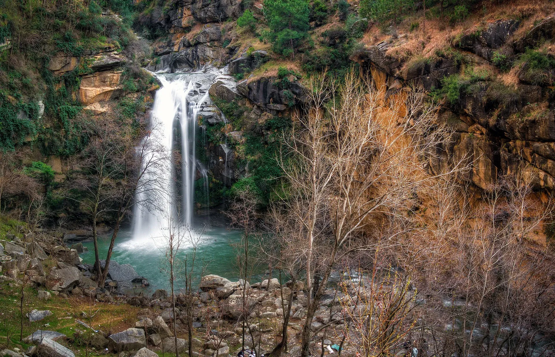
Photo: Imranrashid26, with thanks · CC BY-SA 3.0 · via Wikimedia Commons · temporary stand-in photo
Shingrai Waterfall
A small waterfall near Shingrai village above Manglawar in Swat, 18 to 20 km from Mingora. A short descent from the village is needed. For foreign visitors: the UK FCDO advises against all travel to Swat.
Overview
Shingrai Waterfall (Shingro Dand in Pashto) is near Shingrai village in the Manglawar area of Swat, Khyber Pakhtunkhwa. Sources put it 18 to 20 km from Mingora: Wikipedia says 18 km, and Dawn (14 May 2016) says about 20 km north, at the foot of the Dwasaray peaks. Wikipedia gives a height of about 9 to 11 m and a width of about 21 m. Its pages also list an elevation of 3,000 m and coordinates that do not match Swat, so these have not been used.
Plan your visit
- Nearest town
- Manglawar
- Getting there
Drive north from Mingora towards Manglawar and Shingrai village (about 18 to 20 km). Dawn (2016) reported that visitors climb down the hill from the village to reach the fall. Ask villagers for the path. More
Best months
Mar – Jun, Sep – Oct
The setting
Manglawar, the union council (local government area) that includes Shingrai, lies at about 987 m. It was the capital of the Swat kingdom (Pakhal Sarkar) founded by Sultan Pakhal Swati, and Wikipedia reports that remains of a castle of Sultan Awais Swati, the kingdom's last ruler, can still be seen. Wikipedia places the waterfall about 9 km from Manglawar.
Dawn describes a fall with a loud roar among large hills and green mountains, with a small lake beneath it and a view from the top. The Express Tribune (28 May 2016) describes dense forest and flowers around the water, which it says is deep. Locals warn that people can drown, though some visitors swim in the cold water in hot summers.
What to see and do
- The fall. A wide, low fall that is popular for a cooling-off stop.
- A day out from Mingora. Dawn quotes a visitor who calls it about an hour's drive from Mingora; The Express Tribune says about 40 minutes.
- Local crowds. Dawn reported local families visiting, especially on Fridays and Sundays, and first-time visitors from Mingora surprised that it was so close.
- Elsewhere in Manglawar. Wikipedia lists the Jahanabad Buddha, a large rock-carved figure, and names woodwork from local timber, hand-made shoes and river fish as local specialities. See also Swat Valley, Swat Museum and Mingora.
When to visit
The Express Tribune reported visitors on weekends from March to October, and said water rises in midsummer as glaciers melt, when people tend to stay away. Choose a dry spell, and avoid days after heavy rain.
Where to stay and eat
Stay in Mingora or Manglawar. The Tribune reported no sitting areas or other facilities at the fall in 2016. There is no known newer source.
Good to know
- The approach. Dawn (2016) said no proper road reached the fall, and visitors climbed down from Shingrai village and back up, which it called hard for women in particular. The Tribune described a narrow, unpaved, damaged road. Conditions may have changed.
- Safety. The descent and wet rocks are slippery, deep pools are cold, and midsummer flows are strong. There are no known dated incident reports for this fall.
- Fees. No official fee information found; current fees will be added soon.
- Etiquette. Take litter away. Dress modestly, as most visitors are local families.
- Travel advice. For foreign visitors: the UK FCDO page (updated 27 October 2026, checked 16 November 2026) advises against all travel to Swat, and KP is also under emergency measures and Governor's Rule since 11 October 2026. Read the current page before making any plans.
Highlights
- About 11 m high and 21 m wide (Wikipedia)
- 18 to 20 km from Mingora
- Popular with local families on Fridays
- Reached by climbing down from the village
Getting there
Drive north from Mingora towards Manglawar and Shingrai village (about 18 to 20 km). Dawn (2016) reported that visitors climb down the hill from the village to reach the fall. Ask villagers for the path. We did not run a route calculation because no reliable coordinates for the fall were found.
Tips
- Go in a dry spell; midsummer flow is high
- Wear grippy shoes for the climb down
- Bring water and food; no facilities were reported
- Check FCDO advice and local security news before travelling
Photos we still need: the path or road down from Shingrai village to the fall. Send us yours
Sources and last checked
Last checked Confidence medium6 sources5 still to check
- Last checked
- Method
- Desk research from published sources
- Confidence
- medium
- Checked by
- trek.pk research team
Researched from published sources; not yet checked on the ground by our team. Spot something out of date? Report a mistake.
Sources
- Shingrai Waterfall · Wikipedia · checked
- The unexplored tourist attractions of Swat valley · Dawn · checked
- Creating a splash: Venturing out in search of hidden gems · The Express Tribune · checked
- Pakistan travel advice: warnings and insurance · UK Foreign, Commonwealth & Development Office · checked
- Shingrai (OpenStreetMap Nominatim) · OpenStreetMap · checked
- Manglawar · Wikipedia · checked
Still to be checked on the ground (5)
- Exact coordinates (Wikipedia 34.196 N, 71.991 E is outside Swat; OSM has no Shingrai waterfall in Swat, only a Shingrai sar village in Battagram)
- Elevation (Wikipedia 3,000 m is implausible; no better source)
- Current road or path state
- Whether any facilities now exist
- Height: Wikipedia gives about 9 m on one page and about 11 m on another

