

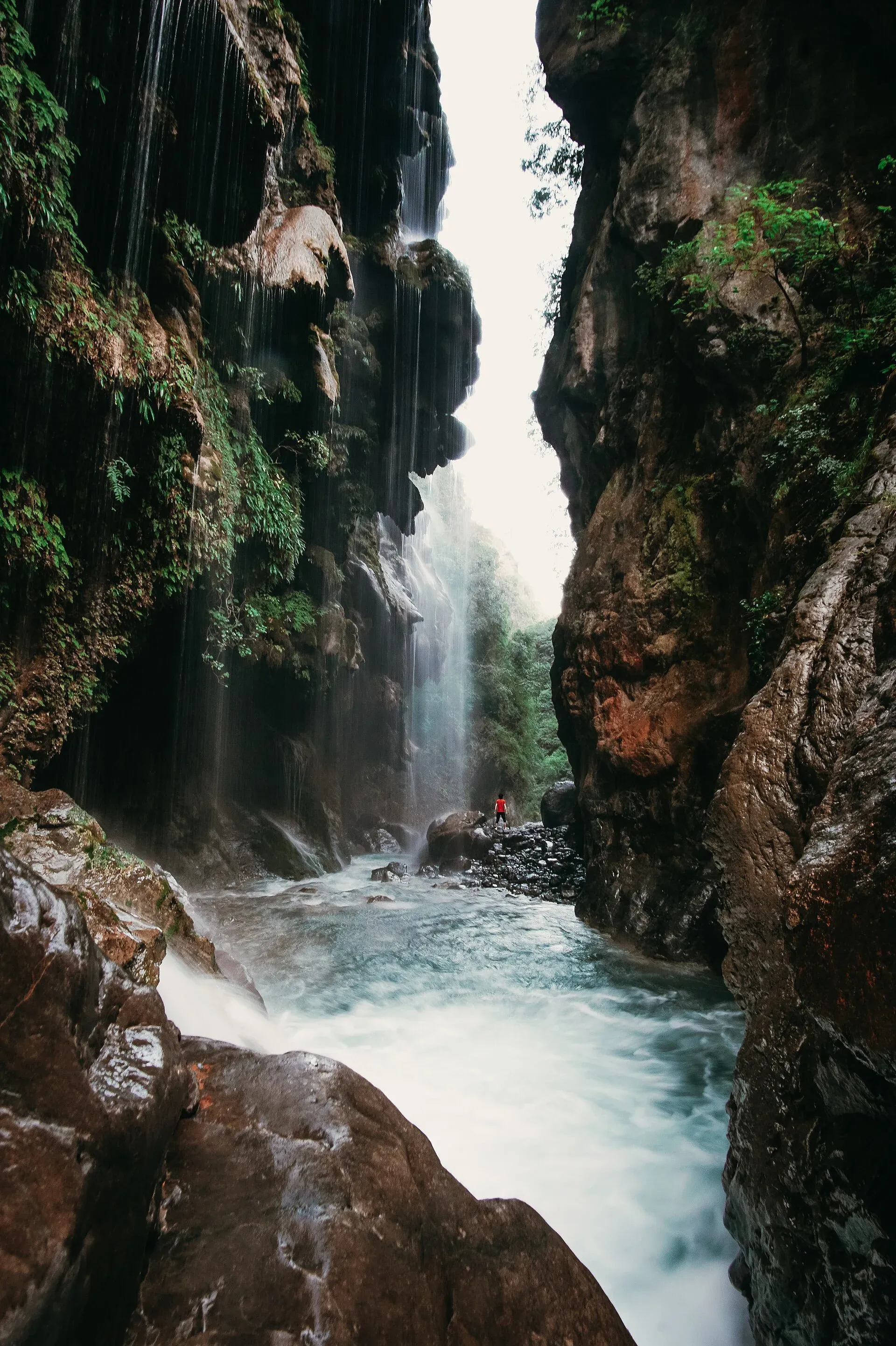
Photo: Danishshaukat10, with thanks · CC BY-SA 4.0 · via Wikimedia Commons · temporary stand-in photo
Umbrella Waterfall
A recently popular waterfall in the Sajikot area of Havelian tehsil, Abbottabad district, reached on foot from a nearby village. Locations in the inventory (Murree) were wrong.
Overview
Umbrella Waterfall is in the Sajikot area of Havelian tehsil, Abbottabad district, Khyber Pakhtunkhwa. It is not near Murree or Kotli Sattian, although some lists place it in Punjab. Wikipedia describes it as a tourist attraction that has emerged relatively recently, and Associated Press of Pakistan describes the Sajikot area as about 120 km from Islamabad. The name refers to the way the water fans out over the rock. No source gives a height.
Plan your visit
- Nearest town
- Havelian
- Getting there
Leave the Hazara Motorway at Shah Maqsood, drive to Havelian and follow the road towards Sajikot, then on to Poona village and walk to the falls. Wikipedia gives about 27 km from Havelian; More
Best months
Jun – Sep
- Umbrella Waterfall
- Related place nearby: Abbottabad
Getting there
Visitors from Islamabad leave the Hazara Motorway at the Shah Maqsood interchange, head for Havelian and follow the road towards Sajikot. One guide says the drive from Havelian to Sajikot Falls takes about 40 minutes, and that Poona village is a further ten minutes or so by road beyond them. The same guide describes the last stretch as steep and in poor condition, and mentions other approaches from Pir Sohawa or via Nathiagali.
Distances differ. Wikipedia gives about 27 km from Havelian. The OSRM routing service gives about 51 km and 63 minutes by road to the map position (estimate, checked 16 November 2026). Treat both as indicative and check a live map.
The walk
The trail starts from Poona village or from a mosque and bazaar area near Sajikot, where vehicles can be left. Guides give very different walking times, from about 10 minutes up to 45 minutes. One guide gives 30 to 45 minutes from Poona, or 35 to 40 minutes from the bazaar, and an approach of roughly 800 m. Plan for the longer figure.
The same guide says the climb is manageable and the return is harder. It describes two ways down to the water: a steeper route that ends with a rope descent, and a gentler route suited to families. The path is rocky and slippery after rain, so wear shoes with grip.
What to see
- The fall. Clear water runs between large rocks and spreads over the rock face in thin curtains, which gives the name. Travel guides describe a wide fall into a shallow pool.
- Sajikot Waterfall. The better-known fall is about 4 km away by one guide's account, and part of it can be seen from here. It has its own page, Sajikot Waterfall.
- Village stalls. The guide lists shops and cafes near the falls serving tea and pakoras (fried fritters), and horses for hire on the path. A porter can carry bags.
When to visit
There is no known official season. The flow is strongest in the monsoon (July and August) and after rain, and weaker in the dry months. Winter is cold; summer temperatures are moderate. Avoid visiting during or just after heavy rain, when the road and trail are at their worst.
Where to stay and eat
Stay in Havelian or Abbottabad. There is no official facility list. Tea and snacks are sold near the falls; bring water and food for a longer visit.
Good to know
- Safety. One guide strongly discourages swimming because of reported drownings, and the nearby Sajikot falls had a bathing ban in 2019 after visitors were swept away (The Express Tribune, 30 July 2019). Stay out of the water.
- Fees. No official fee information found; current fees will be added soon.
- Etiquette. Take rubbish home and respect village land and paths.
- Travel advice. For foreign visitors: the UK FCDO page (updated 27 October 2026, checked 16 November 2026) does not name Abbottabad, but lists other Khyber Pakhtunkhwa districts. Read it before you go.
Highlights
- Wide, umbrella-shaped fall in the Sajikot area
- Walk from Poona village; guides give 10 to 45 minutes
- Two ways down: a steep route with a rope, and a gentler one
- Near Sajikot Waterfall, about 4 km away
Tips
- Treat swimming as unsafe; drownings are reported in this area
- Use a local guide or a live map to find the trailhead
- Wear grippy shoes; the path is rocky
- Leave early so you are out before dark
Photos we still need: the trail from Poona to the fall; the village and path approach. Send us yours
Sources and last checked
Last checked Confidence low5 sources5 still to check
- Last checked
- Method
- Desk research from published sources
- Confidence
- low
- Checked by
- trek.pk research team
Researched from published sources; not yet checked on the ground by our team. Spot something out of date? Report a mistake.
Sources
- Umbrella Waterfall · Wikipedia · checked
- Umbrella Waterfall, Sajikot (location and hike) · Pakistan Traveler · checked
- Bathing banned at Sajikot waterfall · The Express Tribune · checked
- OSRM demo routing service (driving routes) · Project OSRM · checked
- Pakistan travel advice: warnings and insurance · UK Foreign, Commonwealth & Development Office · checked
Still to be checked on the ground (5)
- Exact location and trailhead (Wikipedia pin 33.9958, 73.2952 matches the page; trailhead unconfirmed)
- Walking time (10 to 45 minutes in blogs)
- Height (no source)
- Distance from Havelian (Wikipedia 27 km; OSRM 51 km)
- Whether swimming at Umbrella Waterfall is formally banned (the 2019 ban was at Sajikot falls only)

