

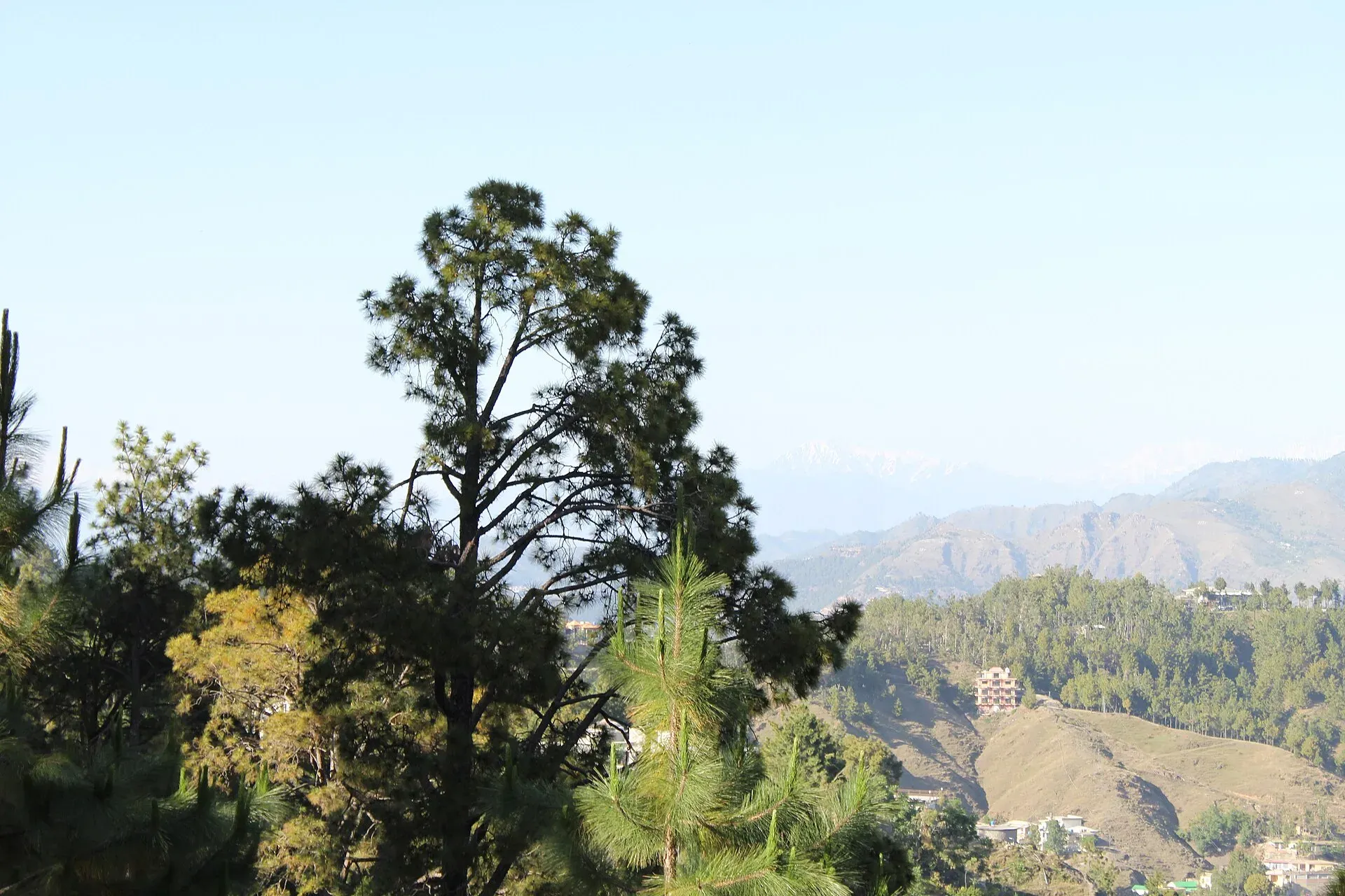
Photo: Malik Sohail Nawaz, with thanks · CC BY-SA 4.0 · via Wikimedia Commons · temporary stand-in photo

Abbottabad
A cool, green cantonment city at about 1,256 m in Hazara, the military academy town and the main gateway to Nathia Gali, Thandiani, Ayubia National Park and the Kaghan Valley.
Overview
Abbottabad is the capital of Hazara Division and Abbottabad District in Khyber Pakhtunkhwa. James Abbott, a British officer, founded it in January 1853, and the name means Abbott's town. It sits at about 1,256 m in pine-covered hills, roughly 120 km north of Islamabad and Rawalpindi. The Pakistan Military Academy at Kakul, about 8 km north-east, and many schools and colleges give the city a smart, disciplined feel.
At the 2023 census Abbottabad had 234,395 people, made up of 159,683 in the cantonment and 74,712 in the municipal committee (Wikipedia, citing the Pakistan Bureau of Statistics). The most widely spoken language is Hindko (75 per cent of urban Abbottabad Tehsil in 2023), followed by Pashto (14 per cent) and Urdu (5 per cent).
Plan your visit
- Getting there
Road: KKH (N-35) from Islamabad, about 106 km (about 1 hour 25 minutes); the Hazara Motorway (M-15) covers part of the route. More
Best months
Apr – Jun, Sep – Oct
- Abbottabad
- Related places nearby: Islamabad, Ayubia National Park, Havelian, Nathia Gali, Thandiani, Mansehra, Shimla Hill (Abbottabad), Sajikot Waterfall
History in brief
Before British rule the area was part of the Durrani Empire and, from 1820, the Sikh Empire. James Abbott, deputy commissioner of Hazara, founded the town in January 1853 and it replaced Haripur as the district headquarters. It grew as a military cantonment and hill sanatorium, with a population of 4,189 in 1881, 11,506 in 1911 and 27,424 in 1941 (Wikipedia). The North-West Frontier Province was created in 1901, and the province was renamed Khyber Pakhtunkhwa in 2010. The 2005 Kashmir earthquake damaged many older buildings, and the city later took in displaced people from Azad Kashmir, Swat and Waziristan.
What to see and do
- Shimla Hill: a hilltop park with views over the city, popular in the evening.
- Ilyasi Masjid: a mosque in Nawan Shehr built around 1927 to 1932 by a small stream below a hill.
- St Luke's Church: a colonial church dating from 1864.
- Lady Garden Park: a small public garden with a marble plaque carrying Abbott's poem about the town.
- Abbott Museum and Old Tehsil Building: reminders of the colonial town.
- Pakistan Military Academy, Kakul: viewing is by permission only. Ask locally about visiting rules.
Wikipedia also lists Abbott House, the Catholic church and the Old Tehsil Building among colonial-era landmarks. Most visitors use Abbottabad as a base for the hills rather than for the city itself.
Schools and colleges
The district administration calls Abbottabad a city of schools and colleges. Besides the Pakistan Military Academy, Wikipedia lists Ayub Medical College (opened in 1979), a COMSATS University campus and a UET Peshawar campus (opened in 2002), as well as long-established schools such as Army Burn Hall College and Abbottabad Public School.
Food and bazaars
The main bazaars are in the town centre and cantonment area, with shops for dry fruit, woollens, kitchenware and daily needs. Local food draws on Hindko and Pashtun cooking: grilled meats, rice dishes and strong tea. Walnuts, honey and dry fruit make good gifts. Wikivoyage names the Nawansheher bazaar, pakoras and fish near Ilyasi Masjid, Qalandarabad kebabs and pulao opposite AMC as local favourites. Ask your hotel for current good places to eat.
Getting there and around
- Road: the usual route is the Karakoram Highway (N-35) from Islamabad and Rawalpindi. The Hazara Motorway (M-15) runs from near Hasan Abdal past Havelian, Abbottabad and Mansehra to Thakot, and shortens the journey (Wikipedia describes the Abbottabad section and the Shimla tunnel link inconsistently, so check the current exit before you travel). Islamabad is about 106 km and roughly 1 hour 25 minutes by road (OSRM, checked 16 November 2026).
- Rail: the nearest station is Havelian, about 16 km south, where the line ends. Wikivoyage says no trains run to Abbottabad itself. Check that passenger trains are running before relying on it.
- Air: no airport. Use Islamabad.
- Around town: rickshaws and taxis. For the hills, hire a car with a driver or take a shared van.
Where to stay
Stay in the cantonment and main road area for hotels with parking and easy access to the main road, or choose a guesthouse in the Galyat hills (Nathia Gali, Ayubia) for cool air and forest walks. Rooms in the hills sell out in June to August, so book ahead.
Day trips
- Thandiani: a hill resort about 25 to 38 km north-east (sources vary) at roughly 2,750 m, with views of distant peaks. The houses and camping ground are used mainly in the summer months.
- Nathia Gali and Ayubia National Park: about 32 to 34 km away (Wikipedia and Wikivoyage). The national park was declared in 1984 and covers about 3,375 ha, with forest walks and pipeline tracks.
- Mansehra: about 25 km north, with the 3rd-century BCE Ashoka rock edicts in Kharosthi script on a rocky hill by the highway. The site is on Pakistan's tentative World Heritage list.
- Kaghan Valley: the road north from Mansehra leads to Balakot and Naran.
- Sajikot Waterfall: a waterfall near Havelian.
One or two days
A short stay can follow this outline, built only from the sights on this page. In the morning, walk up Shimla Hill for the view over the city, then see St Luke's Church, Lady Garden Park and the Abbott Museum area. Eat in the Nawan Shehr bazaar and visit Ilyasi Masjid. On a second day, take the road to Nathia Gali and Ayubia for the pipeline track, or to Thandiani for the high viewpoints.
When to visit
April to June and September to October are pleasant. Wikipedia gives a mean daily maximum of about 21.6 degrees C over the year, with June the warmest month (about 24 degrees C) and January the coolest (about 5 degrees C). July and August bring heavy monsoon rain (the annual average is about 1,532 mm). Winters are cold and sometimes snowy in the hills. The peak season is June to August, when traffic and prices rise.
Good to know
Walking is the main way of getting around town, accounting for 64 per cent of urban trips according to Wikipedia. Roads can be busy and landslides occur in the rainy season. Check road and weather conditions before heading to the hills.
Highlights
- Gateway to Nathia Gali, Thandiani and Ayubia National Park
- Shimla Hill views and colonial landmarks
- Mansehra Ashoka rock edicts nearby
- Starting point for the Kaghan Valley
Hotels, food, fuel and services in Abbottabad
Places to stay
- Hotel One AbbottabadCall Hotel One AbbottabadMap of Hotel One Abbottabad in Google Maps
- Hotel SarbanCall Hotel SarbanMap of Hotel Sarban in Google Maps
- The Point by Roomy, ThandianiCall The Point by Roomy, ThandianiMap of The Point by Roomy, Thandiani in Google Maps
- Triple One Hotel SuitesCall Triple One Hotel SuitesMap of Triple One Hotel Suites in Google Maps
- Tulip Guest HouseCall Tulip Guest HouseMap of Tulip Guest House in Google Maps
- Siran Valley Hotel (Guest house)Call Siran Valley Hotel (Guest house)Map of Siran Valley Hotel (Guest house) in Google Maps
Places to eat
- KFC | AbbottabadCall KFC | AbbottabadMap of KFC | Abbottabad in Google Maps
- Food PlanetCall Food PlanetMap of Food Planet in Google Maps
- Flame On Jadoon PlazaCall Flame On Jadoon PlazaMap of Flame On Jadoon Plaza in Google Maps
- MNAK Restaurant AbbottabadCall MNAK Restaurant AbbottabadMap of MNAK Restaurant Abbottabad in Google Maps
- CrunchiousCall CrunchiousMap of Crunchious in Google Maps
- deMinister Cafe, AbbottabadCall deMinister Cafe, AbbottabadMap of deMinister Cafe, Abbottabad in Google Maps
Essential services fuel stations, mechanics, ATMs, banks, pharmacies and hospitals and clinics
Fuel
- ShellCall ShellMap of Shell in Google Maps
- PSO ROYAL STAR FILLING STATIONCall PSO ROYAL STAR FILLING STATIONMap of PSO ROYAL STAR FILLING STATION in Google Maps
- Chanar CNG Station QalandarabadMap of Chanar CNG Station Qalandarabad in Google Maps
- Goharabad PSO PumpMap of Goharabad PSO Pump in Google Maps
- Valley CNG stationCall Valley CNG stationMap of Valley CNG station in Google Maps
- Yasrab CNGCall Yasrab CNGMap of Yasrab CNG in Google Maps
Mechanics and tyre shops
- Al Azizia Auto workshopCall Al Azizia Auto workshopMap of Al Azizia Auto workshop in Google Maps
- Khan Honda Center Qalandar Abad خان ھنڈا سنٹر قلندرآبادCall Khan Honda Center Qalandar Abad خان ھنڈا سنٹر قلندرآبادMap of Khan Honda Center Qalandar Abad خان ھنڈا سنٹر قلندرآباد in Google Maps
ATMs
- National Bank of Pakistan (NBP) Mirpur/Mandian BranchCall National Bank of Pakistan (NBP) Mirpur/Mandian BranchMap of National Bank of Pakistan (NBP) Mirpur/Mandian Branch in Google Maps
- United Bank LimitedMap of United Bank Limited in Google Maps
- The Bank of KhyberCall The Bank of KhyberMap of The Bank of Khyber in Google Maps
- Bank AlfalahCall Bank AlfalahMap of Bank Alfalah in Google Maps
Banks and money exchange
- Telenor Microfinance BankMap of Telenor Microfinance Bank in Google Maps
- Allied Bank LtdCall Allied Bank LtdMap of Allied Bank Ltd in Google Maps
- Allied BankCall Allied BankMap of Allied Bank in Google Maps
Pharmacies
- Qureshi Brothers Chemists and DruggistCall Qureshi Brothers Chemists and DruggistMap of Qureshi Brothers Chemists and Druggist in Google Maps
- Nighat Medical CenterCall Nighat Medical CenterMap of Nighat Medical Center in Google Maps
Hospitals and clinics
- Valley Medical ComplexCall Valley Medical ComplexMap of Valley Medical Complex in Google Maps
- Shifa Physiotherapy ClinicCall Shifa Physiotherapy ClinicMap of Shifa Physiotherapy Clinic in Google Maps
- Rehmat Memorial Post Graduate Dental HospitalCall Rehmat Memorial Post Graduate Dental HospitalMap of Rehmat Memorial Post Graduate Dental Hospital in Google Maps
- Qureshi Dental ClinicCall Qureshi Dental ClinicMap of Qureshi Dental Clinic in Google Maps
- Dr. Ruqqia SultanaCall Dr. Ruqqia SultanaMap of Dr. Ruqqia Sultana in Google Maps
- Elite International Hospital AbbottabadCall Elite International Hospital AbbottabadMap of Elite International Hospital Abbottabad in Google Maps
Listings come from Google Maps data and are unverified: phone numbers, opening months and prices may have changed. Report a problem · Own one of these? Claim it
Tips
- Travel in April to June or September to October to avoid monsoon rain and summer crowds.
- Book hill-resort rooms early for June to August.
- Check road and weather conditions before heading to Thandiani.
- Use Islamabad for flights; there is no airport here.
Photos we still need: Ilyasi Masjid, St Luke's Church and the Nawan Shehr bazaar. Send us yours
Sources and last checked
Last checked Confidence medium8 sources2 still to check
- Last checked
- Method
- Desk research from published sources
- Confidence
- medium
- Checked by
- trek.pk research team
Researched from published sources; not yet checked on the ground by our team. Spot something out of date? Report a mistake.
Sources
- Abbottabad · Wikipedia · checked
- Thandiani · Wikipedia · checked
- Mansehra Rock Edicts · Wikipedia · checked
- Hazara Motorway · Wikipedia · checked
- OSRM driving routes (road distances and times) · Project OSRM / OpenStreetMap · checked
- Havelian · Wikipedia · checked
- Nathia Gali · Wikipedia · checked
- Abbottabad · Wikivoyage · checked
Still to be checked on the ground (2)
- Whether the M-15 exit and Shimla tunnel link reach Abbottabad itself today (Wikipedia is inconsistent)
- Whether Havelian passenger trains run now (Wikipedia and Wikivoyage give no current timetable)
Nearby and related

Islamabad
Pakistan's green, planned capital at the foot of the Margalla Hills: Faisal Mosque, hillside trails, cafes and the gateway to the north.

Ayubia National Park
A cool pine and fir forest park in the Galyat hills above Abbottabad, with the Pipeline Track, a chairlift, leopards and many birds. Established 1984, about 33 square kilometres.
Havelian
A town on the Dor River in Abbottabad District, on the Karakoram Highway, and the last railway station before the northern hills. Gateway to Sajikot Waterfall.

Nathia Gali
A pine-forest hill station at about 2,410 m in the Galyat hills, with a wooden colonial church, walks to Miranjani and Mukeshpuri, and snow from December to February. Roads often close in heavy snow.

Thandiani
A thickly forested hill station at about 2,750 m above Abbottabad, started by British missionaries and a sanatorium. Snow can close the road for days, so check conditions in winter.

Mansehra
The headquarters of Mansehra District in Hazara, famous for the Ashoka rock edicts near the city. A big market town and the usual stop before Balakot, Naran and the Karakoram Highway.

Shimla Hill (Abbottabad)
A hill park above Abbottabad city, used as an easy evening viewpoint over the valley. A redevelopment plan was reported in 2025.

Sajikot Waterfall
A plunge-pool waterfall of about 61 m in Havelian tehsil, Abbottabad district, and a popular summer picnic spot. Bathing was banned in 2019 after visitors were swept away.

Kaghan Valley (with Naran)
A 155 km Himalayan valley above Balakot along the Kunhar River, with Shogran, Naran, Saiful Muluk and Lulusar lakes, and the road to Babusar Pass. Open mainly from May to October.
Galyat Pine Forests
The conifer and mixed forests of the Galyat hills between Murree and Abbottabad: pine, fir and oak at 2,000 to 2,400 m, with Ayubia National Park and a UNESCO biosphere reserve.