

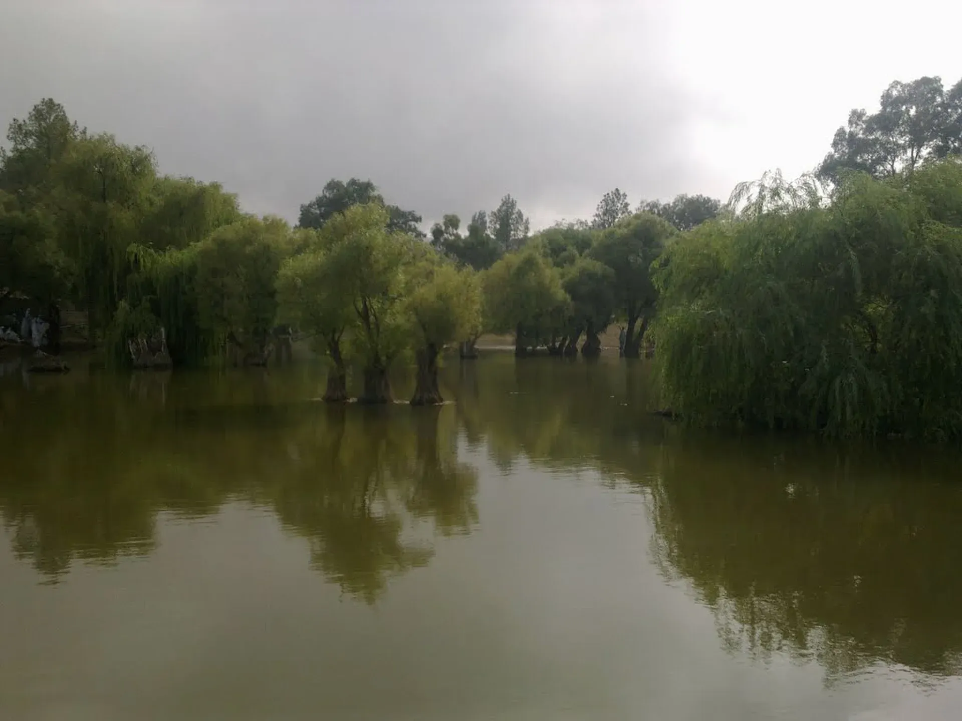
Photo: Younis khosa, with thanks · CC BY-SA 3.0 · via Wikimedia Commons · temporary stand-in photo

Fort Munro
A two-day road trip from Multan to Fort Munro, a cool hill station on the Sulaiman range, via Dera Ghazi Khan: 181 km one way. For foreign visitors: the UK FCDO currently advises against all but essential travel to Dera Ghazi Khan district.
Customise this route Change the dates, stops and how you travel in the Road Trip Planner.
Overview
Fort Munro is a small hill station in Dera Ghazi Khan district, on the Punjab-Balochistan border in the Sulaiman Mountains. The British founded it in 1866 as a summer retreat from the heat of the plains and named it after Colonel Andrew Aldcorn Munro; it was earlier known as Tuman Leghari (Wikipedia). Sources disagree on its height. The Dera Ghazi Khan district website gives 6,470 ft (about 1,970 m), which we use; Wikipedia gives 1,800 m, 1,970 m and 2,180 m in different places.
Who it suits
People based in Multan or Dera Ghazi Khan who want a cooler day or night in summer. The road is paved but long and winding, so it is better by car than motorbike. It is not a trip for a first visit to Pakistan.
Read this first: current advice
For foreign visitors: the UK FCDO advice, updated 27 October 2026 and checked on 16 November 2026, advises against all but essential travel to Dera Ghazi Khan in Punjab. Fort Munro lies in that district, close to Balochistan. Read the advice again before you plan and ask the district administration or Punjab Police for the current position. This page does not say the road is safe.
Recent dated reports add to that caution. Dunya News reported on 1 February 2026 that all routes from Punjab to Balochistan through Dera Ghazi Khan, including the Fort Munro route, were closed "until further notice" for security reasons; there is no known later report saying whether this was lifted. Dawn reported on 9 April 2026 that a Safe City project (cameras and a control room) was approved for Fort Munro and the steel bridge on the road to it. The Express Tribune reported on 1 June 2026 that a visitor was shot dead after a quarrel with local people at Anari Hill, Fort Munro.
When to go
Fort Munro began as a summer escape from the heat of the plains, so May to September is the main season. The Dera Ghazi Khan district page describes the climate as cool and pleasant in summer and extremely cold and harsh in winter, with about 10.7 inches (about 270 mm) of rain a year. Plan on warm clothes at night even in the season.
The route
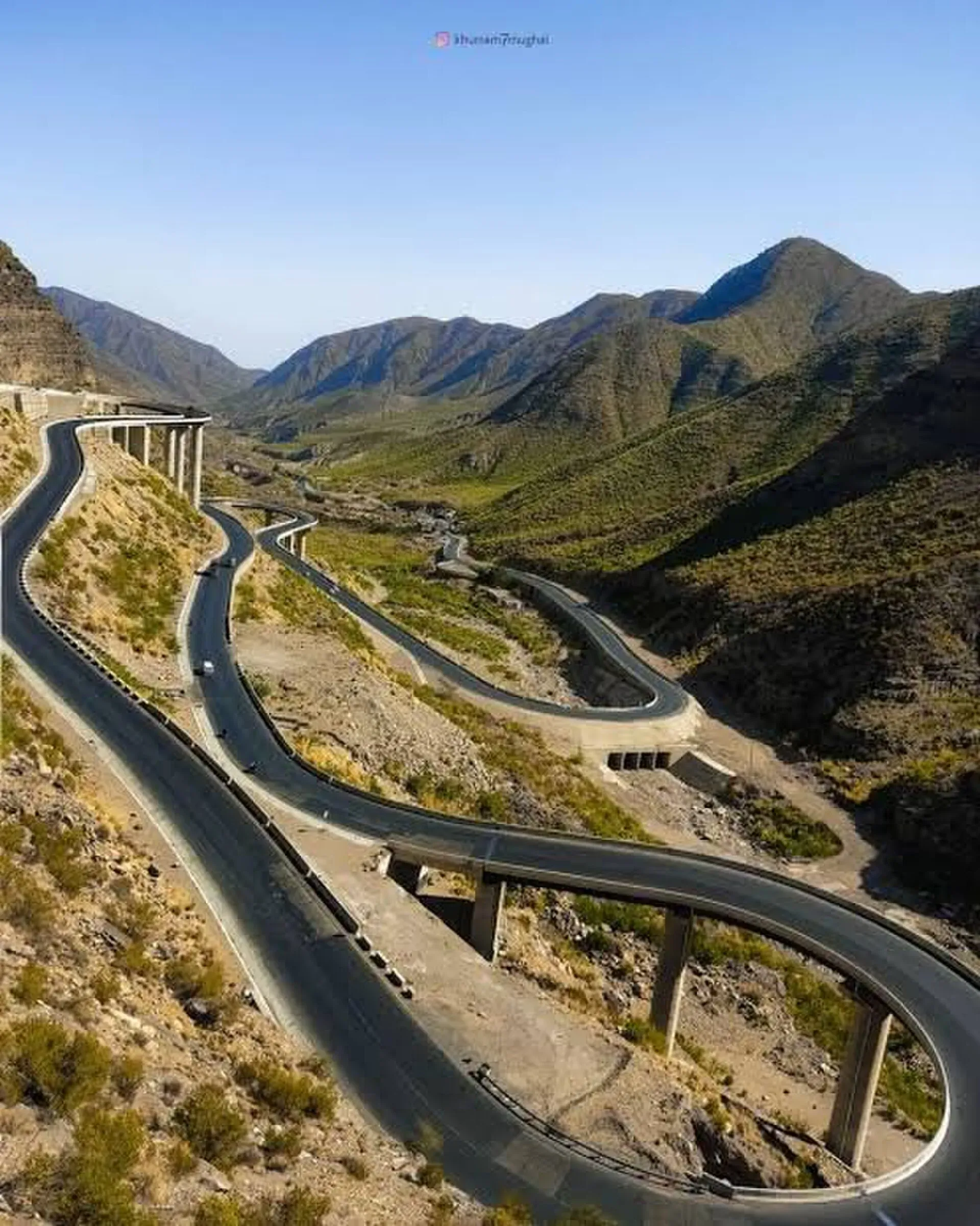
Photo: Leghari, with thanks · CC BY 4.0 · via Wikimedia Commons · temporary stand-in photo

Distances are from OSRM / OpenStreetMap, measured 16 November 2026. Times are driving only, without stops.
- Multan to Dera Ghazi Khan: 98 km, about 1 hour 35 minutes.
- Dera Ghazi Khan to Fort Munro: 87 km, about 1 hour 30 minutes. The road climbs steadily; the last section has bends and steep drops.
- Multan to Fort Munro, direct: 181 km, about 3 hours.
The road is the N-70 (Multan to Qila Saifullah via Dera Ghazi Khan and Loralai), which passes Fort Munro after the Girdu Pass (Wikipedia; OpenStreetMap names it the Multan - Qila Saifullah Highway). Fort Munro is also reachable from Loralai in Balochistan, but this page covers the Punjab approach. A chairlift and cable car at Fort Munro have been proposed for years; Wikipedia says the Punjab government released Rs2 billion in July 2015 for the hill station, including Rs750 million for a chairlift and cable car between Fort Munro and Khar. There is no known confirmation that one was built, so do not plan around it.
Stops on the way
Dera Ghazi Khan (km 98). Wikipedia says the city was founded at the end of the 15th century and named after Ghazi Khan, a Dodai chieftain, when Baloch tribes were invited to settle there. It sits at 123 m on the plain west of the Indus and had 494,464 people at the 2023 census, mostly Saraiki speakers. Summer highs average about 42 C. It is the last big town, so fuel and cash come first.
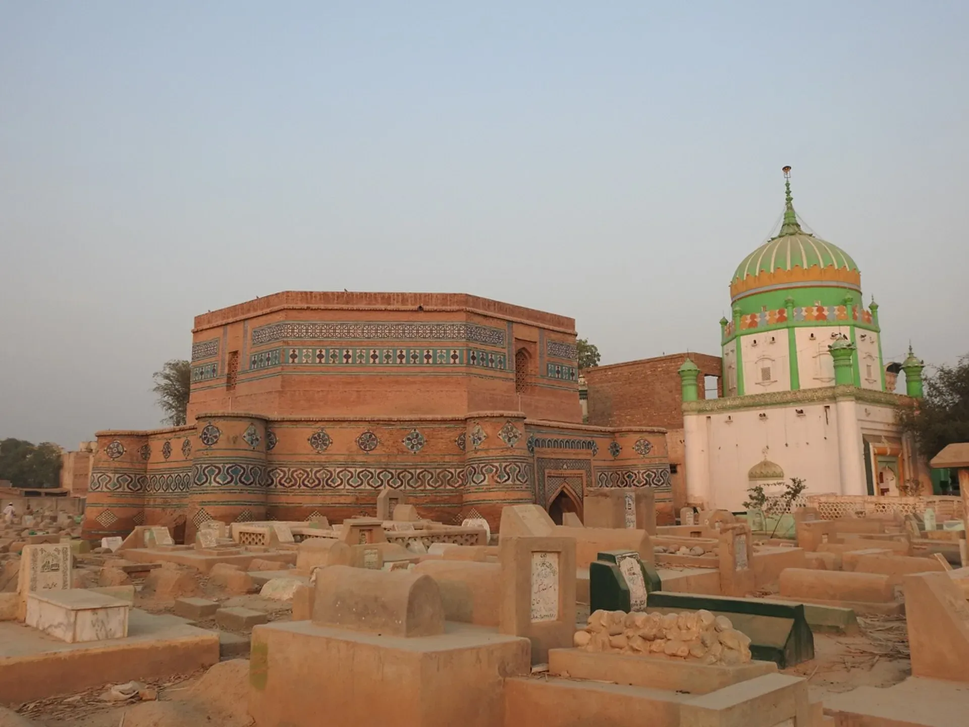
Photo: Amanasad83, with thanks · CC BY-SA 4.0 · via Wikimedia Commons · temporary stand-in photo

Sakhi Sarwar. A town about 35 km from Dera Ghazi Khan, at 284 m, near the shrine of the Sufi saint Syed Ahmad Sultan (Sakhi Sarwar). Wikipedia says the shrine was built in the 13th century and later expanded under Babur. The Sangh Mela, a fair held at Vaisakhi in March and April, has drawn pilgrims for centuries. This is a side stop rather than on the straight line of the road; confirm the route locally.
Girdu Pass. The N-70 climbs through the foothills and passes the Girdu Pass before Fort Munro.
On the hill
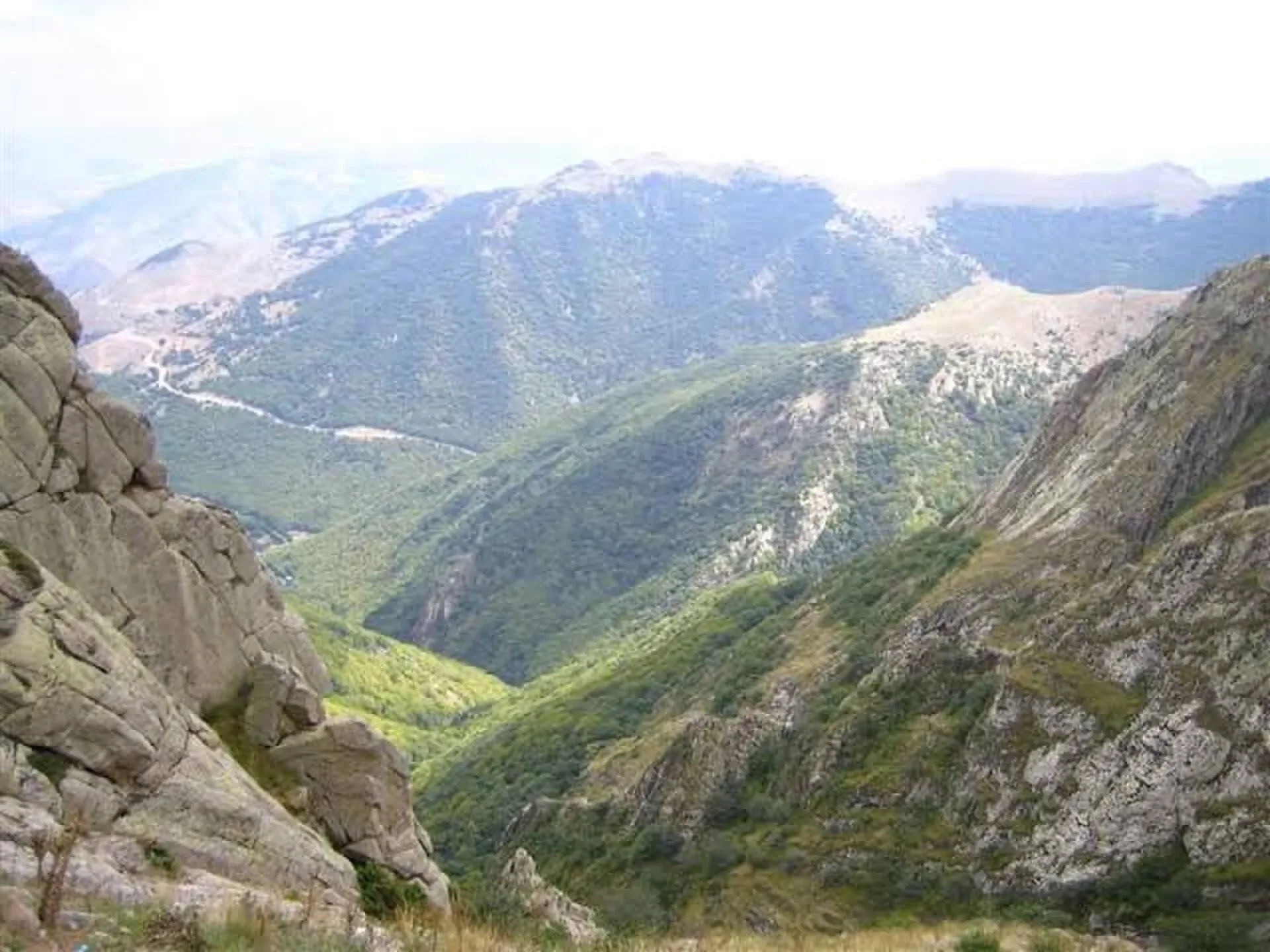
Photo: Leghari, with thanks · CC BY 4.0 · via Wikimedia Commons · temporary stand-in photo

Fort Munro is described as the only hill station of southern Punjab. Wikipedia lists Dames (Damis) Lake and the steel bridges on the approach, and three colonial buildings: Sandeman Lodge, the Commissioner's House and the District Commission Office, with a small Christian cemetery near it. The tops of Yakbai and Mubarki are said to rise above 2,000 m. Wikipedia says the local population is largely nomadic, especially of the Leghari tribe, and that Sulaiman range summits average 1,828 to 2,133 m. Takht-i Sulaiman (5,633 m) in the same range is a shrine visited each year by pilgrims. The district website says the hill was developed in 1869 by Sir Robert Sandeman, while Wikipedia gives a founding date of 1866, so the year differs by source. Juniper and edible pines grow in the north of the range and olives in the centre, with little growth in the south.
Practical information
Services are limited at Fort Munro itself. Fill your tank in Dera Ghazi Khan. Accommodation is basic; ask the Punjab tourism office or district administration for current official rest houses. Fees are not confirmed here; current fees will be added soon. Carry water and your CNIC.
Highlights
- Cool air above the plains
- Views over the Sulaiman range
- Colonial hill station founded in 1866
- Drive through the foothills from Dera Ghazi Khan
Stops
- Dera Ghazi KhanLast big town; fill up here
- Fort MunroHill station on the Sulaiman range
km: distance from the start along the route.
Numbers follow the stops in order. The map shows the stops, not the road itself.
Day by day
Day 1 · Multan to Fort Munro
Drive via Dera Ghazi Khan. Reach the hill by afternoon and walk the viewpoints.
Day 2 · Fort Munro and return
Spend the morning on the hill, then drive back to Dera Ghazi Khan and Multan in daylight.
Road conditions
- Multan to Dera Ghazi Khan: a regular highway, mostly flat.
- Dera Ghazi Khan to Fort Munro: a paved mountain road with bends and drops. There is no known dated report of the current surface; check locally.
- Seasons: hot plains in summer; check forecasts for rain and flash floods in streams along the road.
Fuel and services
Fuel, ATMs and hospitals at Multan and Dera Ghazi Khan. Very limited fuel and medical help at Fort Munro. Carry spare water and food.
Where to stay, eat and fuel up
Places to stay
- Hotel Crown Inn MultanCall Hotel Crown Inn MultanMap of Hotel Crown Inn Multan in Google Maps
- Kashif Fried Chicken & ResturentCall Kashif Fried Chicken & ResturentMap of Kashif Fried Chicken & Resturent in Google Maps
- Avari Boutique MultanCall Avari Boutique MultanMap of Avari Boutique Multan in Google Maps
- Arena by Pearl-ContinentalCall Arena by Pearl-ContinentalMap of Arena by Pearl-Continental in Google Maps
- Belmorris Hotels & ResortsCall Belmorris Hotels & ResortsMap of Belmorris Hotels & Resorts in Google Maps
- Hotel One DG KhanCall Hotel One DG KhanMap of Hotel One DG Khan in Google Maps
Places to eat
- The SicilianCall The SicilianMap of The Sicilian in Google Maps
- 14th Street Pizza Co. - MultanCall 14th Street Pizza Co. - MultanMap of 14th Street Pizza Co. - Multan in Google Maps
- KFCCall KFCMap of KFC in Google Maps
- Al Kaif MultanCall Al Kaif MultanMap of Al Kaif Multan in Google Maps
- McDonald'sCall McDonald'sMap of McDonald's in Google Maps
- Devour - GulgashtCall Devour - GulgashtMap of Devour - Gulgasht in Google Maps
Essential services fuel stations, mechanics, banks, pharmacies and hospitals and clinics
Fuel
- Wahid PSO Petrol Pump jangla walaCall Wahid PSO Petrol Pump jangla walaMap of Wahid PSO Petrol Pump jangla wala in Google Maps
- Nigana F/S Total ParcoCall Nigana F/S Total ParcoMap of Nigana F/S Total Parco in Google Maps
- HASCOL Petrol & CNG StationCall HASCOL Petrol & CNG StationMap of HASCOL Petrol & CNG Station in Google Maps
- Shell Petrol PumpCall Shell Petrol PumpMap of Shell Petrol Pump in Google Maps
- Polwel Hascol Petrol Pump MultanMap of Polwel Hascol Petrol Pump Multan in Google Maps
- Fit petroleumCall Fit petroleumMap of Fit petroleum in Google Maps
Mechanics and tyre shops
- Suzuki Fort Motors (KR)Call Suzuki Fort Motors (KR)Map of Suzuki Fort Motors (KR) in Google Maps
- Fine Cool Car AC and RepairsCall Fine Cool Car AC and RepairsMap of Fine Cool Car AC and Repairs in Google Maps
- Lucky Tyre Service Tyre shop MultanCall Lucky Tyre Service Tyre shop MultanMap of Lucky Tyre Service Tyre shop Multan in Google Maps
- Assembly Line Car WorkshopCall Assembly Line Car WorkshopMap of Assembly Line Car Workshop in Google Maps
- Mr Tyre MultanCall Mr Tyre MultanMap of Mr Tyre Multan in Google Maps
- Smart Motors WorkshopCall Smart Motors WorkshopMap of Smart Motors Workshop in Google Maps
Banks and money exchange
- State Bank Of Pakistan Regional Office MultanCall State Bank Of Pakistan Regional Office MultanMap of State Bank Of Pakistan Regional Office Multan in Google Maps
- Meezan Bank - MDA Chowk BranchCall Meezan Bank - MDA Chowk BranchMap of Meezan Bank - MDA Chowk Branch in Google Maps
- Standard chartered BankMap of Standard chartered Bank in Google Maps
Pharmacies
- Buch International HospitalCall Buch International HospitalMap of Buch International Hospital in Google Maps
- Clinix Bosan RoadCall Clinix Bosan RoadMap of Clinix Bosan Road in Google Maps
- United PharmacyCall United PharmacyMap of United Pharmacy in Google Maps
- Pillbox Plus PharmacyCall Pillbox Plus PharmacyMap of Pillbox Plus Pharmacy in Google Maps
Hospitals and clinics
- Well Being Diagnostic CentreCall Well Being Diagnostic CentreMap of Well Being Diagnostic Centre in Google Maps
- SN HealthcareMap of SN Healthcare in Google Maps
- Mukhtar A Sheikh Memorial Welfare HospitalCall Mukhtar A Sheikh Memorial Welfare HospitalMap of Mukhtar A Sheikh Memorial Welfare Hospital in Google Maps
- Strides Healthcare & Artificial LimbsCall Strides Healthcare & Artificial LimbsMap of Strides Healthcare & Artificial Limbs in Google Maps
- Pak Italian Modern Burn centerCall Pak Italian Modern Burn centerMap of Pak Italian Modern Burn center in Google Maps
- Bakhtawar Amin Memorial Trust Hospital MultanCall Bakhtawar Amin Memorial Trust Hospital MultanMap of Bakhtawar Amin Memorial Trust Hospital Multan in Google Maps
Listings come from Google Maps data and are unverified: phone numbers, opening months and prices may have changed. Report a problem · Own one of these? Claim it
Safety
- Government advice (checked 16 November 2026): the UK FCDO, updated 27 October 2026, advises against all but essential travel to Dera Ghazi Khan (Punjab).
- Route closure (Dunya News, 1 February 2026): all Punjab-Balochistan routes through Dera Ghazi Khan, including the Fort Munro route, were closed until further notice. There is no known report that this was lifted; ask Punjab Police before you set out.
- Recent incident (Express Tribune, 1 June 2026): a visitor was shot dead after a quarrel with local people at Anari Hill.
- Border area: Fort Munro is close to the Punjab-Balochistan border; ask local police about any restrictions.
- Daylight only: do not drive the hill road at night.
Tips
- Check the district security position before you travel.
- Fill up in Dera Ghazi Khan; services are thin on the hill.
- Travel in daylight and avoid driving at night.
- Carry your CNIC and water.
- Do not plan around a cable car; confirm locally if anything is open.
Photos we still need: the colonial buildings (Sandeman Lodge, Commissioner's House) at Fort Munro. Send us yours
Sources and last checked
Last checked Confidence low12 sources6 still to check
- Last checked
- Method
- Desk research from published sources
- Confidence
- low
- Checked by
- trek.pk research team
Researched from published sources; not yet checked on the ground by our team. Spot something out of date? Report a mistake.
Sources
- OSRM driving route service: distances and times measured 16 November 2026 (drive times are without stops) · OSRM / OpenStreetMap contributors · checked
- Pakistan Tourism Guide 2021 · Trade Development Authority of Pakistan (TDAP) · checked
- Fort Munro · Wikipedia · checked
- Work on Fort Munro cable car soon · Dawn · checked
- Pakistan travel advice: warnings and insurance (latest update 27 October 2026) · UK Foreign, Commonwealth and Development Office · checked
- Fort Munro (district page) · District Government Dera Ghazi Khan · checked
- N-70 National Highway · Wikipedia · checked
- Safe City project for Fort Munro · Dawn, 9 April 2026 · checked
- Tourist shot dead after dispute at Fort Munro · The Express Tribune, 1 June 2026 · checked
- All routes from Punjab to Balochistan closed in DG Khan · Dunya News, 1 February 2026 · checked
- Sakhi Sarwar · Wikipedia · checked
- Dera Ghazi Khan · Wikipedia · checked
Still to be checked on the ground (6)
- Whether the February 2026 closure of Punjab-Balochistan routes through Dera Ghazi Khan (including the Fort Munro route) has been lifted, and the current security position
- Whether any cable car, rest house or official campsite is open (a Rs750 million chairlift and cable car was funded in 2015; no report of it being built)
- Road surface on the final 40 km
- Routing point: Wikipedia's coordinate (29.9258 N, 69.9833 E) snaps to a road within 15 m in OSRM; re-run the Multan route (about 178 km from central Multan) with it
- Whether Sakhi Sarwar can be reached as a side stop and its distance from the N-70
- Founding year of the hill station (1866 Wikipedia, 1869 district website)