

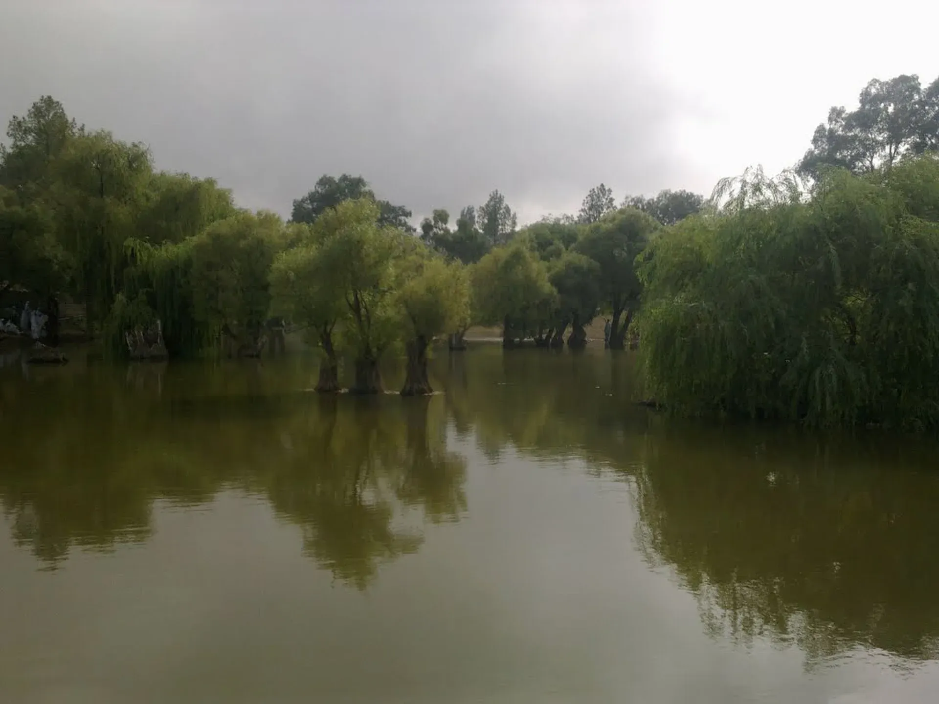
Photo: Younis khosa, with thanks · CC BY-SA 3.0 · via Wikimedia Commons · temporary stand-in photo

Fort Munro
Southern Punjab's only hill station, about 1,800 to 2,200 m in the Sulaiman Mountains above Dera Ghazi Khan, founded in 1866 as a summer base. UK advice is against all but essential travel to Dera Ghazi Khan.
Overview
Fort Munro is a hill station in Dera Ghazi Khan district, Punjab, on the Punjab to Balochistan border in the Sulaiman Mountains. It was founded in the 1860s (Wikipedia says 1866; the district government says 1869) by Sir Robert Groves Sandeman as a summer retreat and is named after Colonel (later Major-General) Andrew Aldcorn Munro, who served as Commissioner of the Derajat and Multan divisions. The area was previously known as Tuman Leghari. During British rule the Multan Commissioner used it as his hot-season headquarters, and Sandeman Lodge, the Commissioner's House and the District Commissioner's office were built here. Wikipedia gives conflicting heights of about 1,800 m, 1,970 m and 2,180 m, and Dawn (2003) and the Dera Ghazi Khan district government both give 6,470 feet (about 1,970 m), the figure used here.
Plan your visit
- Nearest town
- Dera Ghazi Khan
- Getting there
From Dera Ghazi Khan about 85 km, roughly 1 hour 30 minutes by OSRM (checked 16 November 2026); Dawn gave about 90 km. From Multan about 179 to 186 km, 3 hours. More
Best months
Apr – Jun, Sep – Oct
- Fort Munro
- Related place nearby: Dera Ghazi Khan
The Sulaiman Mountains
Fort Munro is in the Sulaiman range, which runs roughly 450 km south from the Gomal Pass towards Jacobabad. The range falls steeply to the Indus on its eastern face and slopes more gradually to the west. Summits average about 1,800 to 2,100 m, and the highest, Takht-i-Sulaiman (5,633 m), is a Muslim shrine visited by pilgrims (Takht-i-Sulaiman). Across the wider range, junipers and edible pines grow in the north and olives in the centre, with sparse cover in the south. The local population has long included nomadic Leghari families.
What to see and do
- Viewpoints. Yakbai Top and Mubarki Top are the best-known high points, above 2,000 m according to Wikipedia.
- Dames Lake and the steel bridges. Small, easy stops along the road.
- Colonial buildings. Sandeman Lodge and the commissioner's houses, plus a small Christian cemetery near the DCO house.
- Cool air. The main attraction is relief from the heat of the southern Punjab plains. The station is also known as a place where people go to recover from illness.
A chairlift and cable car at Fort Munro were proposed in 2003 and again in a 2015 provincial plan; there is no known source that either was built.
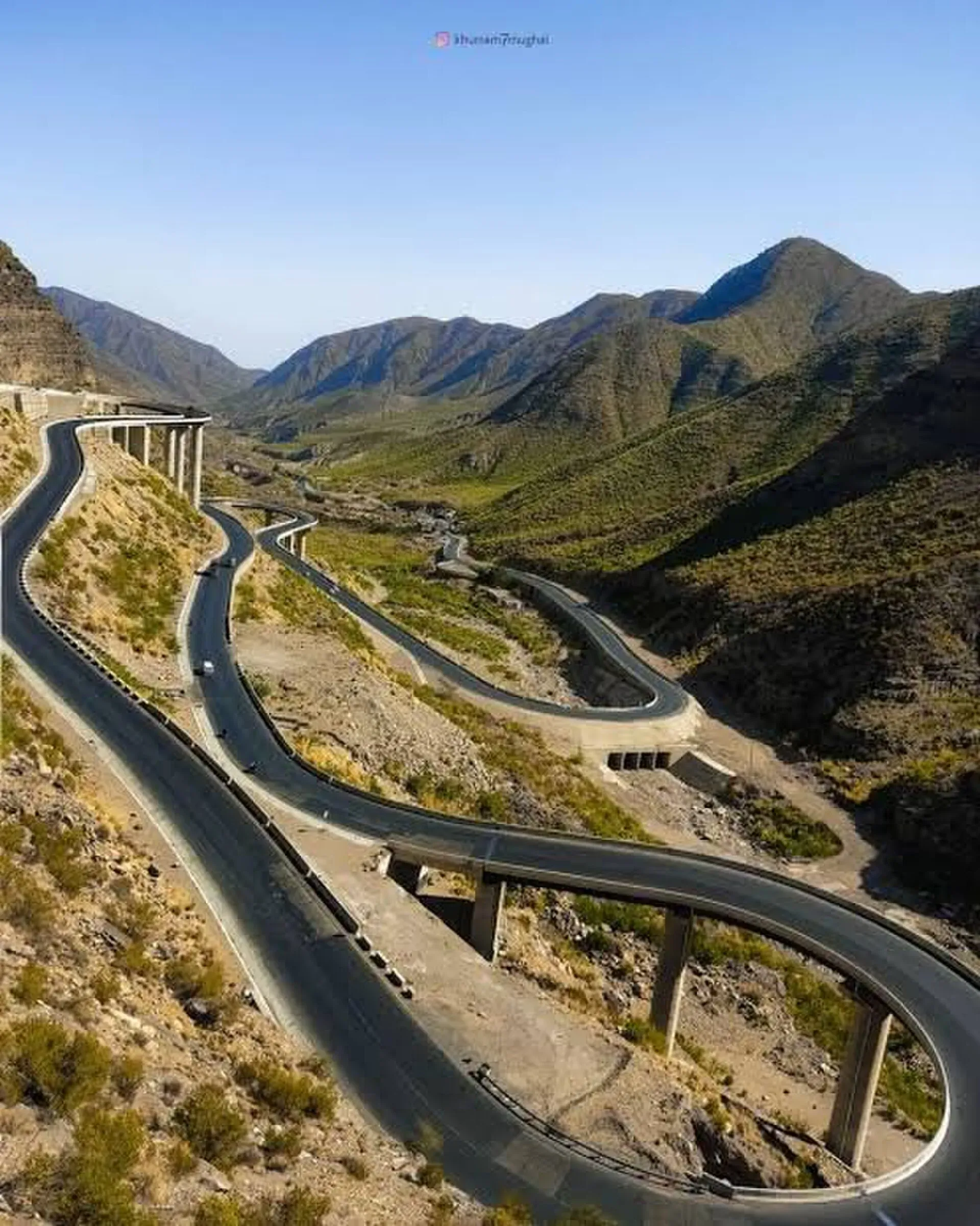
Photo: Leghari, with thanks · CC BY 4.0 · via Wikimedia Commons · temporary stand-in photo

Getting there and the road
Fort Munro is about 85 km from Dera Ghazi Khan and about 185 km from Multan. The road is the route towards Loralai in Balochistan, and the Sulaiman range begins near Rakhni, a provincial border post, on the western side. The climb from the plains is on a mountain road, so allow extra time after rain.
When to visit
Summer from April to September is the busy season; the plains below are very hot. Winter is cool and can be cold at night; there is no known source for snow here.
Safety and travel advice
Ask the district administration or local police about current conditions before you go. For foreign visitors: the UK FCDO (updated 27 October 2026, checked 16 November 2026) advises against all but essential travel to Dera Ghazi Khan (Fort Munro lies in the district of that name), and against all travel to Balochistan, which borders it. Check the live page for exact areas before planning, and ask locally about security on the Quetta road.
Where to stay and eat
Facilities are basic; a few guesthouses and tea stalls operate at the top. Bring water and food, as supply has long been limited: Dawn reported in 2003 that the town's water supply was inadequate.
Good to know
Travel from Dera Ghazi Khan is on a mountain road; drive carefully in rain and fog. There are no confirmed entry fees; current fees will be added soon.
Highlights
- Southern Punjab's only hill station
- Founded 1866 as a British summer headquarters
- Yakbai and Mubarki tops above 2,000 m
- Cool relief from the plains
Hotels, food, fuel and services in Fort Munro
Places to stay
- The Chieftain Hotel & RestaurantCall The Chieftain Hotel & RestaurantMap of The Chieftain Hotel & Restaurant in Google Maps
- Green Park Hotel (TDCP )Fort Monroe ResortCall Green Park Hotel (TDCP )Fort Monroe ResortMap of Green Park Hotel (TDCP )Fort Monroe Resort in Google Maps
- Hotel Diamond hillCall Hotel Diamond hillMap of Hotel Diamond hill in Google Maps
- Multan Hotel and RestaurantCall Multan Hotel and RestaurantMap of Multan Hotel and Restaurant in Google Maps
- Aiwane Khas Hotel ہوٹل اینڈ ریسٹورنٹ ایوان خاصCall Aiwane Khas Hotel ہوٹل اینڈ ریسٹورنٹ ایوان خاصMap of Aiwane Khas Hotel ہوٹل اینڈ ریسٹورنٹ ایوان خاص in Google Maps
- Park View HotelCall Park View HotelMap of Park View Hotel in Google Maps
Listings come from Google Maps data and are unverified: phone numbers, opening months and prices may have changed. Report a problem · Own one of these? Claim it
Tips
- Read the FCDO advice for Dera Ghazi Khan before you plan.
- Take water, food and warm clothes; services are limited.
- Check road and security with local officials.
Photos we still need: Sandeman Lodge or the colonial buildings; Yakbai Top or Mubarki Top viewpoint. Send us yours
Sources and last checked
Last checked Confidence low6 sources3 still to check
- Last checked
- Method
- Desk research from published sources
- Confidence
- low
- Checked by
- trek.pk research team
Researched from published sources; not yet checked on the ground by our team. Spot something out of date? Report a mistake.
Sources
- Fort Munro (Wikipedia) · Wikipedia · checked
- Fort Munro to be developed on pattern of Murree (21 July 2003) · Dawn · checked
- Pakistan travel advice (updated 27 October 2026) · UK Foreign, Commonwealth & Development Office · checked
- OSRM driving routes (distances and modelled times) · OSRM / OpenStreetMap · checked
- Fort Munro · District Government Dera Ghazi Khan · checked
- Safety and security, Pakistan travel advice · UK FCDO · checked
Still to be checked on the ground (3)
- Current facilities, water supply and road state (a 2015 plan promised Rs300m for water and new roads; no confirmation of delivery found)
- Whether any chairlift or cable car has been built (Wikipedia: Rs750m allocated in 2015 for a Fort Munro to Khar link; no completion reported in any source opened)
- Current security status (FCDO safety page says travellers need advance permission for Balochistan and describes regular attacks there; it does not name Dera Ghazi Khan, so check the live regional advice)
Nearby and related

Dera Ghazi Khan
Divisional city on the west bank of the Indus in south-west Punjab, in Saraiki and Baloch country, and the gateway to the cool hills of Fort Munro and the shrine town of Sakhi Sarwar.

Multan
The City of Saints in southern Punjab: blue-tiled Sufi shrines, a crowded old city, blue pottery, sohan halwa and mangoes.

Punjab
Pakistan's most populous province: Mughal Lahore, ancient Taxila and Harappa, Sufi shrines, the Salt Range, the Cholistan desert and the hills of Murree.