

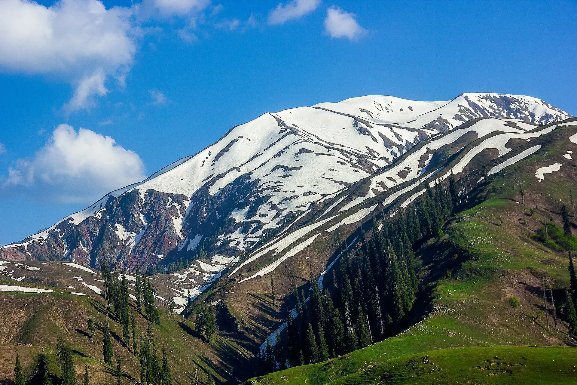
Photo: M.Awais, with thanks · CC BY-SA 4.0 · via Wikimedia Commons · temporary stand-in photo

Makra Peak Trail
- Duration
- 1 day
- Grade
- Strenuous
- Max altitude
- 3,885 m
- Season
- Jun – Sep
A steep hike from Paye above Shogran to Makra Peak (3,885 m) in the Kaghan Valley. About 4 hours up; storms and fog have caused deaths, so go in settled weather.
Overview
Makra Peak (3,885 m) lies on the edge of Kaghan Valley, on the border between Khyber Pakhtunkhwa and Azad Kashmir. The name means "spider" in Urdu. Wikipedia puts it almost 200 km from Islamabad on the Naran road, and OSRM agrees: about 171 km to Balakot and a further 30 km to Shogran, so about 200 km in all.
The hike starts at Paye (spelt Payee by Wikipedia), a meadow at the end of the jeep track above Shogran. It is a single-day climb with no technical sections. The effort comes from the height gain and from the weather: deaths on the mountain have mostly happened in storms and thick fog.
An old Himalayan Journal account from 1930 describes Makra as a survey station on the Kashmir and Kaghan boundary. Its writer camped just below the snow line on the southern slope, found the climb over snow "more arduous than difficult" and met a cornice near the top that blocked the view into Kaghan.
Who it suits
Fit hikers used to long climbs. Pakistan Traveler rates the route moderate to difficult and says that in summer a beginner with good fitness and some hiking experience can manage it. It advises people with breathing problems to avoid it. Winter, from December to March, is the hardest time because of snow and steep slopes.
When to go
June to September is the likely window. Snow lingers in spring and autumn. Start early so you are off the top before afternoon cloud and storms build. The mountain stays cool even in summer, so carry warm layers.
Getting to the start
The road to Shogran leaves the Kaghan road at Kiwai, which Pakistan Traveler puts about 62 km from Mansehra. From Kiwai a road climbs about 7 km to Shogran, a small resort with hotels (Pakistan Traveler gives 6 km in one place). Beyond Shogran the track keeps climbing, past Siri Lake, to Paye. Pakistan Traveler says jeeps can reach Siri, and Wikipedia has the track ending at Paye. Pakistan Traveler says ponies are available between Siri and the meadow base, a walk it puts at about 4 hours.
A second approach starts from the Azad Kashmir side. Pakistan Traveler describes about 35 km from Muzaffarabad to a base camp called Bheri, then a 5 to 6 hour climb. This page covers the Paye route only.
The route
From Paye the path climbs over grass and then steeper ground to the summit ridge. Wikipedia gives about 4 hours from Paye to the top; Pakistan Traveler gives 4 to 6 hours from Paye and 4 to 8 hours from the Siri and Paye meadows base, so allow for a slower day. No reliable distance is published.
Some sections are steep, and the path is hard to follow in fog. The top is a survey-station summit on the boundary ridge. In clear weather it looks across Kaghan on one side and towards Kashmir on the other. Pakistan Traveler names Malika Parbat, Chambra, Musa ka Musalla and Shingri among the peaks in view. Return by the same track.
Pakistan Traveler's sample plan for a two-day trip camps at the Paye base on the first day and sets out about 5 am on the second, returning to camp by about 4:30 pm. This is one operator's idea, not an official schedule.
Culture and people
Shogran is a small resort with hotels, and the Siri and Paye meadows are summer grazing and picnic areas. Local people use jeeps to reach Siri and Paye. Be respectful of farmland and animals, and take your rubbish down.
Practical information
- Jeeps are the normal way to reach Paye from Shogran.
- Carry water and food; none is on the climb.
- Mobile signal is patchy.
- Get a local guide if visibility is poor.
Highlights
- Summit at 3,885 m
- Views over Kaghan and Malika Parbat
- Meadows of Siri and Paye
- Starts from Shogran hill resort
Day by day
- StartPaye (above Shogran)
- Day 1Makra Peak and back
| Day | Route | Hours | Distance | Ascent / descent | Camp and altitude |
|---|---|---|---|---|---|
| Day 1 | Paye to Makra Peak and back | about 4 h up (4 to 8 quoted) | not given | not given | not given |
Day 1 notesLeave Paye early and climb over meadow and then steeper slopes towards the summit ridge. Take care with weather and turn back if fog or storm cloud builds. Spend a short time on the summit, then return the same way and plan to get back to Shogran before dark. | |||||
Getting there
Take the Kaghan road to Kiwai (about 4 to 5 hours from Islamabad by guide-book figures; OSRM gives about 2 hours 30 minutes of pure driving to Shogran, an estimate that ignores mountain road conditions), then 7 km uphill to Shogran. A jeep track runs past Siri Lake to Paye. Jeeps from Shogran are the usual way to reach the start. A second approach from Muzaffarabad, via a base camp called Bheri, is described by Pakistan Traveler but not covered here.
Permits and rules
- Permit needed
- Usually not, Open zone
- Fee
- Current fees will be added soon
- Last checked
- 16 November 2026
No official fee or permit was confirmed. Current fees will be added soon; check with local tourism officials in Shogran.
How trekking permits, NOCs and registration work: Visa and permits.
Season
Best: Jun – Sep
Water and camps
Carry water from Shogran. Camping near Siri and Paye is used by some groups, but there is no known official guidance.
Gear and safety
Weather
Fatalities have mostly happened in fog or storms. Do not climb if clouds are low or thunderstorms are forecast.
Steep ground
Some sections are steep and slippery; use sturdy boots.
Getting lost
Fog hides the path. Use a guide or GPS.
Altitude
The top is 3,885 m, so headaches are possible.
Ask the district administration or local police about current conditions before you go. For foreign visitors: the UK FCDO does not name the Kaghan valley, but it advises against all travel on the Karakoram Highway between Mansehra and Chilas (advice updated 27 October 2026, checked 16 November 2026). Most visitors reach Kaghan by the N-15 from Mansehra, not the KKH. Read the live advice before you plan.
Variations
Combine with the Siri and Paye meadows (half-day, easy). Pakistan Traveler also describes a two-day version with a night at Paye. Other Kaghan hikes include Ansoo, Dudipatsar and Saral lakes.
Tips
- Start before sunrise
- Turn back if fog or storm clouds build
- Take a local guide
- Carry warm and waterproof layers
Stay and eat in Shogran
Shogran is the nearest town to the trek: somewhere to sleep and stock up before and after.
Places to stay
- Lalazar Family ResortCall Lalazar Family ResortMap of Lalazar Family Resort in Google Maps
- Pine Park Hotel & Resort ShogranCall Pine Park Hotel & Resort ShogranMap of Pine Park Hotel & Resort Shogran in Google Maps
- The Spruce Resorts (Shogran)Call The Spruce Resorts (Shogran)Map of The Spruce Resorts (Shogran) in Google Maps
- Sharan Forest GlampingCall Sharan Forest GlampingMap of Sharan Forest Glamping in Google Maps
- Sharan Forest ResortCall Sharan Forest ResortMap of Sharan Forest Resort in Google Maps
- Ahsania Hotel & Restaurant Paras Kaghan valleyCall Ahsania Hotel & Restaurant Paras Kaghan valleyMap of Ahsania Hotel & Restaurant Paras Kaghan valley in Google Maps
Places to eat
- Kiwai KPKMap of Kiwai KPK in Google Maps
- Tourist Inn Hotel And ResturantCall Tourist Inn Hotel And ResturantMap of Tourist Inn Hotel And Resturant in Google Maps
- Abshar Foods HutMap of Abshar Foods Hut in Google Maps
Listings come from Google Maps data and are unverified: phone numbers, opening months and prices may have changed. Report a problem · Own one of these? Claim it
Health and emergency
Mobile signal is patchy on most treks, so tell someone your plan before you go. Emergency numbers
Sources and last checked
Last checked Confidence medium5 sources8 still to check
- Last checked
- Method
- Desk research from published sources
- Confidence
- medium
- Checked by
- trek.pk research team
Researched from published sources; not yet checked on the ground by our team. Spot something out of date? Report a mistake.
Sources
- Makra Peak · Wikipedia · checked
- Makra Peak in Kaghan · Pakistan Traveler · checked
- Pakistan treks and mountain ranges (trek.pk research report) · trek.pk research · checked
- OSRM driving route service: road distances and times measured 16 November 2026 (driving only, optimistic on mountain roads) · OSRM / OpenStreetMap contributors · checked
- The Kagan Valley (Himalayan Journal, vol. 2, 1930) · Himalayan Club · checked
Still to be checked on the ground (8)
- Altitude: Wikipedia gives 3,885 m (citing SummitPost); other pages give about 3,750 m, 3,586 m and 4,000 m. Kept 3,885 m; no official survey found
- Time up and down: Wikipedia says about 4 hours from Paye to the top; other pages say 2 to 8 hours depending on start and fitness
- Distance (not published)
- Season and snow conditions
- Permit or fee (none found in an official source)
- Kiwai to Shogran: 7 km (Wikipedia, Pakistan Traveler) or 6 km (Pakistan Traveler elsewhere)
- Whether the Muzaffarabad (Bheri) approach is in current use
- Path surface and any waymarking between Paye and the summit
Nearby and related

Ansoo Lake Trail

Siri Paye Hike from Shogran

Bashigram Lake Trail
Makra Peak
Makra Peak (3,885 m) is a popular trekking summit above Shogran and Siri-Paye in the Kaghan Valley, about four hours from Paye. Fatal accidents in fog and storms mean it needs care.

Shogran
A meadow hill station at about 2,362 m above Balakot in the Kaghan Valley, the start of the Siri and Paye meadows jeep trip. Landslides and snow can close the road; private cars may not go beyond Shogran.
Siri Paye Meadows
Twin meadows above Shogran in the Kaghan Valley, Siri and Paye, reached by a rough 4x4 track from Shogran and used as the base for the Makra Peak walk.