

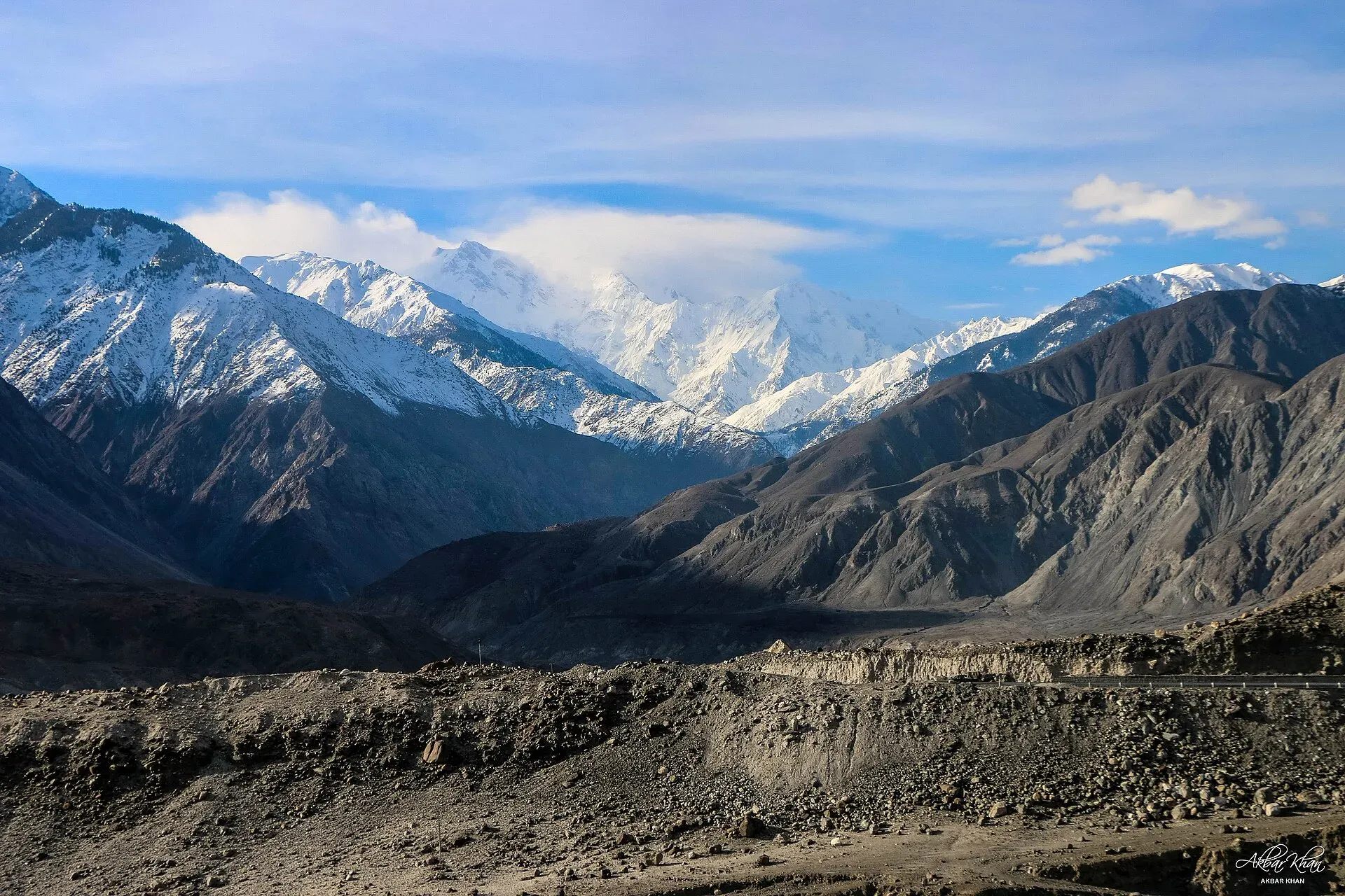
Photo: Akbar Khan Niazi, with thanks · CC BY-SA 4.0 · via Wikimedia Commons · temporary stand-in photo
Himalaya (western end)
Pakistan's share of the Himalaya is its western end: Nanga Parbat (8,126 m) and the high Deosai plateau, reached from Chilas, Astore and Skardu.
Overview
The Himalaya is the great range of South Asia, and Pakistan has its western tip. Here the range ends in a single, enormous mountain: Nanga Parbat, at 8,126 m the ninth highest on Earth and the westernmost of the great Himalayan peaks. To its east lies the Deosai plateau, a wide, high grassland.
The Pakistani Himalaya lies mainly in Gilgit-Baltistan, in the Diamer and Astore districts, with a further part in Azad Kashmir. We do not have a reliable length for the Pakistani portion, so this page does not give one.
Nanga Parbat
Nanga Parbat stands above a bend of the Indus. Its flanks are huge. The Rupal Face on the south side rises about 4,600 m from base to summit, among the tallest mountain faces in the world, while the Rakhiot flank climbs some 7,000 m above the Indus valley over about 25 km. The massif also includes the North Peak (7,816 m), Rakhiot Peak (7,070 m) and the long Mazeno Ridge.
Hermann Buhl made the first ascent on 3 July 1953, on a solo final push without bottled oxygen. The mountain is reportedly rising faster than any other, at about 7 mm a year.
Deosai
Deosai is a plateau between Skardu and Astore, averaging around 4,114 m. It is among the highest plateaus in the world. A national park was created in 1993 to protect the Himalayan brown bear; counts rose from 19 bears in 1993 to 78 in 2022. The park covers 358,400 hectares (about 3,584 square km), according to the Gilgit-Baltistan Forest, Wildlife and Environment Department. Dawn reported in December 2025 that the park is open to tourists from June to November each year; snow and road conditions are for the day, so check locally. Skardu Road Conditions (skardu.pk) says the Skardu-Deosai road is closed in winter and open in summer.
Treks and walks
- Fairy Meadows and Nanga Parbat Base Camp, from Raikot Bridge. This is the best-known walk in the range.
- Rupal valley, from Astore and Tarishing, with views of the Rupal Face.
- Mazeno La, a serious high-level crossing for experienced groups.
- Deosai and Sheosar Lake, reached from Skardu or Astore.
When to go
Plan for June to September. Deosai is best from July to mid-September. Outside summer, the plateau and high valleys are covered in snow.
Good to know
- Access, permits and local security rules change. Check with the Gilgit-Baltistan tourism department before you go.
- The Karakoram, Himalaya and Hindu Kush meet near Jaglot, south-east of Gilgit.
Geology
The western end of the Himalayan collision front. Nanga Parbat is still rising, at roughly 7 mm a year by one widely quoted figure.
Notable peaks
Sources and last checked
Last checked Confidence medium8 sources3 still to check
- Last checked
- Method
- Desk research from published sources
- Confidence
- medium
- Checked by
- trek.pk research team
Researched from published sources; not yet checked on the ground by our team. Spot something out of date? Report a mistake.
Sources
- Nanga Parbat · Wikipedia · checked
- Deosai National Park · Wikipedia · checked
- List of mountains in Pakistan · Wikipedia · checked
- Junction of three mountain ranges · Gilgit-Baltistan Tourism · checked
- Gilgit-Baltistan bans seasonal hotels in Deosai (18 December 2025) · Dawn · checked
- Sheosar Lake · Wikipedia · checked
- Skardu road conditions · skardu.pk · checked
- Deosai National Park · Forest, Wildlife and Environment Department, Government of Gilgit-Baltistan (official site, undated; checked 18 November 2026) · checked
Still to be checked on the ground (3)
- Length of the Pakistani Himalaya (not found)
- Deosai road conditions this season (skardu.pk only says the road is closed in winter and open in summer)
- Sheosar Lake altitude: Wikipedia gives 4,250 m, citing a UNESCO tentative-list page that is not yet checked


