

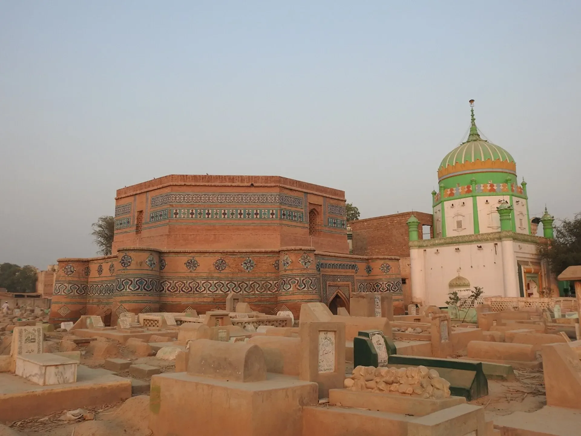
Photo: Amanasad83, with thanks · CC BY-SA 4.0 · via Wikimedia Commons · temporary stand-in photo

Dera Ghazi Khan
Divisional city on the west bank of the Indus in south-west Punjab, in Saraiki and Baloch country, and the gateway to the cool hills of Fort Munro and the shrine town of Sakhi Sarwar.
Overview
Dera Ghazi Khan, often written D. G. Khan, is a city in the far south-west of Punjab, on the west side of the Indus in the Derajat region. It is the headquarters of its district and division. The old town was founded at the end of the 15th century and named after Ghazi Khan, a Baloch chief. The present city was founded in 1910 on a new site. The Sulaiman Mountains rise to the west, and this is the main road into Baloch country and Balochistan.
At the 2023 census the city had 494,464 people (Wikipedia, citing the Pakistan Bureau of Statistics). Saraiki is by far the most widely spoken language, with Urdu and Balochi minorities.
History in brief
The city takes its name from Ghazi Khan, a Dodai chieftain and son of Haji Khan Mirani. Wikipedia says Baloch tribes were invited to settle here in the late 15th century by Shah Husein, the second Langah Sultan of Multan. Under the Mughals the area belonged to the Multan province from the 16th to 18th centuries. Mahmud Khan Gujjar was the de facto ruler from about 1738 to 1772 and is credited with starting canal works. A Sikh army under Khushal Singh, a general of Ranjit Singh, took the area in 1819. After 1947 most Hindus and Sikhs left for India and Muslim refugees settled in the district. The city has grown from 35,909 people in 1951 to 494,464 in 2023.
The city lies at about 123 m, west of the Indus. Summers are very hot, with average highs near 42 degrees Celsius and frequent windstorms off the dry Koh-e-Suleman hills; winters are mild and dry, with average lows near 4 degrees. Average rainfall is about 421 mm a year.
What to see and do
D. G. Khan is a working regional city rather than a sightseeing stop. Most visitors pass through on the way to the hills or the shrines. In town you can:
- Visit the shrine of Ghazi Khan, for whom the city is named, if you want a look at local devotional culture. Dress modestly and ask before taking photographs.
- Walk the old bazaars, where you will find everyday goods, Baloch embroidery and sweets. The city is known for sohan halwa, a hard, dense sweet made from sugar, milk and wheat or corn flour.
- See the river: the Indus is a short drive east. Spring and winter evenings are pleasant for sitting by the water.
Getting there and around
- Road: Multan is about 96 km east and takes roughly 1.5 hours (OSRM, checked 16 November 2026). The roads connect to Layyah, Muzaffargarh, Rajanpur and Dera Ismail Khan.
- Air: Dera Ghazi Khan International Airport is about 15 km from the city centre and mainly serves local travellers. Check the airline for current services.
- Rail: passenger rail is not a practical way to arrive, so use Multan as the railhead.
- Around town: rickshaws and taxis. For hill trips, hire a car with a driver.
Where to stay
Stay near the main bazaar and civil lines for the greatest choice of simple hotels, or in the cantonment-side colonies for quieter streets. Options are limited compared with bigger cities, so book ahead and expect mid-range comfort at best.
Day trips
- Fort Munro: a hill station on the edge of Punjab, about 85 km from the city. It is a summer retreat with cooler air. Sources give its height between about 1,800 m and 2,180 m (Wikipedia itself gives 1,800, 1,970 and 2,180 m in different places). Roads up are steep, and the weather can change fast.
- Sakhi Sarwar: a shrine town about 35 km away, in the foothills. The shrine of Syed Ahmad Sultan, known as Sakhi Sarwar, draws pilgrims all year. A large annual fair (Sangh Mela) is held around Vaisakhi in March and April.
- Taunsa Barrage: on the Indus to the south-east. The barrage wildlife sanctuary was designated a Ramsar wetland in 1996 and is a place for birdwatching.
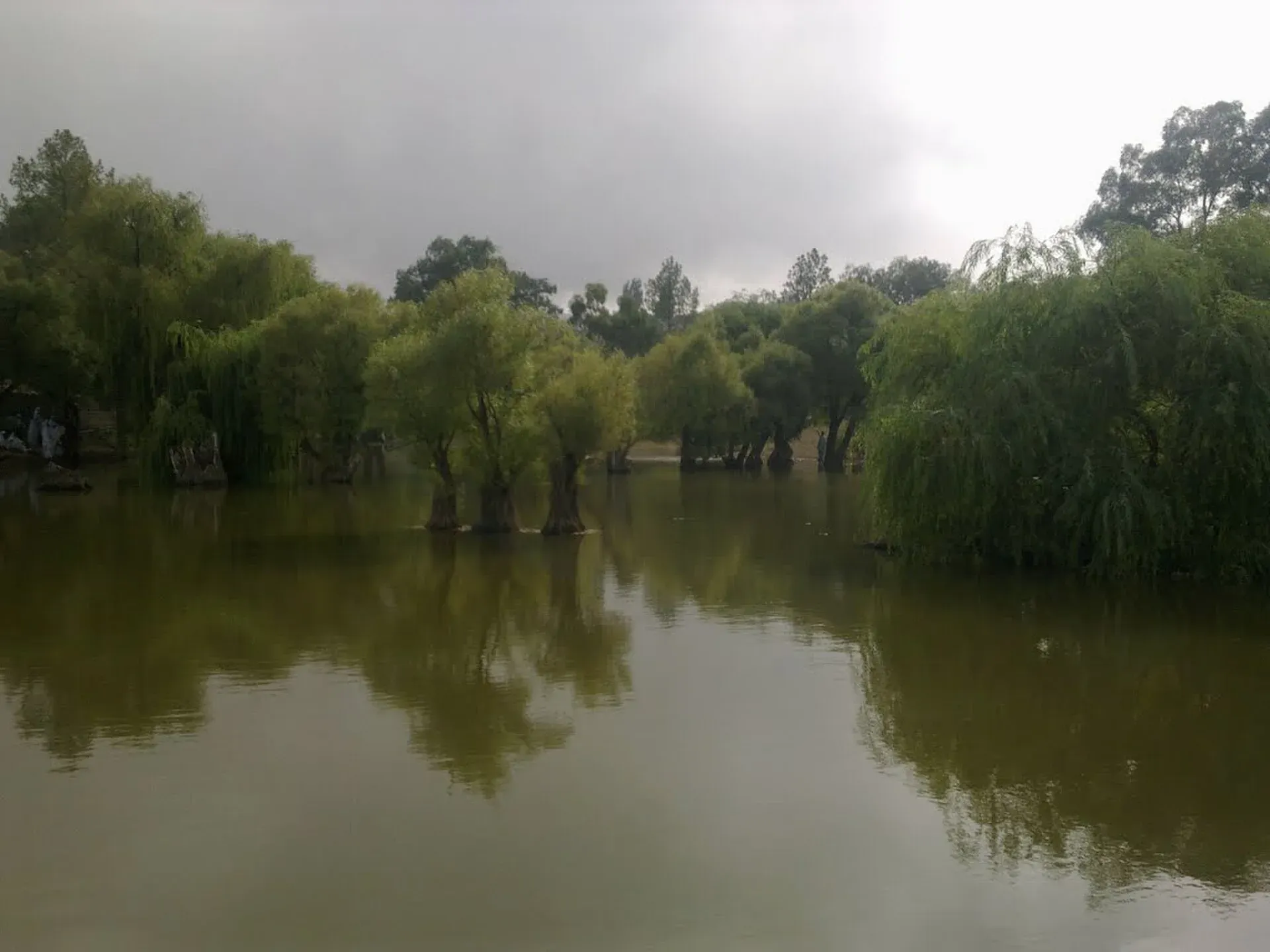
Photo: Younis khosa, with thanks · CC BY-SA 3.0 · via Wikimedia Commons · temporary stand-in photo

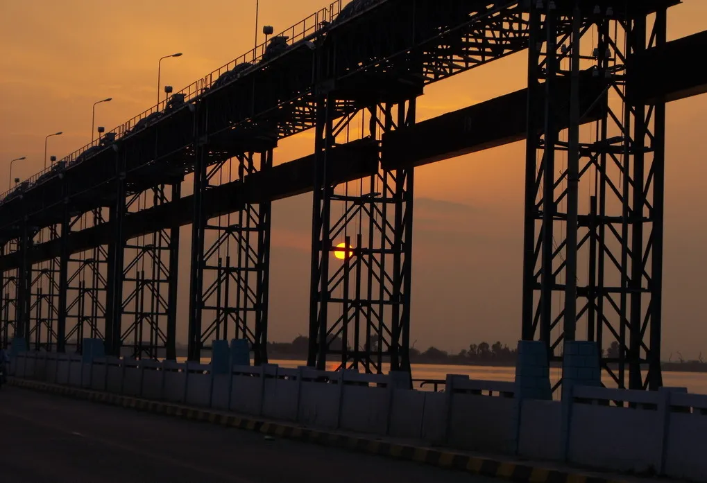
Photo: Akhtar Hassan, with thanks · CC BY-SA 4.0 · via Wikimedia Commons · temporary stand-in photo

When to visit
October to March is best. May to August is extremely hot. The record high is about 46 C, and average summer highs are around 42 C. Winter nights can drop to about 4 C.
Safety and good to know
D. G. Khan lies close to tribal areas and the Balochistan border. Large pilgrim gatherings such as the Sakhi Sarwar fair draw security measures. Check current travel advice with local police or your hotel before heading west of the city, keep to main roads, and avoid travelling after dark. Dress modestly and travel with a local contact where possible.
For foreign visitors: the UK FCDO advises against all but essential travel to Dera Ghazi Khan (advice updated 27 October 2026, checked 16 November 2026). Read the live advice before you plan.
Highlights
- Gateway to Fort Munro and the Sulaiman foothills
- Sakhi Sarwar shrine and spring fair
- Sohan halwa and Baloch crafts
- Taunsa Barrage birdwatching
Hotels, food, fuel and services in Dera Ghazi Khan
Places to stay
- Kashif Fried Chicken & ResturentCall Kashif Fried Chicken & ResturentMap of Kashif Fried Chicken & Resturent in Google Maps
- Hotel One DG KhanCall Hotel One DG KhanMap of Hotel One DG Khan in Google Maps
Places to eat
- Al Aziz Ice Bar And RestaurantCall Al Aziz Ice Bar And RestaurantMap of Al Aziz Ice Bar And Restaurant in Google Maps
- Mirza Samosa & FoodsCall Mirza Samosa & FoodsMap of Mirza Samosa & Foods in Google Maps
- Eat DelightsCall Eat DelightsMap of Eat Delights in Google Maps
- A One Food Palace اے ون فوڈ پیلیسCall A One Food Palace اے ون فوڈ پیلیسMap of A One Food Palace اے ون فوڈ پیلیس in Google Maps
- AB CafeCall AB CafeMap of AB Cafe in Google Maps
- Munro Cafe 2nd BranchCall Munro Cafe 2nd BranchMap of Munro Cafe 2nd Branch in Google Maps
Essential services fuel stations, mechanics, ATMs, banks, pharmacies, hospitals and clinics and Rescue 1122
Fuel
- ShellCall ShellMap of Shell in Google Maps
- Police Welfare Petrol Pump (Shell)Map of Police Welfare Petrol Pump (Shell) in Google Maps
- Foundation Filling StationMap of Foundation Filling Station in Google Maps
- Al Habib Filling Station- Total Petrol StationCall Al Habib Filling Station- Total Petrol StationMap of Al Habib Filling Station- Total Petrol Station in Google Maps
- United Gurmani filling stationCall United Gurmani filling stationMap of United Gurmani filling station in Google Maps
- Khitran Caltex Petrol PumpCall Khitran Caltex Petrol PumpMap of Khitran Caltex Petrol Pump in Google Maps
Mechanics and tyre shops
- نعیم پنکچر ھاؤسCall نعیم پنکچر ھاؤسMap of نعیم پنکچر ھاؤس in Google Maps
- A.Muhammad Shakeel khadim tyre houseMap of A.Muhammad Shakeel khadim tyre house in Google Maps
- Qureshi Auto GarageCall Qureshi Auto GarageMap of Qureshi Auto Garage in Google Maps
- Dildar AUTO work ShopMap of Dildar AUTO work Shop in Google Maps
ATMs
- United Bank - UBLMap of United Bank - UBL in Google Maps
- United Bank - UBLMap of United Bank - UBL in Google Maps
- Faysal BankCall Faysal BankMap of Faysal Bank in Google Maps
- NBPMap of NBP in Google Maps
- Habib Bank LtdCall Habib Bank LtdMap of Habib Bank Ltd in Google Maps
Banks and money exchange
- Pakistan Currency Exchange Western Union DG Khan BranchCall Pakistan Currency Exchange Western Union DG Khan BranchMap of Pakistan Currency Exchange Western Union DG Khan Branch in Google Maps
- Bank AlfalahMap of Bank Alfalah in Google Maps
- Habib Metro BankMap of Habib Metro Bank in Google Maps
- Askari Exchange - DG Khan BranchCall Askari Exchange - DG Khan BranchMap of Askari Exchange - DG Khan Branch in Google Maps
- Habib Qatar International Exchange, Dera Ghazi KhanCall Habib Qatar International Exchange, Dera Ghazi KhanMap of Habib Qatar International Exchange, Dera Ghazi Khan in Google Maps
- Meezan Bank - Kalma Chowk BranchCall Meezan Bank - Kalma Chowk BranchMap of Meezan Bank - Kalma Chowk Branch in Google Maps
Pharmacies
- United PharmacyCall United PharmacyMap of United Pharmacy in Google Maps
- BIN HASHIM PHARMACYCall BIN HASHIM PHARMACYMap of BIN HASHIM PHARMACY in Google Maps
- Siddiq PharmacyCall Siddiq PharmacyMap of Siddiq Pharmacy in Google Maps
- Musa Pharmacy GadaiCall Musa Pharmacy GadaiMap of Musa Pharmacy Gadai in Google Maps
- Hamza Pharmacy (Jampor Rod)Call Hamza Pharmacy (Jampor Rod)Map of Hamza Pharmacy (Jampor Rod) in Google Maps
- Ahmed Medical StoreMap of Ahmed Medical Store in Google Maps
Hospitals and clinics
- Hoor Skin & Laser Experts By Dr Waqas & Dr SeharCall Hoor Skin & Laser Experts By Dr Waqas & Dr SeharMap of Hoor Skin & Laser Experts By Dr Waqas & Dr Sehar in Google Maps
- Skin Care Clinic by Dr Anum ShaharyarCall Skin Care Clinic by Dr Anum ShaharyarMap of Skin Care Clinic by Dr Anum Shaharyar in Google Maps
- Ghazi National Hospital D.G KhanCall Ghazi National Hospital D.G KhanMap of Ghazi National Hospital D.G Khan in Google Maps
- umar Dental Clinic Dr. Rabia iram jatoiCall umar Dental Clinic Dr. Rabia iram jatoiMap of umar Dental Clinic Dr. Rabia iram jatoi in Google Maps
- City Care HospitalCall City Care HospitalMap of City Care Hospital in Google Maps
- Dr HospitalCall Dr HospitalMap of Dr Hospital in Google Maps
Rescue 1122
- 1122 Rescue StationMap of 1122 Rescue Station in Google Maps
- Rescue 1122 Near Gulshan-e-SaeedMap of Rescue 1122 Near Gulshan-e-Saeed in Google Maps
All listings in Dera Ghazi Khan
Listings come from Google Maps data and are unverified: phone numbers, opening months and prices may have changed. Report a problem · Own one of these? Claim it
Tips
- Travel in winter; summers are extremely hot.
- Check conditions with local police before travelling west of the city.
- Hire a driver for Fort Munro; the road is steep.
- Dress modestly at shrines.
Photos we still need: Dera Ghazi Khan old bazaar or sohan halwa; Sakhi Sarwar shrine or fair. Send us yours
Sources and last checked
Last checked Confidence medium7 sources4 still to check
- Last checked
- Method
- Desk research from published sources
- Confidence
- medium
- Checked by
- trek.pk research team
Researched from published sources; not yet checked on the ground by our team. Spot something out of date? Report a mistake.
Sources
- Dera Ghazi Khan · Wikipedia · checked
- Fort Munro · Wikipedia · checked
- Sakhi Sarwar · Wikipedia · checked
- Taunsa Barrage · Wikipedia · checked
- Old trek.pk dera-ghazi-khan page (facts only) · trek.pk · checked
- OSRM driving routes (road distances and times) · Project OSRM / OpenStreetMap · checked
- Dera Ghazi Khan International Airport · Wikipedia · checked
Still to be checked on the ground (4)
- Altitude of Fort Munro (Wikipedia gives 1,800, 1,970 and 2,180 m; no official figure found)
- Current flights from Dera Ghazi Khan airport (Wikipedia lists none; only the Multan-DG Khan-Dubai PIA stopover that ended in 2014)
- Which shrine is shown in the hero photo (the Commons file name says Shrine of Mullah Qaid Shah; Commons is not reachable to confirm)
- Wikipedia does not describe the 1910 relocation of the city; the 1910 date comes from its infobox
Nearby and related

Multan
The City of Saints in southern Punjab: blue-tiled Sufi shrines, a crowded old city, blue pottery, sohan halwa and mangoes.

Lahore
Punjab's capital and Pakistan's cultural city: Mughal forts, mosques and gardens, a lively Walled City, and some of the best food in the country.
Jampur
Tehsil town in Rajanpur District between the Indus and the Sulaiman Range, with 155,243 people at the 2023 census.