

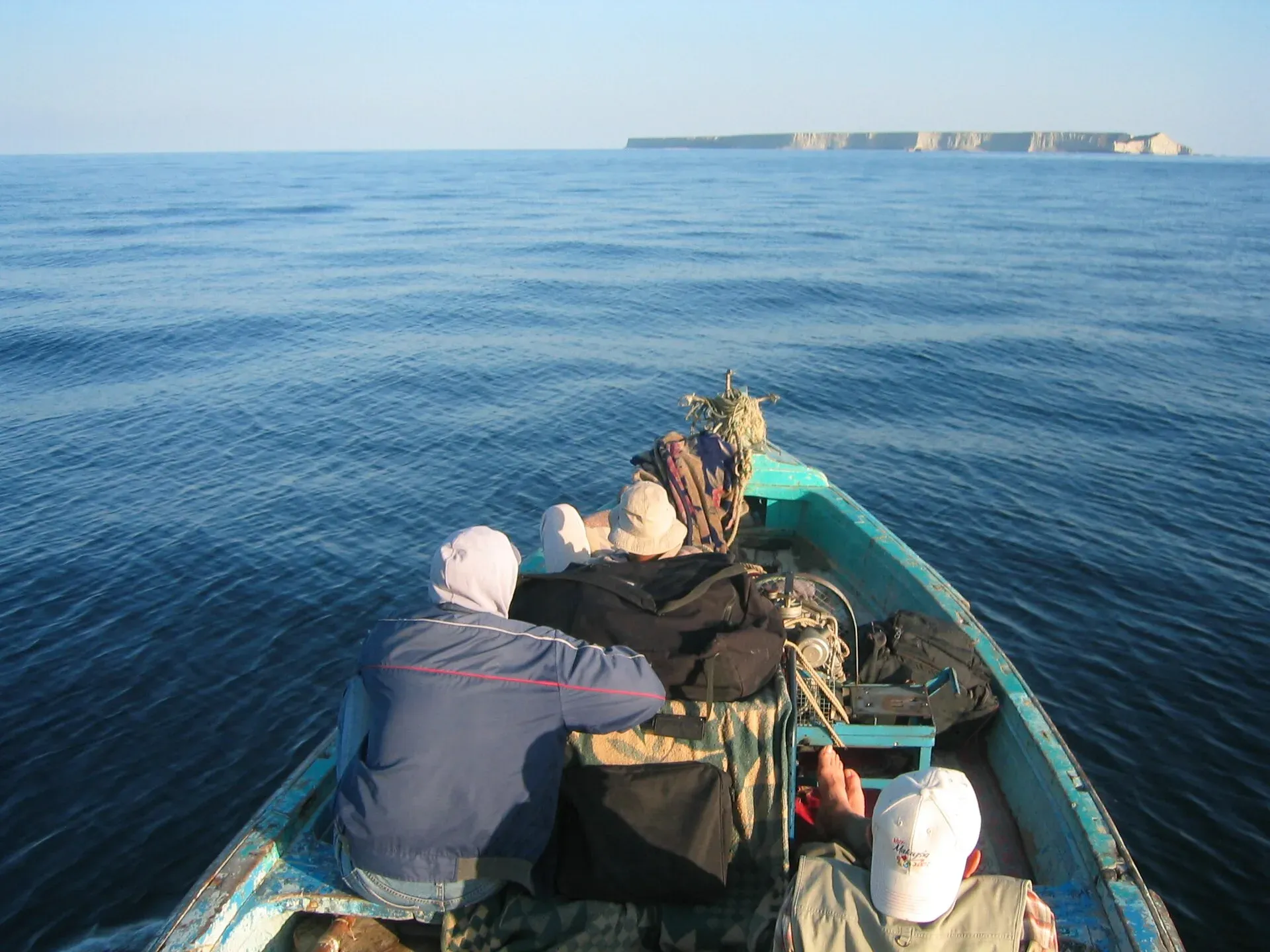
Photo: Unknown (see Commons file page), with thanks · CC BY 2.5 · via Wikimedia Commons · temporary stand-in photo

Astola Island
Pakistan's largest offshore island, 6.7 km2, 25 km off the Makran coast and a marine protected area. It is uninhabited, and visits need permission.
Overview
Astola, also called Haft Talar, "seven hills", or Satadip, is an uninhabited island in the Arabian Sea. Wikipedia gives its area as 6.7 km2 and its highest point as 75 m (a 2016 Dawn visitor's account gives about 15 km2, so figures differ by source). It lies about 25 km from the nearest coast and 35 km south-east of Pasni in Gwadar district, and is Pakistan's largest offshore island.
Plan your visit
- Nearest town
- Pasni
- Getting there
Boats run from Pasni; the trip takes about three hours, and about six from Ormara (Dawn, 2016). Boats are arranged in advance with local fishing-boat owners, and are timed around high tide at Pasni. More
Best months
Oct – Mar
Landscape and wildlife
The island is a tilted plateau with seven small hillocks, deep crevices and natural caves and coves. The north face is a cliff with a sheer drop, and the south face slopes gently. Vegetation is sparse scrub, with no trees and no fresh water. The climate is hot and dry: summer highs are about 32 C, winter days 27-29 C, and annual rainfall is under 28 mm, mostly between November and March.
Green turtles and hawksbill turtles nest on its beaches. Wikipedia also lists an endemic viper, the Astola viper, breeding waterbirds and coral reefs. Feral cats, introduced by fishermen, have wiped out a colony of sooty gulls and threaten other breeding sites. A 2016 Dawn account says turtle hatchlings were freed from fishermen's nets, and describes locals warning visitors about scorpions and the viper.
The island was listed as a Ramsar wetland on 10 May 2001 and declared Pakistan's first marine protected area on 15 June 2017 (IUCN), which with its buffer covers 401.47 km2 (Olive Ridley Project).
People and culture
No one lives here. Fishermen from Sindh and Balochistan use it as a temporary base in the fishing season, which runs from August to May (Olive Ridley Project), usually for a week to ten days at a time. Wikipedia says they fish for lobsters and oysters, and that the island is empty from June to August. There is a small mosque to Pir Khawaja Khizr and the ruins of an old temple to the goddess Kali. A lighthouse was built in 1982 and replaced by a solar-powered one in 1987.
The boat crossing
There is no ferry and no pier. According to Dawn's 2016 account, boats are arranged in advance with local fishing-boat owners, who time departures to high tide at Pasni. The crossing takes about three hours from Pasni and about six from Ormara. Passengers wade ashore from a dinghy and should expect to get wet to at least the shin. Seasickness was common among the party, and the return needs an early start to catch the tide. That account predates the marine protected area, so it does not describe present rules.
What to see and do
There is no established tourism. Dawn's 2016 account describes swimming, walking to the island's high point, bird-watching and watching turtles, and says snorkelling and diving at the coral reefs need a speedboat. Activities such as diving and camping are not covered in any official visitor guidance. Please follow official rules.
When to visit
Wikipedia reports little rain and a hot climate. Dawn's account says rough seas and high tides make the island inaccessible from June to August, and gives September to May as the time to go.
Where to stay and eat
There are no facilities. Everything, including drinking water, has to be brought in. Any overnight stay needs official permission.
Good to know
- Staying without permission is among the prohibited activities in the management plan endorsed by Balochistan's government (Geo News). Contact the Balochistan forest and wildlife department or the Environmental Protection Agency.
- Ask the district administration or local police about current conditions before you go. For foreign visitors: the UK FCDO advises against all travel to Balochistan.
- The island is within Pakistan Navy and Maritime Security Agency waters; check any required clearance.
- Boat and permit fees: current fees will be added soon.
Highlights
- Pakistan's first marine protected area (2017)
- Nesting green and hawksbill turtles
- Seven hills, hence the name Haft Talar
- Coral reefs and breeding waterbirds
- Highest point 75 m
Getting there
Boats run from Pasni; the trip takes about three hours, and about six from Ormara (Dawn, 2016). Boats are arranged in advance with local fishing-boat owners, and are timed around high tide at Pasni. There is no pier, so you wade ashore. Karachi to Pasni is about 508 km and 6.1 hours by road (OSRM). The UK advises against all travel to Balochistan, and a visit needs permission from the authorities (see Good to know).
Tips
- Do not go without written permission; staying without it is prohibited.
- Do not disturb turtles or nests; keep to rules for the nesting season.
- Bring all water; the island has no fresh water.
- Leave no rubbish.
Photos we still need: Astola Island seen from the sea; Astola Island's cliffs and beaches; the Khawaja Khizr mosque or the old temple ruins; turtle nesting beach. Send us yours
Sources and last checked
Last checked Confidence medium8 sources5 still to check
- Last checked
- Method
- Desk research from published sources
- Confidence
- medium
- Checked by
- trek.pk research team
Researched from published sources; not yet checked on the ground by our team. Spot something out of date? Report a mistake.
Sources
- Astola Island · Wikipedia · checked
- Astola Island: Pakistan's First Marine Protected Area · Olive Ridley Project · checked
- Balochistan government endorses management plan of Astola Island · Geo News · checked
- Pakistan Tourism Guide 2021 · TDAP Pakistan · checked
- OSRM driving route calculation · OpenStreetMap / OSRM project · checked
- Pakistan travel advice (updated 27 Oct 2026) · UK Foreign, Commonwealth & Development Office · checked
- Astola Island: Pakistan's first-ever marine protected area (15 June 2017) · IUCN · checked
- Astola: a visitor's account of the boat trip from Pasni (2016) · Dawn · checked
Still to be checked on the ground (5)
- Who issues visit permissions (no source opened names the authority; the Geo News page returned 403 in this pass)
- Management plan rules (Geo News report; needs checking against the official plan)
- Turtle nesting months (Wikipedia, IUCN, Olive Ridley Project and Dawn give no months)
- Whether any operator is licensed for Astola trips (sources describe only informal arrangements with local boat owners)
- Island area (Wikipedia 6.7 km2; Dawn 2016 about 15 km2)
Nearby and related

Pasni
Fishing town on the Makran coast, about 508 km from Karachi, with open beaches and the boat crossing point for Astola Island. Services are limited. Balochistan is under UK FCDO 'all travel' advice.

Gwadar
Arabian Sea port town and Gwadar District headquarters, a fishing settlement that Pakistan bought from Oman in 1958 and now a CPEC port.

Ormara
Small port town on the Makran Coastal Highway, about 351 km west of Karachi, with a curved double-bay beach and a naval base. Services are limited. Balochistan is under UK FCDO 'all travel' advice.

Hingol National Park
Pakistan's largest national park, about 6,100 square kilometres along the Makran Coastal Highway: desert canyons, mud volcanoes, the Hingol River, the Princess of Hope rock and the Hinglaj Mata temple.

Churna Island
A small, uninhabited rocky island about 9 km west of the Hub River mouth, popular for snorkelling and diving, now a marine protected area. Boat and permit rules are unclear; check first.

Zalzala Koh (Earthquake Island)
A small island, probably a mud volcano, that rose off Gwadar after the earthquake of 24 September 2013. It eroded away and no longer exists.
Malan Island (Peer Ghaib)
A mud-volcano island off the Balochistan coast that has risen from the sea and sunk again several times. It is not a lasting place to visit.