

Photo: Shayhaq Baloch, with thanks · CC BY-SA 4.0 · via Wikimedia Commons · temporary stand-in photo

Gwadar
Arabian Sea port town and Gwadar District headquarters, a fishing settlement that Pakistan bought from Oman in 1958 and now a CPEC port.
Overview
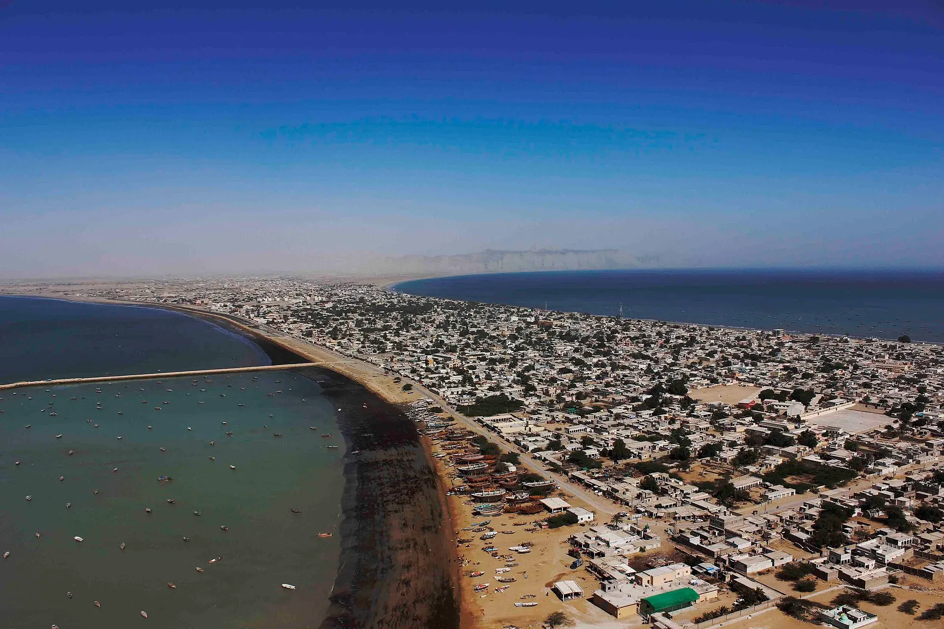
Gwadar is a port town on the Makran coast, on a hammerhead-shaped peninsula opposite Oman, and the headquarters of Gwadar District. It was founded as a fishing settlement in the late 17th century and belonged to the Sultanate of Muscat and Oman from 1783 until Pakistan bought it in 1958. In 2011 it was declared the winter capital of Balochistan. The name comes from Balochi words meaning roughly "gate of the wind".
The 2023 census counted 70,852 people (CityPopulation.de, from the Pakistan Bureau of Statistics). Both CityPopulation.de and Wikipedia give about 90,000 for 2017 (90,201 in the tables), so the fall is large; neither source explains whether the boundary changed.
A deep-sea port and a special economic zone have been built here under the China–Pakistan Economic Corridor, and much of the town is still a working fishing harbour.
Plan your visit
- Getting there
Air: New Gwadar International Airport (operational since January 2025). Road: Turbat about 163 km (2 hours); Karachi about 627 km (7 hours 25 minutes) (OSRM, checked 16 November 2026). Rail: none. More
Best months
Oct – Mar
- Gwadar
- Related places nearby: Surbandar, Pishukan, Zalzala Koh (Earthquake Island), Jiwani Coastal Wetland, Akra Kaur Dam
Geography and history
The town sits on a narrow sandy isthmus about 12 km long that joins the mainland to a headland, Koh-e-Batil, which rises to about 150 m. Two bays flank the isthmus. The western bay, Padi Zirr, is shallow and used by fishing boats. The eastern bay, Demi Zirr, is deep, and Gwadar Port was built there.
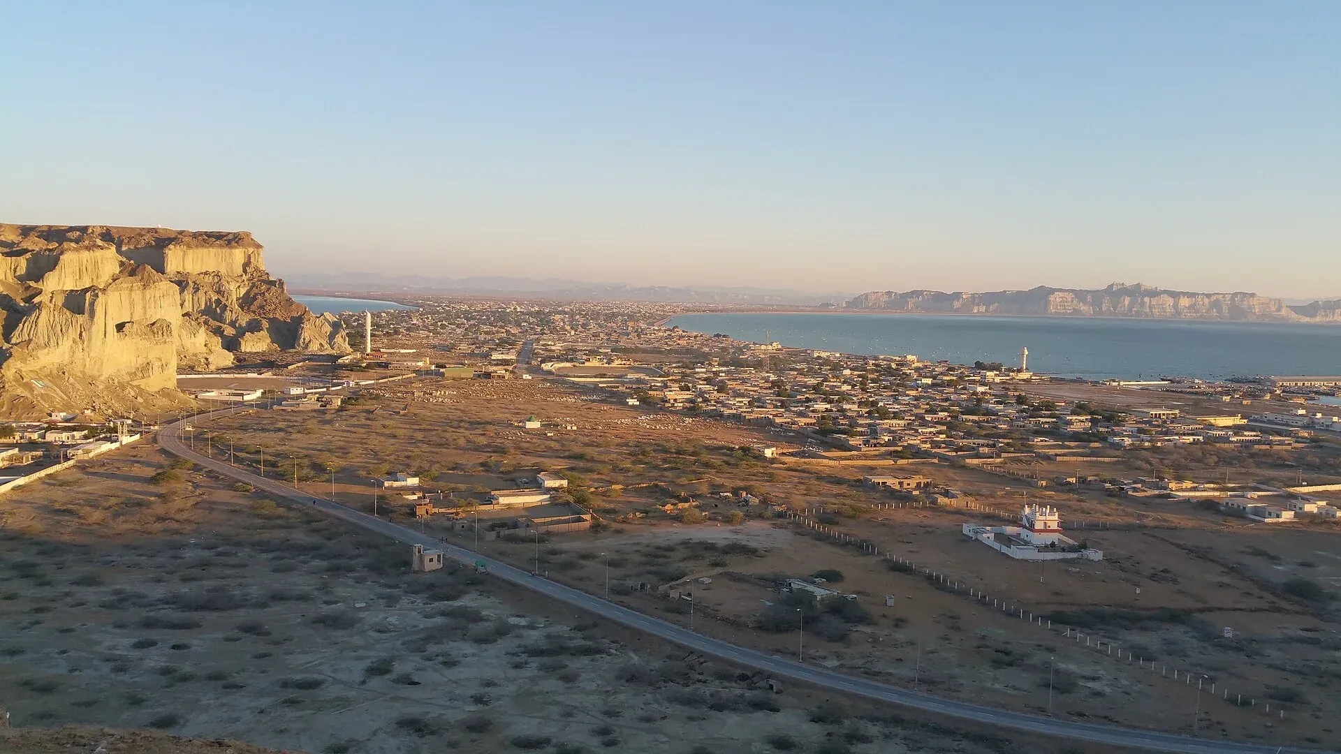
Photo: Madihasalam, with thanks · CC BY-SA 4.0 · via Wikimedia Commons · temporary stand-in photo

Gwadar passed between the Khanate of Kalat, the Gichki Baloch and Muscat before Oman handed it to Pakistan on 8 September 1958. Wikipedia says the Aga Khan IV contributed about 3 million US dollars towards the purchase. Omani-era buildings survive in the town, and in the 2023 census 96.2 per cent of residents gave Balochi as their mother tongue. For most of its history the economy rested on small-scale fishing. China Overseas Port Holding Company took over the port in 2013, and the Gwadar Free Zone began construction in June 2016, though much of it remains unfinished.
The climate is hot desert, with about 100 mm of rain a year. June averages 31 to 32 degrees Celsius and January 18 to 19, and sea breezes soften the heat. In February 2024 about 180 mm of rain fell in 30 hours and flooded the town.
What to see and do
- The old town and harbour: fishing boats, the fish market and the narrow lanes near the port.
- The peninsula and Marine Drive: the headland and seafront road, listed in the TDAP guide among the coast's attractions.
- Coastline: beaches and rock formations along the Makran Coastal Highway. Hingol National Park and the Hinglaj Mata temple lie to the east.
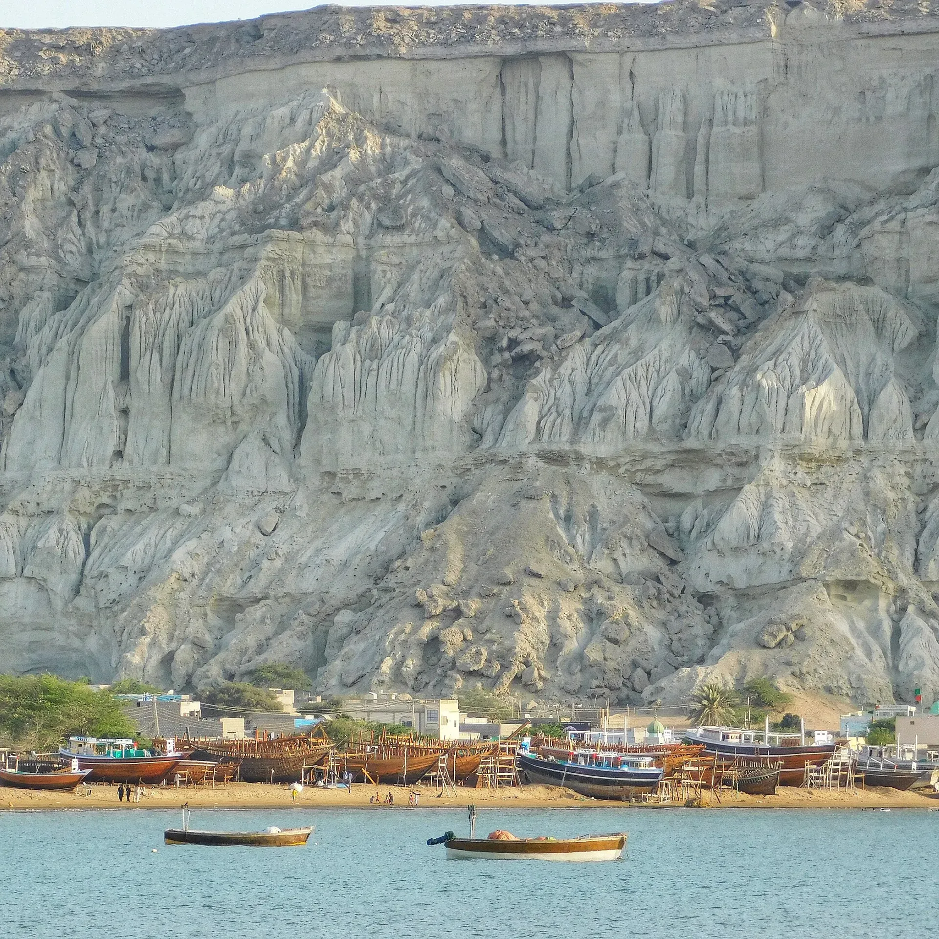
Photo: Sajjad Mahesri, with thanks · CC BY-SA 4.0 · via Wikimedia Commons · temporary stand-in photo

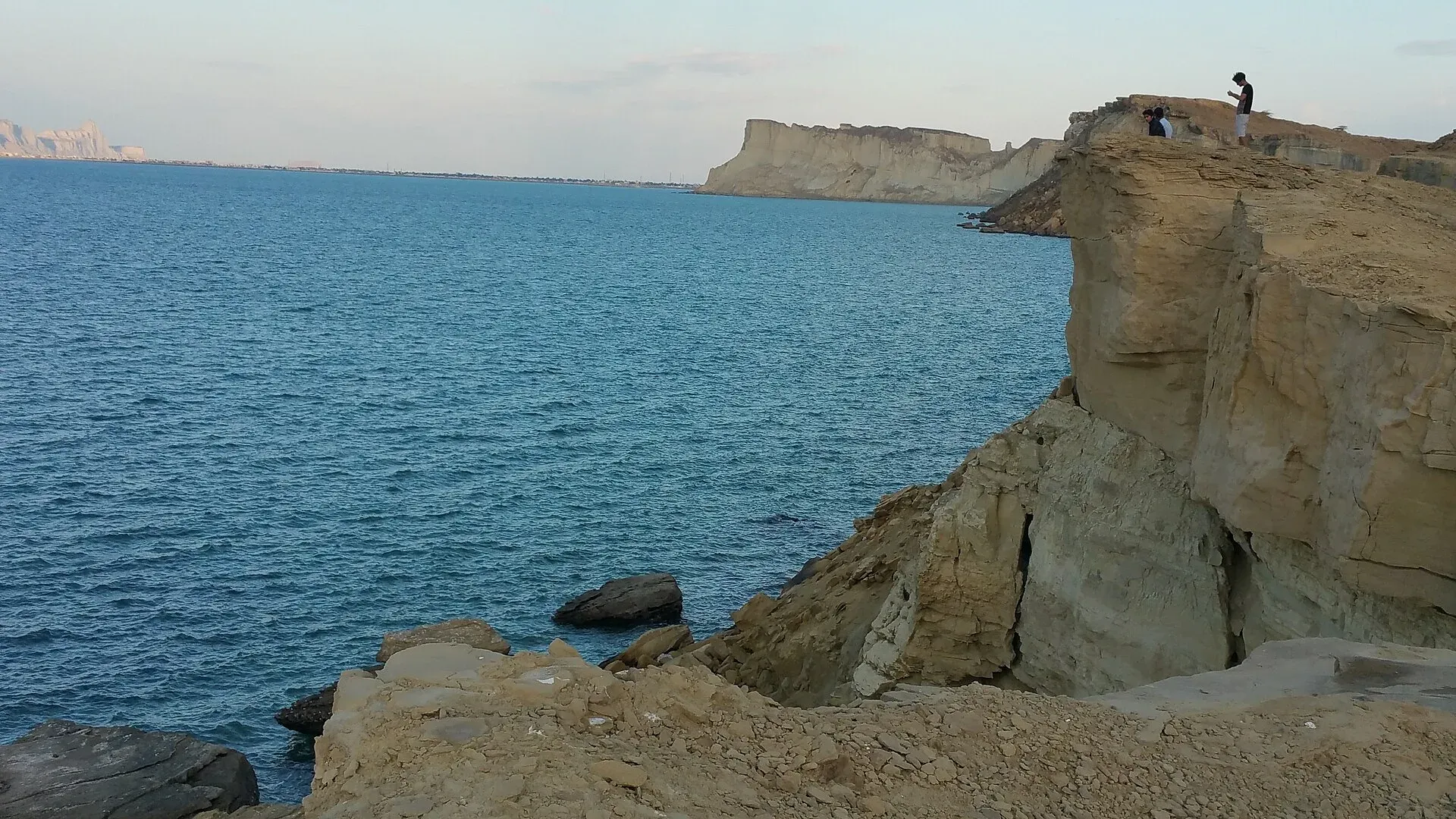
Photo: Madihasalam, with thanks · CC BY-SA 4.0 · via Wikimedia Commons · temporary stand-in photo

When to visit
Winter, from October to March, is the comfortable time. Summers are hot, humid and windy.
Where to stay and eat
Services are those of a district headquarters: expect a government hospital, pharmacies, fuel stations, banks or ATMs and basic guesthouses or hotels in the main bazaar. We have no verified list of facilities or businesses, so confirm before you rely on any of them, and carry cash and fuel. As a growing port town, Gwadar has more hotels than most Balochistan district towns. Fish is the local speciality.
Good to know
New Gwadar International Airport, about 26 km north-east of the town (Wikipedia), has had commercial flights since 20 January 2025, when PIA flight PK-503 arrived from Karachi (Dawn, 21 January 2025). The private airline South Air ran a trial flight from Karachi on 26 May 2026 (Dawn, 27 May 2026). South Air Pakistan announced two weekly services at the new airport for 9 July to 31 October 2026: Thursday Karachi to Gwadar and back, and Saturday Karachi to Gwadar to Quetta and back (Daily Times, 3 July 2026). That period has ended and no later timetable has been found, so check with the airlines before you plan a flight. By road, Turbat is about 163 km (2 hours) and Karachi about 627 km (7 hours 25 minutes) along the Makran Coastal Highway (OSRM, checked 16 November 2026, optimistic). Large projects mean closures, checkpoints and controlled areas around the port.
Ask the district administration or local police about current conditions before you go. Safety: For foreign visitors: the UK FCDO advises against all travel to Balochistan, including Quetta and Ziarat (page updated 27 October 2026; checked 17 November 2026). We do not recommend visiting as a tourist. If you live here or have essential business, follow current guidance from the provincial authorities and your embassy, expect checkpoints, and do not rely on this page for planning. The FCDO also notes an ongoing risk of terrorism across Pakistan.
Highlights
- Arabian Sea port on a hammerhead peninsula
- Bought by Pakistan from Oman in 1958
- New international airport since January 2025
- Gateway to the Makran coast
Getting there
Air: New Gwadar International Airport (operational since January 2025). Road: Turbat about 163 km (2 hours); Karachi about 627 km (7 hours 25 minutes) (OSRM, checked 16 November 2026). Rail: none.
Hotels, food, fuel and services in Gwadar
Places to stay
- Zaver Pearl Continental HotelCall Zaver Pearl Continental HotelMap of Zaver Pearl Continental Hotel in Google Maps
- Sadaf ResortCall Sadaf ResortMap of Sadaf Resort in Google Maps
- PC Hotel GwadarCall PC Hotel GwadarMap of PC Hotel Gwadar in Google Maps
- Sahil Guest HouseCall Sahil Guest HouseMap of Sahil Guest House in Google Maps
- Gwadar Business CenterCall Gwadar Business CenterMap of Gwadar Business Center in Google Maps
- Bait-ul-GwadarCall Bait-ul-GwadarMap of Bait-ul-Gwadar in Google Maps
Places to eat
- Cafe PadizirCall Cafe PadizirMap of Cafe Padizir in Google Maps
- Ajwaa Sweets & BakersCall Ajwaa Sweets & BakersMap of Ajwaa Sweets & Bakers in Google Maps
- CAFE SADAFCall CAFE SADAFMap of CAFE SADAF in Google Maps
- CAFE KULACHICall CAFE KULACHIMap of CAFE KULACHI in Google Maps
- Hot Box Fast FoodCall Hot Box Fast FoodMap of Hot Box Fast Food in Google Maps
Essential services fuel stations, ATMs, pharmacies and hospitals and clinics
Fuel
- PSO Petrol PumpMap of PSO Petrol Pump in Google Maps
- Hascol Petrol StationMap of Hascol Petrol Station in Google Maps
- Kech Petroleum ServiceMap of Kech Petroleum Service in Google Maps
- Kalmati petroleum service gawadarCall Kalmati petroleum service gawadarMap of Kalmati petroleum service gawadar in Google Maps
- Naeem Ghafoor Petrol ServiceMap of Naeem Ghafoor Petrol Service in Google Maps
- Al-Qasim LPG TerminalCall Al-Qasim LPG TerminalMap of Al-Qasim LPG Terminal in Google Maps
ATMs
- Habib Bank LtdCall Habib Bank LtdMap of Habib Bank Ltd in Google Maps
- National Bank Of Pakistan (NBP)Call National Bank Of Pakistan (NBP)Map of National Bank Of Pakistan (NBP) in Google Maps
- Bank Al HabibMap of Bank Al Habib in Google Maps
- Bank AlfalahCall Bank AlfalahMap of Bank Alfalah in Google Maps
- Allied Bank Ltd. (ABL)Call Allied Bank Ltd. (ABL)Map of Allied Bank Ltd. (ABL) in Google Maps
- Summit Bank Gwadar BranchCall Summit Bank Gwadar BranchMap of Summit Bank Gwadar Branch in Google Maps
Pharmacies
- Care Medicos GwadarMap of Care Medicos Gwadar in Google Maps
- S.J PharmacyMap of S.J Pharmacy in Google Maps
- Khurshid Medical StoreMap of Khurshid Medical Store in Google Maps
- Sharif Medical StoreCall Sharif Medical StoreMap of Sharif Medical Store in Google Maps
- Amir Medical StoreCall Amir Medical StoreMap of Amir Medical Store in Google Maps
Hospitals and clinics
- Indus Hospital - GDA Campus, GwadarCall Indus Hospital - GDA Campus, GwadarMap of Indus Hospital - GDA Campus, Gwadar in Google Maps
- Civil Hospital GwadarMap of Civil Hospital Gwadar in Google Maps
- GDA PAK-CHINA FRIENDSHIP HOSPITALMap of GDA PAK-CHINA FRIENDSHIP HOSPITAL in Google Maps
- Fiza medical store & ClinicCall Fiza medical store & ClinicMap of Fiza medical store & Clinic in Google Maps
- Bana medical store & Dr nazeer bana clinicCall Bana medical store & Dr nazeer bana clinicMap of Bana medical store & Dr nazeer bana clinic in Google Maps
- Al Shifa hospitalCall Al Shifa hospitalMap of Al Shifa hospital in Google Maps
Listings come from Google Maps data and are unverified: phone numbers, opening months and prices may have changed. Report a problem · Own one of these? Claim it
Tips
- Check flight schedules with the airline.
- Expect checkpoints and restricted zones near the port.
- Carry cash and fuel on the coastal highway.
Photos we still need: Gwadar fish market or fish dishes; Gwadar port or the new airport (open licence). Send us yours
Sources and last checked
Last checked Confidence medium8 sources6 still to check
- Last checked
- Method
- Desk research from published sources
- Confidence
- medium
- Checked by
- trek.pk research team
Researched from published sources; not yet checked on the ground by our team. Spot something out of date? Report a mistake.
Sources
- Gwadar · Wikipedia · checked
- Balochistan: major cities, municipalities and towns, 2023 census (from Pakistan Bureau of Statistics) · CityPopulation.de · checked
- First flight lands at new Gwadar airport · Dawn · checked
- New airline South Air operates trial flight to Gwadar · Dawn · checked
- Pakistan Tourism Guide 2021 · Trade Development Authority of Pakistan (TDAP) · checked
- OSRM driving routes (road distances and times) · Project OSRM / OpenStreetMap · checked
- Pakistan travel advice (updated 27 October 2026) · UK Foreign, Commonwealth & Development Office · checked
- Two new flights set to operate at Gwadar new airport (3 July 2026) · Daily Times · checked
Still to be checked on the ground (6)
- Flight schedules after 31 October 2026 (South Air's announced season ended then; PIA's current Karachi frequency not found in an official or dated press source)
- 2017 versus 2023 population boundary difference (CityPopulation.de and Wikipedia give 90,201 and 70,852 without explaining the change)
- Access to port and restricted zones (not covered in Wikipedia)
- Hotels and fuel
- Road security on the coastal highway
- Hours or access at the Fish Harbour and old town
Nearby and related

Balochistan
Pakistan's largest and least populated province: Quetta's high valleys, Ziarat's juniper forest, the Makran coast, Hingol and Gwadar. Security and permission rules need checking first.

Turbat
The largest city of southern Balochistan, a date-growing oasis on the Kech River and former Makran capital, among the hottest places on earth.

Karachi
Pakistan's largest city and main port: colonial buildings, museums, beaches, busy bazaars and some of the country's best food.

Hingol National Park
Pakistan's largest national park, about 6,100 square kilometres along the Makran Coastal Highway: desert canyons, mud volcanoes, the Hingol River, the Princess of Hope rock and the Hinglaj Mata temple.

Hinglaj Mata Temple
A cave shrine in a gorge on the Hingol River in Hingol National Park, Balochistan. Hindus revere it as a Shakti peeth, and local Muslims know it as Nani Mandir. The annual Hinglaj Yatra in April is Pakistan's largest Hindu pilgrimage.
Surbandar
Small fishing town on the Arabian Sea in Gwadar District, Balochistan, with about 20,000 people. It has a jetty but no established tourism. The UK advises against all travel to Balochistan.
Pishukan
Fishing town and union council on the western shore of Gwadar West Bay, about 25 km from Gwadar port. It has no visitor facilities. The UK advises against all travel to Balochistan.

Zalzala Koh (Earthquake Island)
A small island, probably a mud volcano, that rose off Gwadar after the earthquake of 24 September 2013. It eroded away and no longer exists.

Jiwani Coastal Wetland
A Ramsar-listed lagoon and mangrove area at the north-east end of Gwatar Bay, near Jiwani, important for migratory birds and nesting sea turtles.
Dasht River
An intermittent river of Makran, formed at Mirani Dam by the Kech and Nihing rivers. It runs to the Arabian Sea near Jiwani. Travel advice: FCDO advises against all travel to Balochistan.
Akra Kaur Dam
The main water source for Gwadar, a reservoir in Gwadar District completed in 1995. It is a water-supply site with no known visitor facilities; FCDO advises against all travel in Balochistan.