

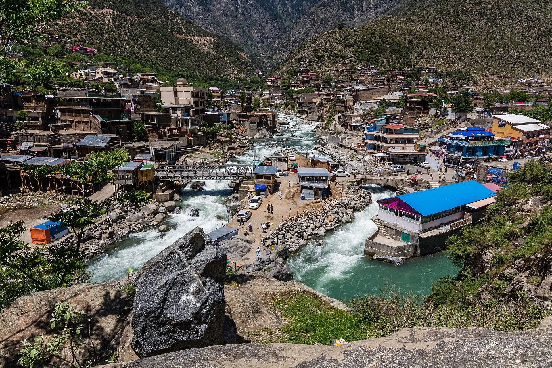
Photo: Muhammad Ashar, with thanks · CC BY-SA 3.0 · via Wikimedia Commons · temporary stand-in photo

Bahrain
A riverside town at about 1,432 m in Upper Swat, at the meeting of the Daral and Swat rivers, known for riverside guesthouses, crafts and the trail to Daral and Saidgai lakes.
Overview
Bahrain (also spelled Behrain) is a town in Upper Swat District, Khyber Pakhtunkhwa, about 60 km north of Mingora at 1,432 m on the right bank of the Swat river (Wikipedia). The name means two rivers, as the Daral and Swat rivers meet here. It is the tehsil headquarters of Behrain Tehsil and lies in the Swat Kohistan region. The 2023 census counted 76,728 people, up from 61,787 in 2017. Torwali is the local language, and the town was formerly called Bhaunal in Torwali. Pashto and Urdu are also spoken. Wikivoyage describes residents as a mix of Pashtuns and Kohistanis.
Plan your visit
- Getting there
Road: about 56 km north of Mingora on the Swat valley road, around 45 minutes by OSRM (checked 16 November 2026), and beyond it is Kalam. Local vans and buses run along the valley road. More
Best months
Apr – Jun, Sep – Oct
- Bahrain
- Related places nearby: Swat Valley, Kalam, Mingora Bazaar, Madyan, Daral Lake, Saidgai Lake
Where it sits on the Swat road
Wikivoyage puts Madyan about 60 km from Mingora and Bahrain about 10 km north of it, with Kalam roughly 100 km from Mingora. At Kalam the Ushu and Utrot rivers join to form the Swat River, and the paved road ends there. The road beyond Bahrain is snowbound in winter.
What to see and do
- River confluence: the Daral river joins the Swat river just below the bazaar, and guesthouses line the banks. Wikipedia mentions the view of the meeting point as one of the town's draws.
- Craft shops: woodwork and local handicrafts are on sale. Wikivoyage mentions carved wooden chairs, tables and doors in particular.
- Daral and Saidgai lakes: Bahrain is the base for the trail to these lakes (Wikipedia). Wikipedia's Daral Lake page puts the lake at about 3,505 m and gives roughly three to four hours from Bahrain over bare mountains, then a descent east to the lake, or four to five hours from Gabina Jabba where a jeep road ends. Wikivoyage says two to three hours of hard trekking from Saidgai. These are unofficial figures, so ask locally. Winter snow closes the trails. See also Saidgai Lake.
- Road to Kalam: the Swat valley road continues north.
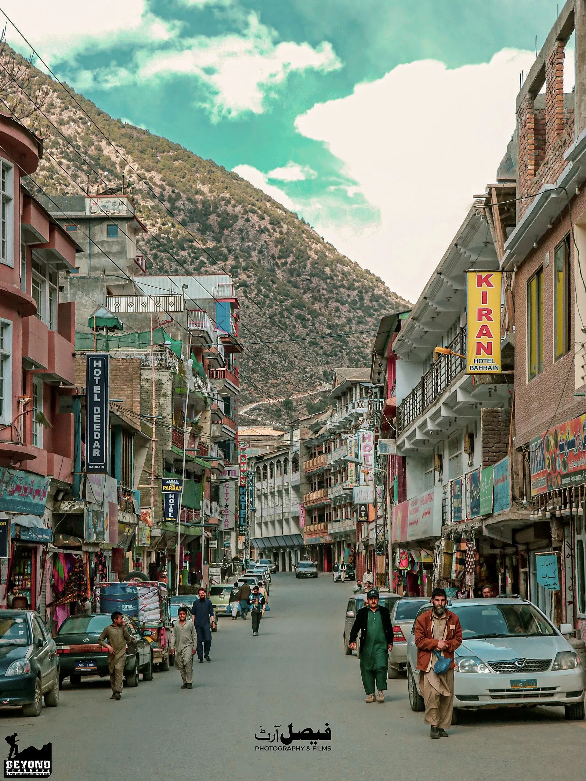
Photo: Faisal Nouman, with thanks · CC BY-SA 4.0 · via Wikimedia Commons · temporary stand-in photo

Food and shopping
Food is typical Swat fare. Wikivoyage names trout (the local fish), chicken and mutton karahi, kebabs, paye (trotters in broth), handi dishes and rice, and local plums, apricots and peaches. Swat is also known for embroidered shawls, carved wood and handmade carpets.
Climate
Wikipedia gives an average annual temperature of 16.6 C and annual rain of about 866 mm. July is the hottest month (27.0 C average) and January the coldest (4.8 C). March is the wettest month and November the driest.
When to visit
April to June and September to October. Wikivoyage gives April to October as the main season, with April and May best while the slopes are green. Summer is busy, and winter brings snow in the upper valley.
Where to stay and eat
Riverside hotels and guesthouses are along the water and the main road. Food is typical Swat fare: trout in season, rice, meat, bread and tea.
Good to know
- Pakistan's Swat valley has been affected by security events and flood damage in the past. Check current local conditions.
- There is no sourced list of fuel, ATM or hospital details for Bahrain. Wikivoyage names Government Central Hospital and Saidu Hospital in Saidu Sharif (near Mingora). Check with local officials or Mingora.
- Dress modestly and ask before photographing people.
Ask the district administration or local police about current conditions before you go. Travel advice: For foreign visitors: the UK FCDO advises against all travel to Swat (advice updated 27 October 2026, still current when checked on 17 November 2026), and notes KP emergency measures and Governor's Rule since 11 October 2026. Bahrain is in Swat, so this applies. Read the live advice before you plan.
Highlights
- Daral and Swat river confluence
- Base for Daral and Saidgai lakes
- Riverside guesthouses
- Torwali crafts
Getting there
Road: about 56 km north of Mingora on the Swat valley road, around 45 minutes by OSRM (checked 16 November 2026), and beyond it is Kalam. Local vans and buses run along the valley road.
Stay, eat and essentials near Bahrain
Within 8 km of Bahrain, nearest first.
Places to stay
- BLUEWATER CONTINENTAL HOTEL - MADYAN (Owner Gul Rehman )Call BLUEWATER CONTINENTAL HOTEL - MADYAN (Owner Gul Rehman )Map of BLUEWATER CONTINENTAL HOTEL - MADYAN (Owner Gul Rehman ) in Google Maps
- Emarat Plaza Hotel and Family ApartmentsCall Emarat Plaza Hotel and Family ApartmentsMap of Emarat Plaza Hotel and Family Apartments in Google Maps
- Swat Holiday Hotel & RestaurantCall Swat Holiday Hotel & RestaurantMap of Swat Holiday Hotel & Restaurant in Google Maps
- Madyan Hotel Pvt LimitedCall Madyan Hotel Pvt LimitedMap of Madyan Hotel Pvt Limited in Google Maps
- Swat Haven ResortCall Swat Haven ResortMap of Swat Haven Resort in Google Maps
- Chail Trout ParkCall Chail Trout ParkMap of Chail Trout Park in Google Maps
Places to eat
- Usman Shinwari RestaurantCall Usman Shinwari RestaurantMap of Usman Shinwari Restaurant in Google Maps
- Lahori RestaurantCall Lahori RestaurantMap of Lahori Restaurant in Google Maps
- Himalaya Trout Fish Farm And RestaurantMap of Himalaya Trout Fish Farm And Restaurant in Google Maps
- Park way hotelCall Park way hotelMap of Park way hotel in Google Maps
Essential services fuel stations and pharmacies
Fuel
- Petrol Pump پٹرول پمپMap of Petrol Pump پٹرول پمپ in Google Maps
- PSO HAMZA FILLING STATIONCall PSO HAMZA FILLING STATIONMap of PSO HAMZA FILLING STATION in Google Maps
- Shahgram filling stationMap of Shahgram filling station in Google Maps
Pharmacies
- Hamid Medical StoreMap of Hamid Medical Store in Google Maps
- Ittehad Medical StoreMap of Ittehad Medical Store in Google Maps
- Habib ChemistCall Habib ChemistMap of Habib Chemist in Google Maps
Listings come from Google Maps data and are unverified: phone numbers, opening months and prices may have changed. Report a problem · Own one of these? Claim it
Tips
- Read the live FCDO advice on Swat.
- Ask locally about road and river conditions.
- Dress modestly.
- Book ahead in the summer season.
Photos we still need: the Daral and Swat river confluence; carved wood craft shops in Bahrain bazaar. Send us yours
Sources and last checked
Last checked Confidence medium5 sources3 still to check
- Last checked
- Method
- Desk research from published sources
- Confidence
- medium
- Checked by
- trek.pk research team
Researched from published sources; not yet checked on the ground by our team. Spot something out of date? Report a mistake.
Sources
- Bahrain, Pakistan · Wikipedia · checked
- OSRM driving routes (road distances and times) · Project OSRM / OpenStreetMap · checked
- Pakistan travel advice · UK FCDO (GOV.UK) · checked
- Daral Lake · Wikipedia · checked
- Swat Valley · Wikivoyage · checked
Still to be checked on the ground (3)
- Fuel and ATM availability in Bahrain (no source found; hospitals are in Saidu Sharif/Mingora)
- Daral lake trail details (unofficial times only: 3-4 h from Bahrain, 4-5 h from Gabina Jabba)
- Flood and road damage on the Swat valley road (no current source; FCDO reports road closures in KP)
Nearby and related

Swat Valley
A long green river valley in northern Khyber Pakhtunkhwa, with Gandhara Buddhist sites, orchards, hill towns and the road up to Kalam. Check the current security advice before you plan a trip.

Kalam
The last large town in the upper Swat Valley, at about 2,000 m where the Ushu and Gabral rivers meet. Kalam is the base for Ushu, Utror, Mahodand Lake and Kundol Lake.

Mingora Bazaar
The main market of Mingora, the biggest city in Swat. A busy everyday bazaar for cloth, crafts and local produce. UK advice is against all travel to Swat.

Swat River
A perennial river of northern Khyber Pakhtunkhwa formed at Kalam by the Ushu and Gabral streams. It runs through the Swat Valley to the Kabul River near Charsadda. Travel advice currently warns against Swat.

Madyan
Madyan is a riverside town at about 1,320 m in upper Swat, KP, home to Torwali people, known for trout and as the base for Bashigram Lake and Malam Jabba. For foreign visitors: the UK FCDO advises against all travel to Swat.
Daral Lake
An alpine glacial lake at about 3,500 m in the hills above Bahrain, Swat, reached by a trek from Bahrain or from Gabina Jabba. Open in summer only.
Saidgai Lake
A glacial lake at about 3,500 m on the Swat and Upper Dir border, reached on long steep trails from Ushirai (Dir), Sultanr (Swat) or Lalko. Also called Saidgai Dand.