

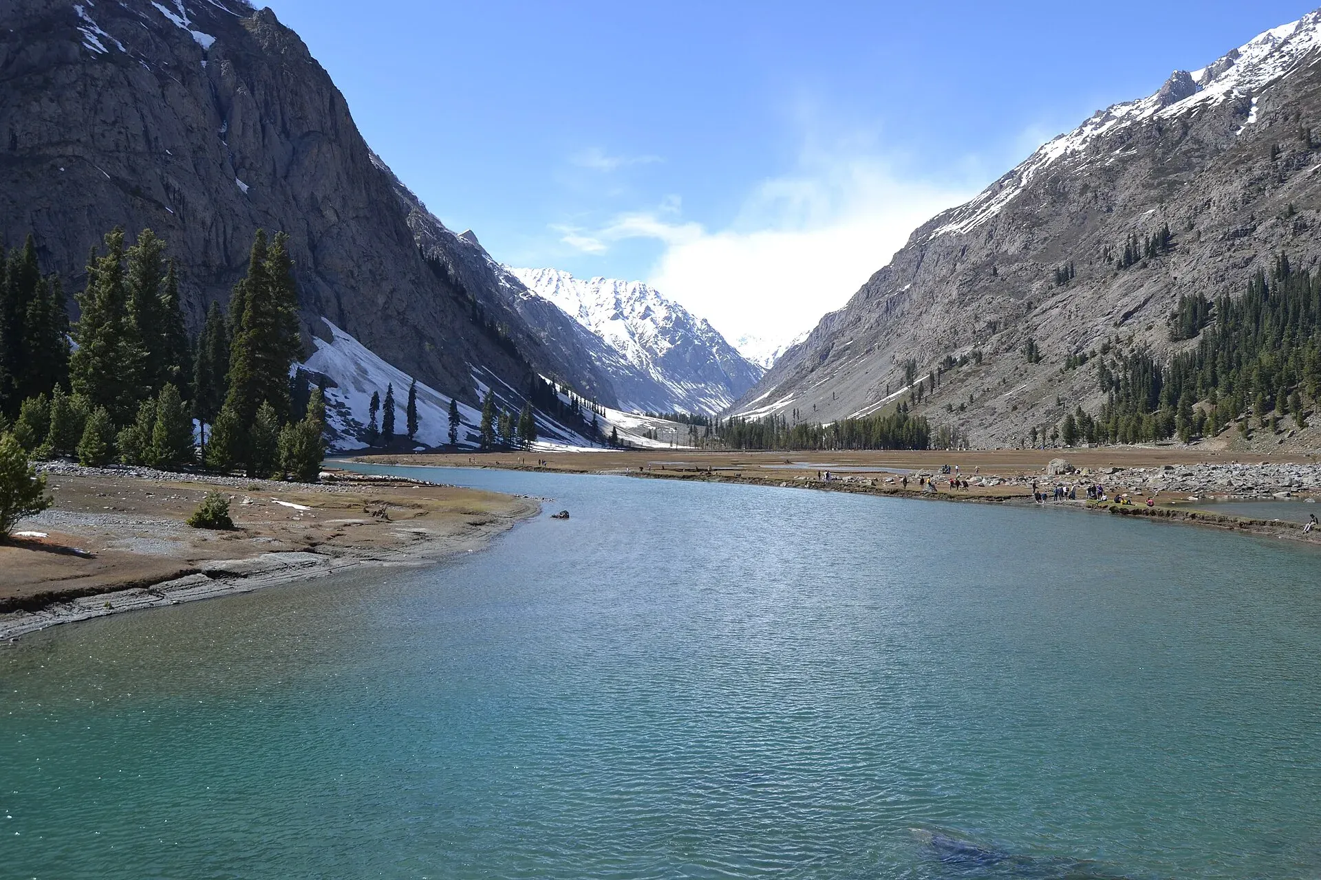
Photo: Xain, with thanks · CC BY-SA 3.0 · via Wikimedia Commons · temporary stand-in photo

Swat River
A perennial river of northern Khyber Pakhtunkhwa formed at Kalam by the Ushu and Gabral streams. It runs through the Swat Valley to the Kabul River near Charsadda. Travel advice currently warns against Swat.
Overview
The Swat is a perennial river in northern Khyber Pakhtunkhwa, about 240 km long, draining a basin of roughly 13,000 sq km. It rises in the glacial valleys of the Hindu Kush and is fed by meltwater all year. It forms at Kalam where the Ushu (Usho) and Gabral rivers meet, runs through narrow gorges in the Kalam Valley to Madyan, crosses the plains of the lower Swat Valley to Chakdara, meets the Panjkora near Qalangi, and ends at the Kabul River near Charsadda. Its mean annual flow is about 280 cubic metres a second near Munda. The name may come from the Sanskrit Suvastu, "clear blue water", and ancient Greek and Chinese writers recorded it as Soastus and Su-ho-to.
Plan your visit
- Nearest town
- Mingora
- Getting there
Mingora, the main town, is reached by road from Islamabad via the Malakand Pass and Chakdara. Kalam lies further up the valley. More
Best months
May – Oct
Course and use
The river changes character along its length. Above Madyan it runs fast through narrow gorges; towns such as Bahrain are built right along the water. Below Madyan it spreads across the wide floor of the lower Swat Valley, and after Chakdara it enters a narrow gorge again before the Panjkora joins at Qalangi.
The British built the Amandara Headworks in 1903 to feed canals in lower Swat and Malakand. The Upper Swat Canal passes under the Malakand Pass through the Benton Tunnel, finished in 1914. The Munda Headworks, built in 1921 below Dargai, feed canals in Charsadda, Swabi and Mardan. Two hydropower plants use the river: Jabban (1938) and Dargai (1952). The Mohmand (Munda) Dam, rated at 740 MW, was under construction according to Wikipedia, and further plants have been proposed upstream. Sand and gravel mining has changed the riverbed, increased erosion, harmed trout habitat and raised flood risk.
What to see and do
- Kalam and the upper valley. The Ushu stream leads to Mahodand Lake, about 40 km from Kalam at 2,865 m. The Gabral stream leads to Kharkhari Lake, about 17 km north of Utror. Both are known for pine forest, and summer alpine flowers include geum, blue poppy, potentilla and gentian. See the Kalam, Mahodand Lake and Kalam–Utror–Gabral pages.
- Mingora and Saidu Sharif. The river runs through the main towns, with the Swat Museum and Buddhist sites nearby.
- Fishing. Trout live in the upper river and its side streams. A permit is generally required and closed seasons apply; current fees will be added soon; ask the Khyber Pakhtunkhwa Fisheries Department.
- Rafting and boating. Operators have advertised raft trips on the river. There is no known official list of approved sections.
History and culture
Swat was a centre of Gandhara Buddhism, and the valley has many stupas and rock carvings along the river. Respect local customs on dress and photography.
When to visit
Spring to autumn is the usual season. Snowmelt makes the river highest in summer; heavy monsoon rain can bring sudden surges.
Where to stay and eat
Mingora, Madyan, Bahrain and Kalam have hotels and restaurants. Check any riverside business is set back from the water.
Good to know
- Floods. In June 2025 a sudden surge swept away a group of picnickers on the river near Mingora. Reports gave differing death tolls. Afterwards the provincial government began clearing buildings from the riverbed and restricted recreation near rivers; we have not confirmed what rules apply today. Never sit, wade or park on riverbeds, even when the water looks low.
- Ask the district administration or local police about current conditions before you go. Safety. For foreign visitors: the UK FCDO (updated 27 October 2026, checked 16 November 2026) advises against all travel to Swat and to Upper and Lower Dir, and notes KP emergency measures and Governor's Rule since 11 October 2026. Do not plan travel here until that changes. See the river crossings guide for general river safety.
Highlights
- Formed at Kalam by the Ushu and Gabral streams
- Runs through the whole Swat Valley
- Meets the Panjkora and then the Kabul River near Charsadda
- Irrigates Swat, Malakand and the Peshawar Valley
- A 2025 flash flood shows why riverbed safety matters
Getting there
Mingora, the main town, is reached by road from Islamabad via the Malakand Pass and Chakdara. Kalam lies further up the valley. Because the FCDO advises against all travel to Swat, check the latest advice and local conditions before you go.
Tips
- Check the FCDO advice before any plan for Swat
- Never sit or wade on the riverbed
- Check PMD and NDMA alerts in monsoon
- Ask the KP Fisheries Department about trout rules
Photos we still need: Swat River at Mingora or Chakdara (lower valley). Send us yours
Sources and last checked
Last checked Confidence medium5 sources4 still to check
- Last checked
- Method
- Desk research from published sources
- Confidence
- medium
- Checked by
- trek.pk research team
Researched from published sources; not yet checked on the ground by our team. Spot something out of date? Report a mistake.
Sources
- Swat River (Wikipedia) · Wikipedia · checked
- Kabul River (Wikipedia) · Wikipedia · checked
- Swat River tragedy coverage, June 2025 · Dawn · checked
- Swat River tragedy exposes failures in oversight · Geo News · checked
- Pakistan travel advice (updated 27 October 2026) · UK Foreign, Commonwealth & Development Office · checked
Still to be checked on the ground (4)
- Current riverbank and recreation restrictions in Swat after June 2025 (Dawn, 30 June 2025, reports a mining halt and encroachment removal on the Swat, and riverbank bans elsewhere in KP; no current Swat-specific order found)
- Rafting approvals (no official source)
- Trout licence rules and fees (no official source)
- Death toll of the June 2025 incident (Dawn's first report, 30 June 2025, says about 14 tourists; later reports differ; not stated on the page)
Nearby and related

Swat Valley
A long green river valley in northern Khyber Pakhtunkhwa, with Gandhara Buddhist sites, orchards, hill towns and the road up to Kalam. Check the current security advice before you plan a trip.

Kalam
The last large town in the upper Swat Valley, at about 2,000 m where the Ushu and Gabral rivers meet. Kalam is the base for Ushu, Utror, Mahodand Lake and Kundol Lake.

Mahodand Lake
A cold trout lake at about 2,865 m in the Usho valley above Kalam, reached by a rough 4x4 track of around 40 km. Open in summer only.

Kalam, Utror and Gabral
The head of the Swat valley: Kalam town where the Ushu and Gabral rivers meet, with Ushu forest, Utror and Kundol Lake, Gabral, and jeep tracks to Mahodand Lake.

Saidu Sharif
The administrative town of Swat, joined to the bazaar city of Mingora, with the ancient Butkara stupa, the Swat Museum of Gandhara art, a Sufi shrine and the road into the Swat valley.

Swat Museum (Saidu Sharif)
The Swat Museum between Mingora and Saidu Sharif shows Gandharan Buddhist sculpture and local crafts. It was damaged in 2005 and 2008, and a new seismic-resistant building opened in 2014.

Kabul River
A river of about 700 km that rises in Afghanistan, enters Khyber Pakhtunkhwa near Peshawar, passes Charsadda and Nowshera, and joins the Indus near Attock. Not a visitor destination at present; see travel advice.
Mohmand Dam
A concrete-faced rockfill dam under construction on the Swat River in Mohmand District, north of Peshawar. It is a construction site in an area covered by FCDO advice against all travel.

Swat and Kalam
A 4-5 day road trip from Islamabad up the Swat valley by the M-16 and N-95 to Mingora, Madyan, Bahrain and Kalam, with Mahodand Lake and Ushu forest in summer.