

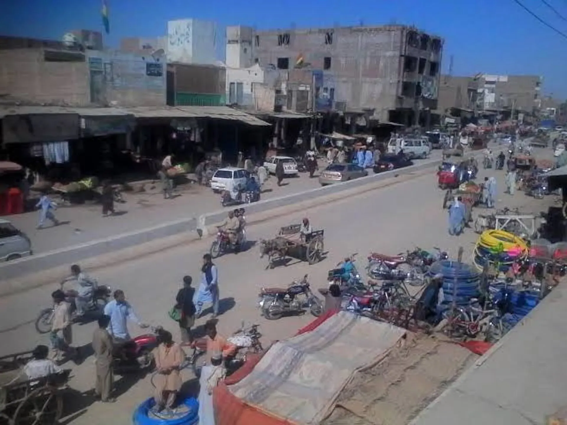
Photo: Farazhusaynakhter, with thanks · Public domain (CC0) · via Wikimedia Commons · temporary stand-in photo

Dera Murad Jamali
The canal-irrigated farming city and administrative centre of Nasirabad District in eastern Balochistan, on the Rohri to Chaman railway near the Sindh border.
Overview
Dera Murad Jamali, often shortened to D.M. Jamali, is a flat, low-lying city in eastern Balochistan. It is the headquarters of Nasirabad District and Nasirabad Division, close to the Sindh border. Its original name was Temple Dera, after Captain H. M. Temple, a British political agent for Sibi in 1891 to 1892, and locals still sometimes call it "Tipul". Nasirabad became a district in 1974. The 2023 census counted 106,952 people in the city (CityPopulation.de, compiled from the Pakistan Bureau of Statistics).
The city lies at about 67 m above sea level on the plains fed by the Pat Feeder canal from Guddu Barrage, and rice is widely grown in this canal-irrigated belt. Sindhi, Balochi, Saraiki and Brahui are all spoken here.
Plan your visit
- Getting there
Road: Sukkur about 117 km (about 1 hour 25 minutes); Quetta about 270 km (about 3 hours 15 minutes). Rail: Dera Murad Jamali station on the Rohri to Chaman line. Air: use Sukkur or Quetta. More
Best months
Nov – Mar
History and people
The city was part of Kalat District in 1954. In 1974 it became the headquarters of the newly created Nasirabad District, split from Kalat. It covers 281 km2 and is run by a municipal committee. The population grew from 38,431 in 1998 to 96,591 in 2017 and 106,952 in 2023. In the wider urban subdivision about 34 per cent speak Sindhi, 25 per cent Balochi, 22 per cent Saraiki and 18 per cent Brahui.
What to see and do
This is not a tourist destination and there are no recognised visitor sights. It is mainly an administrative and farming centre. If you must pass through:
- The bazaars: local markets for grain, cloth and farm supplies.
- The railway station: the city is on the Rohri to Chaman line.
- The canal country: the surrounding irrigated farmland is the area's main feature. Water sharing on the Pat Feeder canal is a long-running local concern.
Food and bazaars
Expect everyday Sindhi and Balochi food: rice, daal, bread and tea. No list of local specialities is published.
Getting there
- Road: Sukkur is about 117 km and 1 hour 25 minutes by road, and Quetta about 270 km and 3 hours 15 minutes (OSRM, checked 16 November 2026). The N-65 national highway serves the city.
- Rail: Dera Murad Jamali station is on the Rohri to Chaman line. Check Pakistan Railways for current services, as rail operations in Balochistan are sometimes suspended.
- Air: no airport is listed. The nearest are at Sukkur and Quetta.
Getting around
Rickshaws and local vans are the main transport. Intercity buses run along the highway.
Where to stay
Accommodation is limited. Look near the main highway and railway station. Travellers on essential business often stay in Sukkur instead.
Day trips
Options are limited. Sukkur and its Indus sights are about 117 km away, and Jacobabad lies on the Sindh side. Check security before leaving the city. Wikipedia's references report explosions on the railway track in Naseerabad in December 2025 and February 2026 (the second killed a railway employee), so treat rail travel here with extra care.
When to visit
November to March is cooler. Summers on the Sindh-Balochistan plains are very hot.
Safety
Ask the district administration or local police about current conditions before you go. For foreign visitors: the UK FCDO advises against all travel to Balochistan Province, with no exceptions listed (page updated 27 October 2026; checked 16 November 2026). Travelling here as a visitor is therefore not recommended. If you live in or have essential business in the area, follow current guidance from the provincial authorities and your embassy. The FCDO also notes an ongoing risk of terrorism across Pakistan.
Good to know
Carry identification and expect checkpoints. Facilities for visitors are minimal.
Highlights
- Headquarters of Nasirabad Division
- Pat Feeder canal farmland
- On the Rohri to Chaman railway
- Close to the Sindh border
Hotels, food, fuel and services in Dera Murad Jamali
Places to eat
- Al Makkah Hotel & RestaurantCall Al Makkah Hotel & RestaurantMap of Al Makkah Hotel & Restaurant in Google Maps
- Dost Hotel and RestaurantCall Dost Hotel and RestaurantMap of Dost Hotel and Restaurant in Google Maps
Essential services fuel stations, mechanics, ATMs, banks, pharmacies and hospitals and clinics
Fuel
- Pakistan State Oil (PSO) - Shah Petrol StationCall Pakistan State Oil (PSO) - Shah Petrol StationMap of Pakistan State Oil (PSO) - Shah Petrol Station in Google Maps
- Maula Madad Petroleum ServiceMap of Maula Madad Petroleum Service in Google Maps
- PSO-AL RAZA FILL STATIONCall PSO-AL RAZA FILL STATIONMap of PSO-AL RAZA FILL STATION in Google Maps
- Al Qadir Petroleum ServiceCall Al Qadir Petroleum ServiceMap of Al Qadir Petroleum Service in Google Maps
- Al Taj Petroleum ServiceCall Al Taj Petroleum ServiceMap of Al Taj Petroleum Service in Google Maps
- Al Hafeez Petroleum ServiceMap of Al Hafeez Petroleum Service in Google Maps
Mechanics and tyre shops
- Sakhi Sultan Baho o Motor GarageCall Sakhi Sultan Baho o Motor GarageMap of Sakhi Sultan Baho o Motor Garage in Google Maps
- Mash Allah Autos and ElectritionsCall Mash Allah Autos and ElectritionsMap of Mash Allah Autos and Electritions in Google Maps
- Al Qadir MENGAL bike parts & workshopMap of Al Qadir MENGAL bike parts & workshop in Google Maps
- پنچر کی دکانCall پنچر کی دکانMap of پنچر کی دکان in Google Maps
ATMs
- National Bank of Pakistan (NBP)Call National Bank of Pakistan (NBP)Map of National Bank of Pakistan (NBP) in Google Maps
- Zarai Tarqiyati Bank LimitedMap of Zarai Tarqiyati Bank Limited in Google Maps
Banks and money exchange
- Bank Al Habib Ltd بینک الحبیب لمیٹڈMap of Bank Al Habib Ltd بینک الحبیب لمیٹڈ in Google Maps
- Khushhali Microfinance BankCall Khushhali Microfinance BankMap of Khushhali Microfinance Bank in Google Maps
- The First MicroFinance Bank Ltd. (FMFB)Call The First MicroFinance Bank Ltd. (FMFB)Map of The First MicroFinance Bank Ltd. (FMFB) in Google Maps
- Sindh Bank سندھ بینکMap of Sindh Bank سندھ بینک in Google Maps
- Meezan Bank - Dera Murad Jamali BranchCall Meezan Bank - Dera Murad Jamali BranchMap of Meezan Bank - Dera Murad Jamali Branch in Google Maps
Pharmacies
- Dileep medical storeCall Dileep medical storeMap of Dileep medical store in Google Maps
- Domki Medical storeCall Domki Medical storeMap of Domki Medical store in Google Maps
Hospitals and clinics
- DHQ HospitalCall DHQ HospitalMap of DHQ Hospital in Google Maps
- Civil HospitalMap of Civil Hospital in Google Maps
- Al Raheem HospitalMap of Al Raheem Hospital in Google Maps
- Elum ClinicCall Elum ClinicMap of Elum Clinic in Google Maps
All listings in Dera Murad Jamali
Listings come from Google Maps data and are unverified: phone numbers, opening months and prices may have changed. Report a problem · Own one of these? Claim it
Tips
- Check security advice before any travel.
- Carry identification and expect checkpoints.
- Base in Sukkur if travelling on essential business.
- Expect extreme heat in summer.
Photos we still need: the Pat Feeder canal and rice fields. Send us yours
Sources and last checked
Last checked Confidence low5 sources4 still to check
- Last checked
- Method
- Desk research from published sources
- Confidence
- low
- Checked by
- trek.pk research team
Researched from published sources; not yet checked on the ground by our team. Spot something out of date? Report a mistake.
Sources
- Dera Murad Jamali · Wikipedia · checked
- City populations, 2023 census (compiled from Pakistan Bureau of Statistics) · CityPopulation.de · checked
- Pat Feeder canal and rice in Nasirabad (background) · Dawn · checked
- OSRM driving routes (road distances and times) · Project OSRM / OpenStreetMap · checked
- Pakistan travel advice (safety and security; updated 27 October 2026) · UK Foreign, Commonwealth & Development Office · checked
Still to be checked on the ground (4)
- Local sights, food and hotels (very little published)
- Current train services on the Rohri-Chaman line
- Current security conditions (FCDO advice against all travel to Balochistan stands)
- Current state of the Pat Feeder canal (latest source found is Dawn, 2015)
Nearby and related

Balochistan
Pakistan's largest and least populated province: Quetta's high valleys, Ziarat's juniper forest, the Makran coast, Hingol and Gwadar. Security and permission rules need checking first.

Quetta
Balochistan's high-valley capital, the Fruit Garden of Pakistan: bazaars, sajji, orchard valleys and the base for Hanna Lake and Ziarat.