

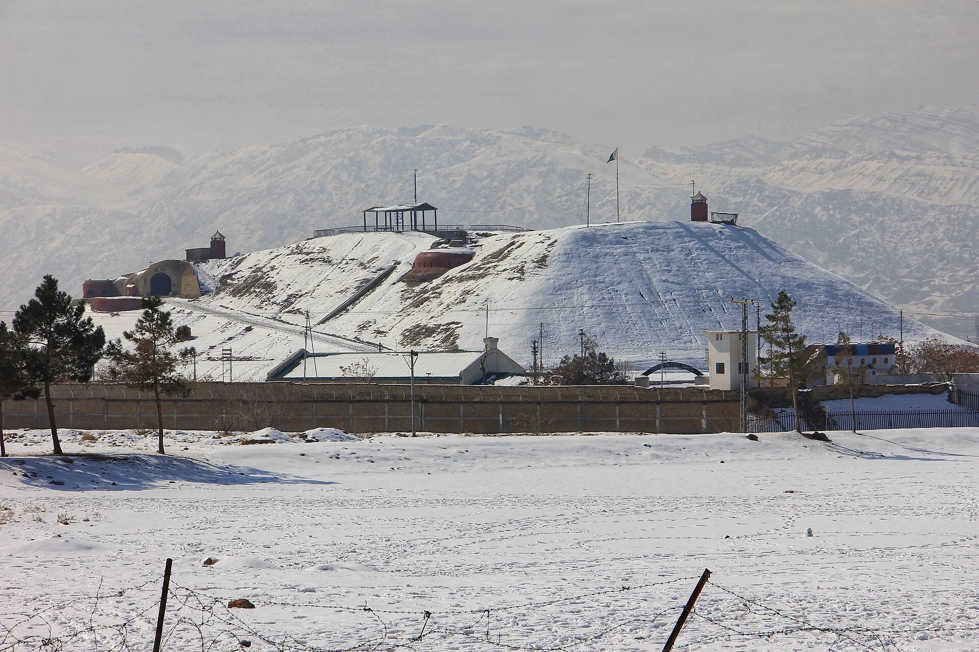
Photo: Puffmuffin, with thanks · CC BY-SA 4.0 · via Wikimedia Commons · temporary stand-in photo

Quetta
Balochistan's high-valley capital, the Fruit Garden of Pakistan: bazaars, sajji, orchard valleys and the base for Hanna Lake and Ziarat.
Overview
Quetta is the capital of Balochistan, in a high valley at about 1,680 m, ringed by bare mountains. It is known as the Fruit Garden of Pakistan because of the orchards of the surrounding valleys. The city has a cool dry climate, a mix of Baloch, Pashtun, Hazara and other communities, and a strong bazaar culture. It is also the base for the Hanna Lake, Urak Valley, Ziarat and Hazarganji Chiltan areas. Conditions for travellers vary, so check current advice before you plan a trip.
Plan your visit
- Getting there
Air: Quetta International Airport (UET). Rail: Jaffar Express (Peshawar to Quetta); check Pakistan Railways. Road: N-25 from Karachi (about 700 km), N-40 and N-50 towards the western borders. More
Best months
Apr – Oct
- Quetta
- Related places nearby: Takatu National Park, Wali Tangi Dam
History in brief
Quetta was a small fort town on the route between Afghanistan and the Indus plains, held by the Khan of Kalat and later by the British from 1876, who built a garrison and the Staff College. A severe earthquake in 1935 destroyed much of the city, and many of the buildings you see today date from afterwards.
Neighbourhoods
- Jinnah Road and the old bazaar: the commercial heart, with shops, dry fruit and carpet dealers. Good for shopping.
- Cantonment and Zarghoon Road: quiet, leafy and well kept. Good for a base.
- Satellite Town and Sariab Road: newer residential districts with restaurants.
- Hazara Town: a distinct neighbourhood at the foot of the hills.
- Samungli and Brewery Road: the south and south-west edge of the city.
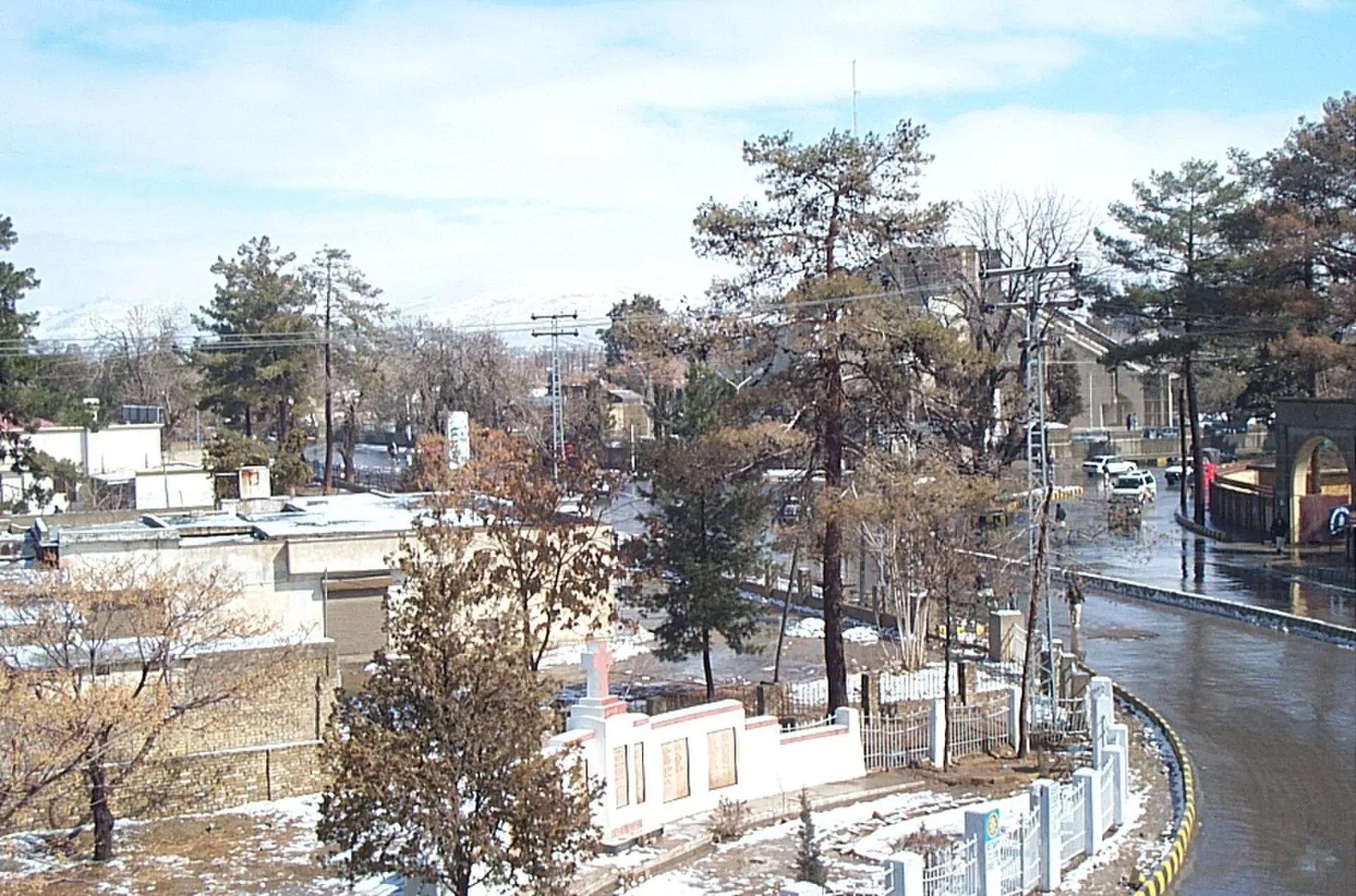
Photo: Ajmalahmedkhan, with thanks · CC BY-SA 3.0 · via Wikimedia Commons · temporary stand-in photo

Top sights
- Hanna Lake and Urak Valley: a lake and orchard valley about 10 to 20 km from the city, popular for picnics.
- Hazarganji Chiltan National Park: protected hills with markhor and a rare juniper forest, about 20 km south-west.
- Quetta Bazaar and Jinnah Road: dry fruit, carpets, embroidery and Afghan crafts.
- Quaid-e-Azam Residency (Ziarat): a historic wooden residence about 130 km north-east, reached by a mountain road.
- Orchard valleys around the city: short drives to see the blossom in spring or the harvest in late summer.
- Bolan Pass: a historic mountain route south-east of the city; check current road advice.
- Quetta Cantonment and the Staff College area: a leafy colonial-era district (access to military areas is restricted).
- Dry fruit shops on Jinnah Road: almonds, pistachios, raisins and dried apricots.
- Pir Ghaib waterfalls: a seasonal waterfall site south-east.
- Mountain drives toward Ziarat and Pishin: scenic roads with orchards and juniper forest.
Food
Quetta is famous for sajji (whole roast lamb or chicken), Afghan-style pulao, naan, kebabs and Kandahari tea. Dry fruit, almonds and pomegranates are local products. Sajji is a whole leg of lamb marinated in local spices and roasted slowly over an open fire. Landi is lamb dried in the shade and kept for winter. Khadi kebab is a local favourite. Tea houses serve kawa (green tea, often sweet) and doodh patti (milk tea), and old tea shops work as social clubs. Sajji restaurants and tea houses are found around Jinnah Road and Prince Road. In winter, dry meat (landi) and hot soups are common. Choose busy places and drink bottled water.
Bazaars and crafts
The main bazaar runs along Jinnah Road. Kandahari Bazaar is on Shahrah-e-Iqbal, and Liaquat Bazaar and Suraj Ganj Bazaar are on Shahrah-e-Liaquat (Wikivoyage). Typical purchases are Balochi mirror work, Pashtun embroidery, hand-knotted carpets and dried fruit. Balochi carpets are woven by nomadic communities and are usually coarser than Persian rugs, but many are small enough to carry. Bargain politely.
Museums
- Quetta Archaeological Museum: Stone Age tools, prehistoric pottery and finds from Mehrgarh, the early farming site south of the city, along with old weapons, manuscripts and photographs from before the 1935 earthquake.
- Geological Museum: rocks and fossils of Balochistan, on Sariab Road near the university.
- Command and Staff College Museum: interesting for British-era military history; the grounds are in a restricted military area.
Getting there
- By air: Quetta International Airport (UET), officially Quaid-e-Azam International Airport, sits at about 1,605 m and has domestic flights to cities such as Karachi, Lahore and Islamabad. Current international routes are not confirmed.
- By rail: the Jaffar Express runs between Peshawar and Quetta. Train services from Quetta were suspended and restored several times in 2026 for security reasons (Dawn and The Express Tribune, March to June 2026), and Dawn reported on 14 August 2026 that the Bolan Mail to Karachi and the Quetta to Chaman train had been suspended for about six months. The Jaffar Express was running again after short halts, but the latest report we have is from August 2026, so check Pakistan Railways for current status.
- By road: the N-25 links Quetta to Karachi (about 700 km) and the N-40 and N-50 to Iran and Afghanistan borders. Long coach rides pass through remote country, so check road conditions.
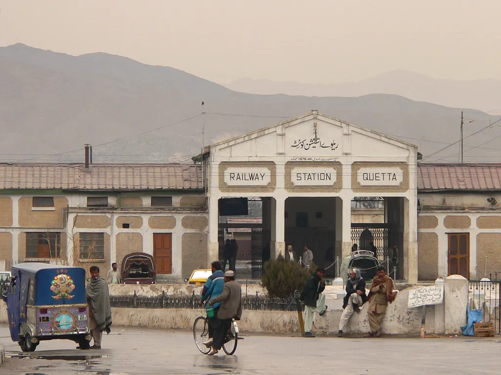
Photo: Waqas Usman, with thanks · CC BY-SA 2.5 · via Wikimedia Commons · temporary stand-in photo

Getting around
Taxis, rickshaws and ride-hailing apps work in the city. Intercity buses leave from several terminals. Distances to Ziarat and Hanna are best covered in a hired car.
Where to stay
- Cantonment and Zarghoon Road: the best-known hotel area, with a calm setting.
- Jinnah Road and Satellite Town: more choice and easier access to bazaars and restaurants.
Book ahead in the main holiday seasons.
When to visit
April to October is the best time, with warm days and cool nights. Winters from December to February are cold, with frost and occasional snow. The valley gets little monsoon rain.
Safety and etiquette
Security conditions in Balochistan vary and change quickly. Check the latest official advice from your government and from local authorities, and consider travelling with a local guide or operator. Foreign visitors may need to follow movement or registration rules. Avoid demonstrations. Dress conservatively and ask before photographing people, especially women. Keep to the main roads and well-known sites.
For foreign visitors: the UK FCDO advises against all travel to Balochistan, including Quetta (advice updated 27 October 2026, checked 16 November 2026). Read the live advice before you plan.
Day trips
- Hanna Lake and Urak Valley (30 minutes).
- Hazarganji Chiltan National Park (about 30 minutes).
- Ziarat (about 130 km, roughly three hours), a hill town at about 2,400 m with juniper forest and the Residency where Jinnah spent his last weeks.
- Kharkhasa (about 10 km west), a narrow valley with picnic areas and birdlife.
- Pishin Valley (about 50 km), where orchards are watered by karez (underground irrigation channels), with a reservoir at Bund Khushdil Khan.
- Bolan Pass (check access).
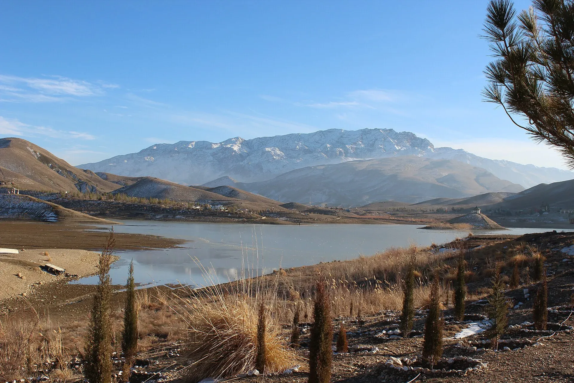
Photo: Aysafaran, with thanks · CC BY-SA 4.0 · via Wikimedia Commons · temporary stand-in photo

Good to know
A fee applies at some parks and sites; current fees will be added soon. Check with the Balochistan Forest and Wildlife Department or the local tourism office. Access to some areas may require permission.
Highlights
- Jinnah Road bazaar and dry fruit
- Hanna Lake and Urak Valley
- Hazarganji Chiltan National Park
- Ziarat juniper forest as a day trip
- Sajji and Kandahari tea
Hotels, food, fuel and services in Quetta
Places to stay
- Serena Hotel, QuettaCall Serena Hotel, QuettaMap of Serena Hotel, Quetta in Google Maps
- METRO HOTELCall METRO HOTELMap of METRO HOTEL in Google Maps
- Jan Luxury HotelCall Jan Luxury HotelMap of Jan Luxury Hotel in Google Maps
- BMC Complex Boys HostelMap of BMC Complex Boys Hostel in Google Maps
- Zamzama HotelCall Zamzama HotelMap of Zamzama Hotel in Google Maps
- Grand Hotel QuettaCall Grand Hotel QuettaMap of Grand Hotel Quetta in Google Maps
Places to eat
- Jaan Broast And BiryaniCall Jaan Broast And BiryaniMap of Jaan Broast And Biryani in Google Maps
- Takatu Nights RestaurantCall Takatu Nights RestaurantMap of Takatu Nights Restaurant in Google Maps
- Usmania RestaurantCall Usmania RestaurantMap of Usmania Restaurant in Google Maps
- Abdali Baba Super MarketCall Abdali Baba Super MarketMap of Abdali Baba Super Market in Google Maps
- Quetta Club LimitedCall Quetta Club LimitedMap of Quetta Club Limited in Google Maps
- Mubarak Food & Restaurant Branch 2 QuettaCall Mubarak Food & Restaurant Branch 2 QuettaMap of Mubarak Food & Restaurant Branch 2 Quetta in Google Maps
Essential services fuel stations and hospitals and clinics
Fuel
- Caltex Petrol PumpCall Caltex Petrol PumpMap of Caltex Petrol Pump in Google Maps
- ShellCall ShellMap of Shell in Google Maps
- Askari Petrol Pump (PSO Pump)Call Askari Petrol Pump (PSO Pump)Map of Askari Petrol Pump (PSO Pump) in Google Maps
- Byco Petrol PumpMap of Byco Petrol Pump in Google Maps
- Sehar CNG & PSO Fuel StationCall Sehar CNG & PSO Fuel StationMap of Sehar CNG & PSO Fuel Station in Google Maps
- ShellCall ShellMap of Shell in Google Maps
Hospitals and clinics
- Saleem Medical ComplexCall Saleem Medical ComplexMap of Saleem Medical Complex in Google Maps
- Aria Institute of Medical Sciences - AIMSCall Aria Institute of Medical Sciences - AIMSMap of Aria Institute of Medical Sciences - AIMS in Google Maps
Listings come from Google Maps data and are unverified: phone numbers, opening months and prices may have changed. Report a problem · Own one of these? Claim it
Tips
- Check current security advice before you plan.
- Carry warm clothes; evenings are cool even in summer.
- Keep to main roads and known sites.
- Travel with a local guide if possible.
Photos we still need: Quetta bazaar or dry-fruit stalls, and sajji (openly licensed). Send us yours
Sources and last checked
Last checked Confidence medium11 sources7 still to check
- Last checked
- Method
- Desk research from published sources
- Confidence
- medium
- Checked by
- trek.pk research team
Researched from published sources; not yet checked on the ground by our team. Spot something out of date? Report a mistake.
Sources
- Quetta · Wikipedia · checked
- Hazarganji Chiltan National Park · Wikipedia · checked
- Pakistan Railways · Ministry of Railways · checked
- List of cities in Pakistan by population (2023 census) · Wikipedia · checked
- List of airports in Pakistan · Wikipedia · checked
- Foreign travel advice: Pakistan (updated 27 October 2026) · UK FCDO · checked
- Jaffar Express resumes service from Quetta (2026) · Dawn · checked
- Train services partially restored in Quetta (April 2026) · The Express Tribune · checked
- Train services from Quetta suspended (2026) · Dawn · checked
- Quetta (travel guide) · Wikivoyage · checked
- Jaffar Express suspended (14 August 2026) · Dawn · checked
Still to be checked on the ground (7)
- Security situation and foreigner movement rules (follow the FCDO advice; no official movement rules opened)
- Pir Ghaib waterfall access (Wikipedia's Quetta article does not mention it)
- Quetta Cantonment access (no source; Wikipedia gives none)
- Bolan Pass road status (Wikipedia: N-65 links Quetta and Sibi; no current condition; the Sibi to Khost rail line is out of service as of 2024)
- Current fees (to be added)
- Rail: whether the Jaffar Express runs now (last dated report 14 August 2026) and whether the Bolan Mail has returned (reported suspended for six months at that date; Wikipedia, edited 26 May 2026, lists the Jaffar Express as operational daily)
- Foreign-visitor access: Wikivoyage (Feb 2025) reports police permission and escorts for foreigners; not confirmed from an official page
Nearby and related

Quetta's Mountains: Chiltan, Takatu and Zarghun Ghar

Karachi
Pakistan's largest city and main port: colonial buildings, museums, beaches, busy bazaars and some of the country's best food.

Multan
The City of Saints in southern Punjab: blue-tiled Sufi shrines, a crowded old city, blue pottery, sohan halwa and mangoes.
Takatu National Park
A mountain park north-east of Quetta, declared on 13 January 2025 across Quetta and Pishin districts. About 135 square kilometres around Koh-e-Takatu, home to Sulaiman markhor. Not set up for casual visits.
Wali Tangi Dam
A small mountain water-supply dam in the Urak Valley east of Quetta, built in the early 1960s. It feeds irrigation and drinking water, and sits in Balochistan where the UK FCDO advises against all travel.