

Photo: Ahmad Haq, with thanks · CC BY-SA 4.0 · via Wikimedia Commons · temporary stand-in photo

Faisal Mosque
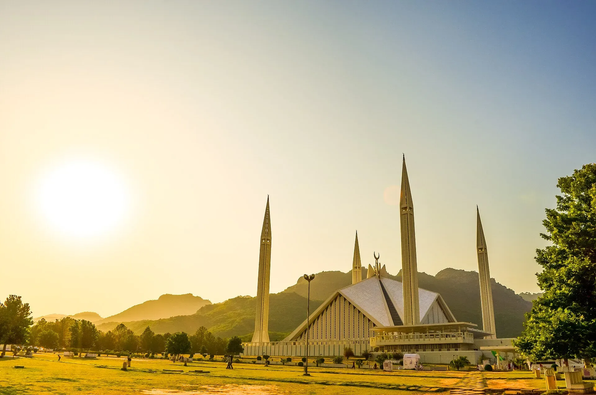
Pakistan's national mosque, at the foot of the Margalla Hills in Islamabad. A tent-shaped hall with no dome and four 90 m minarets, open to respectful visitors outside prayer times.
Overview
Faisal Mosque is the national mosque of Pakistan. It stands at the northern end of Faisal Avenue, at the foot of the Margalla Hills, and it is the building most people picture when they think of Islamabad.
The design is unusual. There is no dome. Instead, eight concrete shell walls slope together to form a triangular prayer hall, shaped like a Bedouin tent, with four minarets around it. Each minaret is 90 m tall, and the mosque is described as having the tallest minarets in South Asia. The architect Vedat Dalokay, from Turkey, said the form abstractly recalls the Kaaba, with the four minarets framing an imagined cube.
Plan your visit
- Nearest town
- Islamabad
- Getting there
From the centre of Islamabad the mosque is about 7 km and 10 minutes by road (OSRM; checked 16 November 2026), more at rush hour. Use a taxi or ride-hailing app, or the Metro Bus network and a short ride on. More
Best months
Mar – Apr, Oct – Nov
- Faisal Mosque
- Related places nearby: Islamabad, Margalla Hills National Park, Daman-e-Koh, Pir Sohawa, Shakarparian
History
King Faisal of Saudi Arabia backed the idea of a national mosque during a visit to Pakistan in 1966. An international competition in 1969 drew 43 proposals from architects in 17 countries, and Dalokay won. About 190,000 square metres of land were allocated. Construction began in 1976 under National Construction Limited, with Saudi Arabia paying more than 130 million riyals. The mosque is named after King Faisal, who was assassinated in 1975. It was complete in 1986, and Wikipedia lists the first prayer as 18 June 1988. Some conservative Muslims criticised the unconventional design at first. The International Islamic University used the grounds until it moved to a new campus in 2000.
It was the largest mosque in the world from 1986 to 1993 and is now the sixth largest by capacity.
What to see and do
- The prayer hall. The hall rests on four concrete girders and is lined in white marble, with mosaics and calligraphy and a chandelier in Turkish style. The west wall carries the Kalimah (the declaration of faith) in early Kufic script, repeated in mirror image, and the qibla wall has blue and white calligraphic tiles by the Turkish artist Mengu Ertel. The hall holds about 10,000 people.
- The courtyard. Entry is from the east, through a courtyard with porticoes. Counting courtyards and grounds, Wikipedia gives figures of 74,000 and 300,000 worshippers for the full site, and sources differ.
- The setting. The Margalla Hills rise directly behind. The mosque is easy to see from Daman-e-Koh above the city, and it looks different in morning haze and in evening light.
- The grounds. The site covers about 130,000 square metres. It also holds a library, a lecture hall, a museum and a cafe, according to Wikipedia.
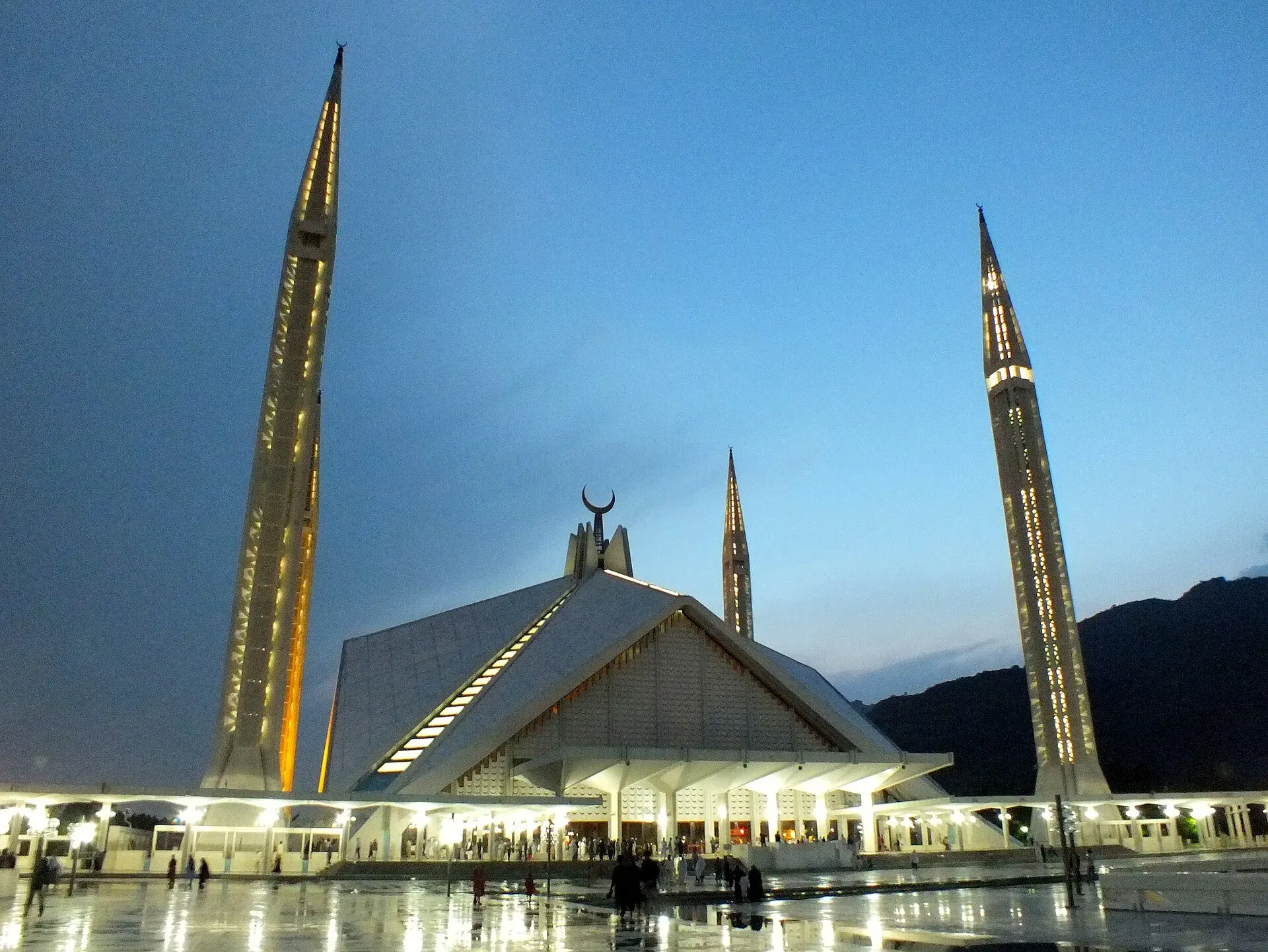
Photo: King Eliot, with thanks · CC BY-SA 4.0 · via Wikimedia Commons · temporary stand-in photo

When to visit
March, April, October and November are the most comfortable months. Go in the morning or late afternoon, and avoid the five daily prayer times and Friday midday prayers, when the mosque is full of worshippers.
Where to stay and eat
Most visitors stay elsewhere in Islamabad and come for a short visit. The Blue Area, F-6 and F-7 have hotels and restaurants; see the Islamabad page.
Good to know
- Dress. This is a working mosque. Wear long sleeves and trousers or a long skirt. Women should carry a scarf for the head. Take your shoes off before entering the courtyard.
- Entry. There is no known official notice of opening hours or charges, and travel guides disagree on hours. Ask at the gate. No fee is confirmed here.
- Photos. Photography is generally fine in the courtyards. Do not photograph people at prayer without asking.
- Security. Expect bag checks. For foreign visitors: the UK FCDO notes an ongoing risk of terrorism and asks visitors to take care around tourist sites and religious sites (checked 16 November 2026). Islamabad is not on its list of areas it advises against.
- Nearby. Daman-e-Koh and Pir Sohawa are on the hills above, and the Margalla Hills National Park trails start close by.
Highlights
- Tent-shaped hall with no dome
- Four minarets, each 90 m tall
- Margalla Hills as the backdrop
- Won a 1969 international design competition
Getting there
From the centre of Islamabad the mosque is about 7 km and 10 minutes by road (OSRM; checked 16 November 2026), more at rush hour. Use a taxi or ride-hailing app, or the Metro Bus network and a short ride on. Rawalpindi is about 15 km from central Islamabad. The mosque lies at the end of Faisal Avenue, below the Margalla Hills.
Tips
- Avoid prayer times and Friday midday.
- Dress modestly and carry a scarf for the head.
- Remove your shoes before the courtyard.
- Ask at the gate about current opening hours.
Sources and last checked
Last checked Confidence medium4 sources3 still to check
- Last checked
- Method
- Desk research from published sources
- Confidence
- medium
- Checked by
- trek.pk research team
Researched from published sources; not yet checked on the ground by our team. Spot something out of date? Report a mistake.
Sources
- Faisal Mosque · Wikipedia · checked
- Pakistan travel advice (Warnings and insurance) · UK FCDO (GOV.UK) · checked
- OSRM routing (driving distances) · OSRM project · checked
- Islamabad · Wikivoyage · checked
Still to be checked on the ground (3)
- Current opening hours and any entry charge (sources disagree; no official notice found)
- Rules for non-Muslim visitors and parts open to them (Wikivoyage says open to non-Muslims outside prayer times, sometimes shut altogether; no official notice)
- First prayer date (Wikipedia: completed 1986, first prayer 18 June 1988; unchanged)
Nearby and related

Islamabad
Pakistan's green, planned capital at the foot of the Margalla Hills: Faisal Mosque, hillside trails, cafes and the gateway to the north.

Margalla Hills National Park
The green hills above Islamabad: hiking trails, viewpoints, leopards and goral, a few minutes from the city centre. Established in 1980 and covering about 174 square kilometres.

Daman-e-Koh
A hilltop garden and lookout in the Margalla Hills, about 731 m up and 16 km by road from central Islamabad. It looks over the city's sectors, Faisal Mosque and Rawal Lake.

Pir Sohawa
A hill-top spot on the Margalla Hills at about 914 m, 22 km by road from central Islamabad. It is a lookout, a trailhead and a cafe stop above the city.

Shakarparian
A low hill and park near Zero Point in Islamabad. Its terrace at the Pakistan Monument gives easy views over the city to the Margalla Hills, best near sunset.